Thursday, November 9, 2017 La Porte District Forecast
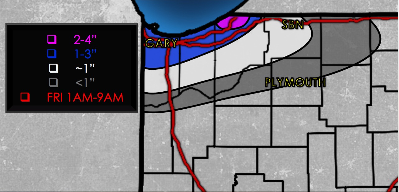
Synopsis: Continue to target lake effect snow showers tonight from St. Joseph, La Porte, Porter to Lake Counties from east to west as we get into Friday morning. Snowfall totals ~1″ will be possible, with local amounts of 2-4″ possible where that heaviest band sets up close to the water. The next system of interest comes in Sunday afternoon into Monday morning…we are concerned for some slick surfaces with a refreeze given temps fall into the upper 20s to lower 30s as the precipitation works east. We will have a short-term update later this afternoon, if you have questions please let us know…have a blessed day! -Kirk
Today’s video (6 min):
Current thoughts on snowfall accumulation: