Today’s Illinois Video Forecast:
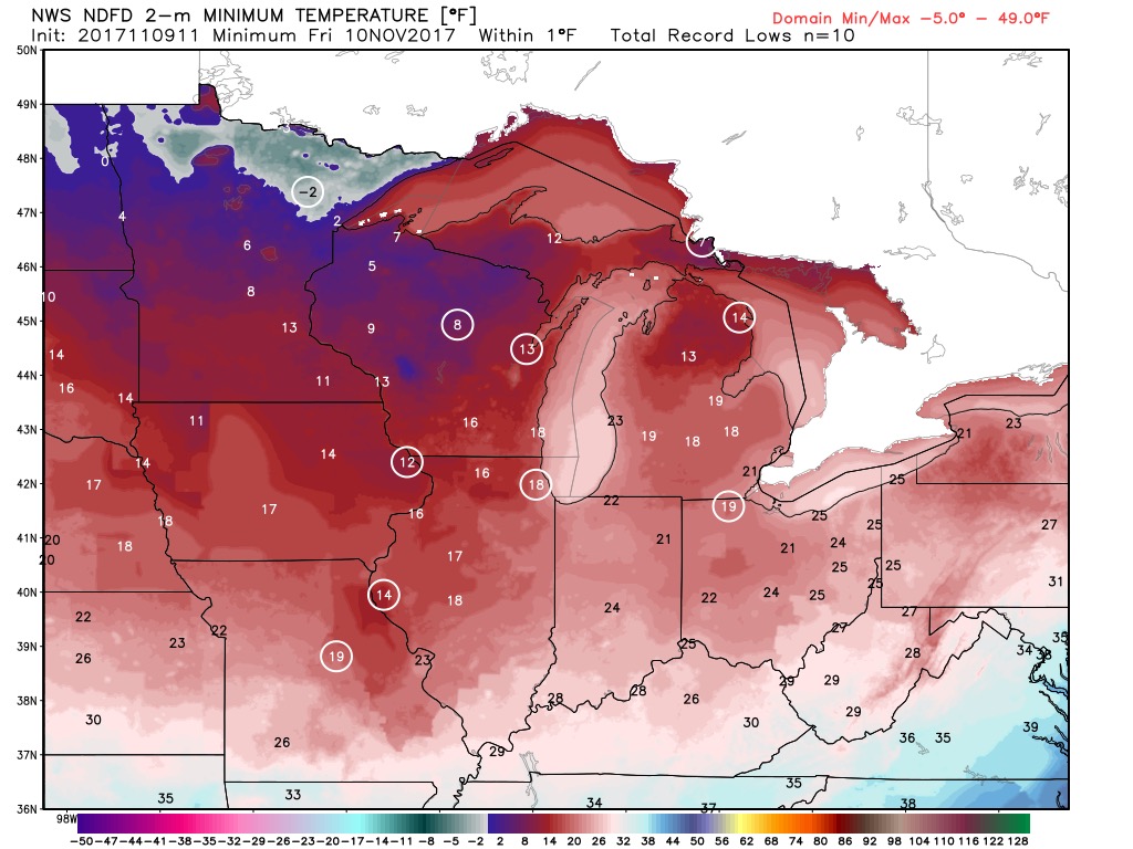
The coldest air of the season arrives tonight. Some areas could reach near record lows!
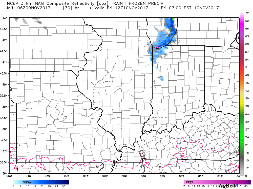
As winds shift to the northeast Friday morning, it will bring lake-effect snow showers to portions of Will, Cook, and Lake counties during the day. Some areas especially near the lake shore could see 1″ or so of snowfall (localized higher depending on how long the band sets up). The rest of the area remains dry with mostly sunny skies.
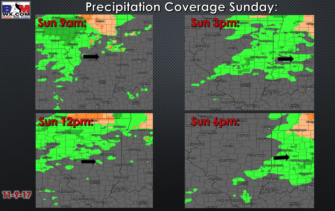
Saturday is looking dry with increased clouds. Light precipitation moves in overnight Saturday and continuing through the day Sunday. It will be cold enough to see a wintry mix across northern portions of the state. This could create a few slick spots especially Sunday morning. (orange color on the maps below represents sleet):
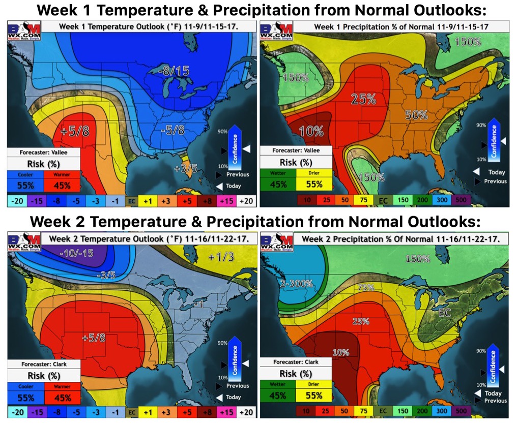
Weeks 1 and 2 outlooks:
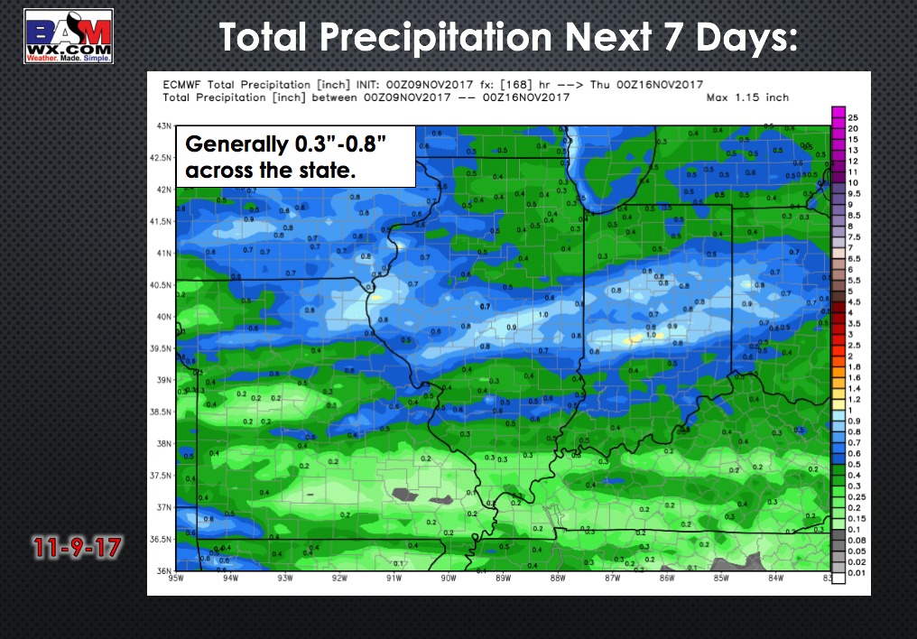
Total precipitation next 7 days: