11-6-17 Indiana Monday Forecast. More Rain South Tonight. Calmer Late Week.
Synopsis: Heavy rain and even tornadoes hit portions of the state this weekend. Flash flooding in spots. Thoughts and prayers with those affected by Sundays Tornadoes in Jay county IN. More rain is possible from I70 south tonight and again Tuesday night. Temps overall will be much colder with the coldest mornings being Fri and Sat. The weather pattern relaxes a bit overall the next 10 days with the only notable weather event coming Sat night from a weak front bringing some showers with it. Warmer and calmer next week. The one area of concern would come Thursday night into Friday across NW IN where some lake effect snow showers are possible. As sharply colder air aloft moves in over very warm lake waters if you’re in NW IN I do just want to at-least mention the potential for that right now.
As the colder air mass works in Thursday night we will at-least monitor the potential for lake effect snow showers but it becomes unfavorable in Indiana rather quickly as high pressure quickly follows. 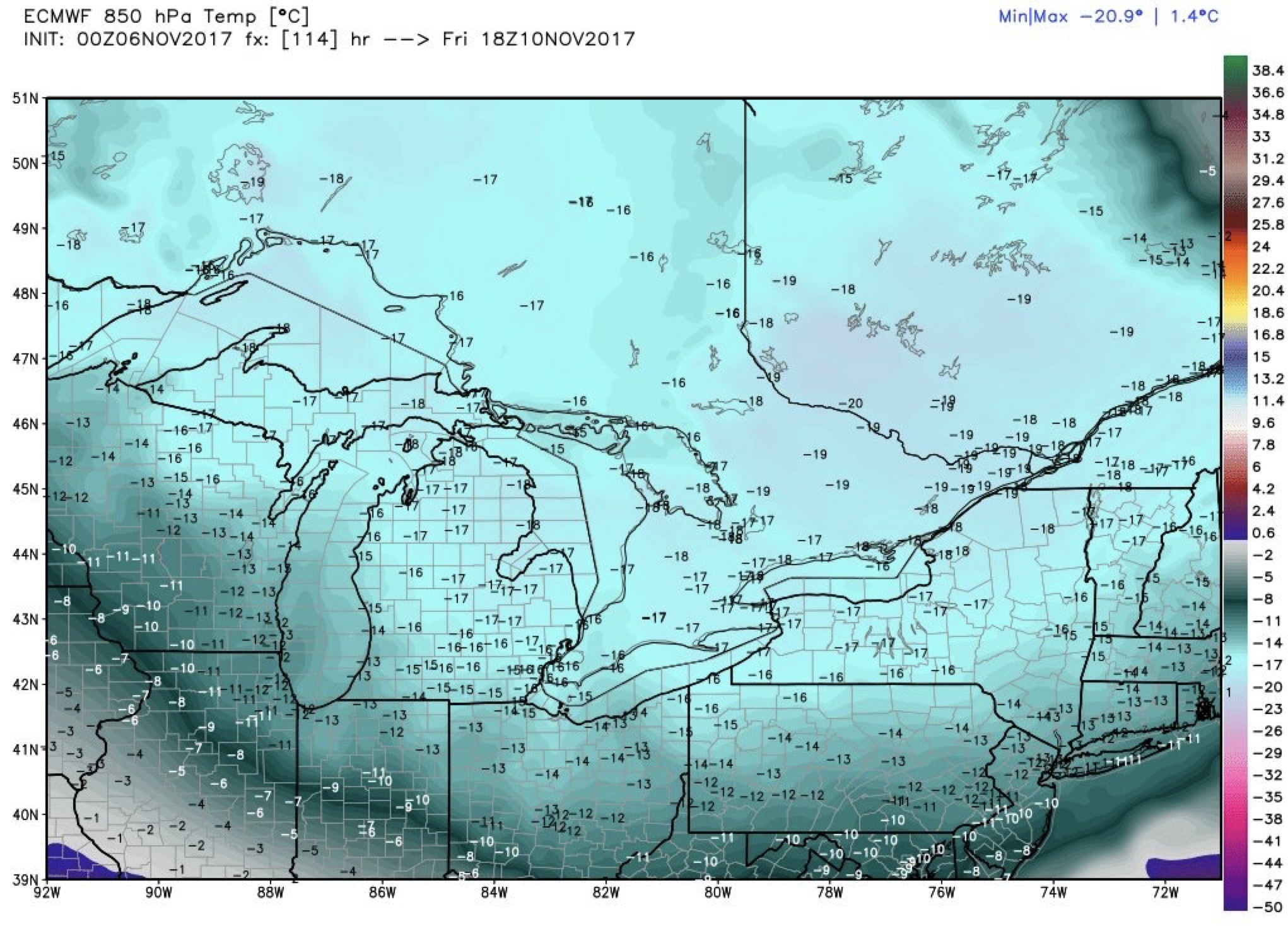
Weeks 1&2 Outlooks: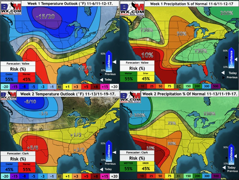
Video today is 5 mins.