Northern Plains Video Forecast:
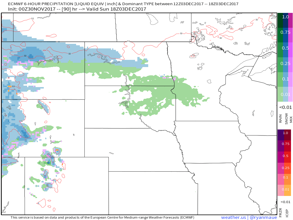
Forecast radar from Sunday afternoon into early Tuesday shows our next storm system moving across the area, bringing precipitation as early as Sunday, with showers transitioning to snow Monday and Monday night as colder air moves in. Light snow accumulations will be possible. Still plenty of questions regarding how this system evolves, so it will be important to check back for the latest information!
7-day precipitation:
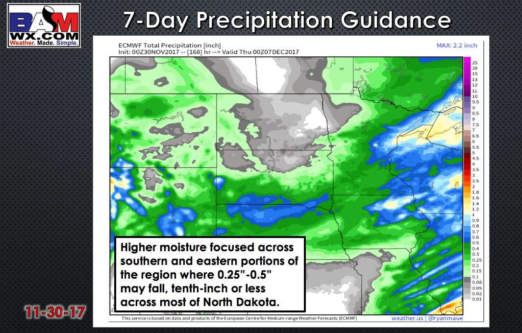
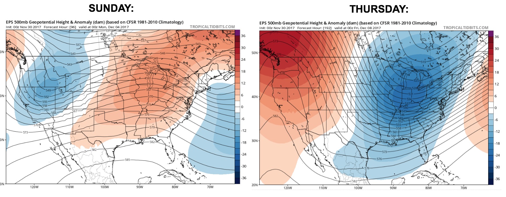
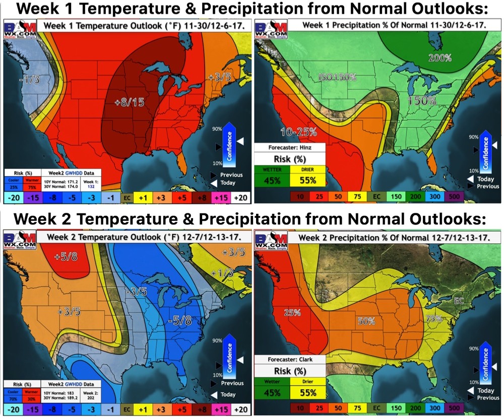
We transition from above normal temperatures this weekend to a true winter feel as we progress through the first week of December! This pattern is ripe for multiple shots of light snow as well.
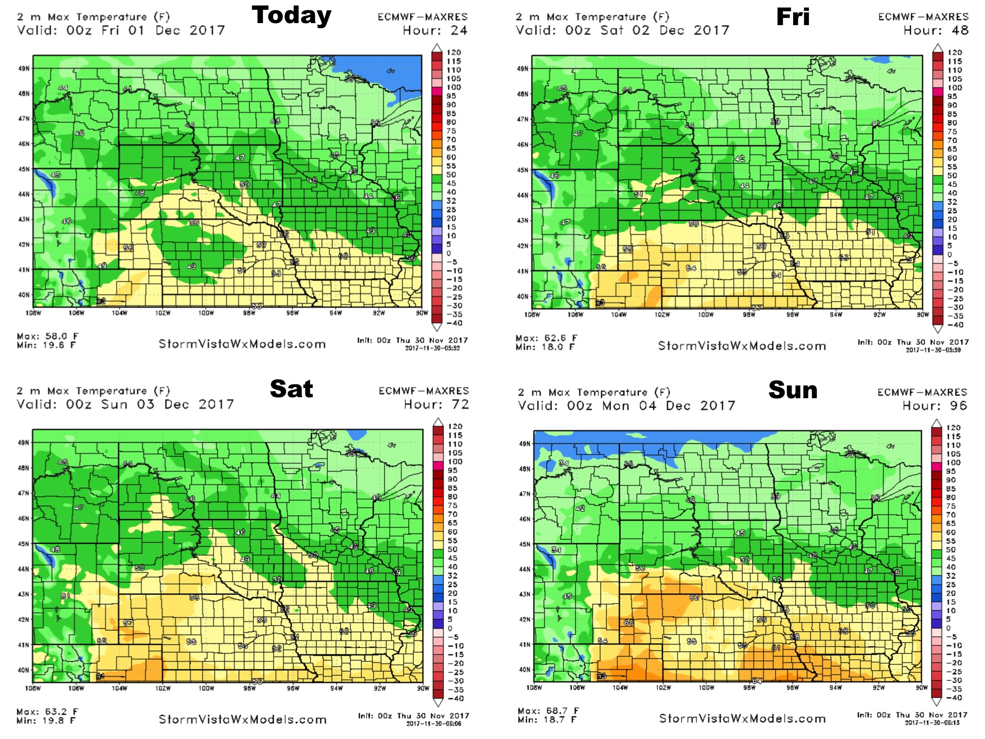
High temperatures over the next 4 days:
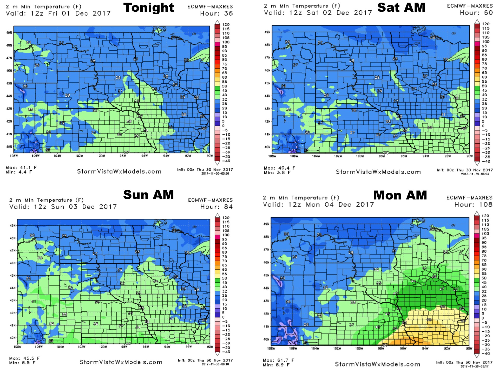
Low temperatures over the next 4 days: