Friday, November 3, 2017 Missouri Forecast:
Today’s video (6 min):
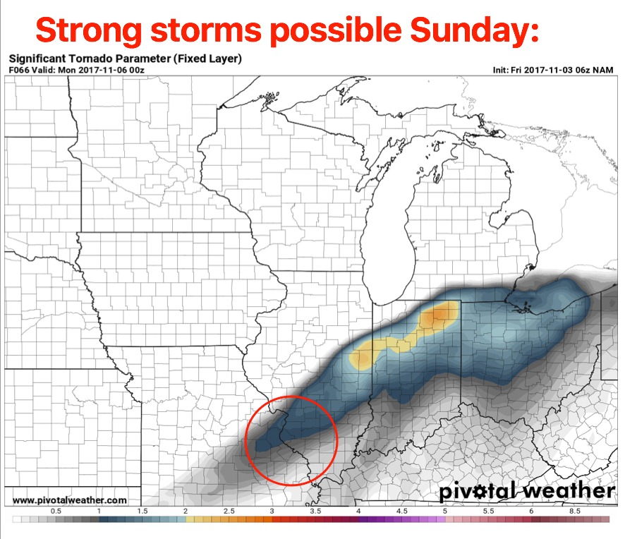
Watching the threat for strong to severe storms on Sunday…primary risk areas will be across the eastern 1/3 of the state…can’t rule isolated tornadoes, damaging winds and localized large hail…localized heavy rainfall a threat as well.
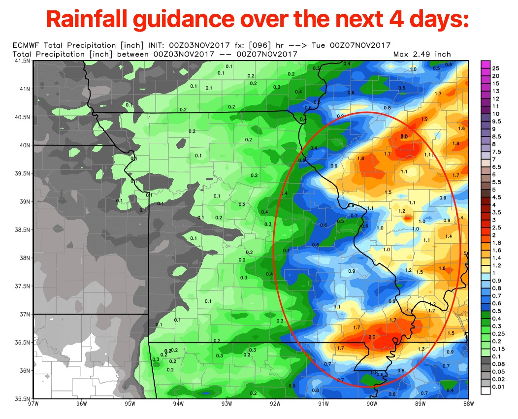
Rainfall guidance over the next 4 days…locations further west light precipitation noted ~0.1-0.3″ with ~0.5-1″ and isolated higher amounts 1.5″+ possible across eastern locations with the elevated strong storm threat Sunday.
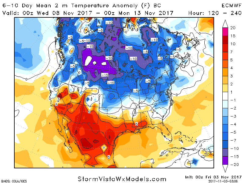
Continued cooler pattern lingers into next week…matches our call for the 2nd week of November cool shot…the longevity of the cold is definitely at play here…current thoughts is we warm up the pattern through the second half of November.