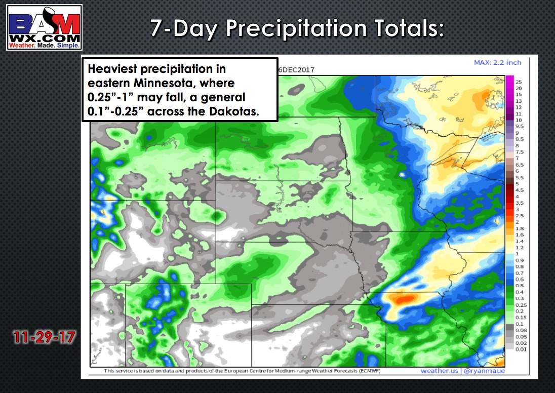
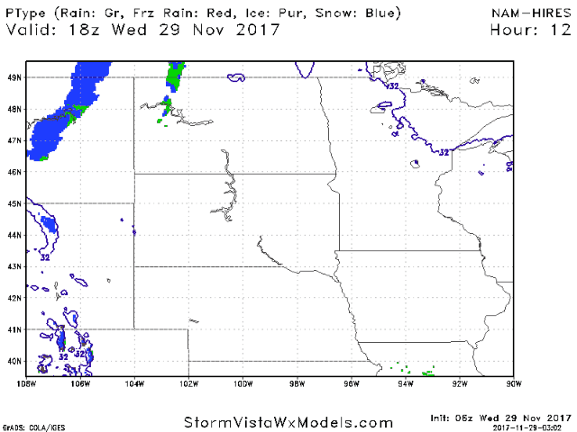
Today’s Northern Plains Forecast:
A weak disturbance will move across northern sections of North Dakota into Minnesota late this afternoon into tonight, bringing a light wintry mix. The majority of the region stays dry. Here is the forecast radar over the next 30 hours:
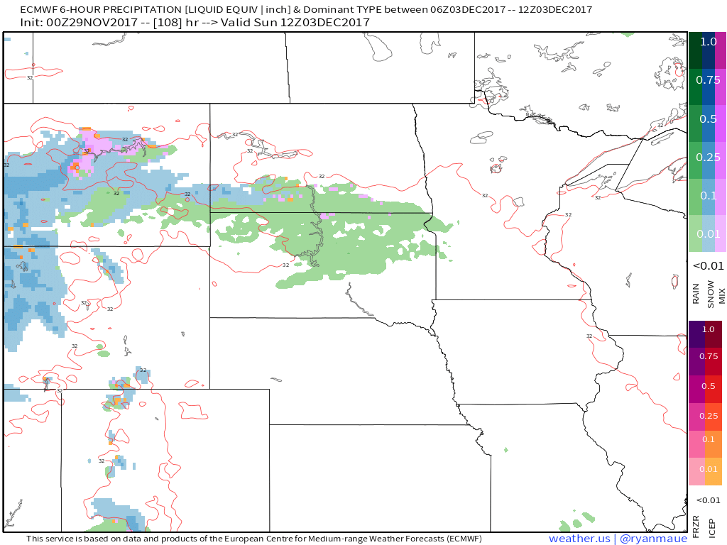
Mainly dry and quiet weather continues through Saturday. Changes begin on Sunday with the threat for a few showers, followed by a transition to snow showers Monday into Tuesday as a storm system deepens with northeast progression. There could be some snow accumulation, but far too early for specifics.
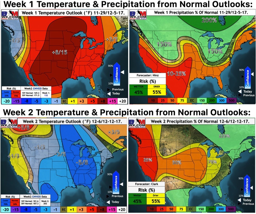
Get ready for a very cold week next week! Here are our weeks 1 and 2 outlooks: