Today’s video (7 min):
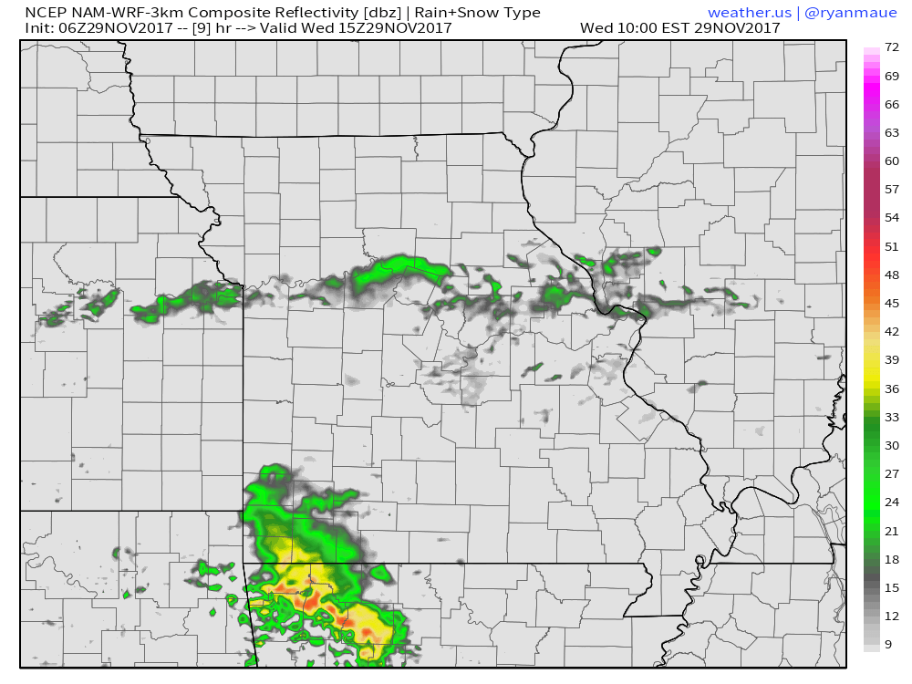
Simulated radar guidance today shows really the only decent rainfall through will be south of Joplin this morning…locations south of I-70 and further east may squeeze ~0.1-0.2″ out of this through noon Thursday, however locations north will remain dry and cooler.
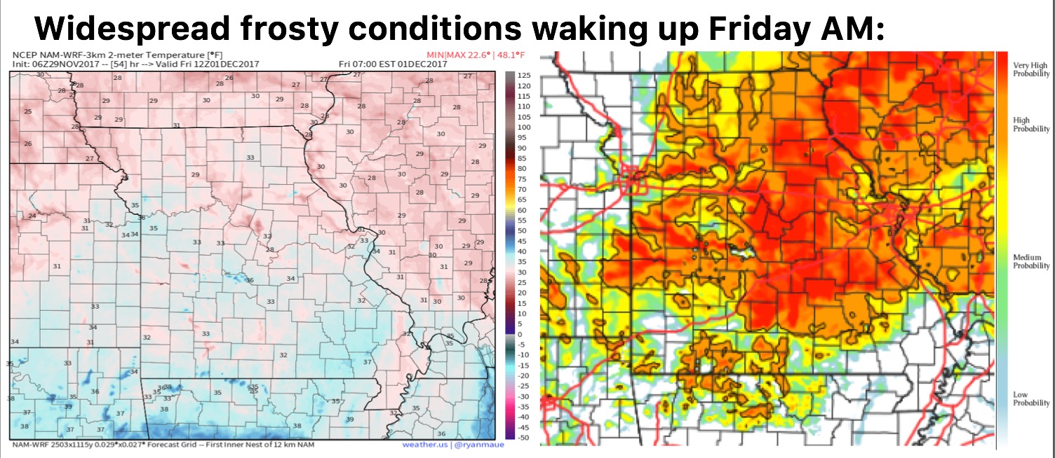
Expecting widespread frosty conditions waking up Friday morning as skies clear and winds calm behind the cold front:
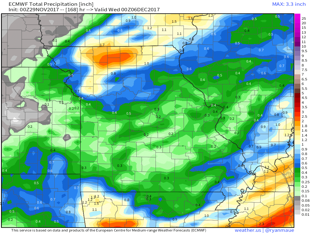
Next chance for more widespread rainfall comes late Sunday into Monday as a warm front and a trailing cold front swings east…can’t rule out a gusty storm threat as well need to watch…here’s a look at the latest Euro guidance on rainfall over the next week…I think it’s underdone across central locations, wouldn’t be shocked to see more widespread 0.5-1″:
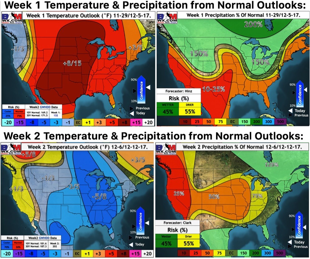
Updated long-range outlooks over the next 2 weeks shows the progressively colder pattern working in as we get into that 2nd week of December: