Today’s Illinois Video Forecast:
A weak disturbance brings the threat for a few light showers after midnight tonight through late morning Thursday, especially near and south of I-70.
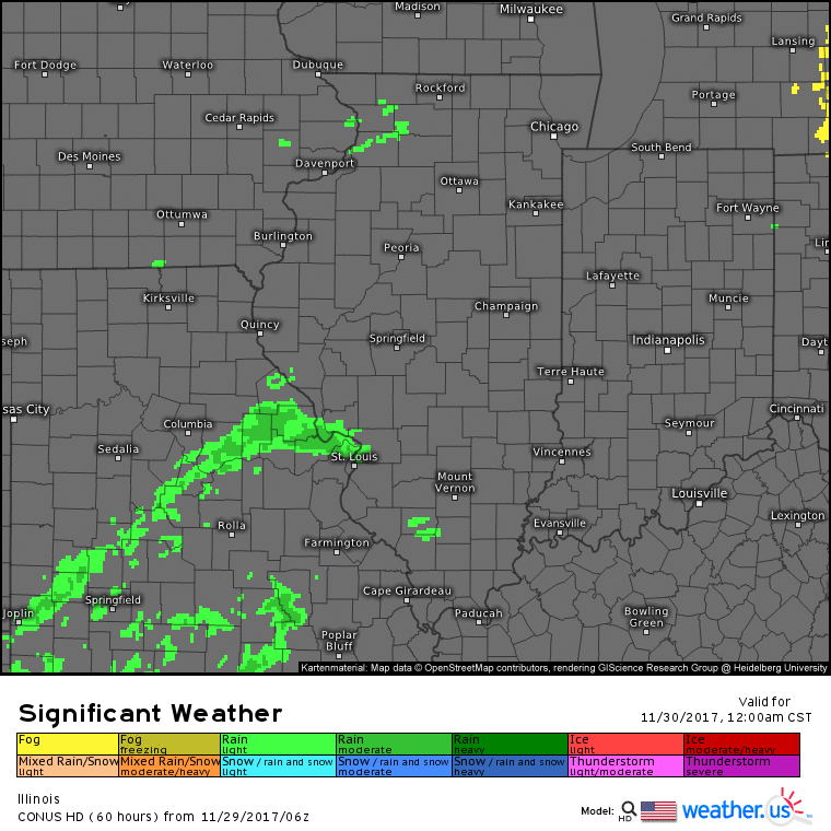
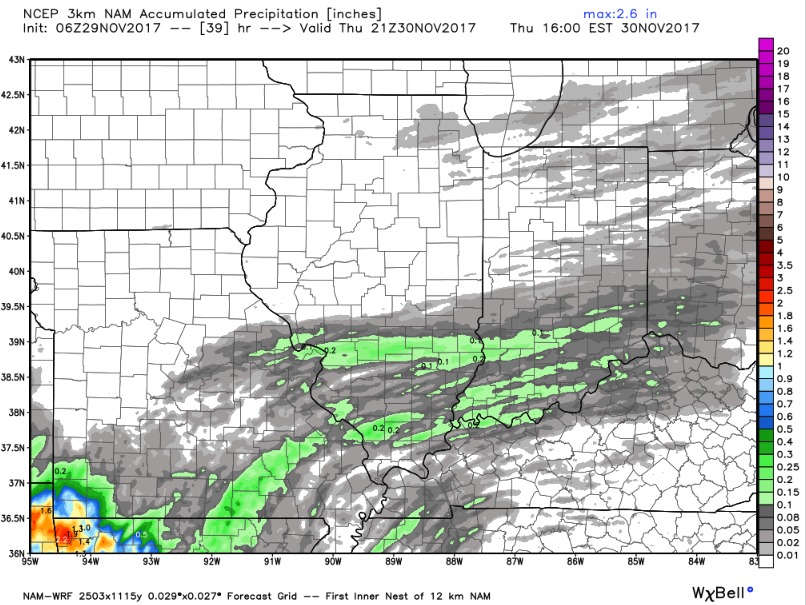
Here is the rainfall guidance over the next 36 hours…bottom-line is that many spots in central/northern Illinois likely don’t even get a drop of rain, with areas along/south of I-70 seeing 0.1″-0.2″ in spots.
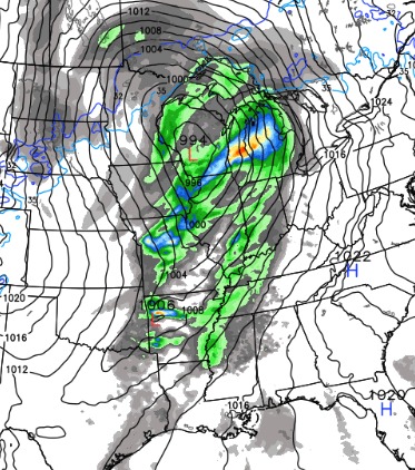
Great weather for Friday and most of the weekend with sunshine and pleasant highs in the upper 40s to mid 50s….these mornings will likely feature some frost as well. Still targeting our next system early next week to bring widespread rain chances across the state on Monday, possibly even a few thunderstorms. This will be followed by sharply cooler air on Tuesday, and expect an increasing wintry feel mid to late next week. In fact, it’s very possible to see highs late next week not get above freezing for numerous areas. Could we also see some snow chances?? Yes! Check out the video for more. Here is a look at the European model forecast for Monday afternoon showing a potent system working across the state:
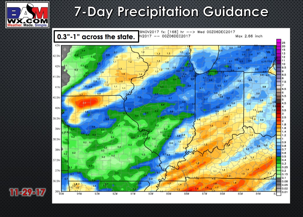
7-day rainfall guidance:
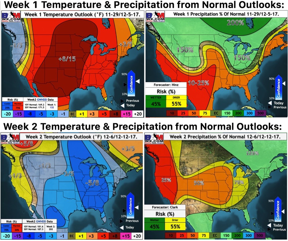
Weeks 1 and 2 outlooks: