Today’s Nebraska/Iowa Video Forecast:
A front is moving through the area this morning, bringing an increase clouds but no precipitation. Temperatures are very mild this morning ahead of the front, cooler behind the frontal passage. Temperatures/satellite at 8AM CST shown below:
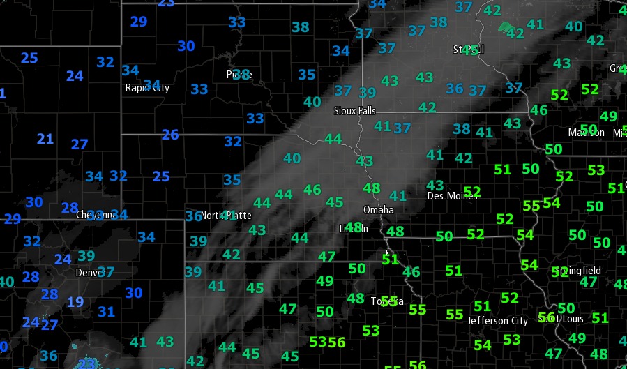
Not as warm as yesterday…but highs today will still be above normal ranging from the upper 40s to middle 50s for most. Clouds should clear from northwest to southeast through the day.
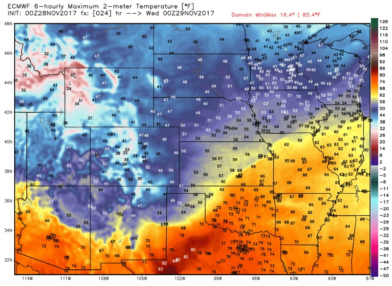
It is a very quiet weather pattern for the rest of the week. A weak disturbance moving up from Missouri may bring a few showers to southeast Iowa Wednesday evening, otherwise remaining dry with high pressure building in Thursday through Saturday with sunshine. Temperatures remain well above normal this week.
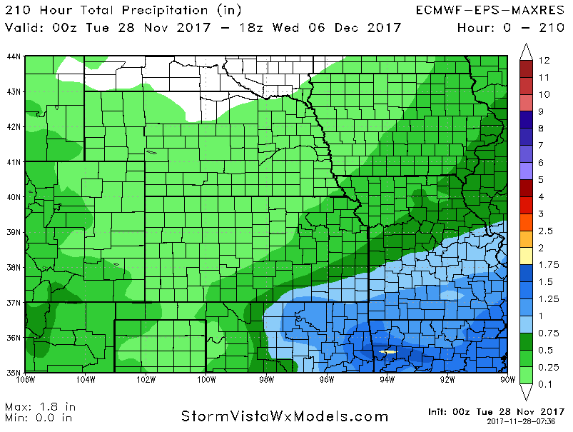
We likely see a developing storm system move across the area early next week, followed by a shift to a colder pattern across the central and eastern United States as we rumble closer to mid-December. Uncertainty is a bit higher right now on how much rain we will see over the next week. An average of 51 European ensemble members for 7-day rainfall is shown below. This places rain totals of 0.25″-0.5″ across southeast Iowa, with the rest of the area seeing less than a quarter inch. That said, I feel this could trend higher in the coming days as the operational European is much more aggressive.
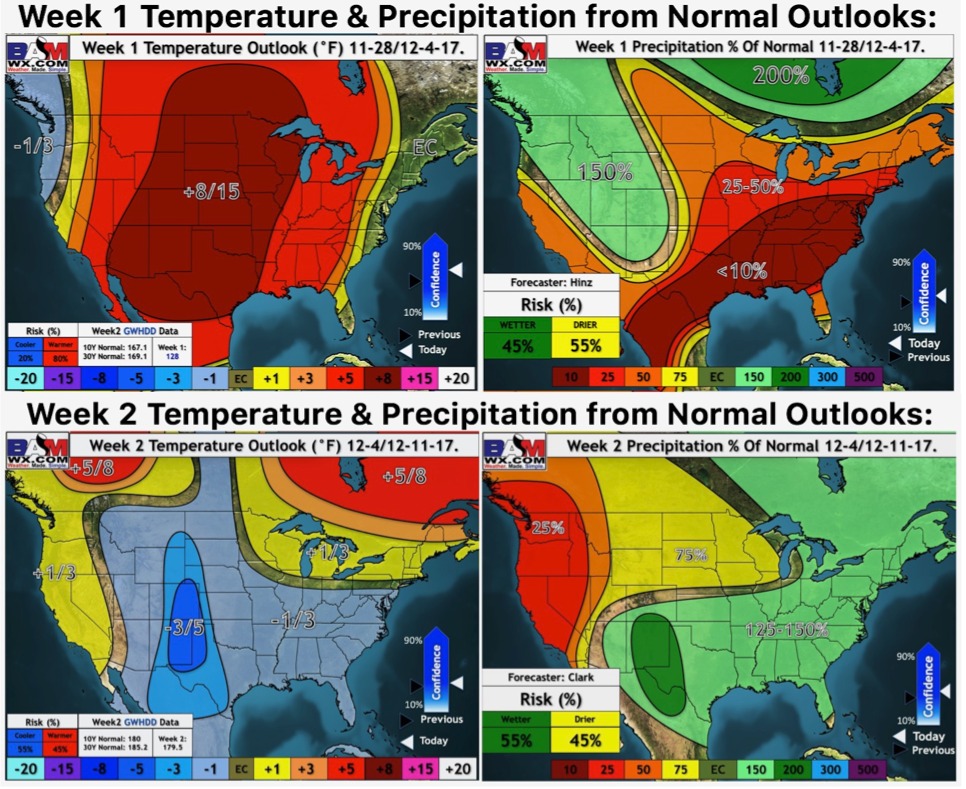
Here are our weeks 1 and 2 outlooks: