Today’s Illinois Video Forecast:
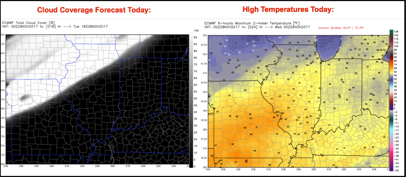
A weak front will move into the state from northwest to southeast this afternoon into tonight. Overall it appears there will be no rainfall with this front, just an increase in clouds. Warm highs in the 60s for much of the state, with southerly winds gusting 20-30 mph.
It appears the main chance for any rain this week will come Wednesday night and Thursday morning. Models have trended even weaker with this rain chance, just expecting some scattered light showers amounting to less than a tenth inch for most spots. This system should quickly exit Thursday morning with sunshine building back in.
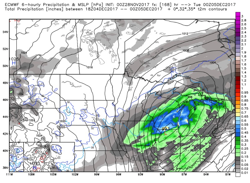
High pressure builds back in for Friday and Saturday with dry conditions expected. Temperatures remain mild with highs in the upper 40s to mid 50s. Much of Sunday looks dry as well with an increase in clouds along with a breezy southerly wind, ahead of a developing system set to impact the area early next week. European model forecast for Monday evening shown below….if that solution verifies it would bring rain and even thunderstorms followed by sharply colder air by the middle of the week.
Check out the upper-level pattern as it transitions from a ridge (warmth) to a consistent trough (cold) as we get into mid-December:
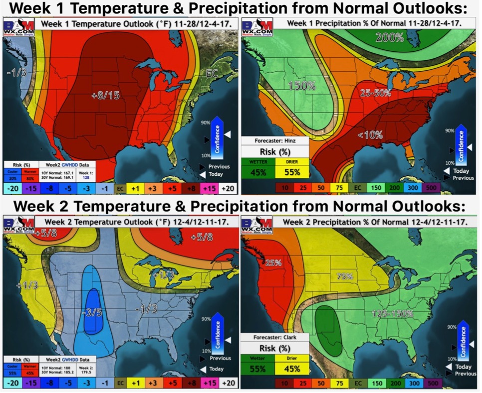
Weeks 1 and 2 outlooks: