Today’s video covering Missouri and Kansas:
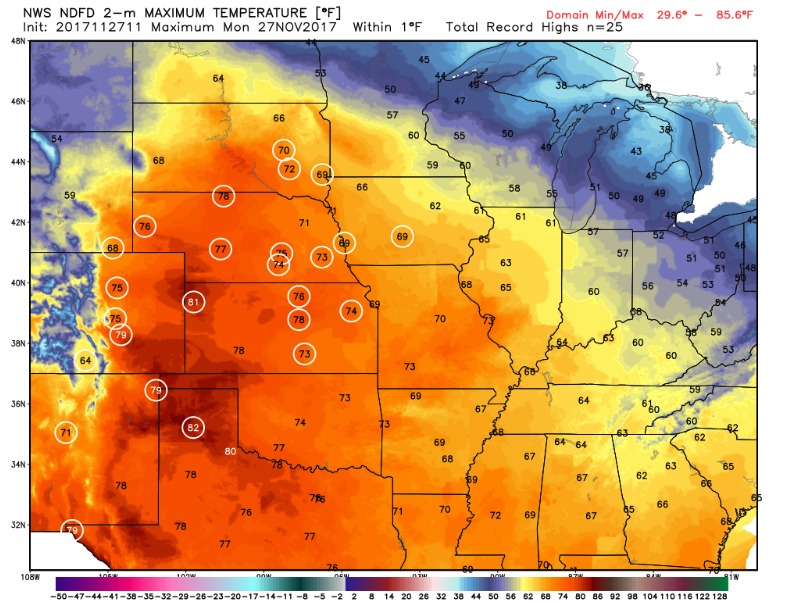
Expect a very warm day with highs in many areas reaching the 70’s! Several locations across Kansas could reach record highs. It will remain dry with mostly sunny skies.
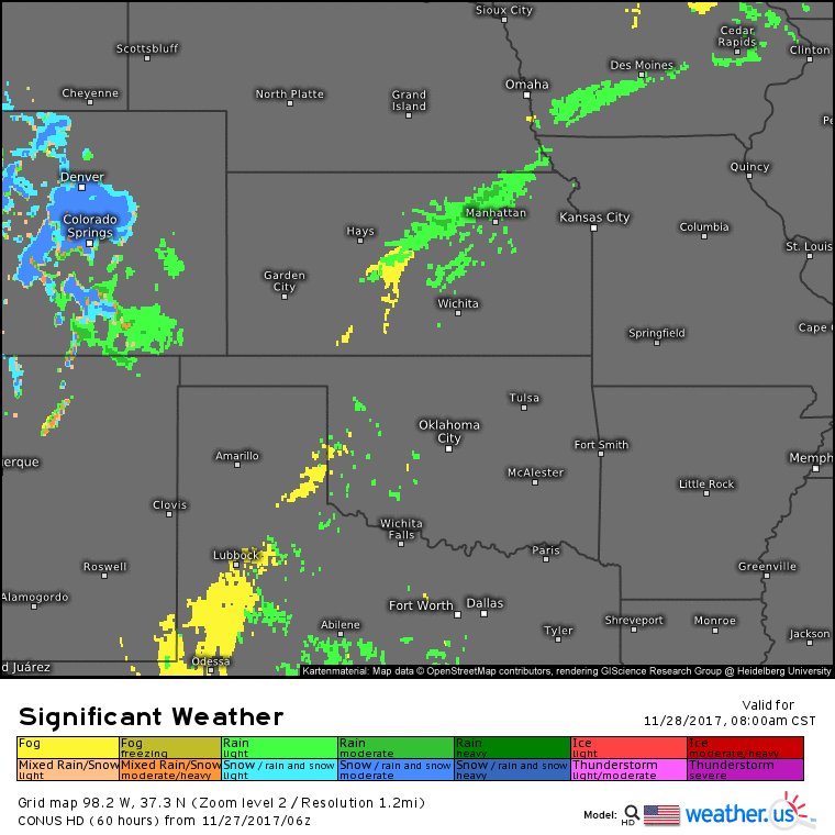
A weak front will settle southward into the area Tuesday, bringing increased clouds and the threat for a few spotty showers. A disturbance will move along the front bringing better chances for rainfall Tuesday night mainly over the southern half of Kansas, moving into Missouri on Wednesday as it starts to weaken. Note the timestamp on the bottom right.
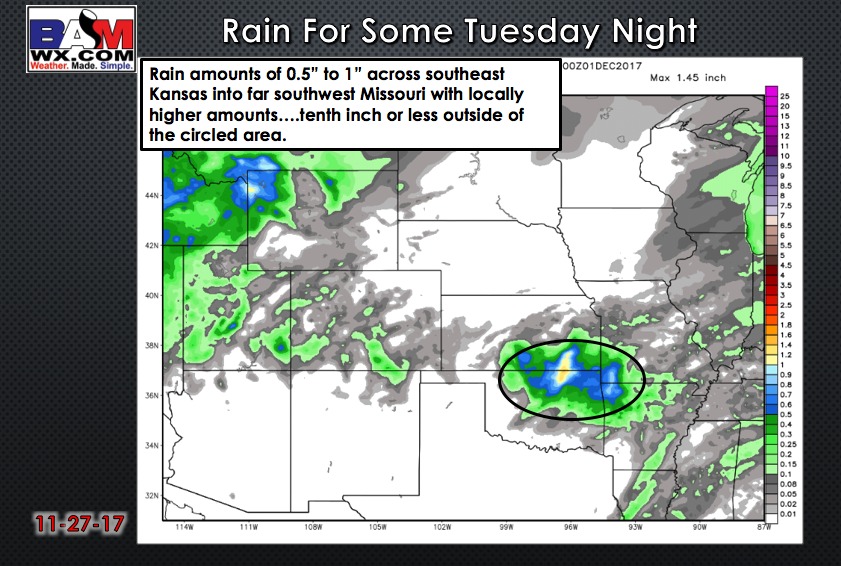
Expect rainfall with this system…portions of southeast Kansas do see some decent, much needed moisture.
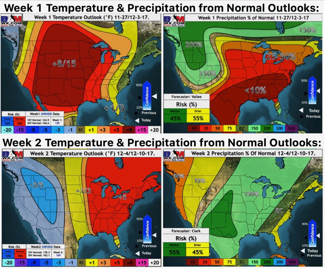
A quiet weather pattern takes hold for late week. It appears our long spell of rather uneventful weather weeks will be coming to an end next week with a much more active pattern showing up. This also ushers in changes to much colder air as we grow deeper into the first half of December. Check out our long range video for more information! Here are our weeks 1 and 2 outlooks: