Today’s Video (6min)
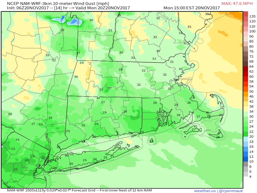
Breezy again today, generally 15-30 mph out of the West.
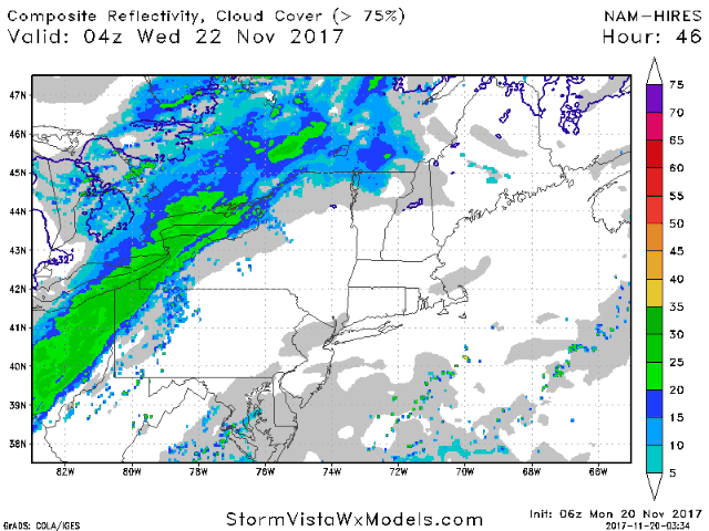
Our next rain maker comes late Tuesday night into Wednesday. Projected radar guidance below:
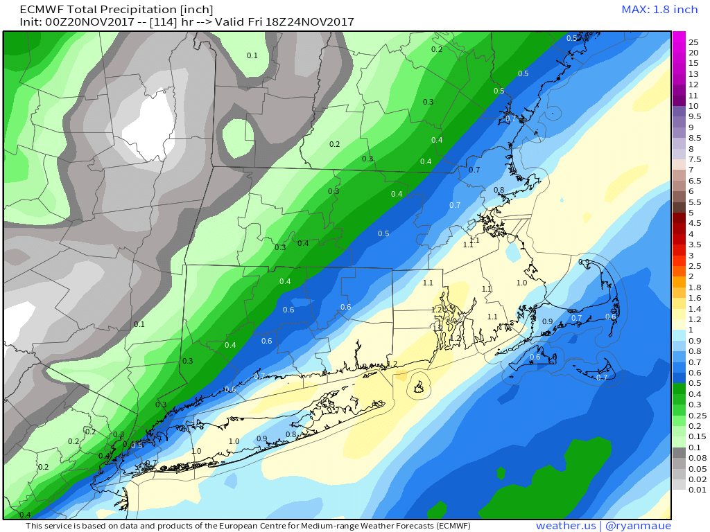
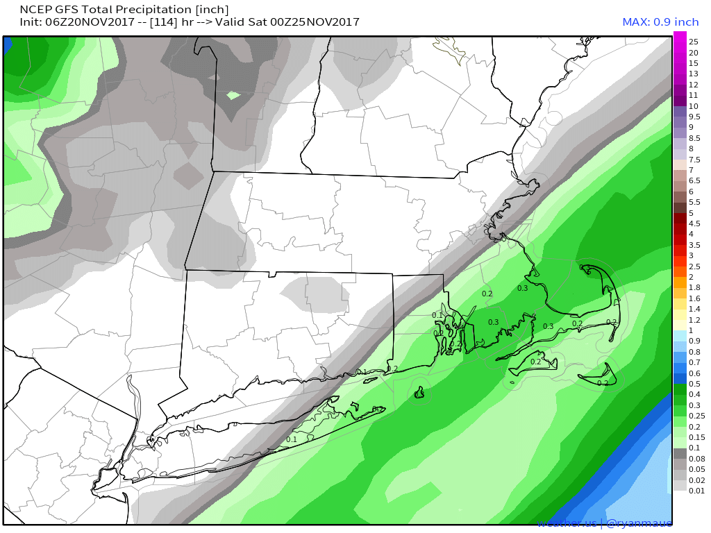
Total rainfall may be fairly impressive with this system, ranging from 0.10-0.50″ northwest, to 0.50-1.50″ south an east. European model shown below.
However, some uncertainty still exists with how far northwest precipitation will come. Note the GFS model below is well southeast. I think this will adjust northwestward some in the coming days.
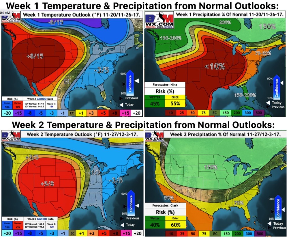
Updated week 1 and 2 outlooks show a chill sticking around to end the month.