Key Points – Thursday, November 2, 2017:
Synopsis: Good Thursday morning! Waking up to areas of fog along with drizzle this morning, as warmer air continues to lift northward into the state. A mild day ahead with continued areas of drizzle and light showers through the day. Rain chances will increase this evening and tonight as a cold front moves through. A few thunderstorms will be possible tonight, with an isolated strong storm not out of the question. Friday will feature showers exiting southern Indiana early tomorrow, with dry conditions settling in with some sunshine. A warm front lifts into the state on Saturday, bring a few scattered showers and thunder. It will turn much warmer through the weekend. The main focus will be the increasing concern for severe storms Sunday evening and night as a strong cold front moves through the state. We will need to watch this closely.
Today’s Video (8 min):
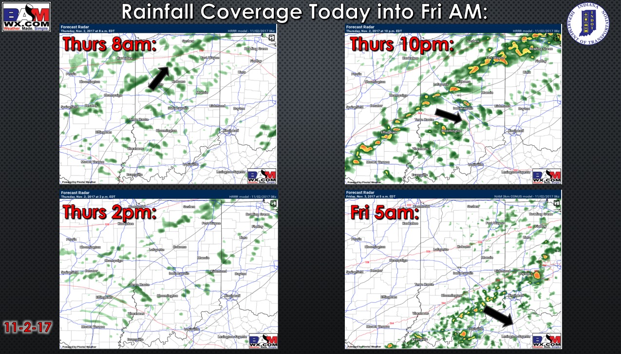
Rainfall coverage forecast for today into Friday morning…patchy drizzle through the day, then we look for increasing showers and isolated storms tonight:
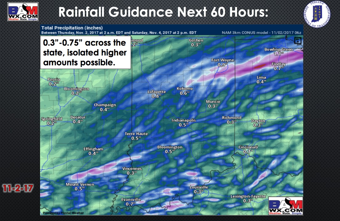
Forecast rainfall next 60 hours:
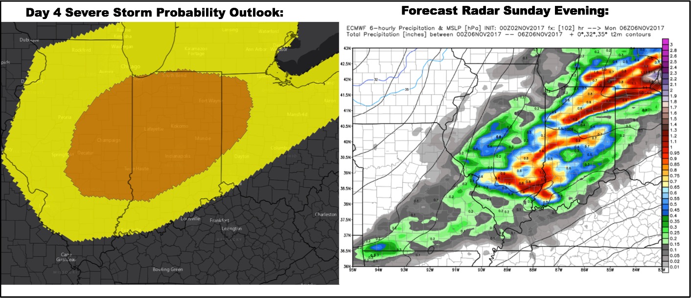
The warmer air building in through the weekend will come with a price….the threat for severe storms Sunday evening. Currently it looks like all of Indiana will be in line for severe storm potential….highest probabilities at this point indicate central and northern portions of the state in the highest threat.
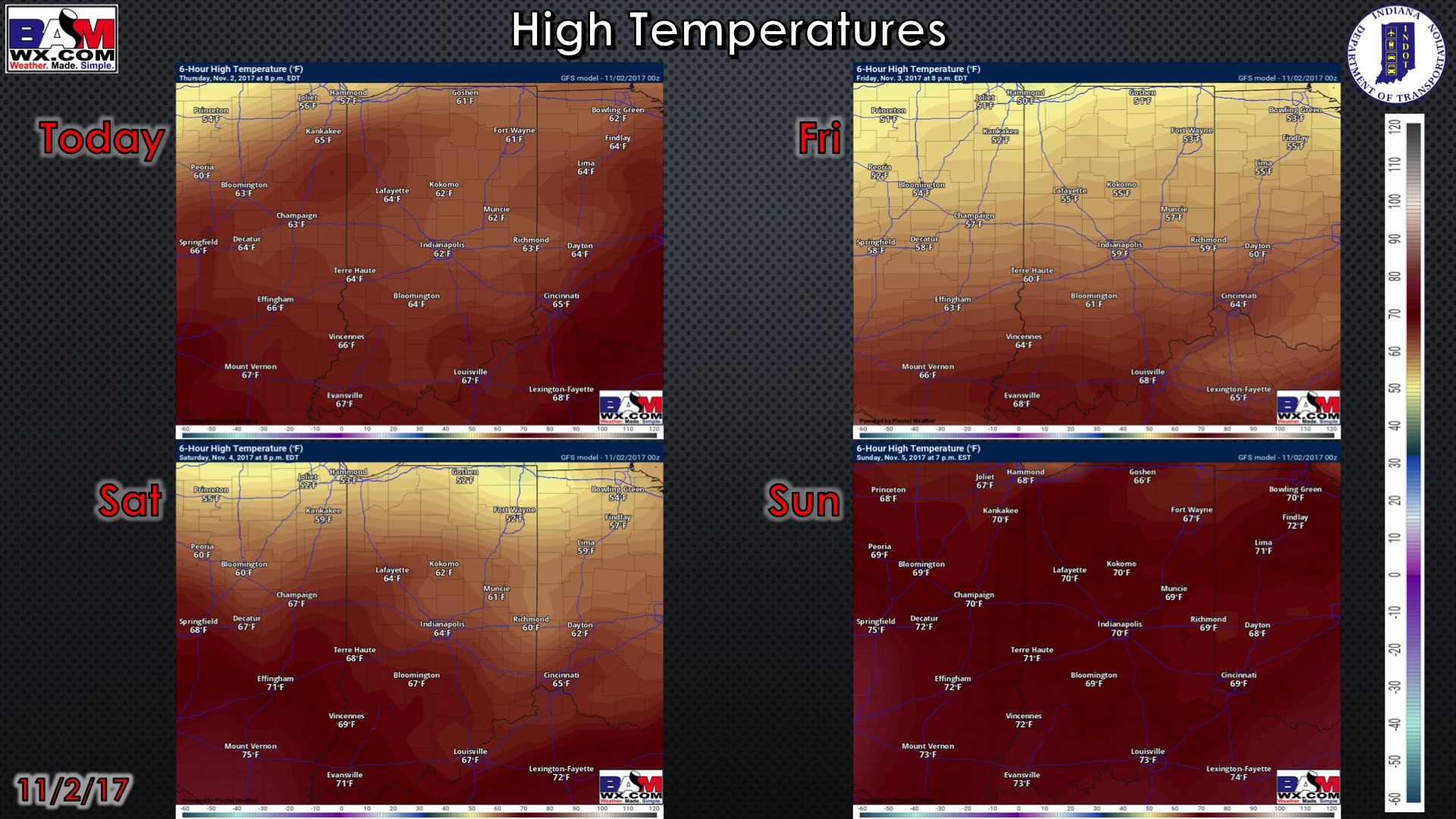
High temperature guidance over the next 4 days:
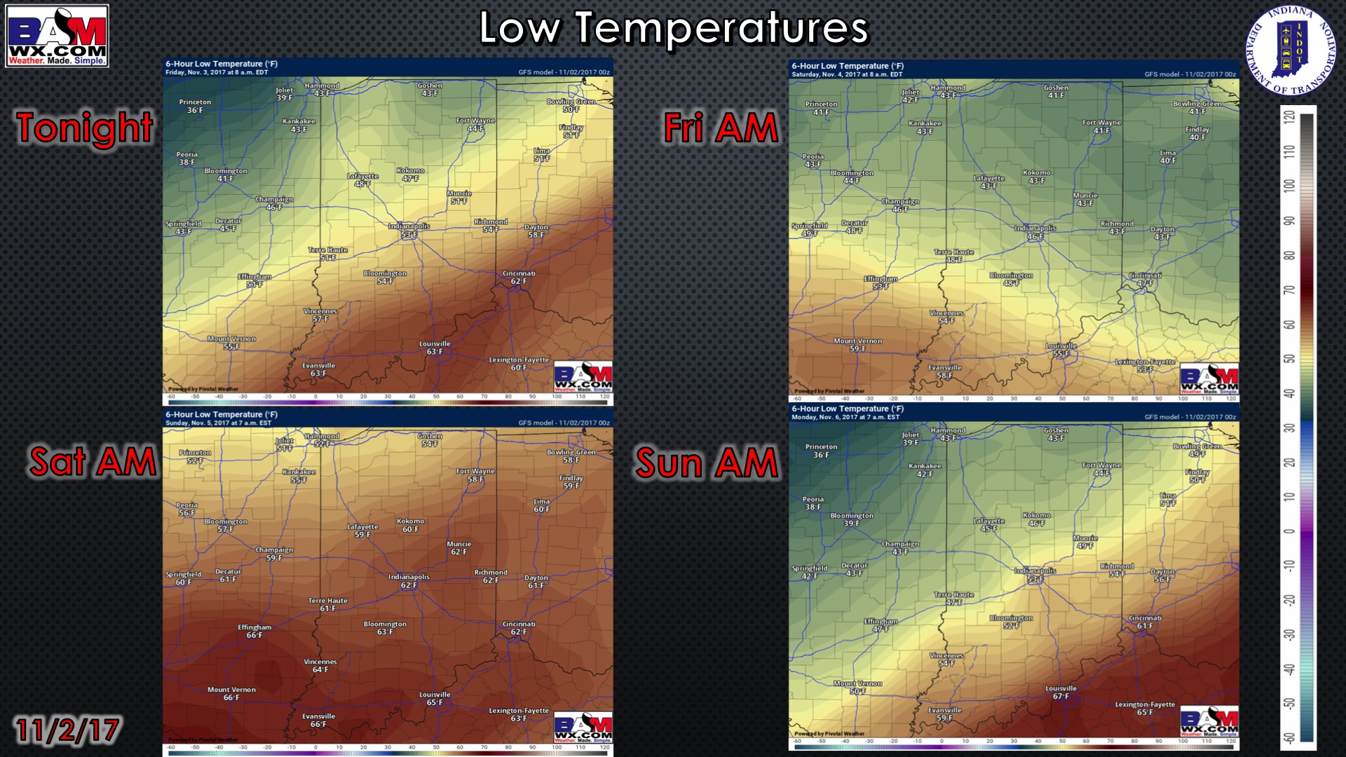
Low temperatures over the next 4 mornings:
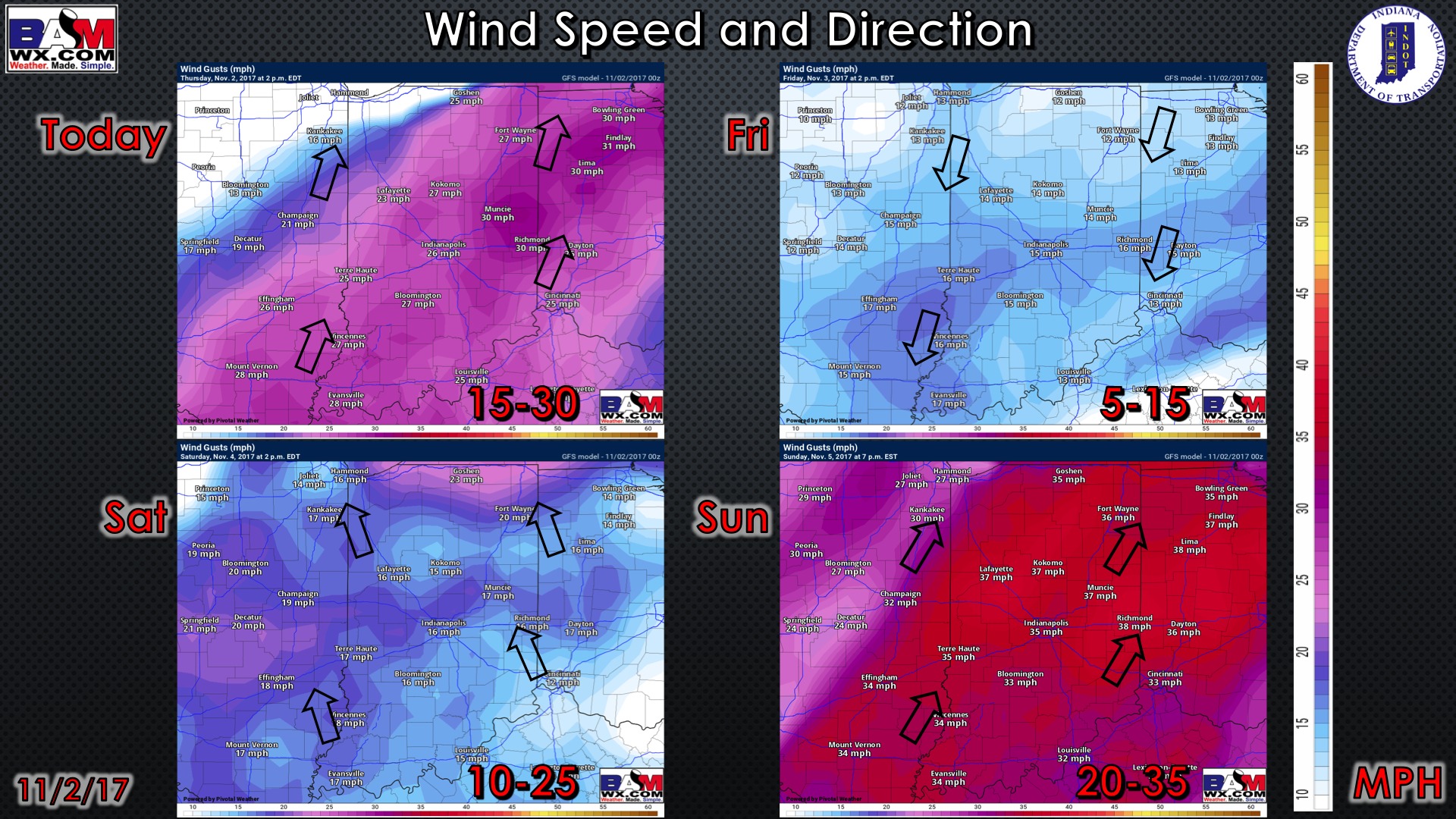
Wind forecast over the next 4 days:
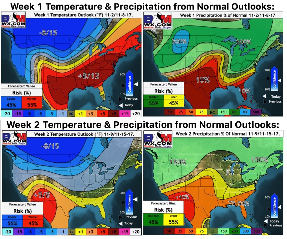
Weeks 1 and 2 outlooks: