Today’s Illinois Video Forecast:
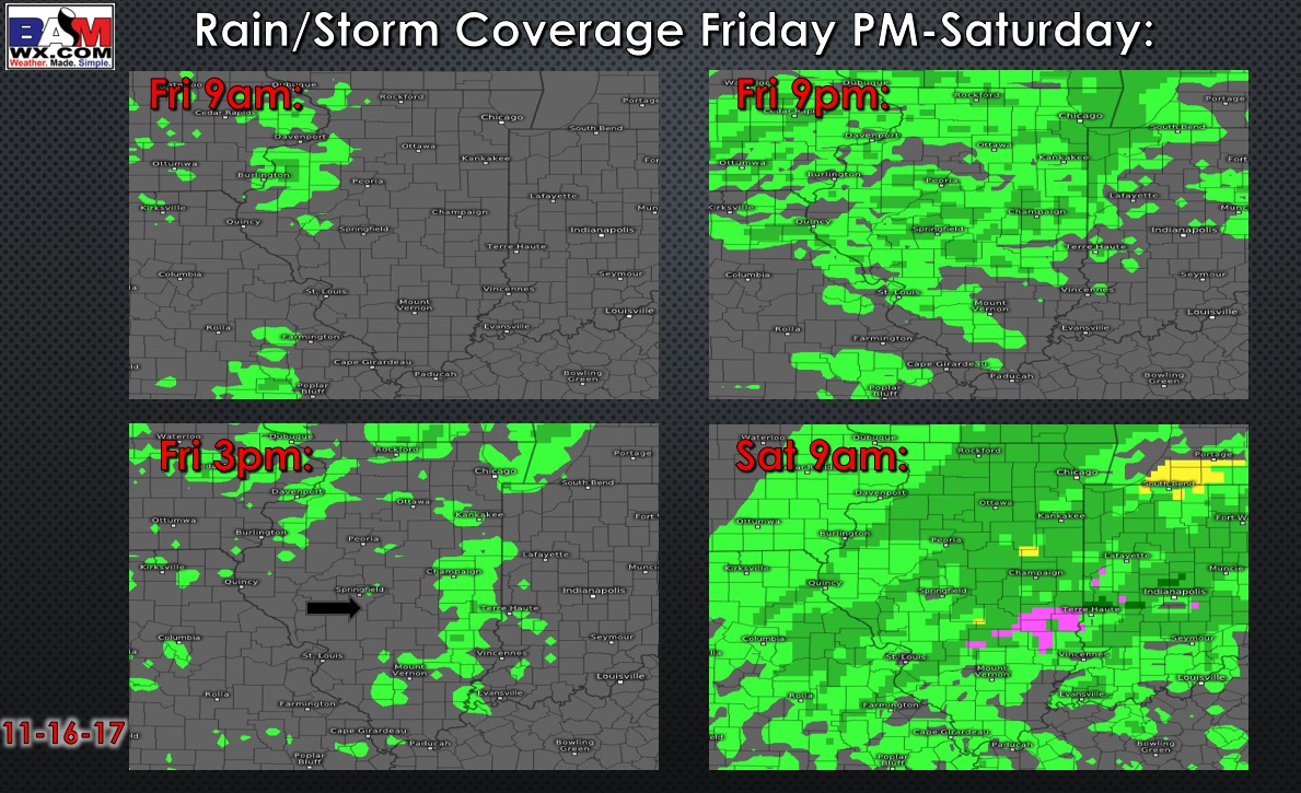
Forecast timing/coverage of the increasing showers Friday and Saturday:
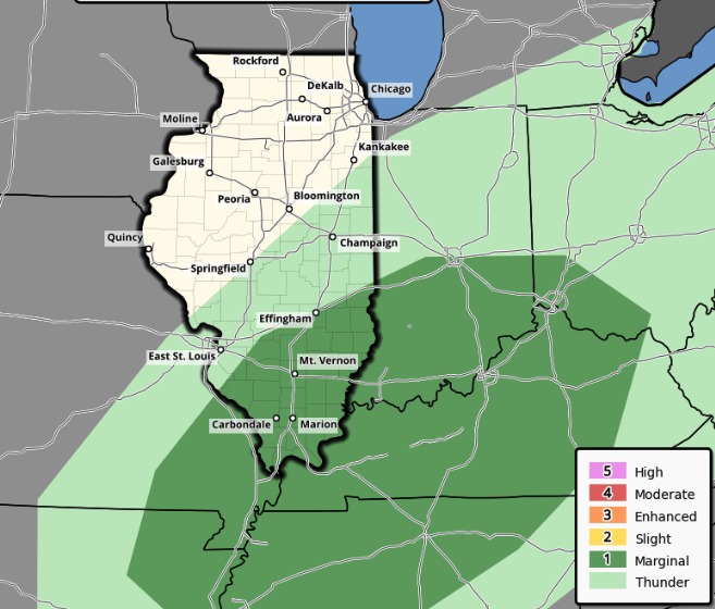
A marginal severe risk for southern, southeast Illinois south of I-70 on Saturday. This is where the greatest energy will be present for the potential of isolated damaging wind gusts.
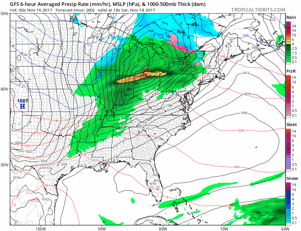
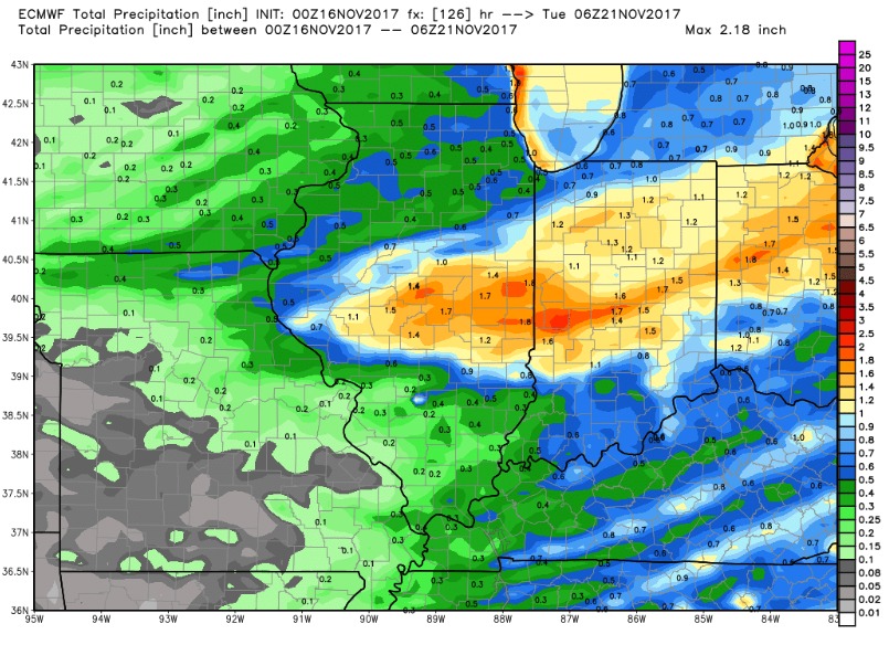
Current rainfall guidance indicates central portions of the state from Springfield to Decatur, Charleston, Champaign areas see the heaviest rain where 1-2″ could fall. Lower totals north and south:
Could see some wet snow mix in with the back-edge of the rain across northern Illinois Saturday afternoon as colder air filters in. Much colder but dry on Sunday. Briefly milder air early next week, but turning chilly mid-week with a shot of cooler air.