Wednesday, November 15, 2017 Missouri Forecast
Today’s video (7 min):
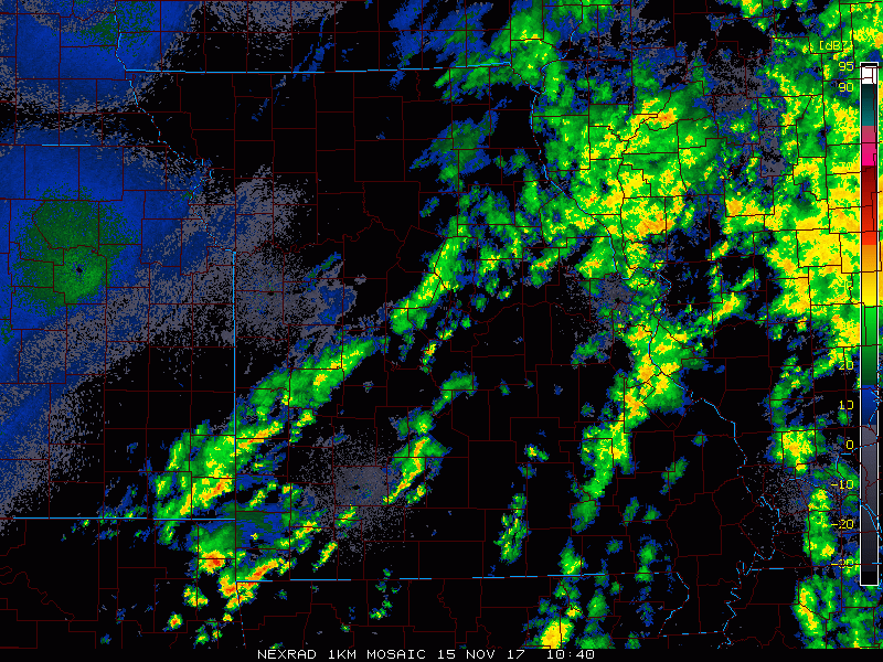
Current radar this morning shows the showers and a couple of storms work west to east across the southeastern half of the state…we clear from northwest to southeast with sunshine expected across most locations today (exception being the Bootheel of MO with lingering clouds/precip):
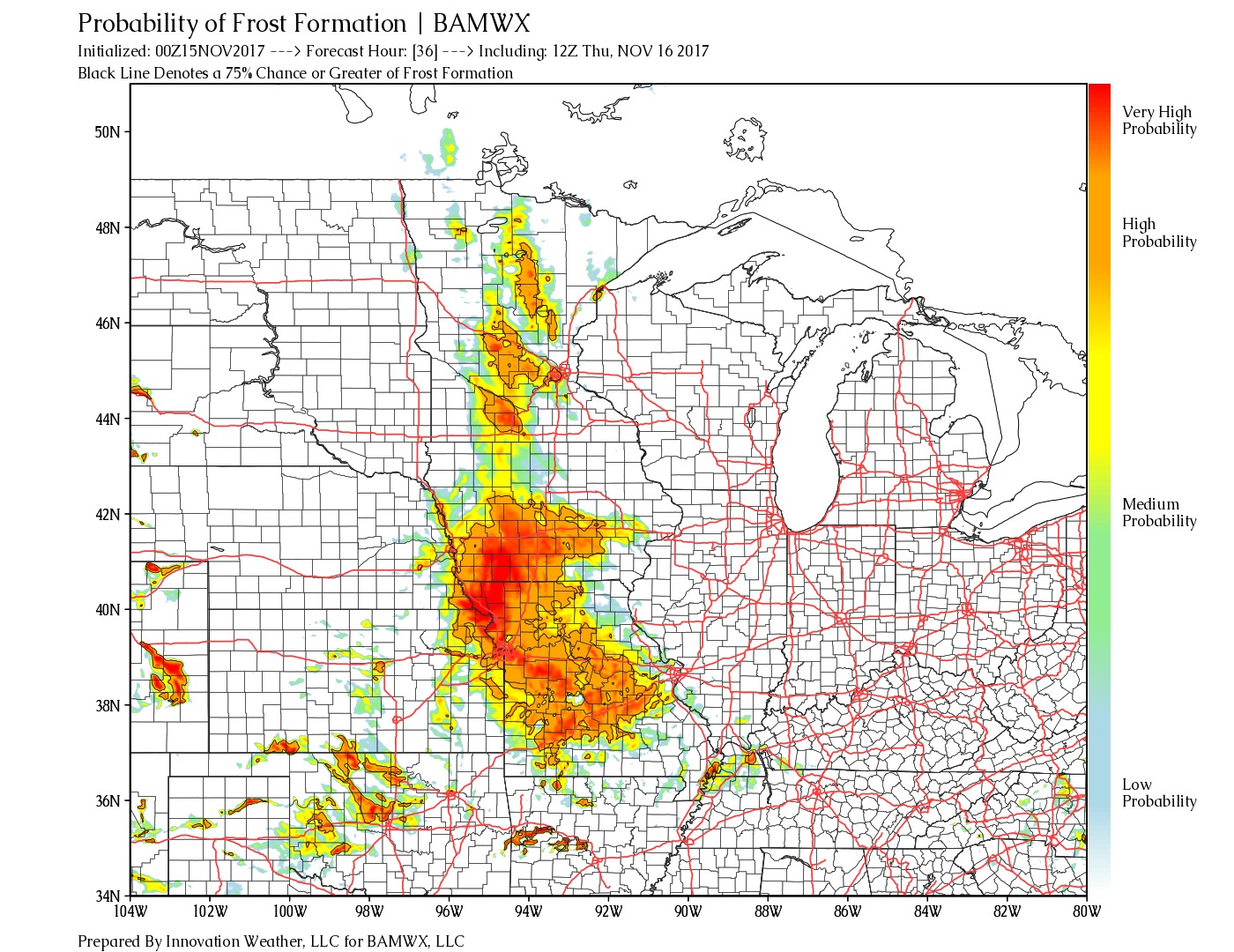
Frost formation probability tool indicates north of I-44 patchy frost will be possible…the highest probabilities will be north of I-70 waking up Thursday morning:
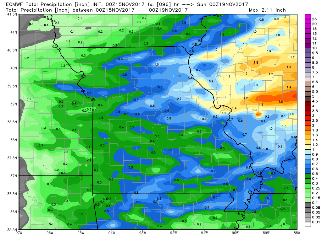
Rainfall guidance over the next 4 days…gusty storms still possible across the eastern half of the state Friday into Saturday as cold front works east…localized amounts exceeding 1.0″ will be possible:
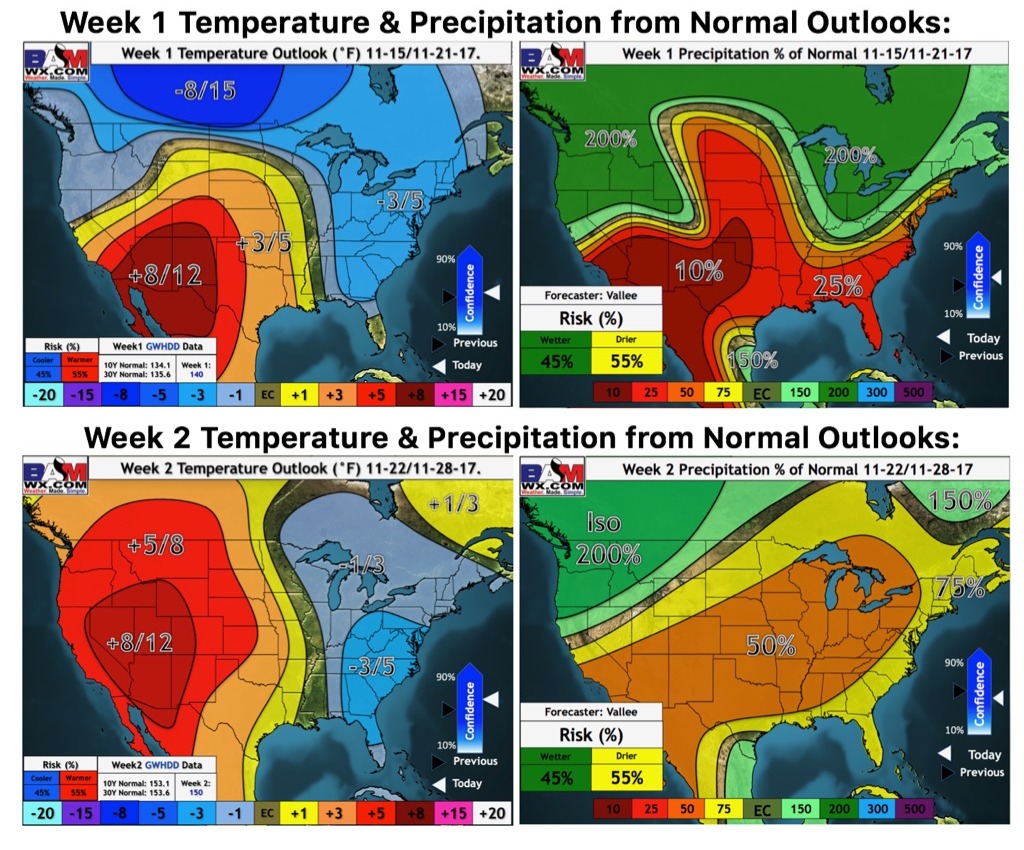
Updated weeks 1 and 2 long-range outlooks…overall the pattern to end November is drier with the warmth focused west and more “normal” temperatures expected across the eastern half of the state: