Tuesday, November 14, 2017 Missouri Forecast
Today’s video (6 min):
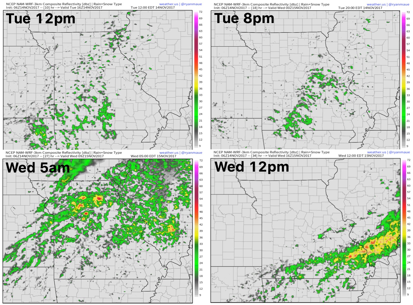
Showers and a few rumbles of thunder continue to move east today ~40/50% in coverage…we see an uptick in rainfall coverage overnight into Wednesday morning as the cold front moves northwest to southeast:
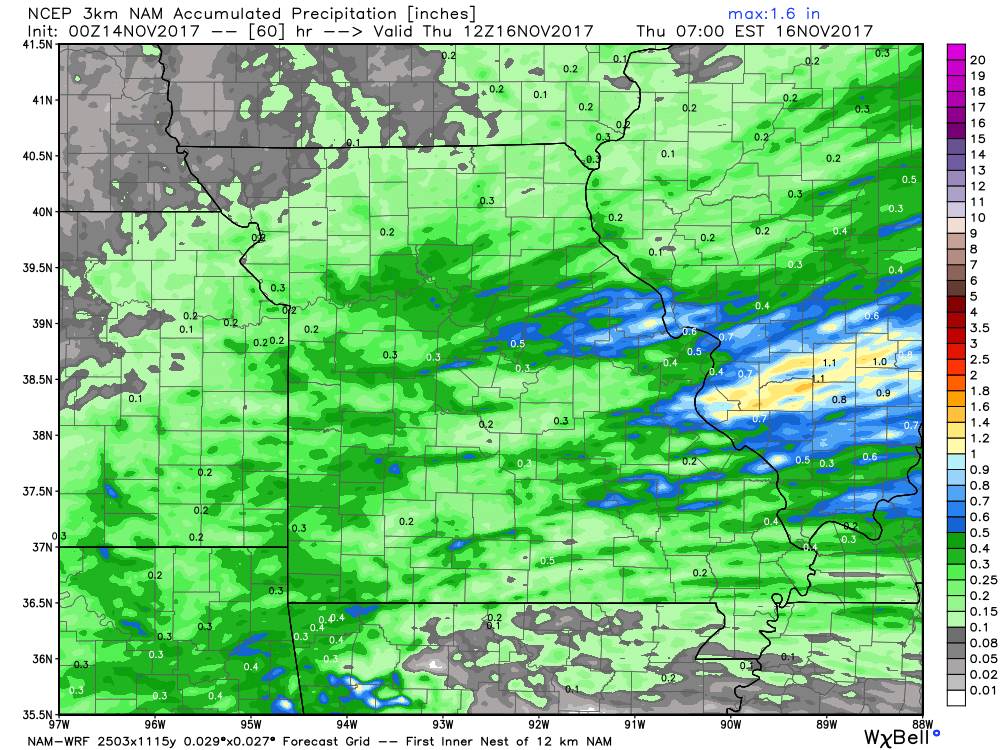
Rainfall guidance over the next 60 hours…locations south of the I-70 corridor see ~0.25-0.5″ with localized 1″ totals possible where storms may develop along the front:
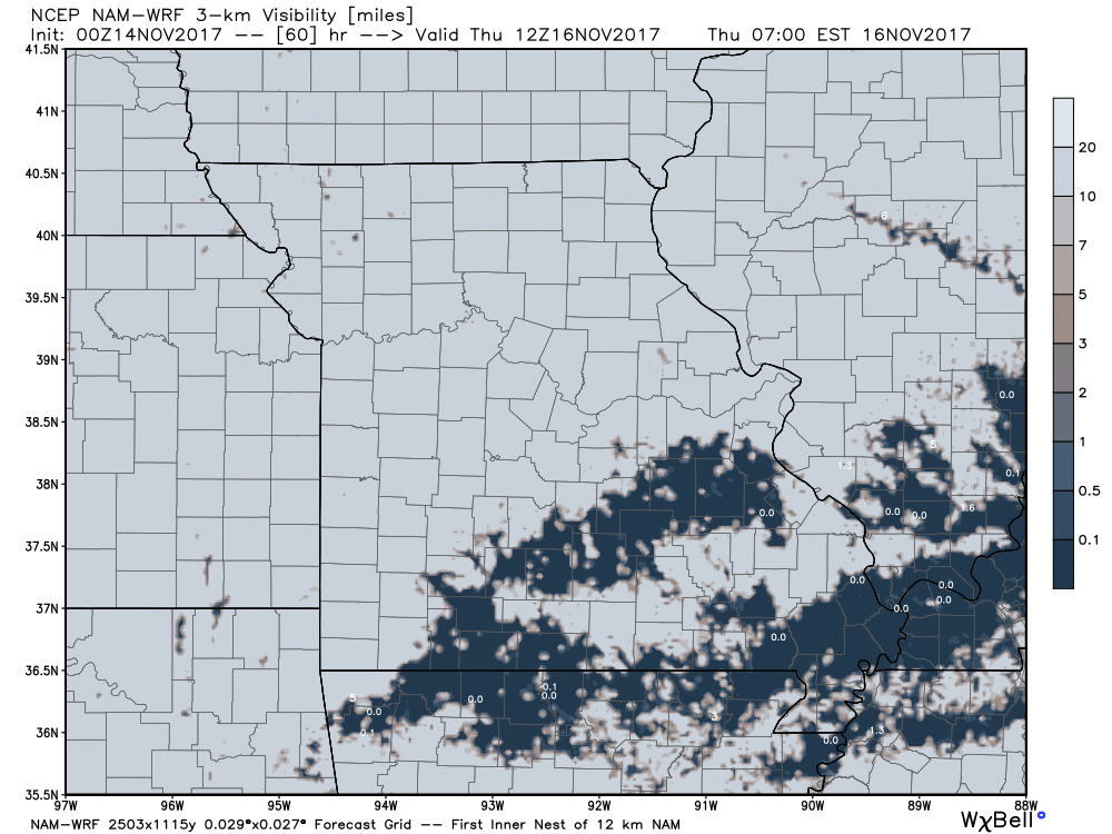
Watching for the possibility for fog to develop across locations to the southeast Thursday morning where skies clear and winds calm:
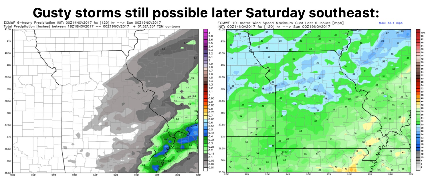
Continue to monitor for gusty storms possible later Saturday as a powerful system moves into the Midwest…the best threat will be across eastern Missouri locations drier west:
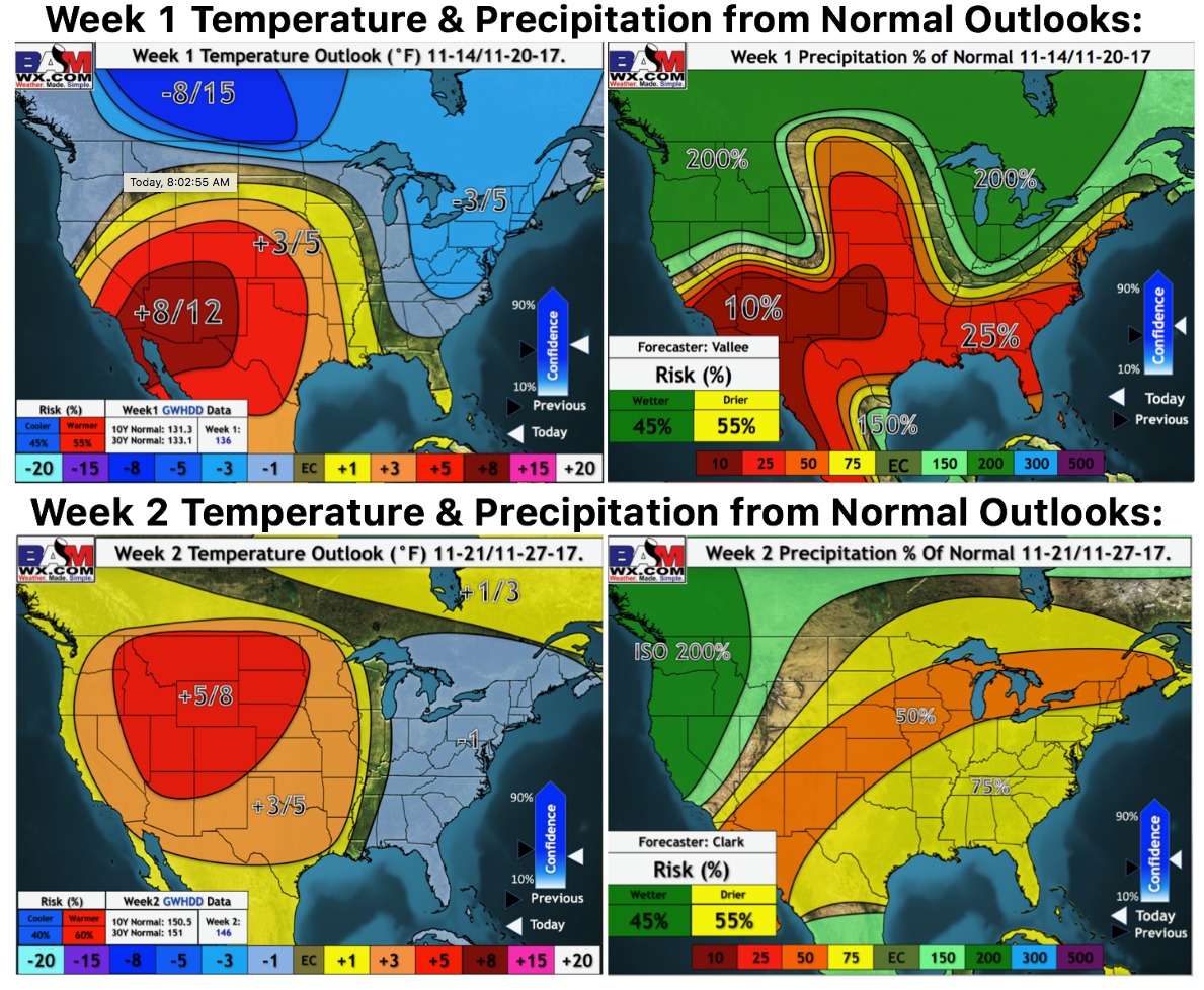
Updated weeks 1 and 2 long-range outlooks…we’ve warmed things up a bit into the week 2 timeframe.