Key Points – Monday, October 9, 2017:
Synopsis: Good Monday morning! A little patchy fog/drizzle waking up early this morning as the disturbance that brought rainfall further south this weekend continues to push east. Watching late tonight into the predawn hours of Tuesday as another wave of precipitation works in from southwest to northeast, we mention in the video how the forecast models could be slightly underdoing the shower threat as well; can’t rule out some patchy dense fog waking up Tuesday morning as well. The low pressure then swings through Tuesday night before exiting east early Wednesday. The next “organized” rainfall chance looks to move into the forecast area this coming Sunday into Monday, if you have any questions with forecast please don’t hesitate to reach out…have a blessed day! -Kirk
Today’s video (5:40min):
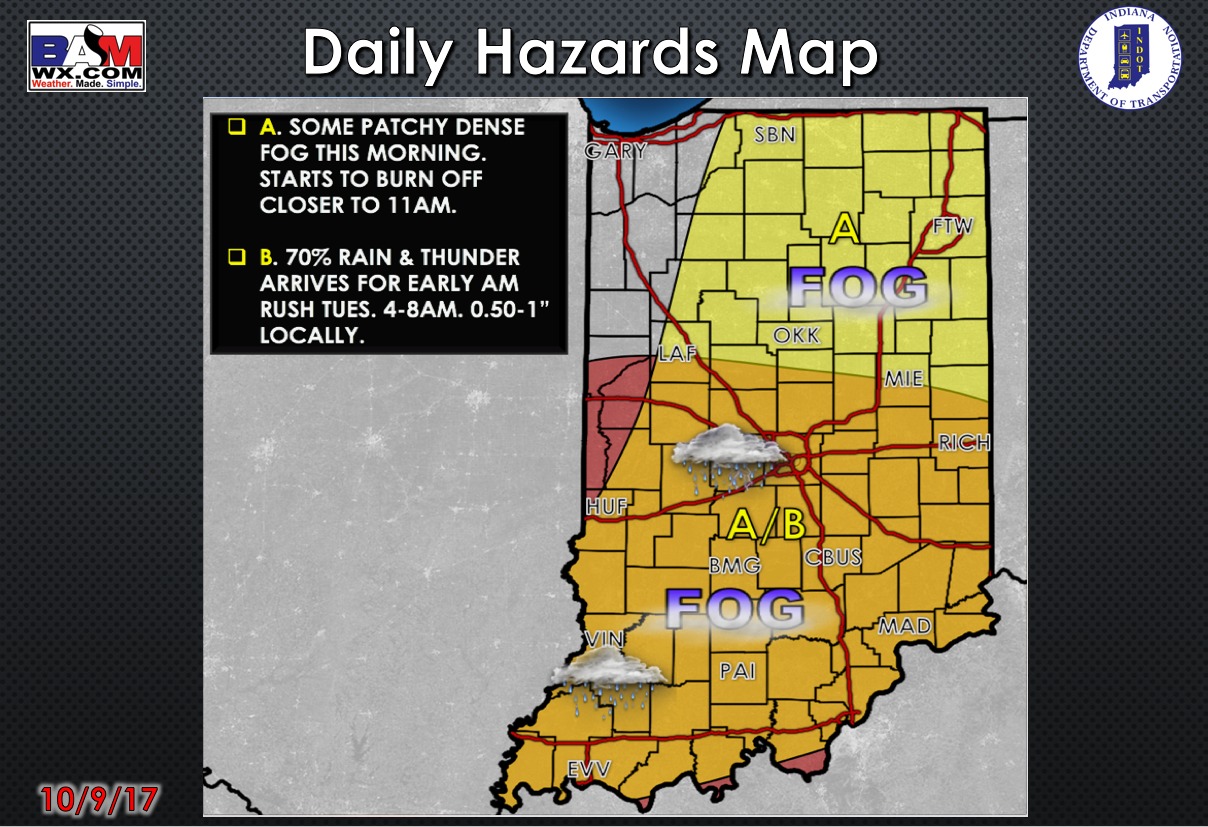
Today’s weather hazard quicksheet:
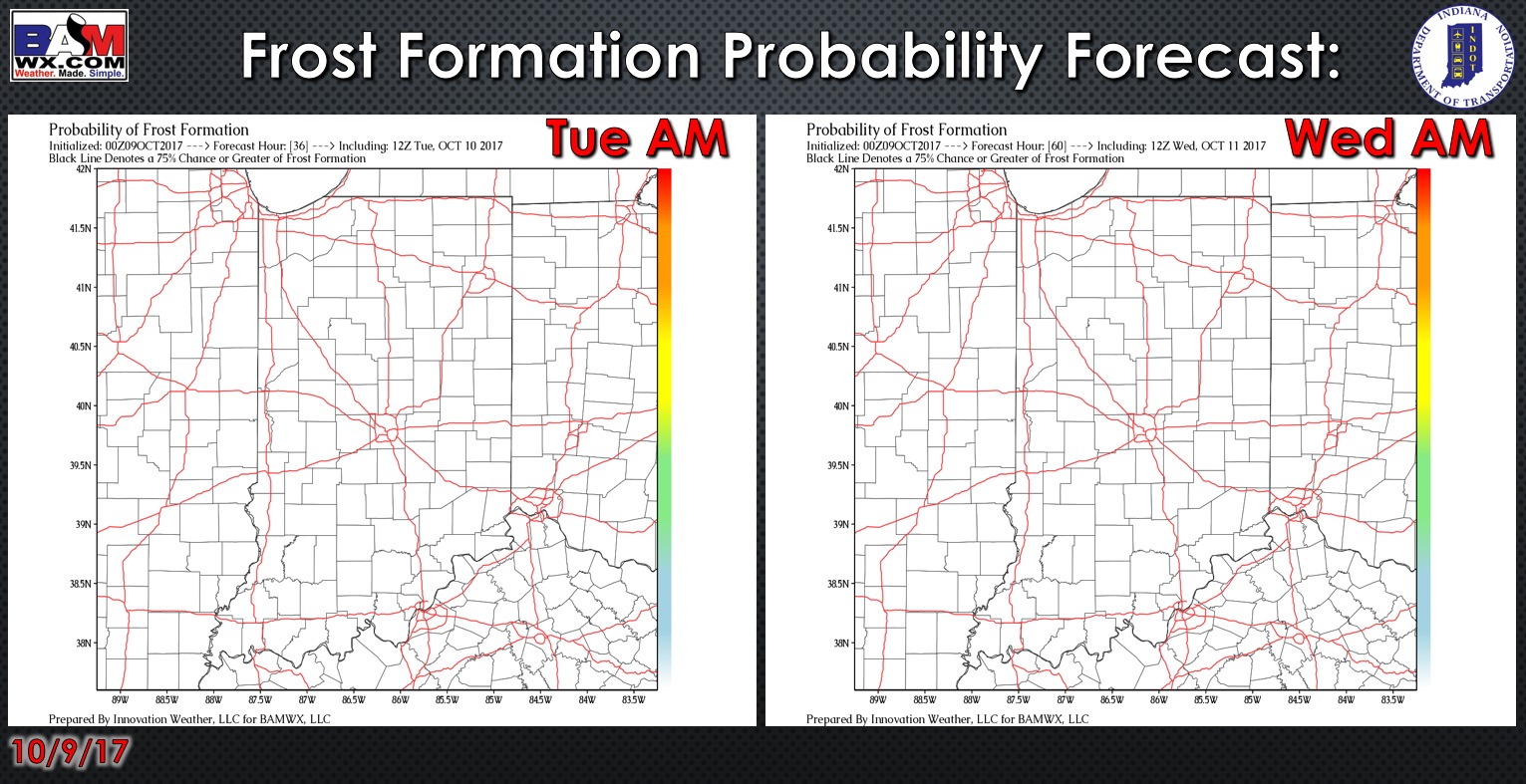
Exclusive BAMwx frost probability formation forecast over the next 2 mornings is below…no frost is expected:
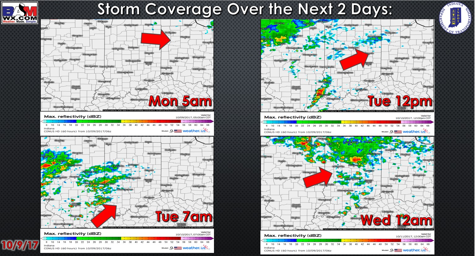
Storm coverage over the next 2 days
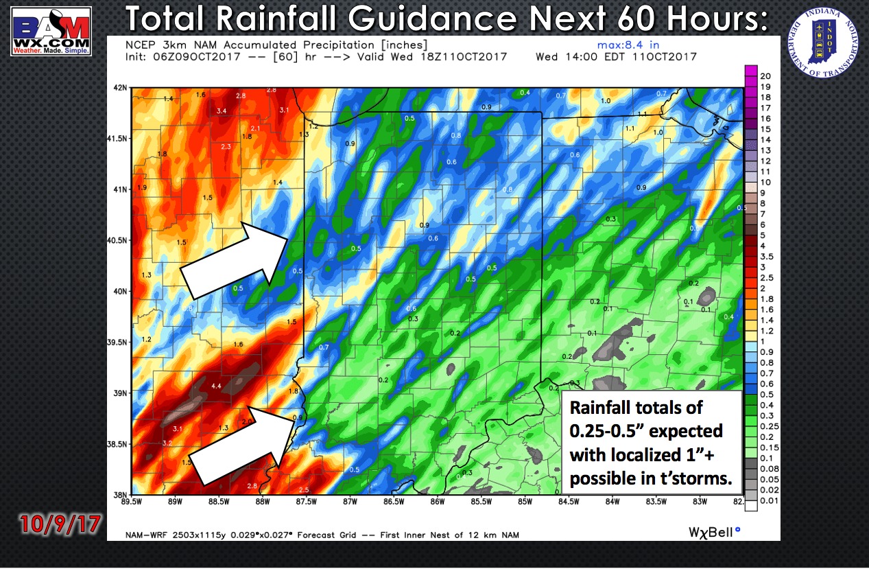
Total rainfall guidance over the next 60 hours:
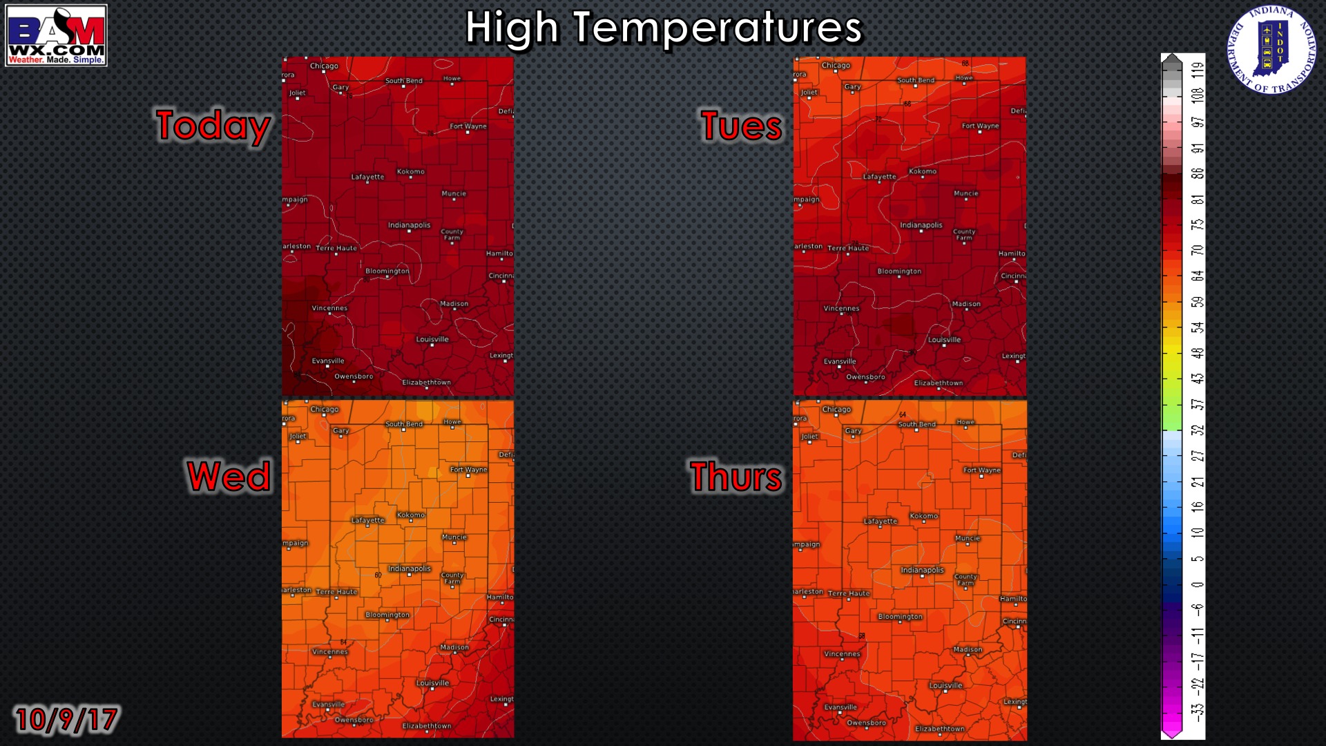
High temperature guidance over the next 4 days:
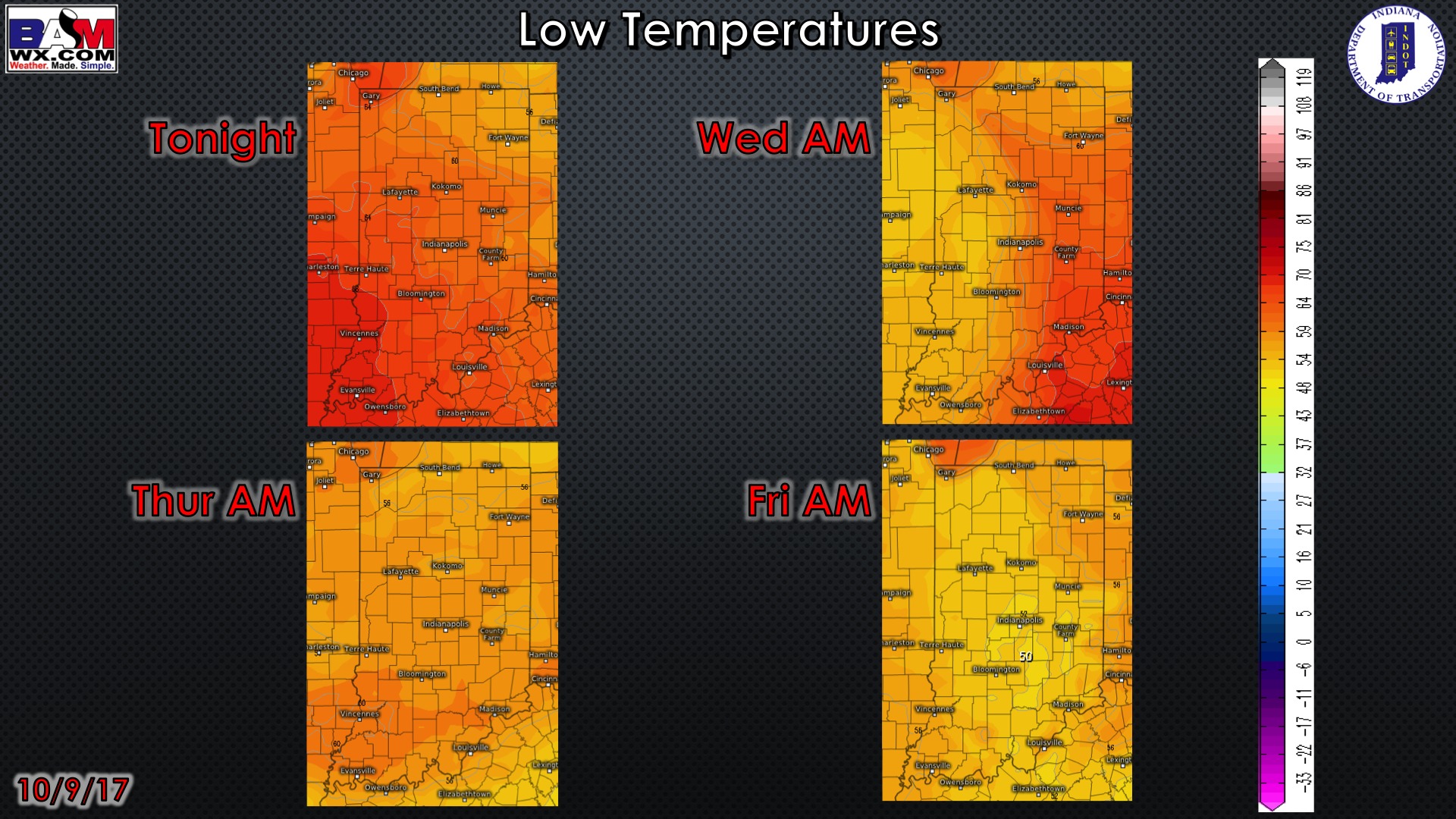
Overnight low temperature guidance over the next 4 mornings:
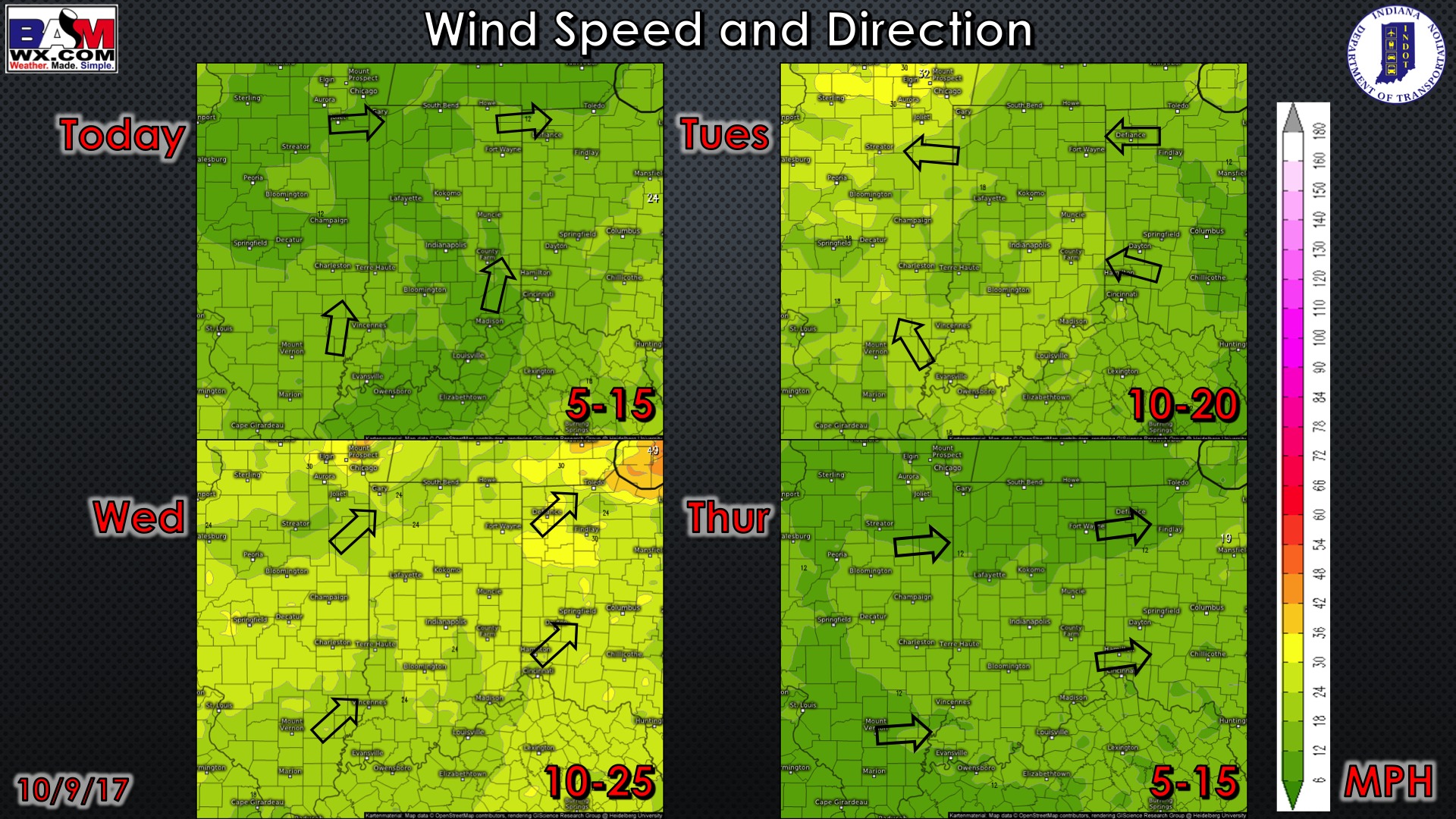
Wind gusts forecast guidance over the next 4 days:
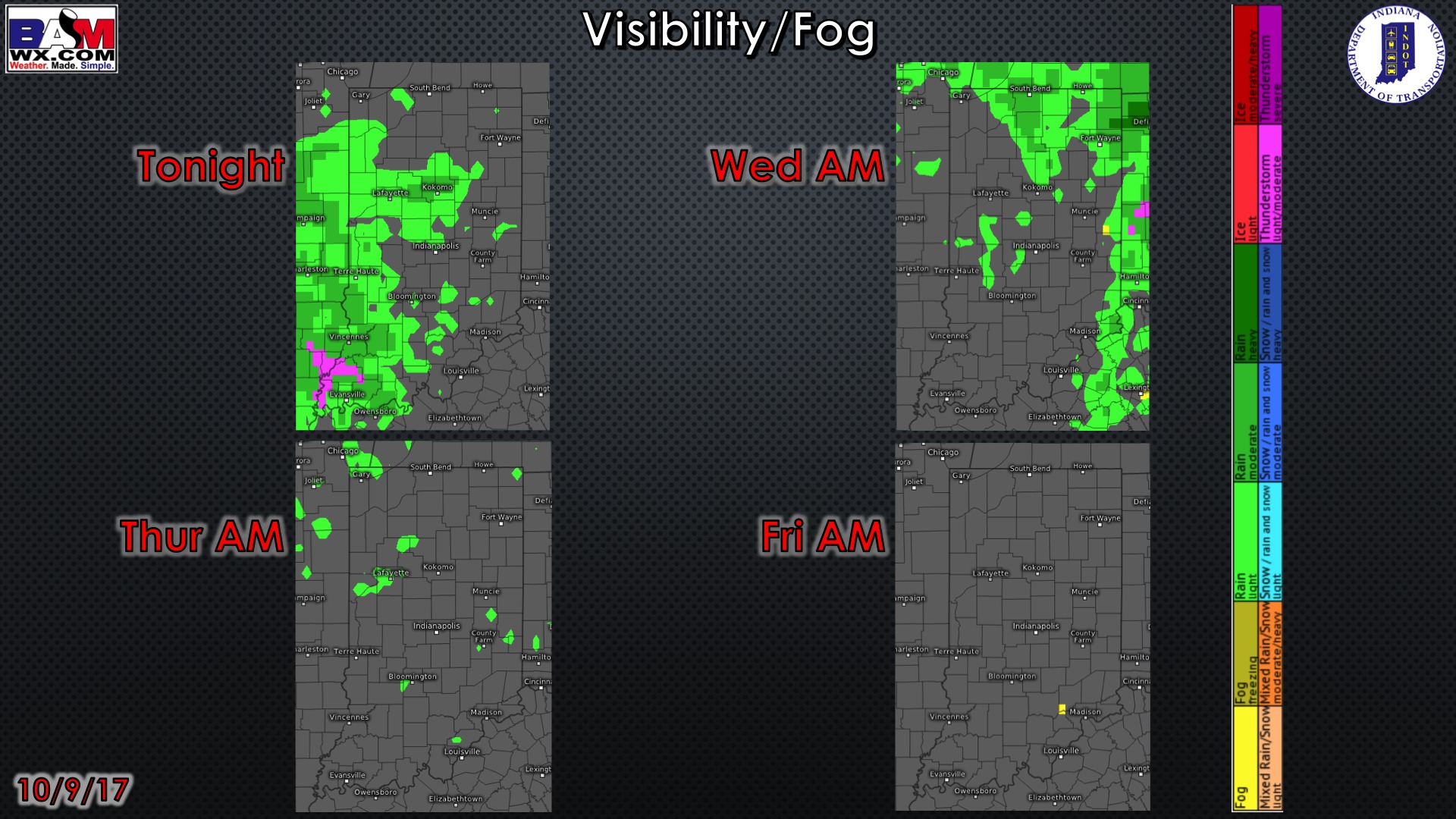
Visibility guidance over the next 2 mornings:
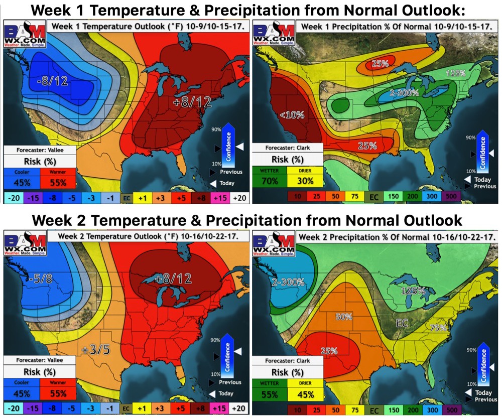
Weeks 1-2 temperature and precipitation from normal outlooks: