Key Points – Friday, October 6, 2017:
Synopsis: Good Friday morning! It’s an unseasonably warm and mainly dry forecast today with a warm front situated just north of the area. We are eyeing a cold front to push through Saturday evening, bringing scattered storms along with warm and windy conditions ahead of this front. Still watching the potential of additional rains later Sunday through Monday. Heaviest rain potential in southeast Indiana, as tropical moisture rides up along a stalled front to our south. Our “cool-down” next week is not looking impressive, as temperatures likely remain above normal. More info in today’s video. Have a blessed day, and let us know if you have any questions!
Today’s video (5 min):
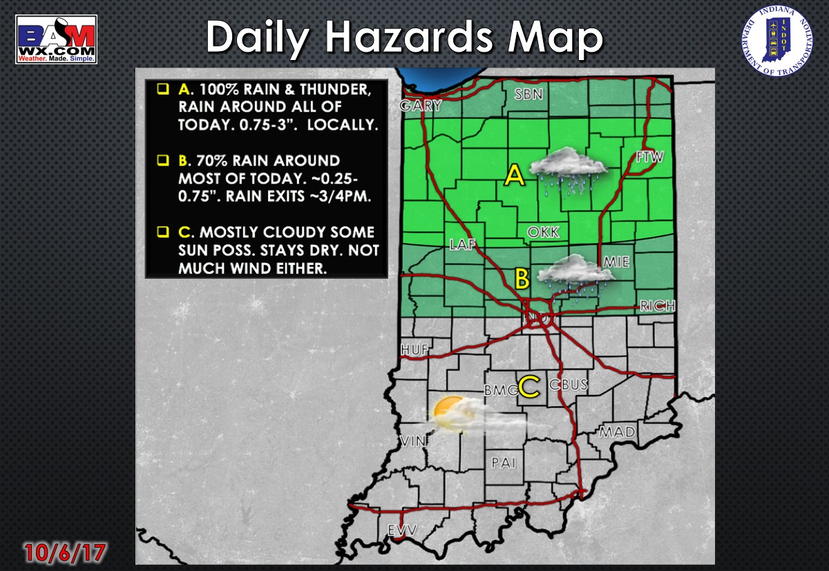
Today’s weather hazards quick sheet:
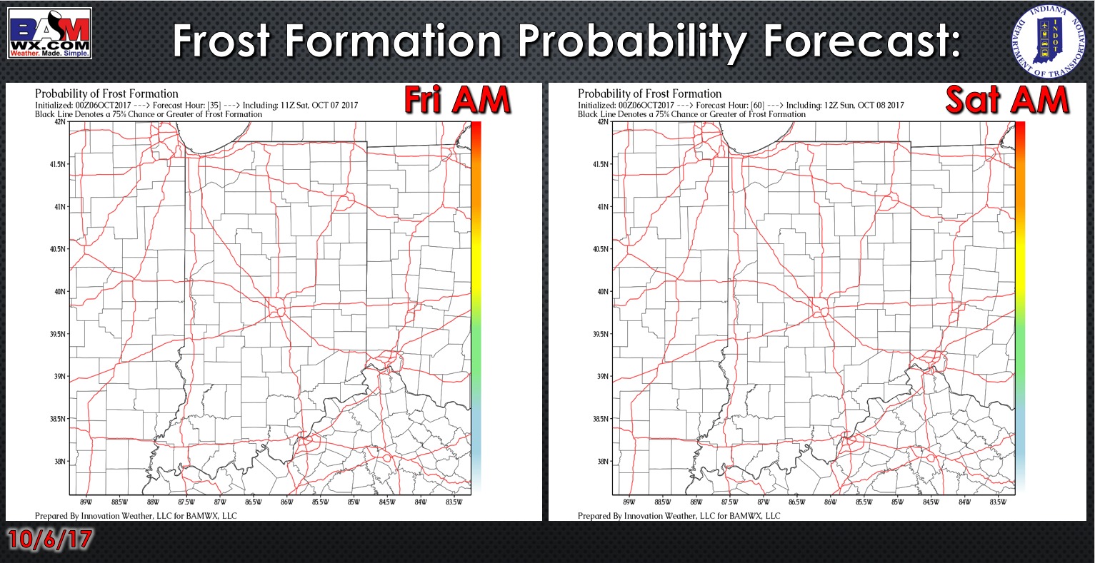
Exclusive BAMwx frost formation probability forecast over the next 2 mornings is shown below. Not worried about any frost with unseasonably warm temperatures.
Rain and storm coverage forecast over the next 2 days is shown below. Small shower chance today, but it generally stays dry with most of the showers staying north. The first half of Saturday into mid-afternoon will be dry. Scattered rain/storm chances arrive from mid-afternoon onward, with the best chances along the cold front during the evening hours beyond 6pm.

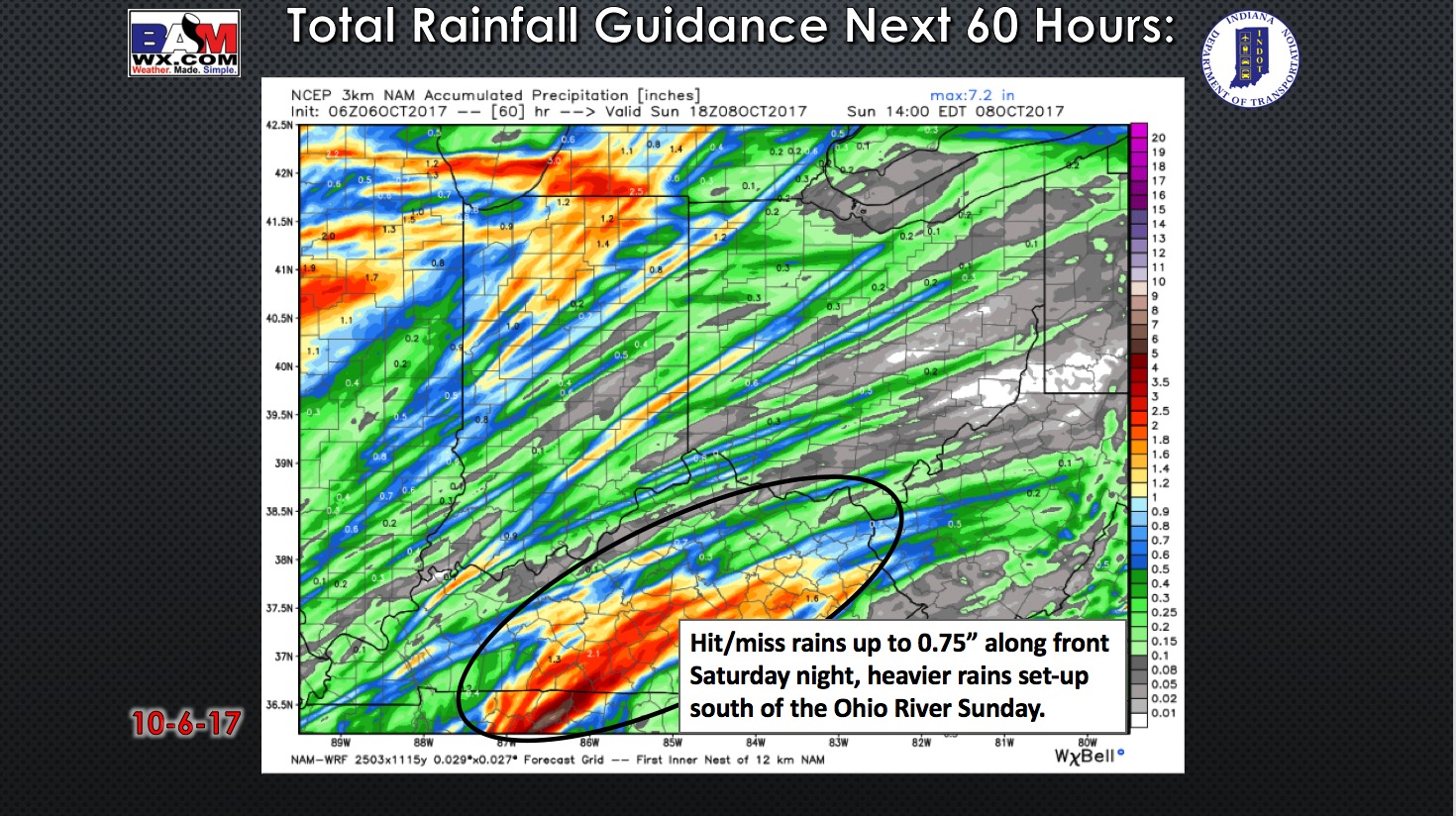
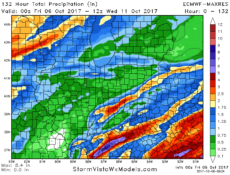
Rainfall guidance over the next 60 hours is shown below. This will not be a uniform rain event Saturday evening, with hit/miss storm activity. The heavier bands could drop locally a half-inch to three-quarters, but a lot of areas see less. Rains become heavy just south of the Ohio River Sunday morning as tropical moisture begins to move northward and interact with this stalling front.
We will hold on to rain chances Sunday along the Ohio River, while areas further north stay dry much of the day. Showers move northward Sunday night and Monday, bringing additional rainfall chances to much of the forecast area.
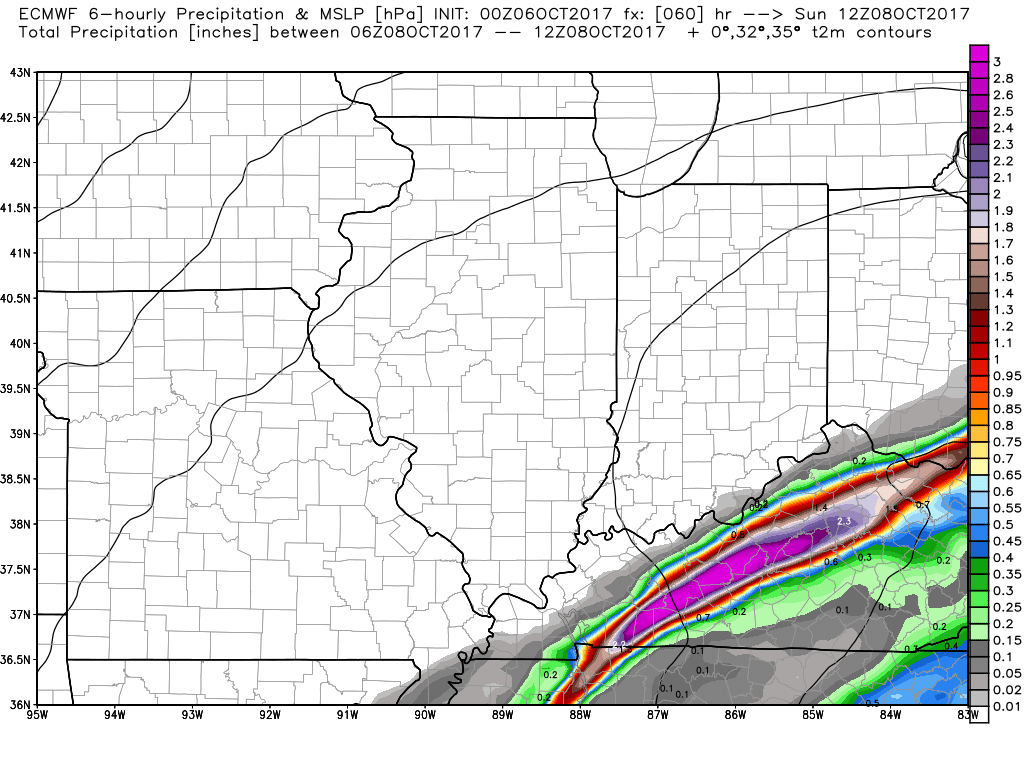
Still some uncertainty in rainfall placement/totals as discussed in the video, but the latest European model has localized bands of heavy rainfall across the area.
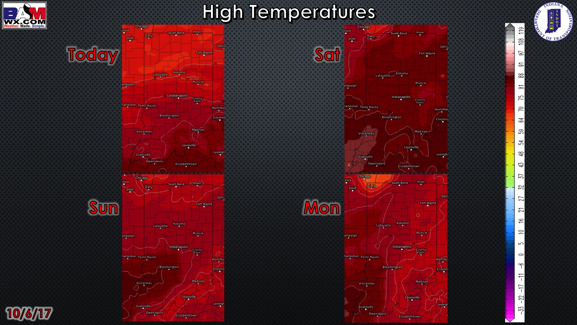
High temperatures over the next 4 days:
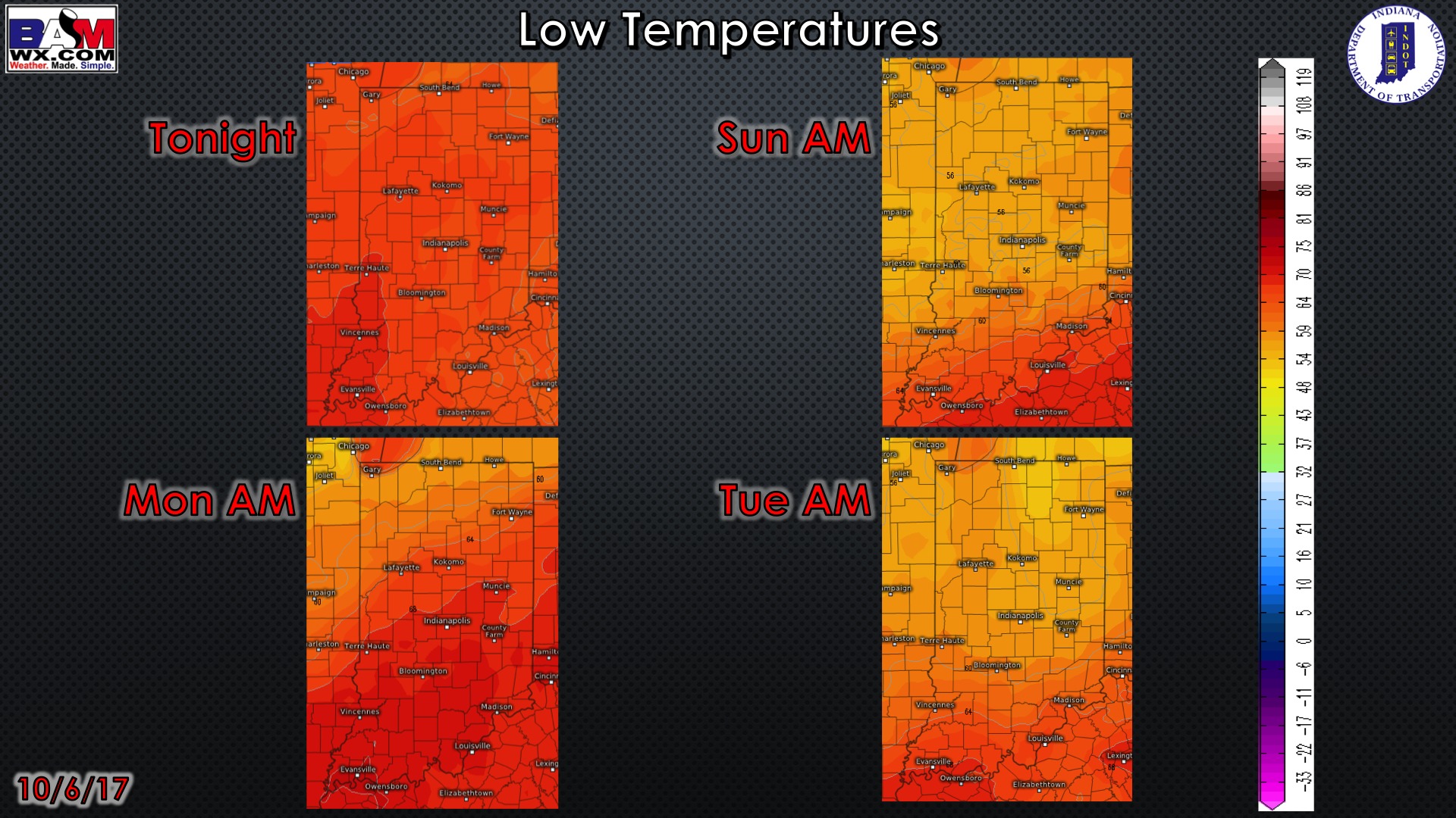
Low temperatures over the next 4 mornings:
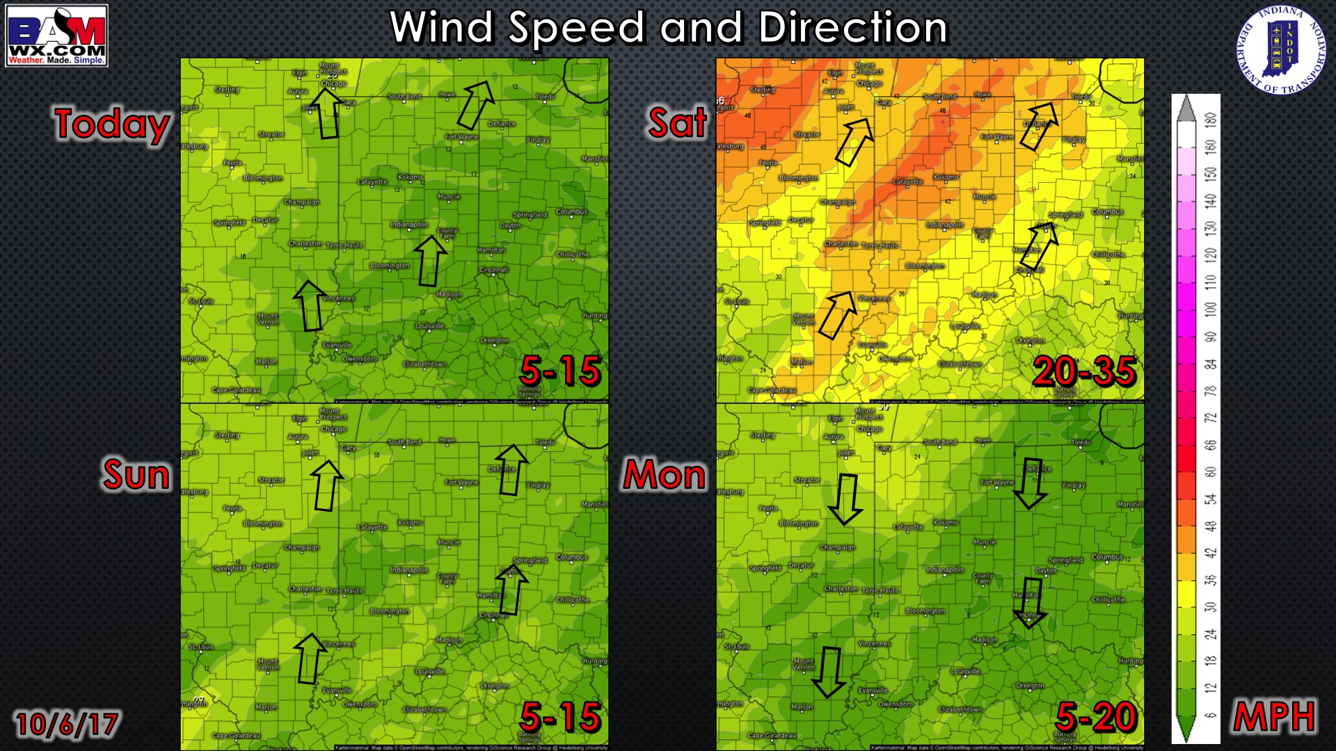
Wind forecast over the next 4 days…watch for windy conditions on Saturday.
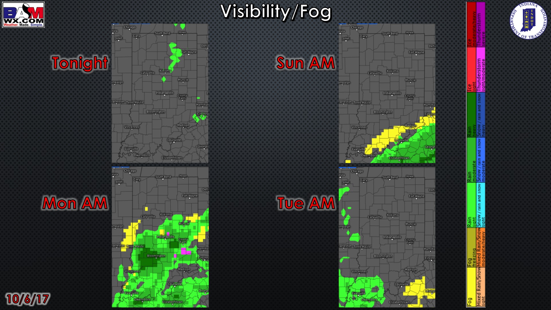
Visibility forecast over the next four nights is shown below. No fog concerns tonight – perhaps some patchy fog along the Ohio River Sunday morning.
Latest weeks 1 and 2 precipitation and temperature outlook:
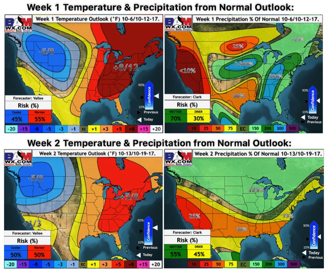
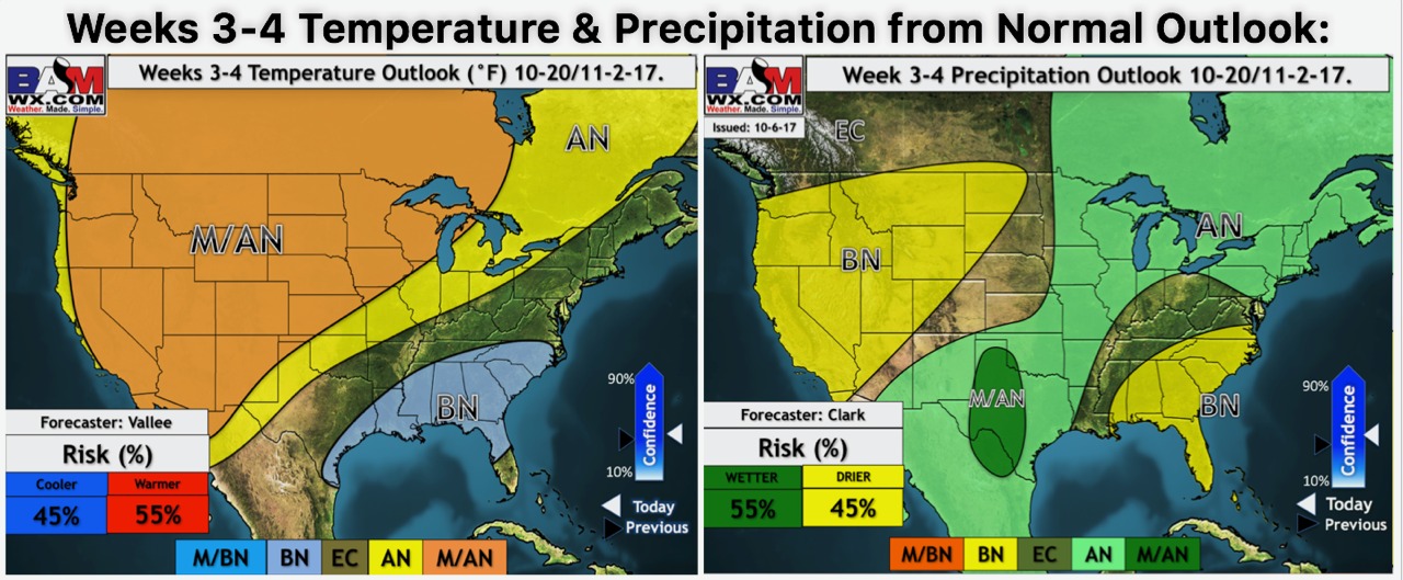
Our weeks 3 and 4 outlook (updated every Friday) favors near to slightly above normal temperatures and near normal precipitation.