Key Points – Thursday, October 5, 2017:
Synopsis: Good Thursday morning! A frontal boundary draped across central Indiana is providing a focus for rain and storms today, expect these rains to impact northern portions of southern Indiana this morning into mid-afternoon. Overall, it’s a dry forecast on Friday and even into most of Saturday, but a front arrives Saturday afternoon and evening with scattered showers and storms on Saturday night. The forecast becomes more unsettled for southern Indiana as we go into early next week, as there is potential for heavy rains as remains of a tropical system move through. Unseasonably warm temperatures will continue over the next several days before much cooler air arrives towards the middle of next week. Detailed analysis in the video and discussion below. Have a blessed day, and let us know if you have any questions.
Today’s video (5:56):
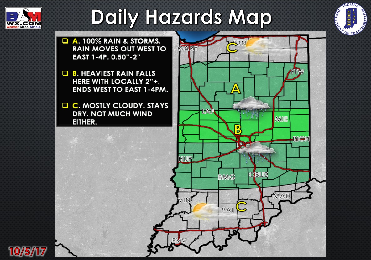
Today’s weather hazards quick sheet:
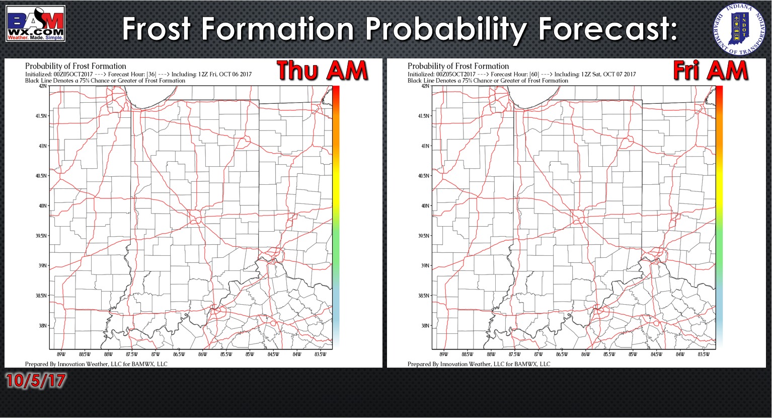
Exclusive BAMwx frost probability formation forecast over the next 2 mornings is shown below. Obviously we are not expecting frost with unseasonably warm lows in the 60s.
Rain and storm coverage forecast over the next 2 days is shown below. Looking at a near guarantee of rain in northern sections of the area this morning into early afternoon, meanwhile areas further south along the Ohio River stay dry. Heading into Friday, a small chance for a few showers in northern sections of the area, but overall it looks dry.
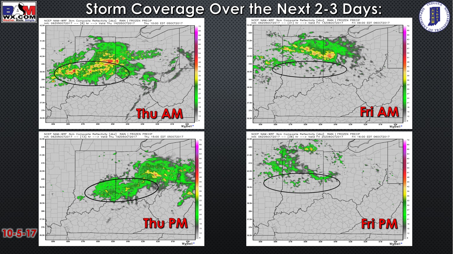
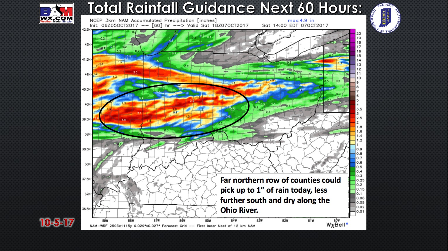
Rainfall guidance over the next 60 hours is shown below. 1″ of much needed rain is likely today in the far northern row of counties (esp. in Morgan and Johnson counties). Lower rain totals the further south you are, with areas along the Ohio River staying dry over the next 2 days.
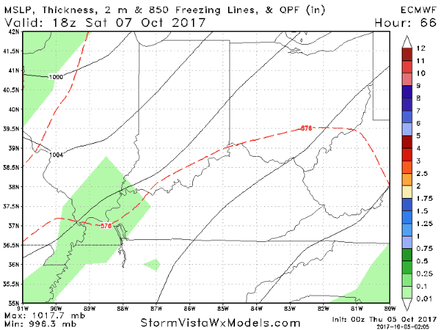
A developing storm system will allow the front to lift well north of the area Friday in Saturday with mainly dry and warm conditions. A cold front will move into southern Indiana late Saturday bringing showers and storms later in the afternoon into Saturday night. After a brief break early Sunday, remains of a tropical system bring heavy rain chances starting Sunday night and through the day Monday.
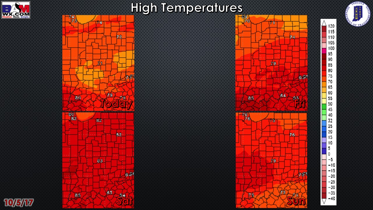
High temperature guidance over the next 4 days:
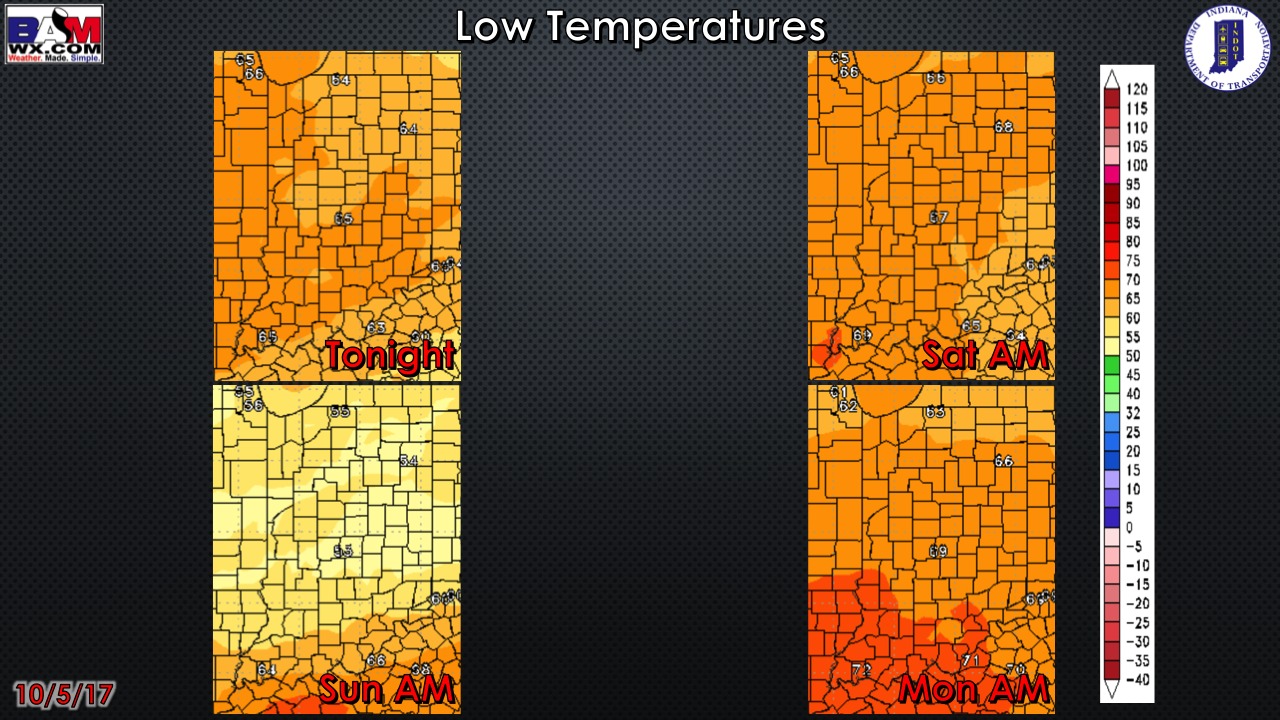
Low temperatures over the next 4 mornings:
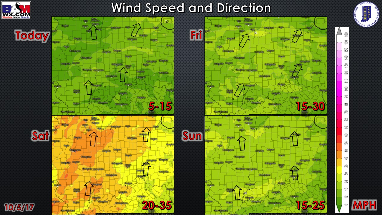
Wind forecast over the next 4 days…very windy on Saturday:
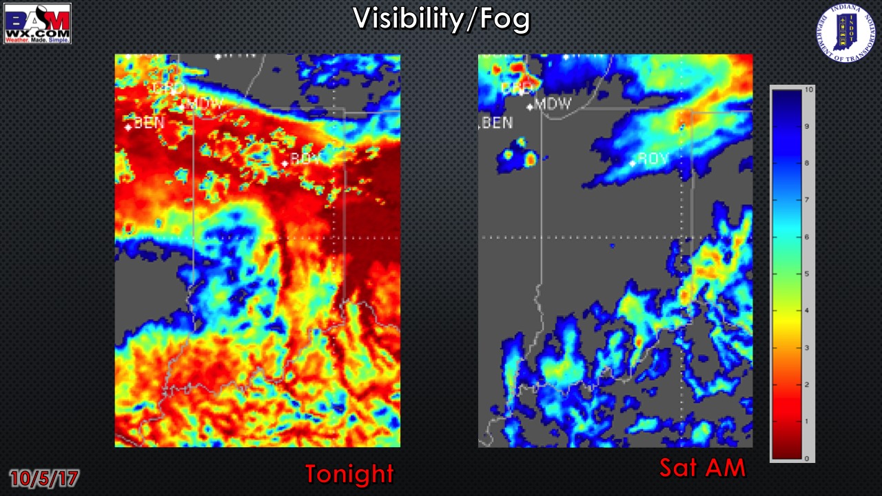
Visibility forecast over the next two nights is shown below. Patchy fog will be possible tonight, then not looking at much if any fog concerns Friday night.
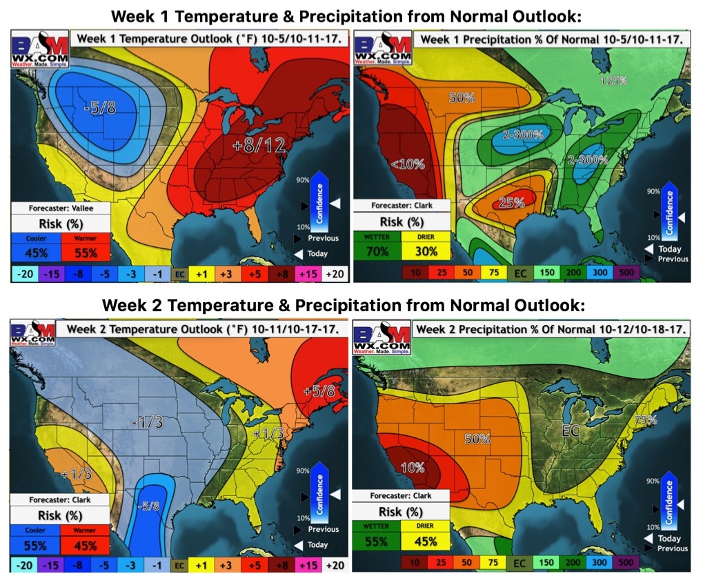
Latest weeks 1 and 2 outlooks: