Key Points – Wednesday, October 4, 2017:
Synopsis: Good Wednesday morning! A front is approaching from the northwest this morning, with scattered storms possible mainly in the northwestern portions of the southern Indiana region this afternoon. Lingering threat for a few showers Thursday morning, but certainly not looking at widespread coverage. The bulk of the rains stay just north of the area late week, with the next best chance Saturday evening as a cold front moves through the region. Still some uncertainty in rainfall chances early week as discussed in the video below. Temperatures will run well above normal into early next week, before turning sharply cooler by mid-week.
Today’s video (6 min):
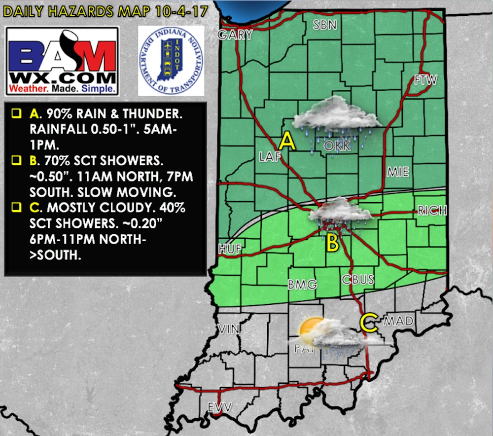
Today’s weather hazards quick sheet:
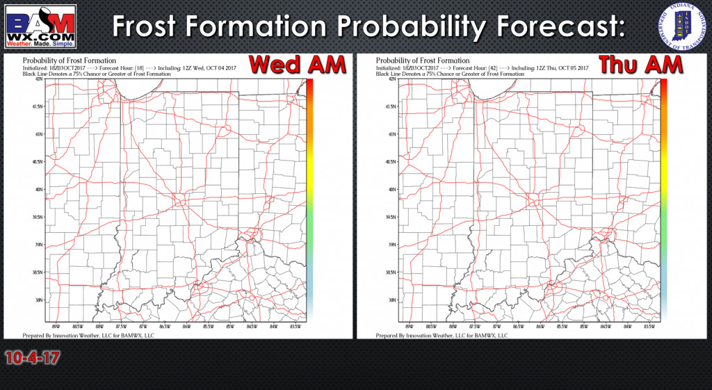
Exclusive BAMwx frost probability formation forecast over the next 2 mornings is shown below. No frost is expected:
Rain/storm coverage forecast is shown below. Far northern row of counties in the forecast area will have a ~50-70% risk for scattered showers this afternoon, then a few scattered showers drift further south into the evening. Expect a few scattered showers Thursday morning with ~30% coverage as the boundary lifts back to the north as a warm front.
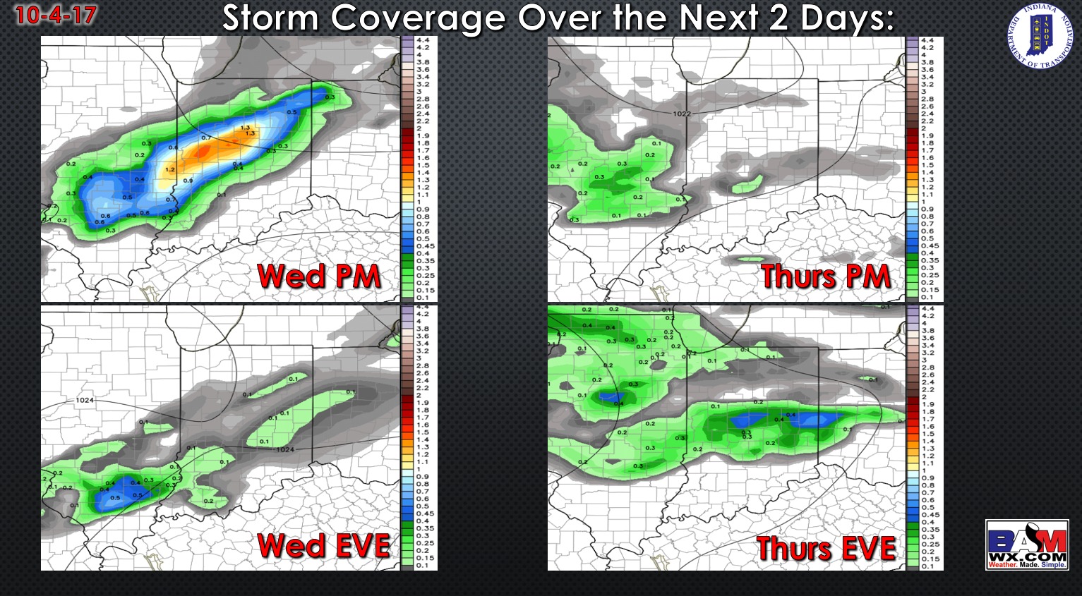
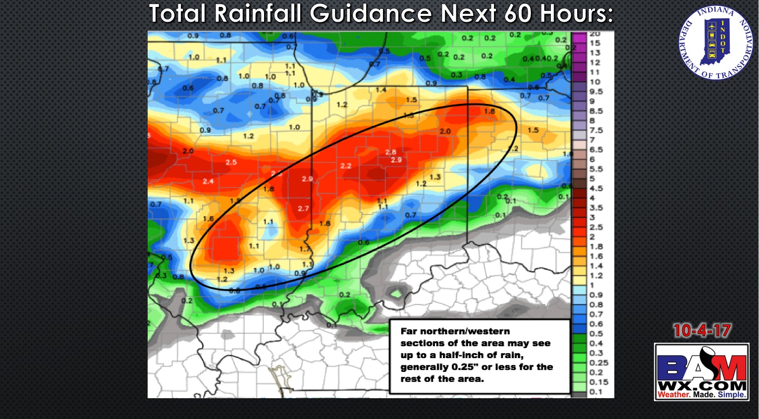
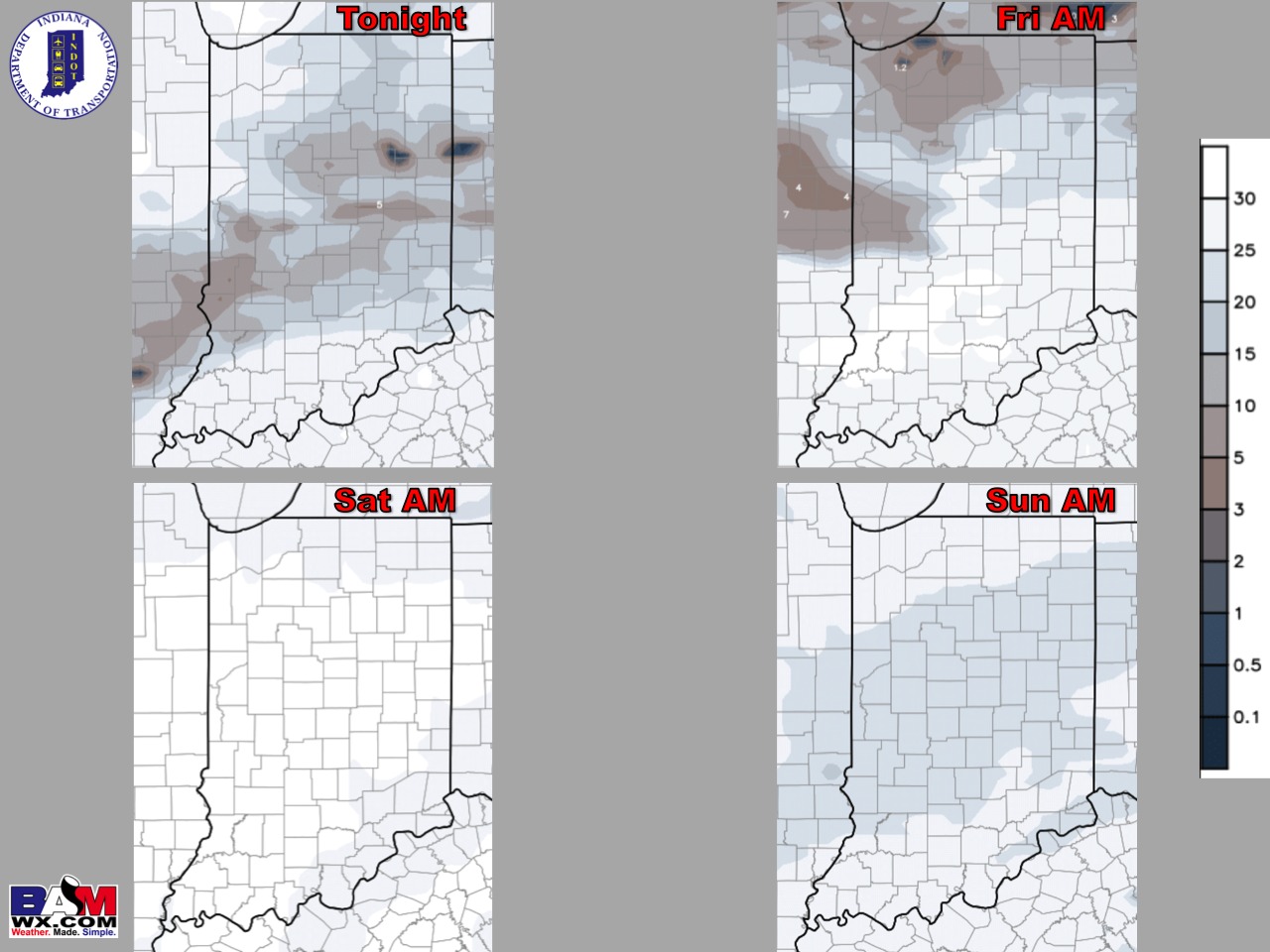
Total rainfall over the next 60 hours is shown below. Far northern/western sections of the area may see up to a half-inch of rainfall, but further south generally a quarter-inch or less.
Much of the rains stay north of the region Friday, with a few showers possible in northern sections of the area. A cold front bringing in the next best chance for a few scattered storms Saturday evening.
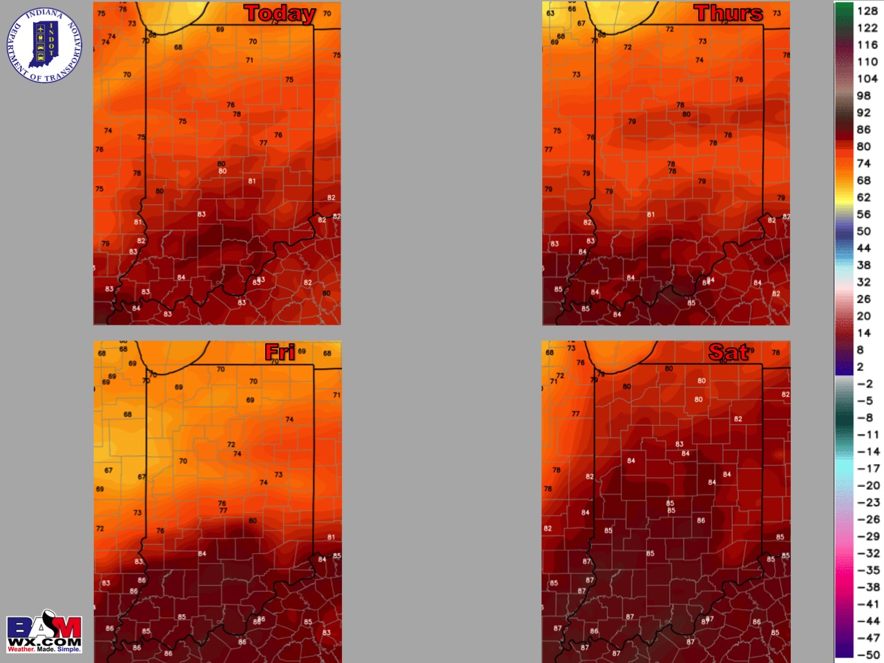
High temperature guidance over the next 4 days:
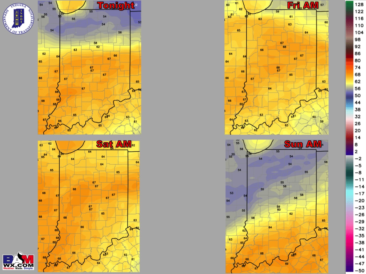
Low temperature guidance over the next 4 mornings:
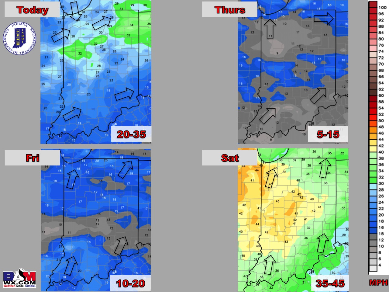
Wind forecast over the next 4 days:
Visibility forecast over the next 4 nights is shown below. Little to no visibility concerns, possibly some patchy fog to the north tonight.
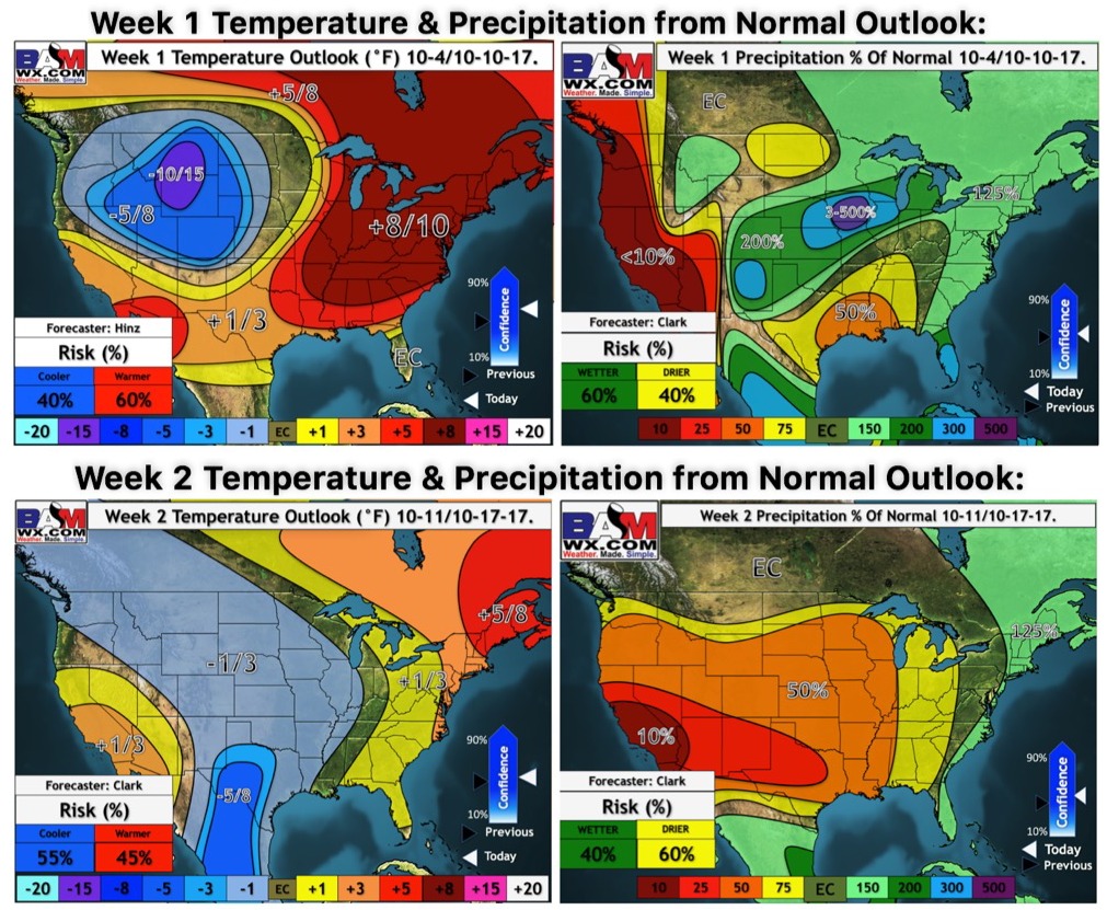
Weeks 1 and 2 temperature and precipitation outlooks: