Key Points – Wednesday, October 4, 2017:
Synopsis: Good Wednesday morning! Showers and t’storms building in on a line this morning from southwest to northeast ahead of a cold front, expanding in coverage as we progress throughout the morning into early afternoon. Most of the rain moves out of central/northern parts of the state by ~6pmEDT, although a few lingering showers will hang around this evening. An additional shot for showers and storms works in along a warm front Thursday evening lifting south to north into Friday as well at ~50% coverage. Working into Saturday we work in ~40/50% chance for showers, pushing east leaving Sunday as an overall nice day. Anywhere from 1″ to localized 3″ total will be possible through the weekend. In the video we discuss a big cold front mid to late next week and temperatures potentially dipping into the upper 30s with possible frost. If you have any questions at all please let us know, have a blessed day! -Kirk
Today’s video (6 min):
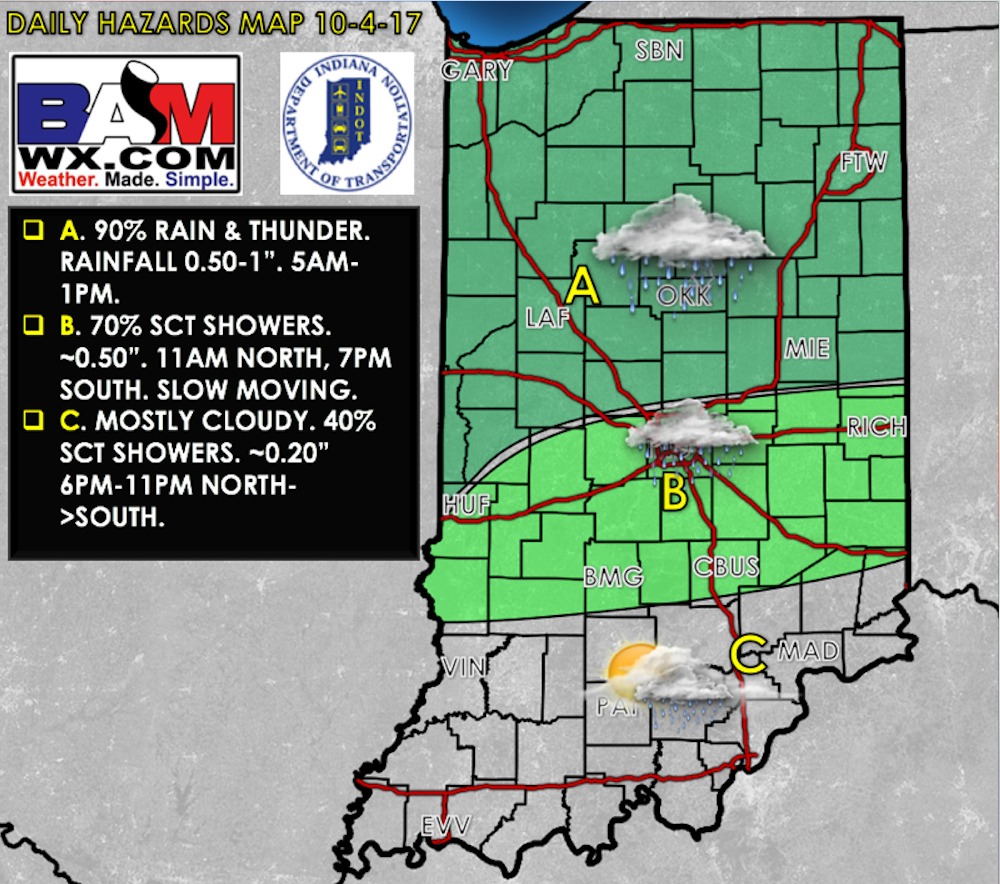
Today’s weather hazards quick sheet:
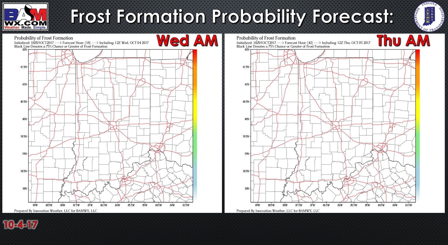
Exclusive BAMwx frost probability formation forecast over the next 2 mornings is below…no frost is expected:
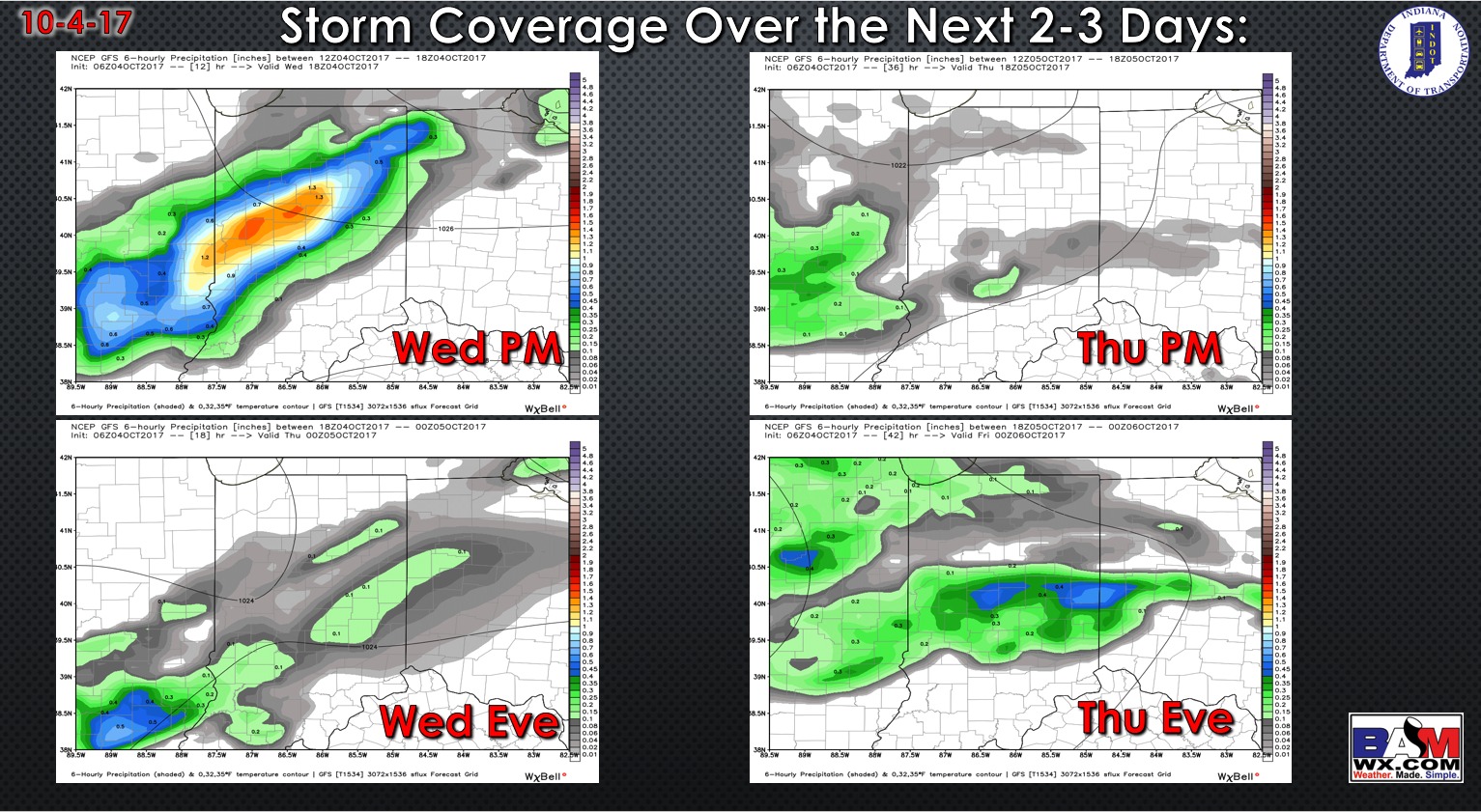
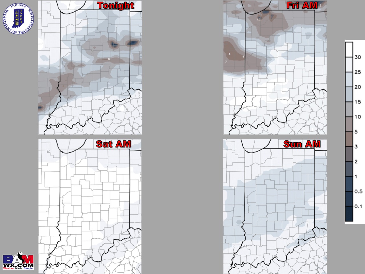
Storm coverage over the next 2 days…rain continues to expand into the forecast area (although it won’t be a complete washout the entire time, periods of moderate/heavy rainfall will be possible).
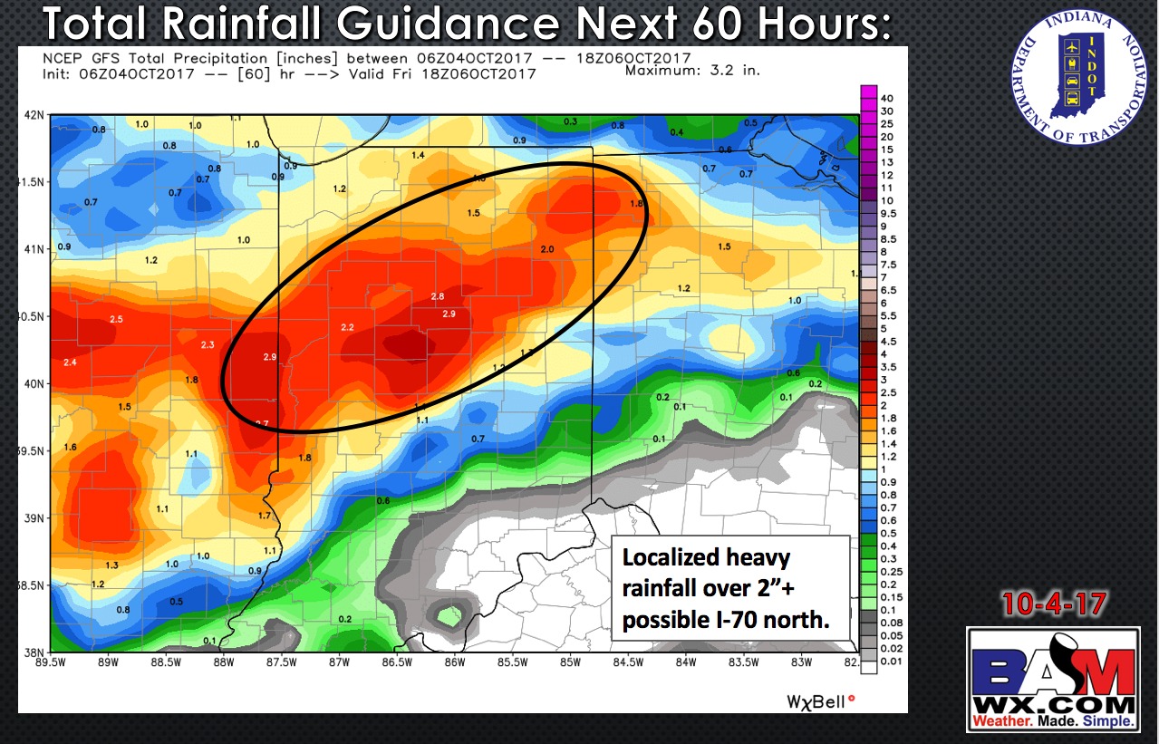
Total rainfall guidance over the next 60 hours favors localized heavy rainfall of 2″+ mainly I-70 north:
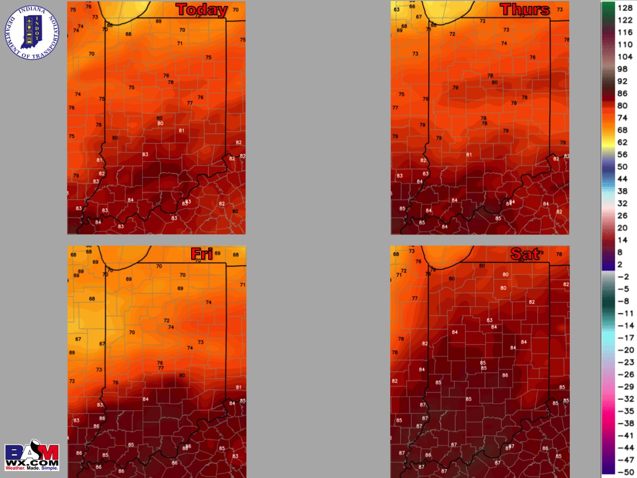
High temperature guidance over the next 4 days:
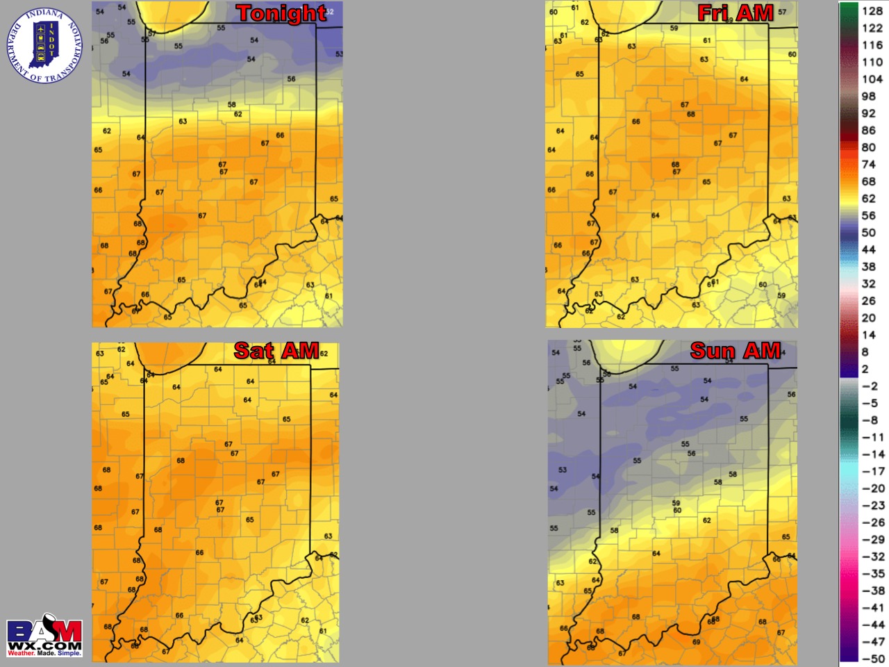
Overnight low temperature guidance over the next 4 mornings:
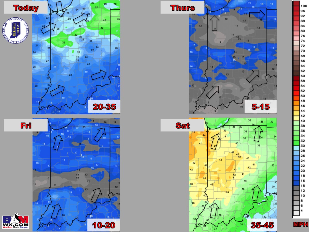
Wind gusts forecast guidance over the next 4 days:
Visibility guidance over the next 4 mornings (the darker the color shade, the more reduced the visibility…great tool for finding drizzle/fog):
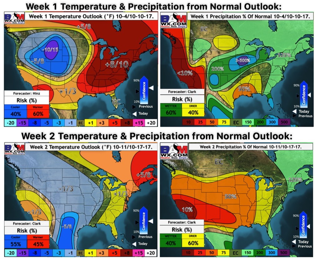
Week 1-2 temperature and precipitation from normal outlooks: