Key Points – Tuesday, October 31, 2017:
Synopsis: Good Tuesday morning! Today we discussed the cool start to the day with many south of I-70 in the lower 30s…overall we have more clear skies but cooler than normal with widespread lower 40s for highs today. Expecting showers to build in across the state early Tuesday morning from the southwest to northeast. Overall the precipitation will remain all rain Wednesday morning, but can’t rule out periods of wintry precipitation mixing south of I-70, however, temperatures will be above freezing and climbing quickly into the lower 40s after daybreak Wednesday…not expecting any travel implications at this time (will update later this afternoon on this). We begin our warmer trend Wednesday beyond into late week…additional chances for rainfall linger into the weekend as well. If you have any questions please let us know, have a blessed day! -Kirk
Today’s video (6 min):
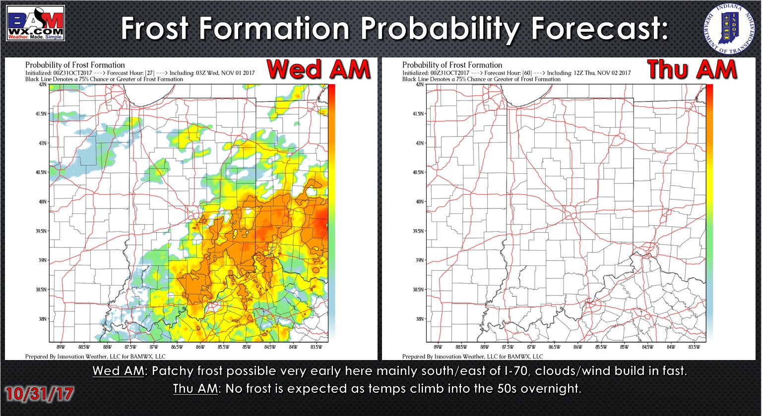
Latest glance at the frost probability tool:
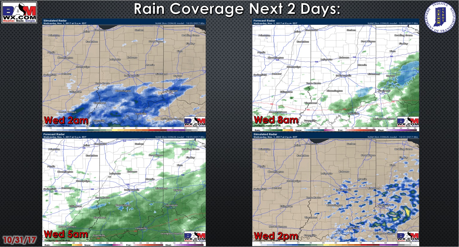
Showers moving southwest to northeast early Wednesday morning:
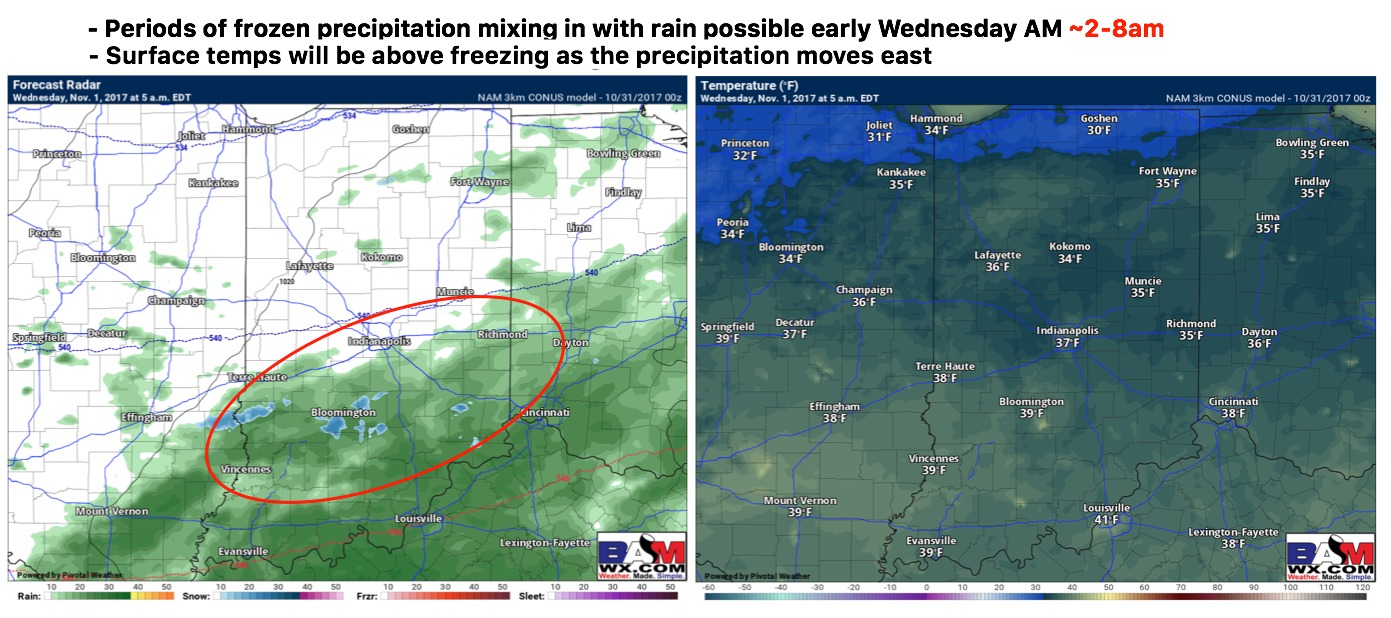
Can’t rule out some frozen precipitation with rain showers working in at times ~2-8am as discussed in the video…the air aloft is very cold despite the temperatures at the surface; expecting temps to rebound quickly into the lower 40s after sunrise Wednesday morning with all precipitation expected to return to rain.
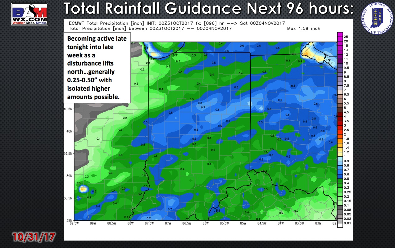
Total rainfall over the next 4 days from the latest European model:
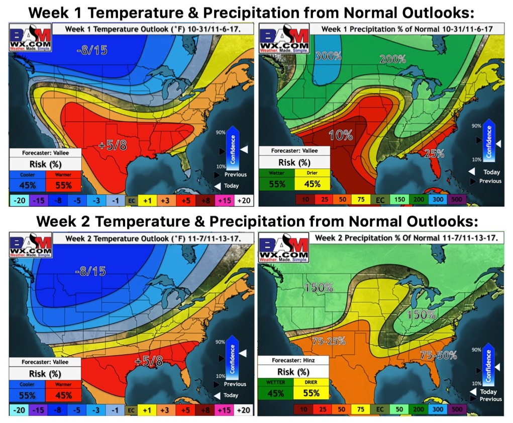
Weeks 1 and 2 updated temperature and precipitation from normal:
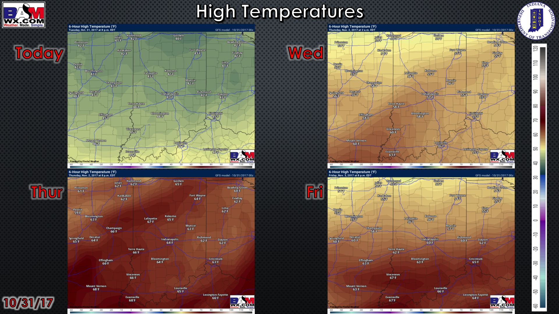
High temperature guidance over the next 4 days:
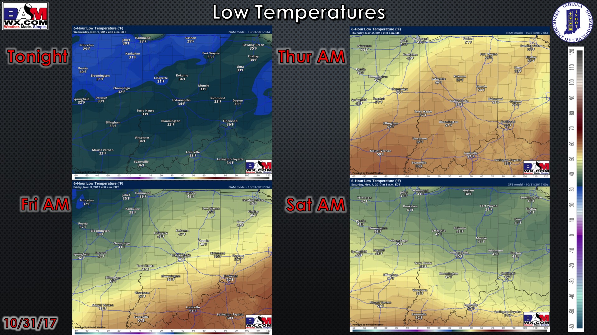
Low temperature guidance over the next 4 mornings:
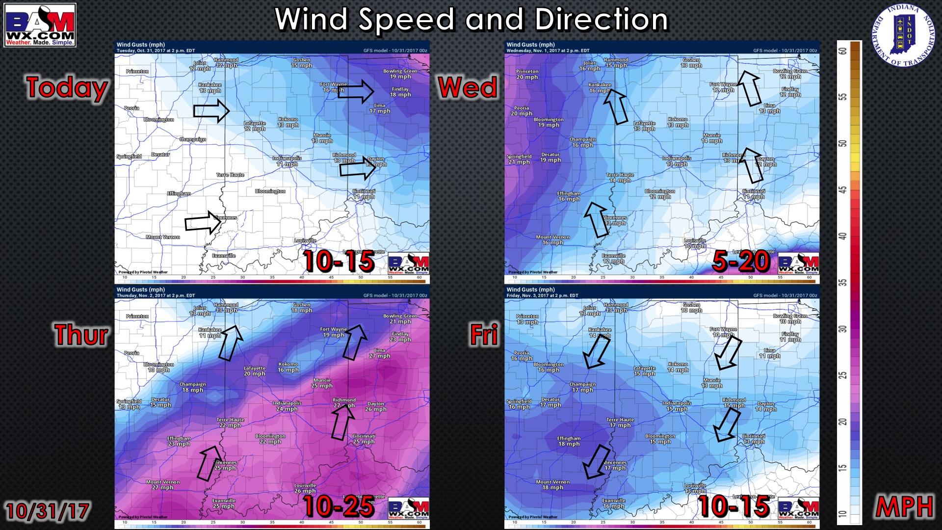
Wind forecast guidance over the next 4 days…getting windy into Thursday: