Today’s Missouri Local Forecast Update – Tuesday, October 31, 2017:
Today’s video (6 min):
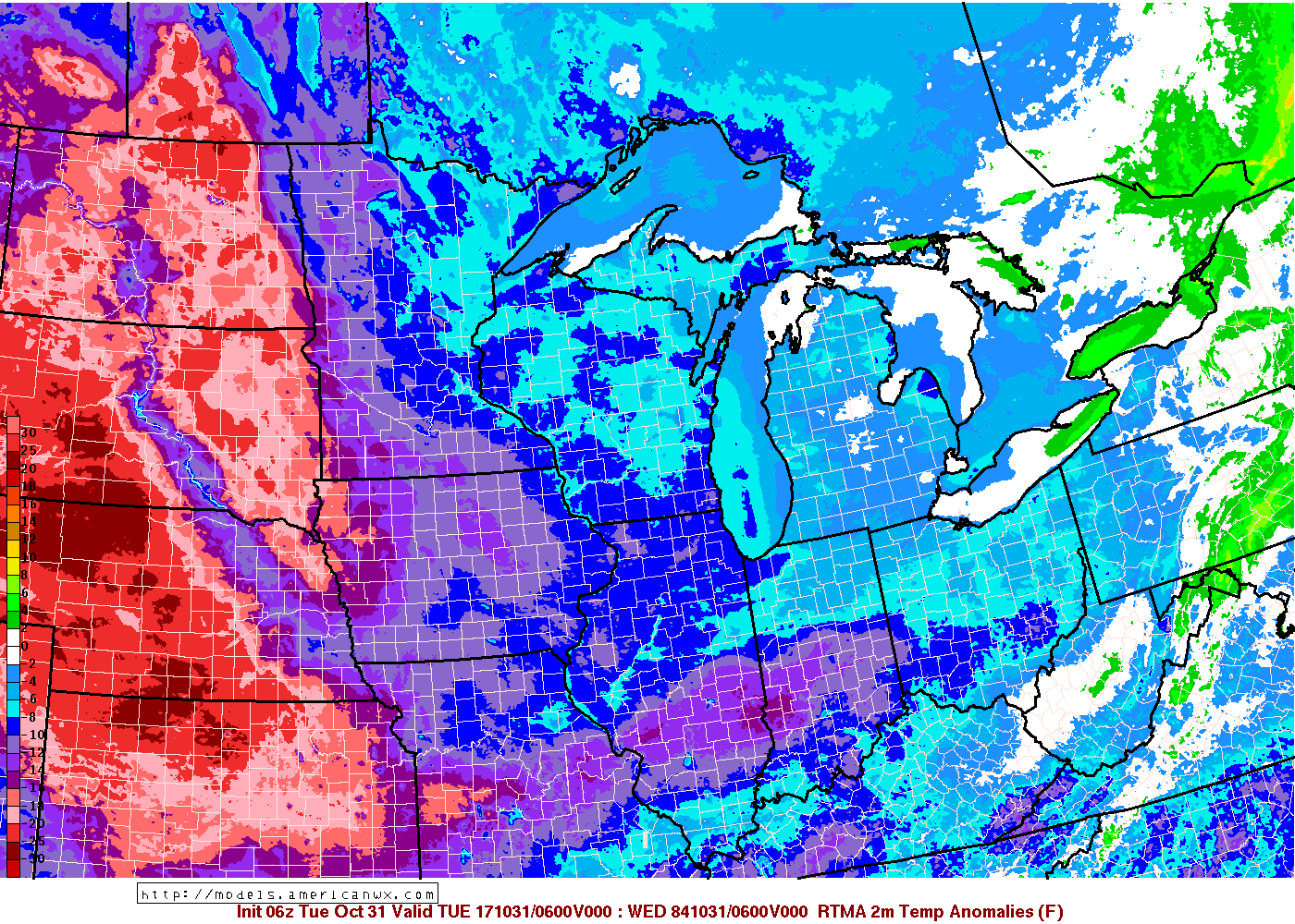
Very chilly to start the day with the majority of the locations in the state seeing upper 20s to lower 30s:
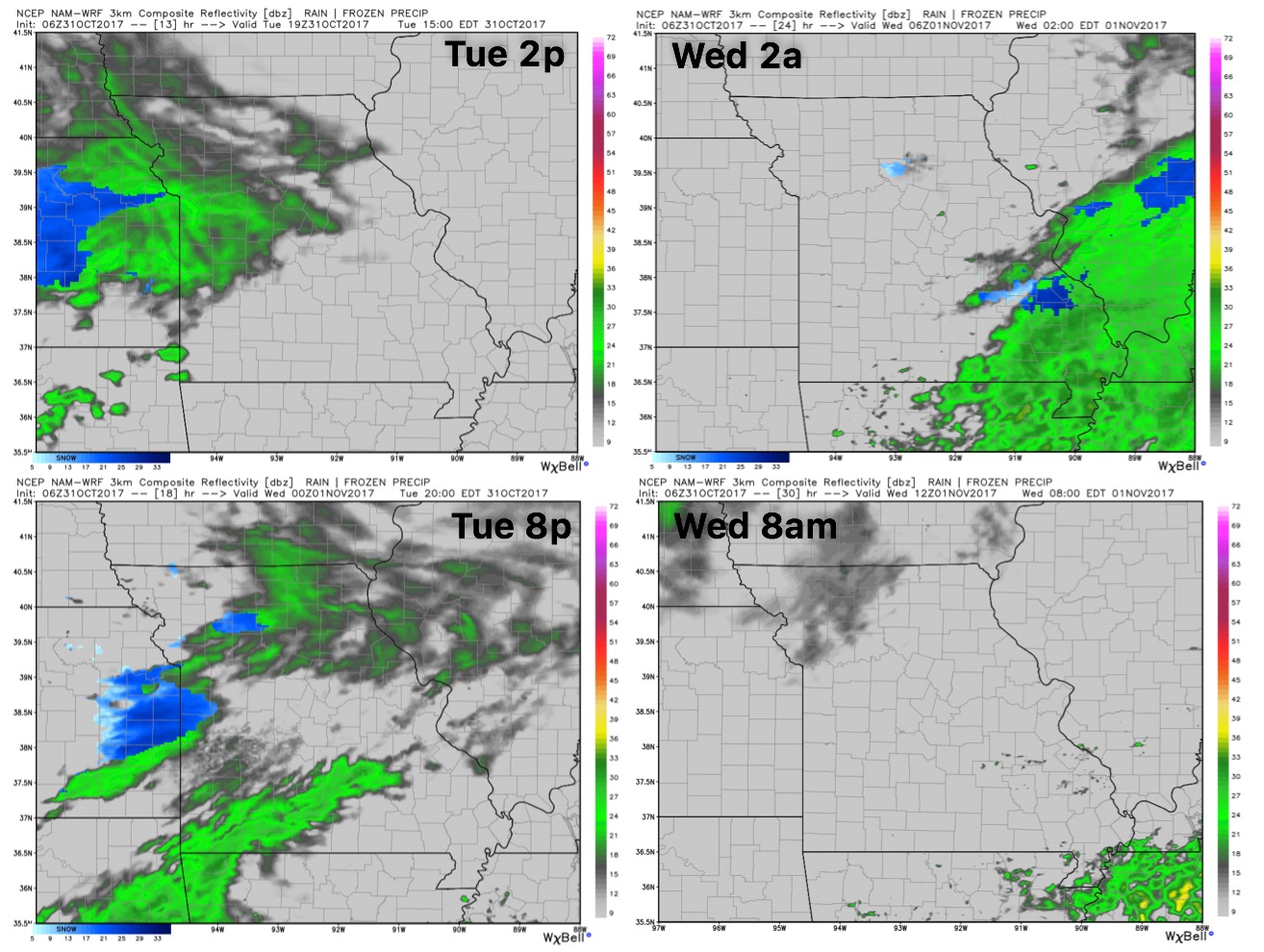
Here’s a quick glance of simulated radar over the next 24 hours or so…expecting light precipitation to work in from west to east…periods of a wintry mix will be possible as the air aloft is very cold, despite temps at the surface being above freezing. No frozen accumulation is expected.
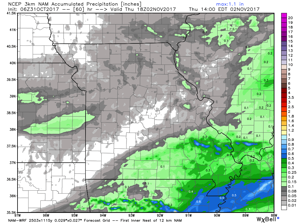
Total rainfall guidance over the next 60 hours…very light precipitation noted across the majority of the state (generally <0.1″)…locations to the southeast near the Bootheel will see ~0.25-0.5″.
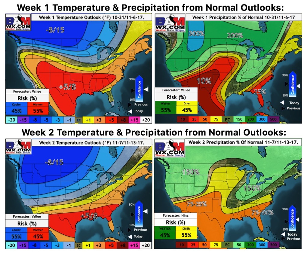
Updated weeks 1 and 2 temperatures from normal outlooks…shows the overall inactive period over the next 2 weeks, barring locations to the southeast, as well as the warmer trend into the first week of November: