Key Points – Monday, October 30, 2017:
Synopsis: Good Monday morning! Cooler than normal temperatures continue through the middle of the week. Expecting some light showers to move across mainly central/south central Indiana later this morning into the afternoon with a disturbance and cold front moving through. High pressure provides dry and very cool weather Tuesday. Far northern Indiana may see a few lake effect rain/snow showers late tonight into early Tuesday. A more active pattern sets in mid-week and beyond with more swings in the thermometer.
Today’s Indiana Video Forecast:
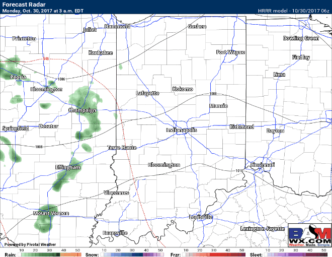
Light showers move eastward across central Indiana through the day, especially late morning into mid-afternoon:
Total rainfall through this evening:

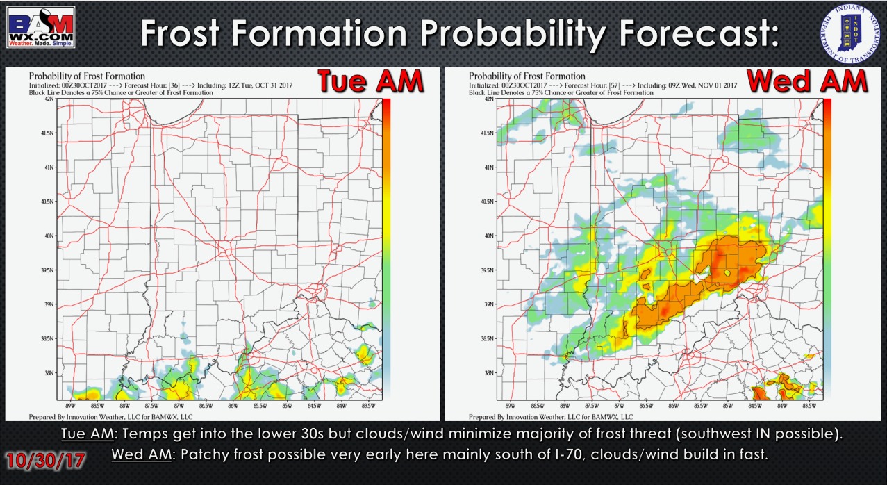
Frost formation probability forecast over the next 2 mornings:
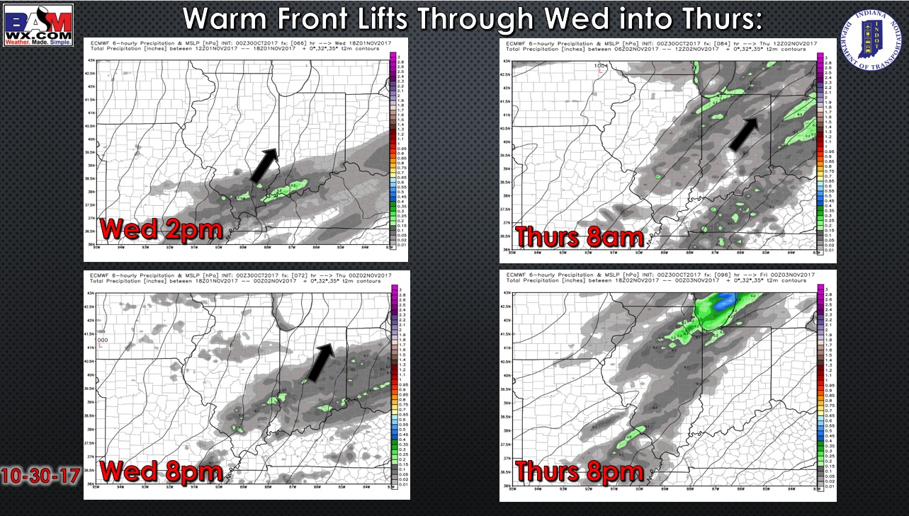
More showers work in with a warm front Wednesday into Thursday from south to north:
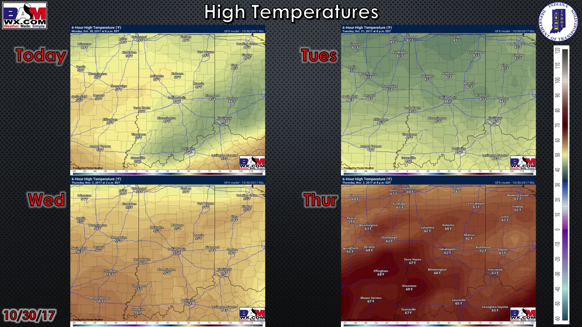
High temperatures over the next 4 days:
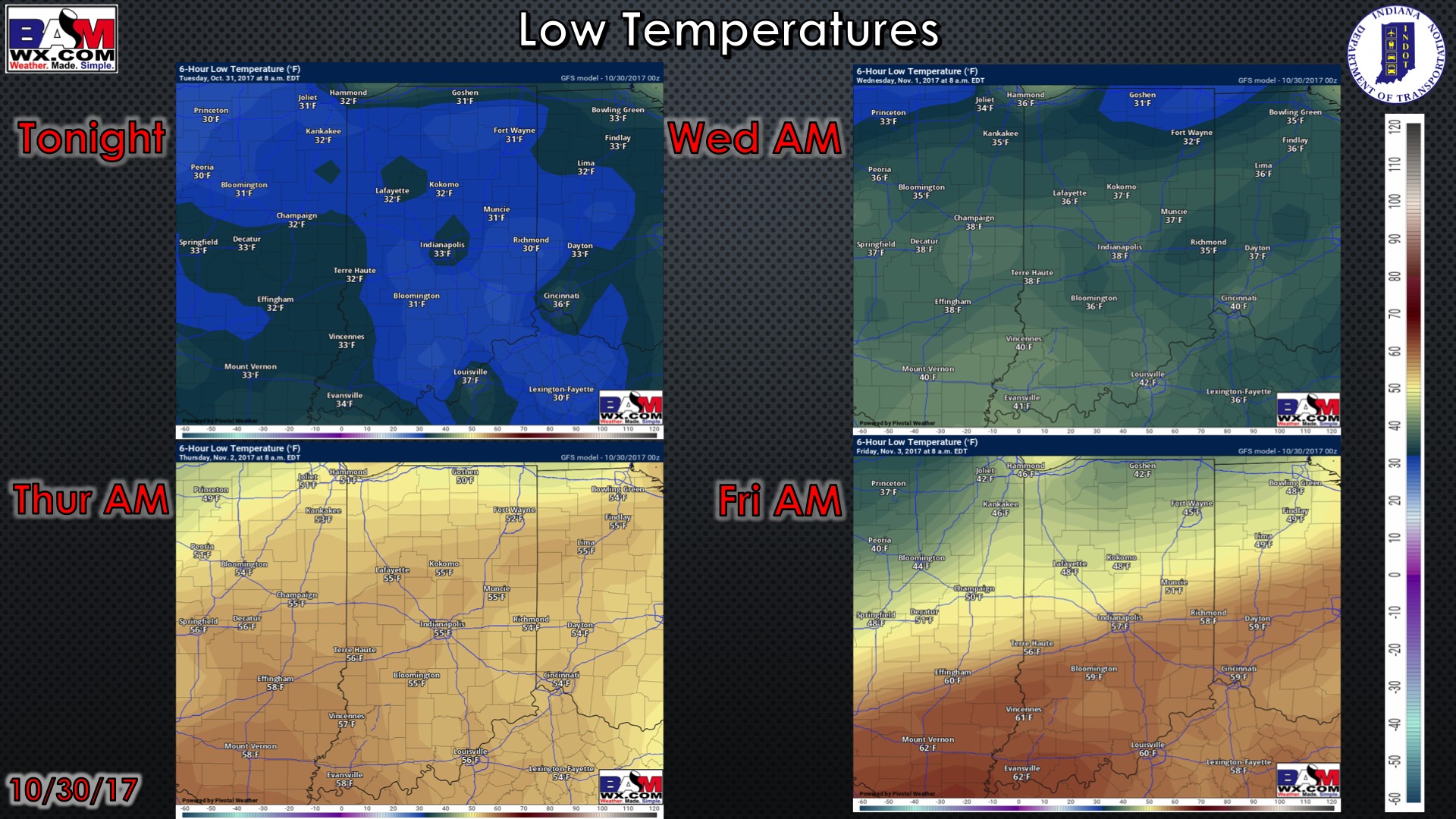
Low temperatures over the next 4 mornings:
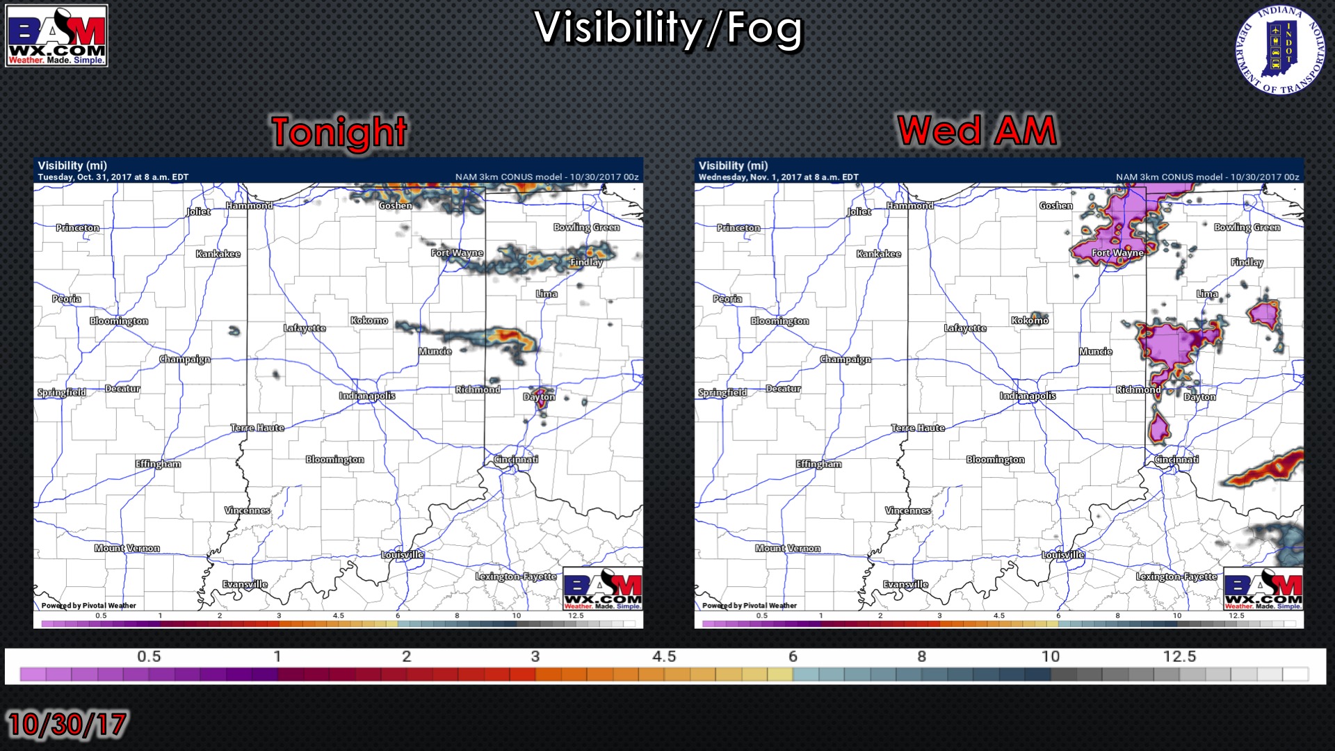
Visibility forecast over the next 2 mornings is shown below. Overall not seeing much of a fog threat…perhaps a bit over northeast Indiana Wednesday morning:
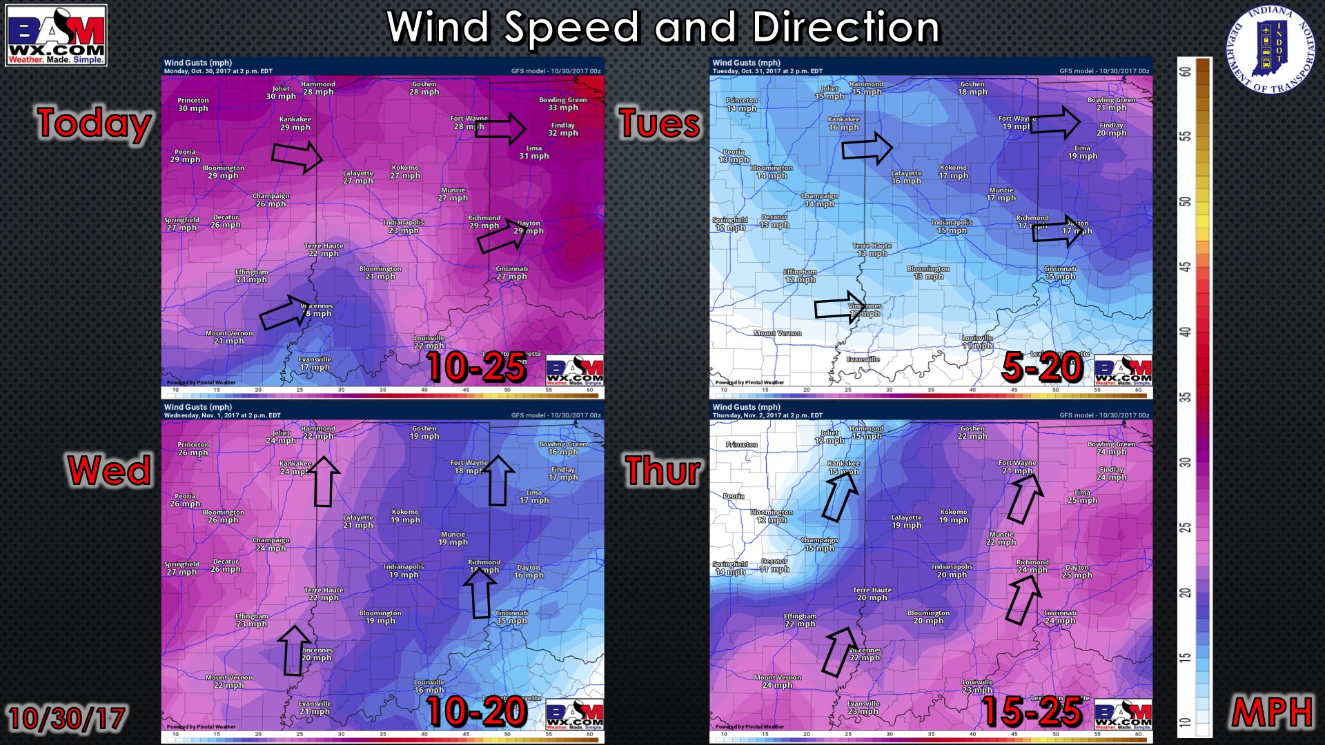
Wind forecast over the next 4 days:
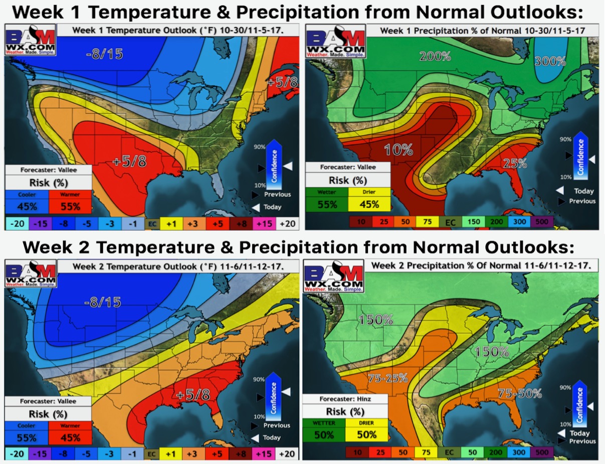
Weeks 1 and 2 temperature and precipitation from normal outlooks: