Key Points – Friday, October 27, 2017:
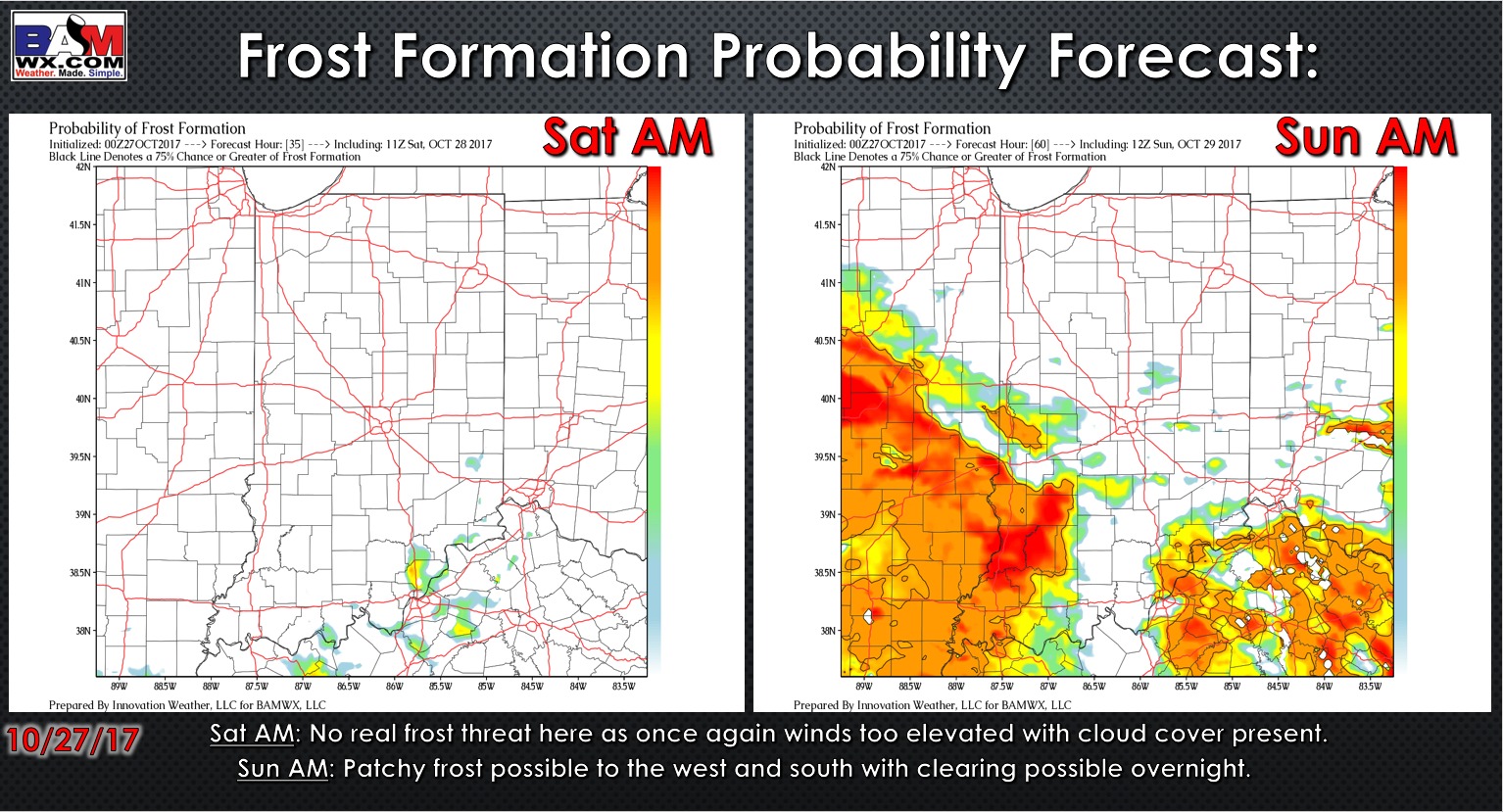
Synopsis: Good Friday morning! We continue to eye precipitation working in later this morning from west to east along a cold front…we are starting the day warm in the lower 50s overall, but temps fall throughout the day as well. Late tonight a few pockets of heavy snow showers working on early Saturday morning for southeast Indiana locations, however, surfaces temperatures never fall below freezing…we do not expect any travel impacts at this time as we warm up in the upper 30s by daybreak (a few slick spots possible for a couple of hours before daybreak here). Saturday night into Sunday skies clear out and the winds will calm…west and southwestern parts of the state will see another hard frost with temps getting into the lower 30s. Can’t rule out a few lake effect snow flurries on Saturday night into Sunday as well (no accumulation expected). Our next weather system of any concern comes Monday even across the area bringing light showers. We also note in the video we turn warm towards the end of next week as a ridge returns across the eastern US. If you have questions please let us know, have a blessed day! -Kirk
Today’s video 5:30min):
Frost probability tool over the next 2 mornings:
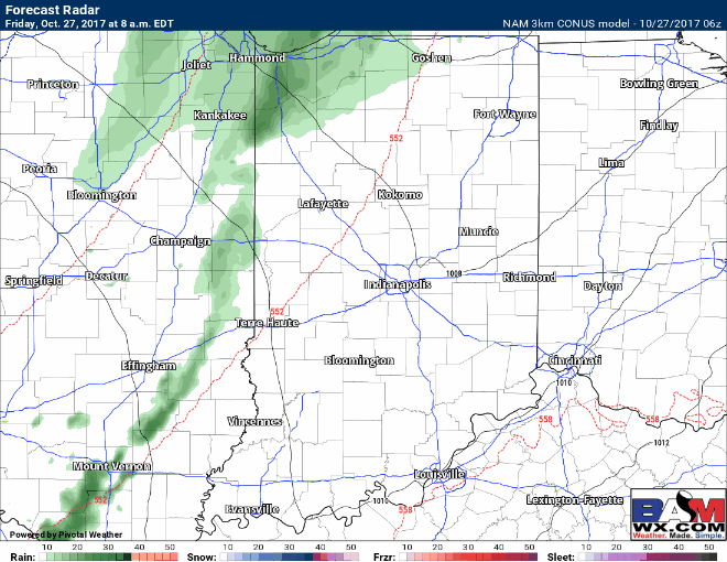
Simulated radar guidance throughout the day today…the best rainfall chances for moderate showers will be across the eastern half of the state today. We do have a timeframe from ~2-7am EDT where some pockets of heavy snow showers will be possible across southeastern Indiana. With that being said, surface temperatures will not get below freezing, a few slick spots will be possible in the predawn hours Saturday, but surface temperatures and winds rise after daybreak…not expecting travel impacts at this time.
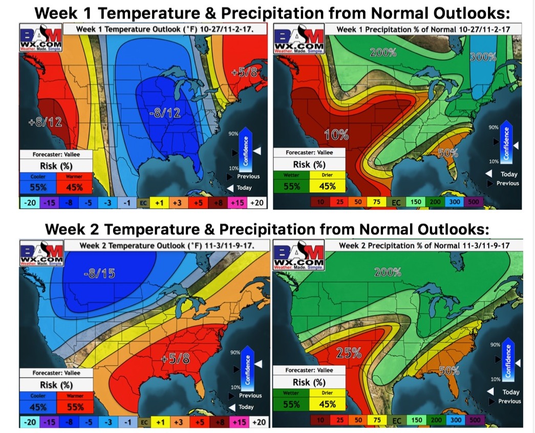
Updated weeks 1 and 2 long-range outlooks: