Key Points – Friday, October 27, 2017:
Synopsis: Good Friday morning! A cold front is beginning to push into northwest Indiana this morning. This front will work east through the morning, with temperatures actually falling through the day into the lower 40s this afternoon. We expect showers to work in through the day into tonight, with the main focus across the Fort Wayne district. Watching for some lake-effect rain and snow showers Saturday afternoon through Sunday morning. Not expecting any impact to roadways, but nevertheless some of you see the first flakes of the season.
Today’s video:
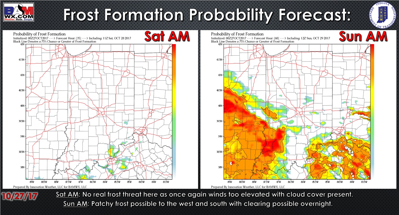
Latest frost formation probability forecast over the next 2 days…clouds and wind prevent frost concerns this weekend in northern Indiana.
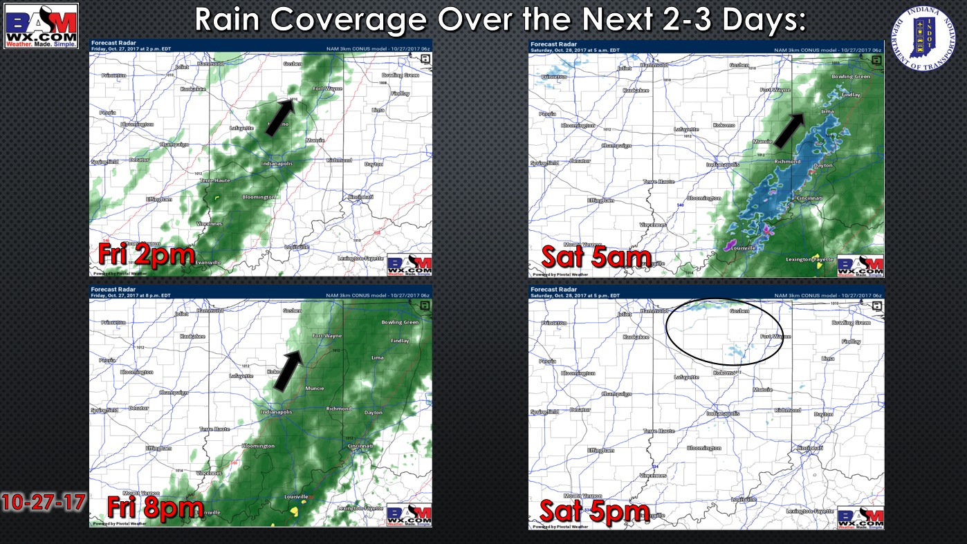
Precipitation coverage forecast over the next 2 days:
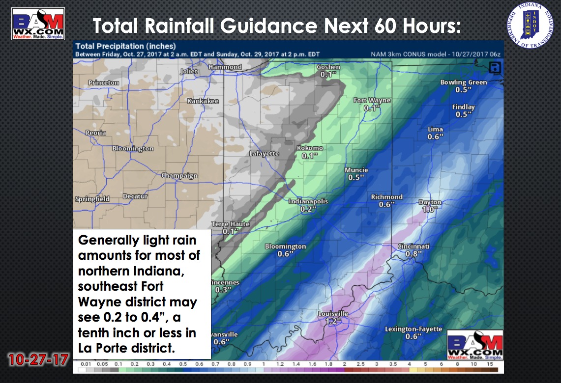
Total precipitation over the next 60 hours:
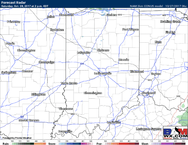
Here is the future radar forecast from 2pm Saturday to 2pm Sunday. Note the lake effect rain and snow showers Saturday night into Sunday morning, mainly focused in extreme northern counties near Michigan with a due west wind- northern La Porte, St. Joseph, Elkhart, Lagrange, and Steuben counties will have the highest risk for the more numerous snow shower activity Saturday night into early Sunday.
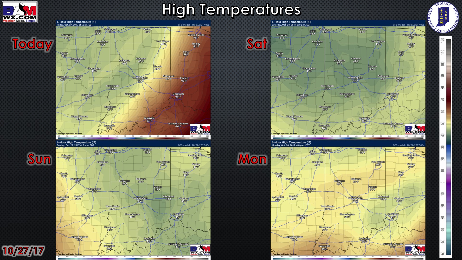
High temperatures over the next 4 days:
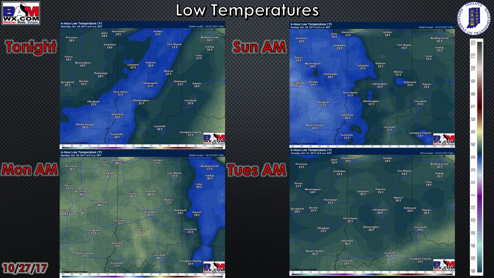
Low temperatures over the next 4 mornings:
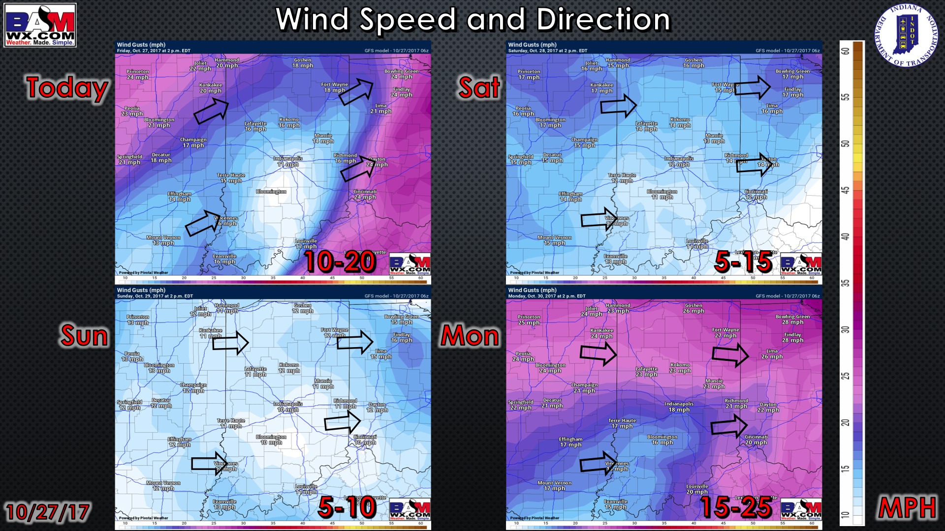
Wind forecast over the next 4 days: