Key Points – Thursday, October 26, 2017:
Synopsis: Good Thursday morning. Waking up to the coldest morning of the season so far with widespread frost across many areas, especially northern and eastern Indiana. A nicer day of weather is ahead with mostly sunny skies and a nice recovery in temperatures this afternoon in the 50s north to 60s south and west. A front moves through late tonight and through the day Friday, with falling temperatures expected. Showers look to move in along and behind the front Friday afternoon through Friday night, especially across the south and east half of the state, with a sharp cut-off to the northwest. As colder air filters in Friday night, enough cold air may catch up with the back-edge of the rain to see a few wet snow flakes before ending across eastern Indiana. Not expecting any accumulation nor any impact to roadways as temperatures will be too warm.
Today’s Video:
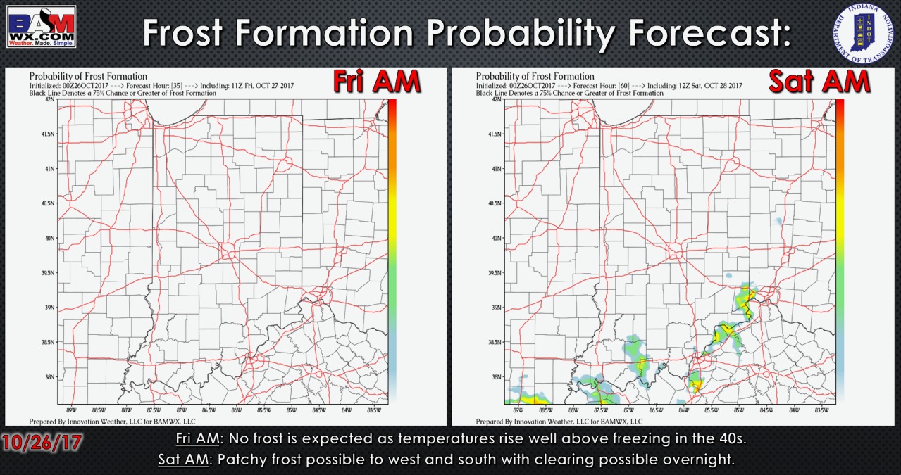
Latest frost formation probability forecast is shown below:
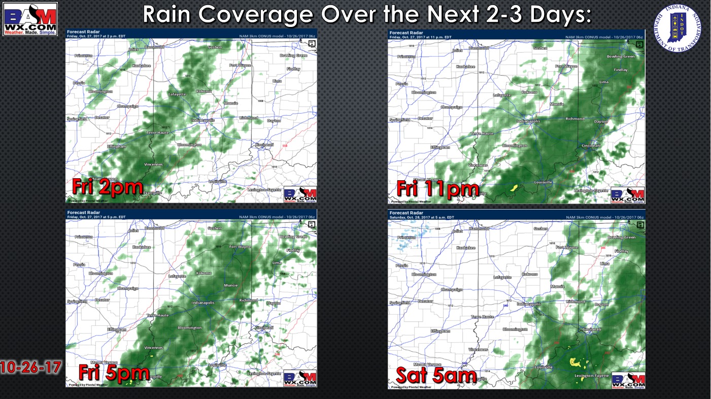
Here is the rain coverage forecast through early Saturday. No rain concerns today. Showers move in from southwest to northeast Friday afternoon, shifting to the east Friday night. Note northwest Indiana likely sees little to no rainfall.
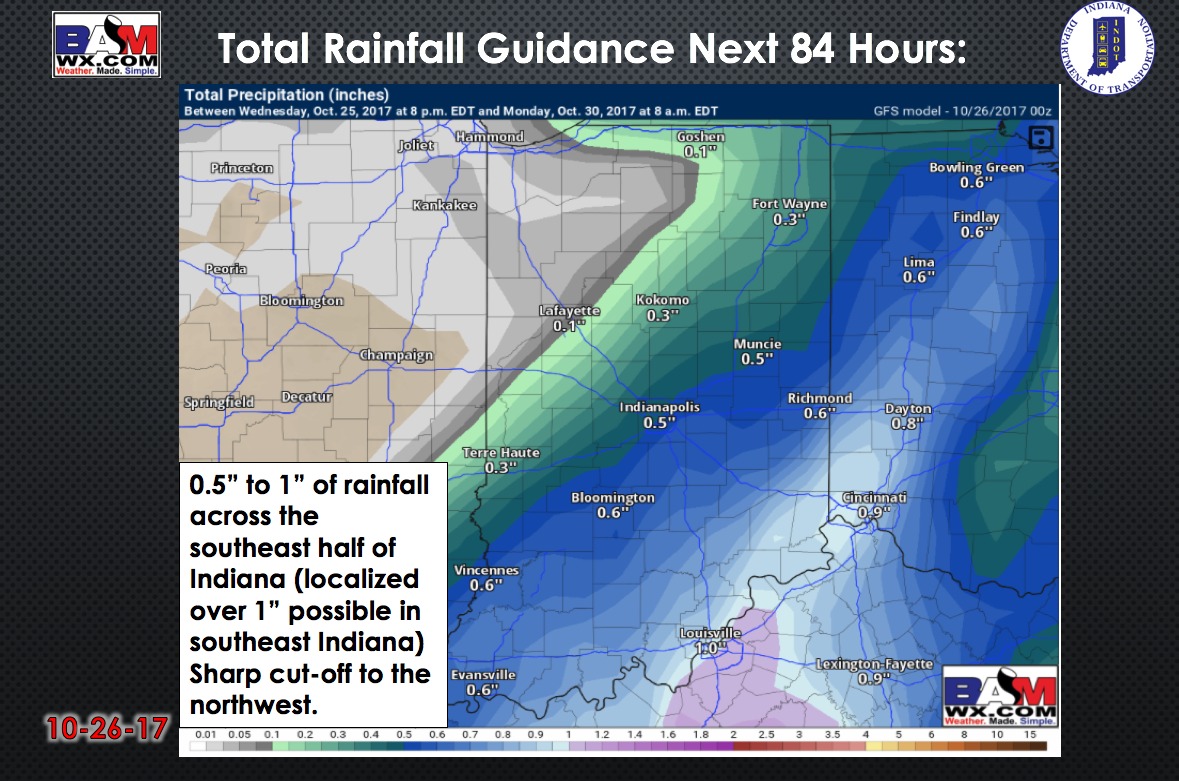
Total rainfall over the next 84 hours:
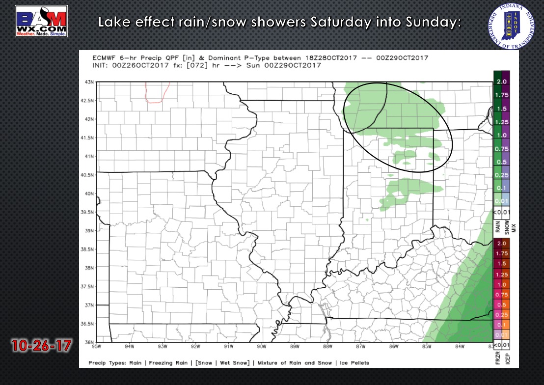
Watching for some lake-effect precipitation in northern/northeast Indiana mainly Saturday afternoon into Sunday morning. It will be cold enough to mix with some snow showers. Not expecting any accumulation at this time.
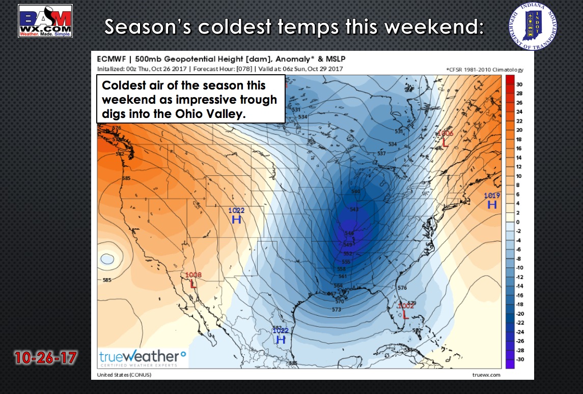
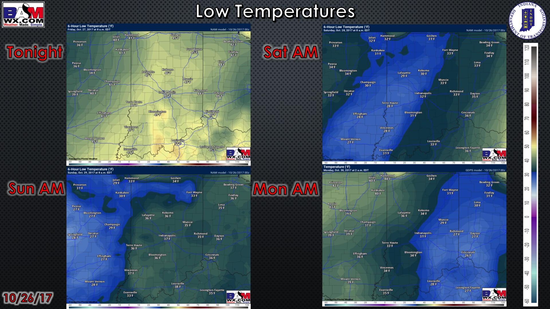
Very chilly weekend ahead with a hint of winter in the air.
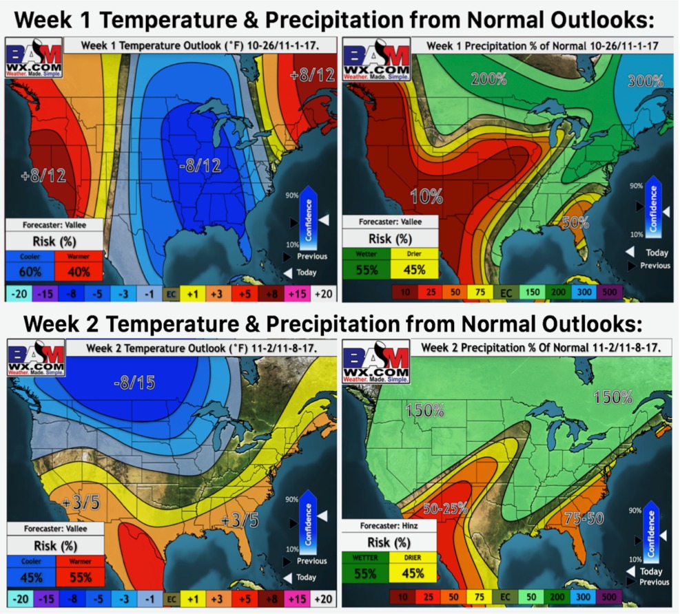
Weeks 1 and 2 temperature and precipitation from normal outlooks:
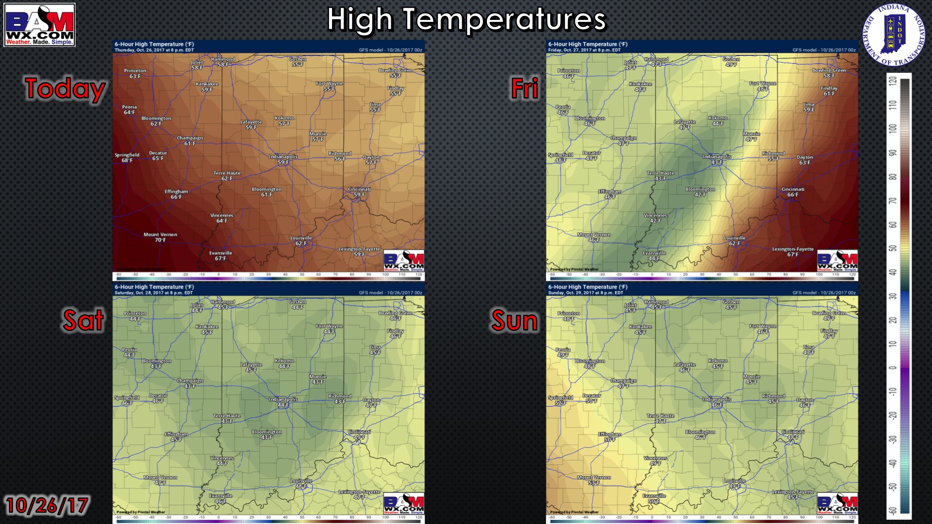
High temperatures over the next 4 days:
Low temperatures over the next 4 mornings:
 Wi
Wi
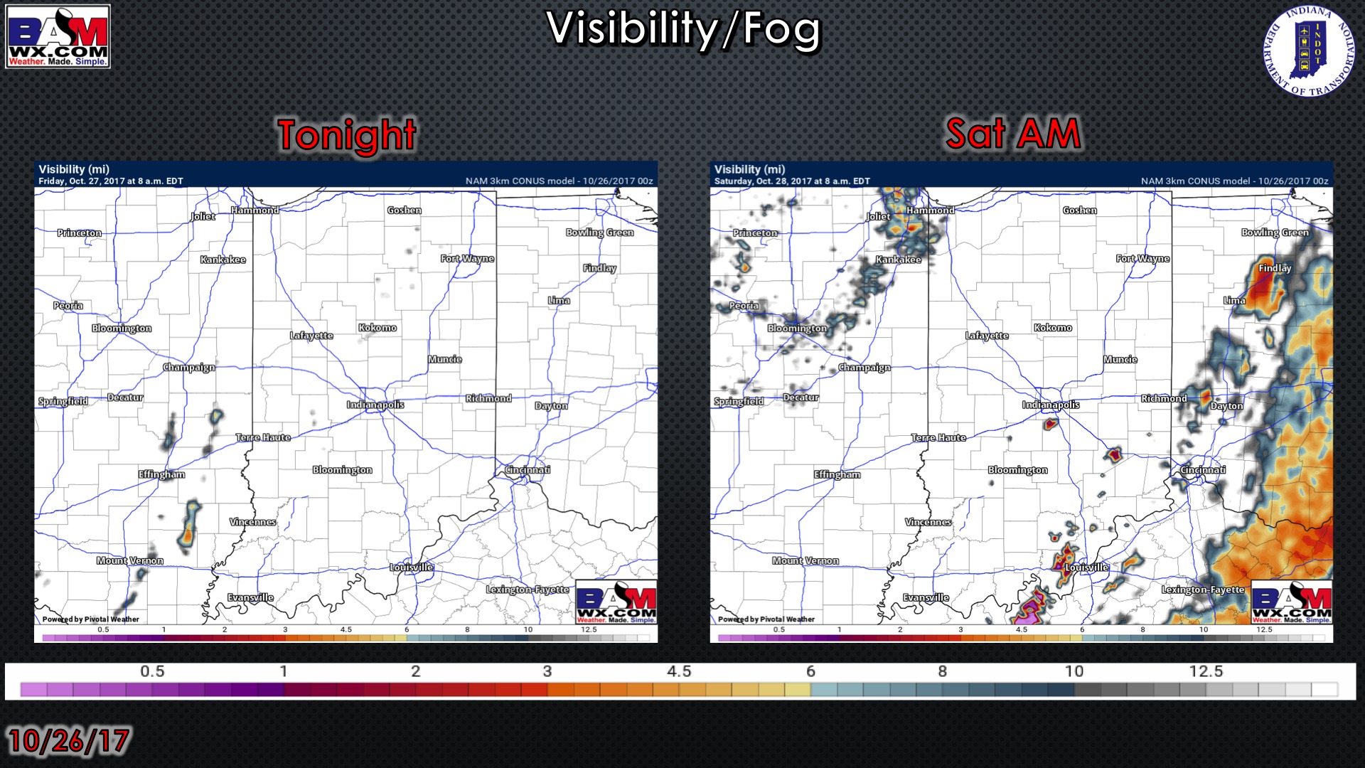
Visibility guidance over the next 2 mornings:
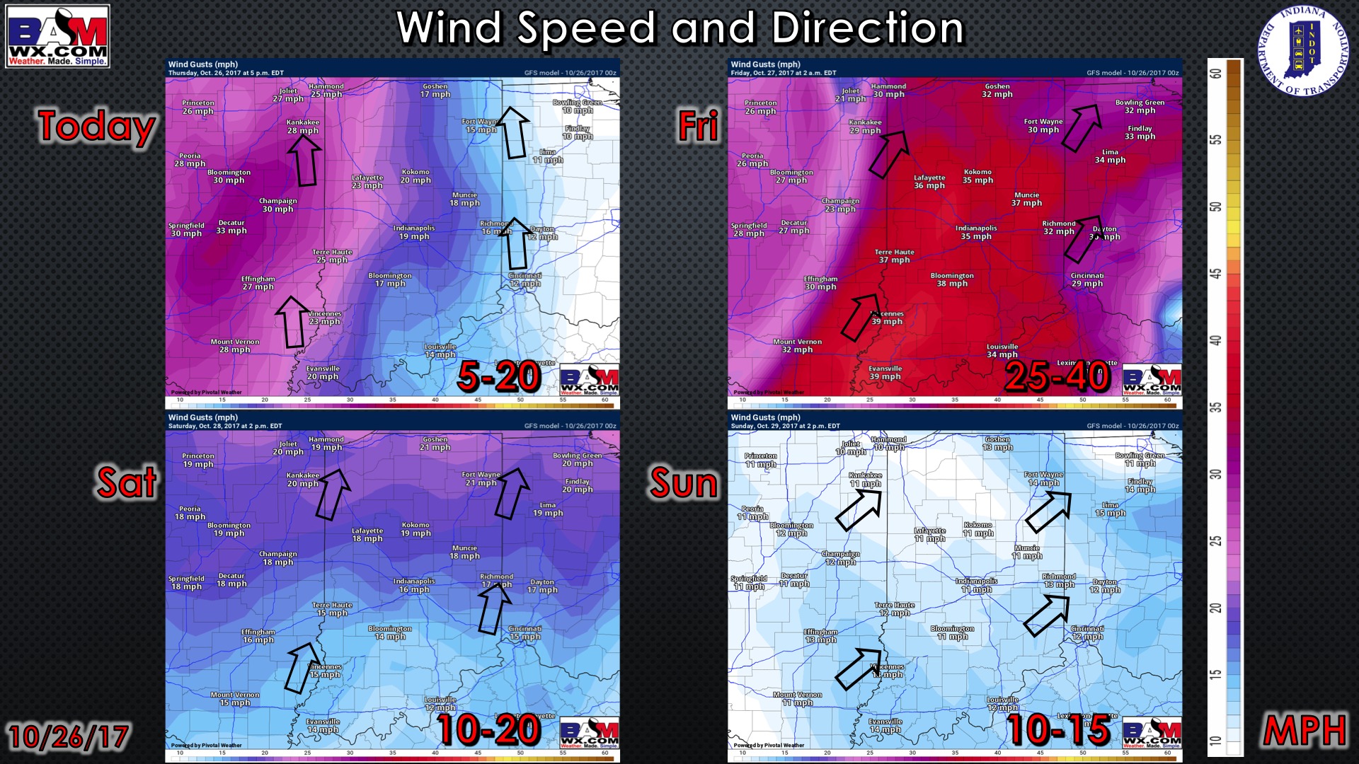
Wind forecast over the next 4 days: