Key Points – Thursday, October 26, 2017:
Today’s video (7 min):
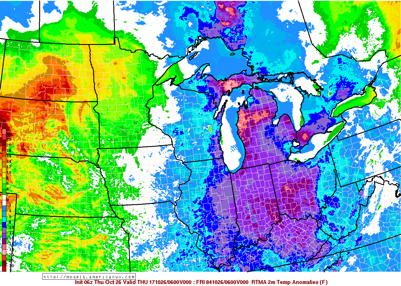
Temperature anomalies this morning show the much colder temps moving in with widespread mid to upper 30s especially to locations further north and east:
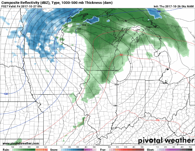
Watching our next precipitation chances work west to east on Friday…we are not overly impressed by the moisture attached to the cold front across the majority of IL locations barring locations to the far south where ~0.25-0.75″ will be possible. We also are increasing our confidence for the season’s first flakes will be possible on Saturday filtering in that chilly air on the backside of the low pressure…squeezing out any moisture left as light rain showers with snow showers mixed in at times (no accumulation).
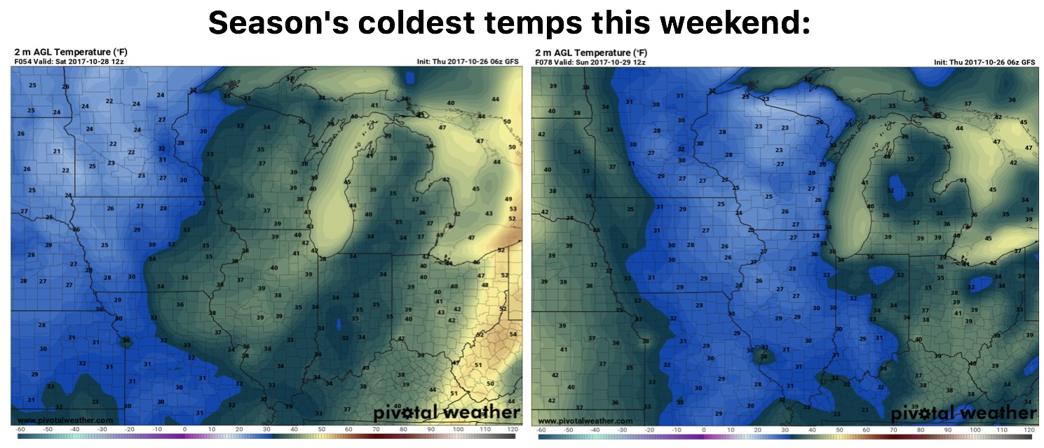
Season’s coldest temperatures filter in this weekend as the next trough digs into the Ohio Valley…our frost chances will increase on Sunday morning as well:
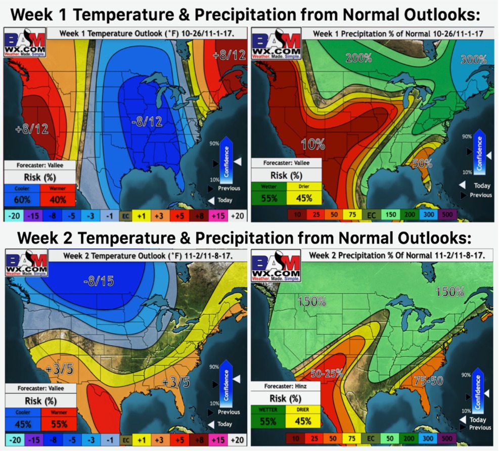
Weeks 1 and 2 updated long range outlooks: