Key Points – Tuesday, October 24, 2017:
Synopsis: Good Tuesday morning! Continue to have showers and drizzle moving back in, off-and-on, throughout the day today as a low pressure system lingers throughout the Ohio Valley…much cooler with highs expected to be in the upper 40s and lower 50s at best further south. We highlight in the video how the bottom drops out on temperatures Thursday morning with lows expected to get into the lower 30s…with calm winds and clear skies we are concerned for not only a hard frost but patchy freezing fog as discussed in the video. Eyeing the next front to move in Friday night into Saturday morning bringing our next chance for showers, maybe even a rumble of thunder. If you have any questions with the forecast please let us know, have a blessed day! -Kirk
Today’s video (7 min):
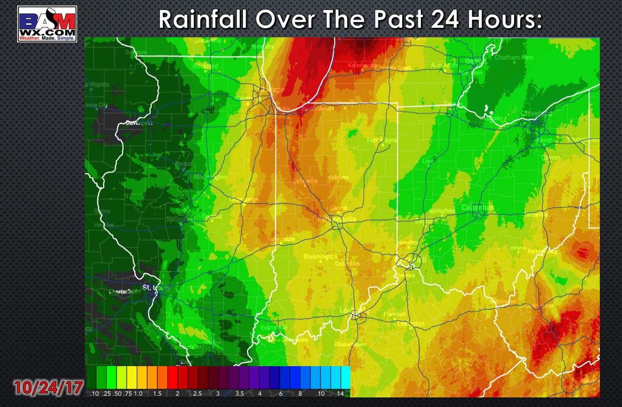
Rainfall totals over the past 24 hours:
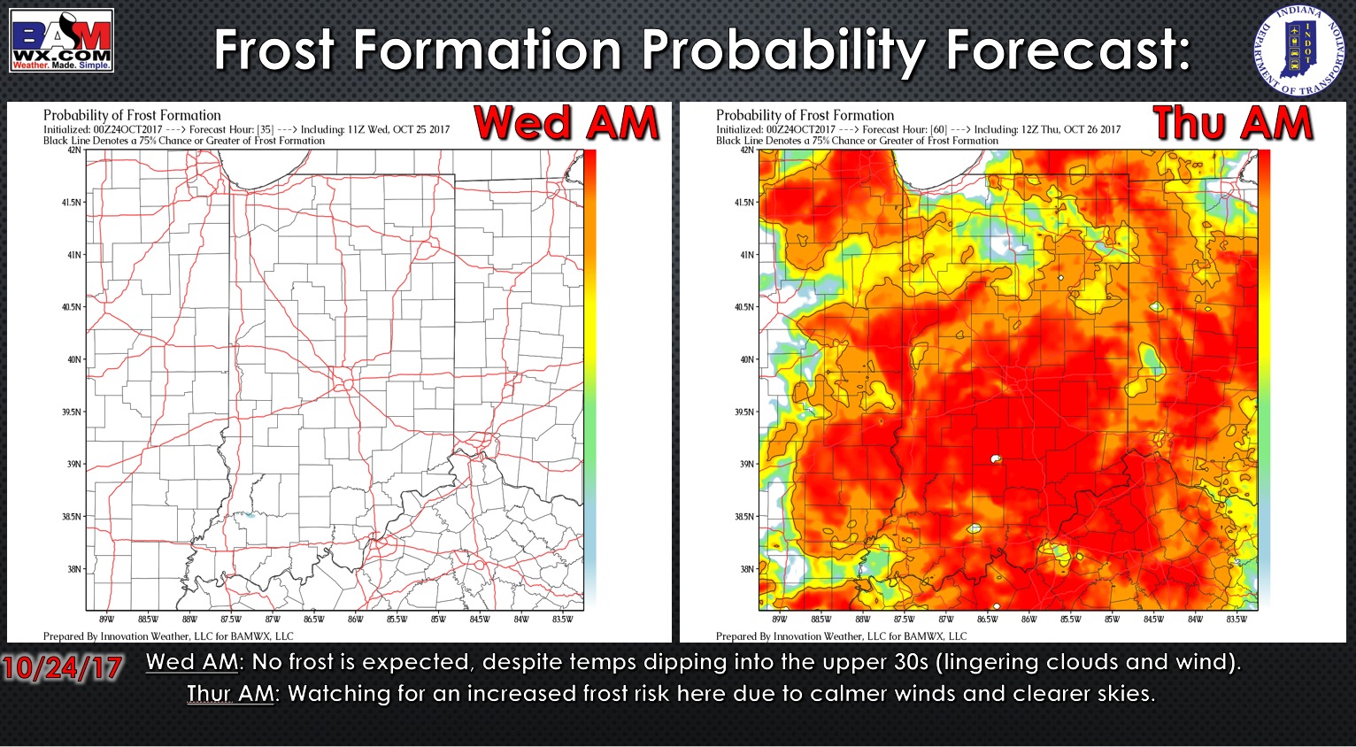
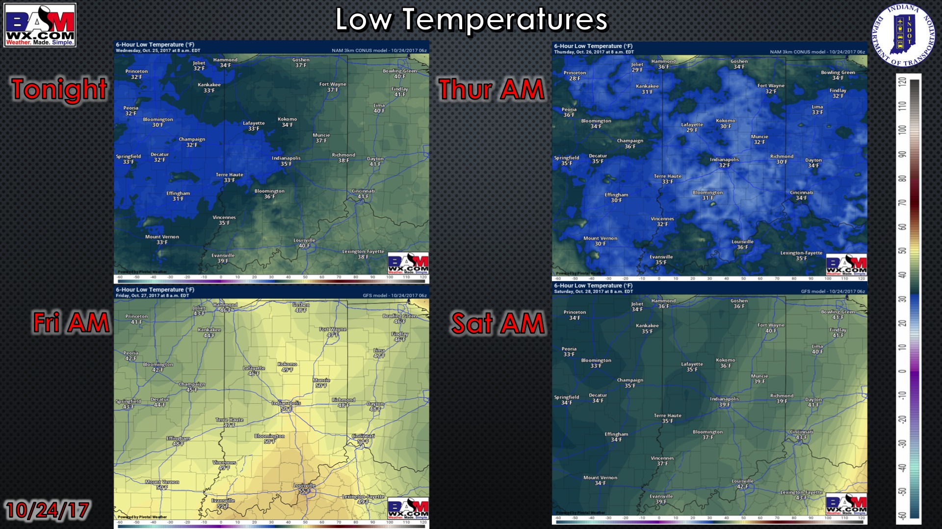
Here is the frost potential outlook over the next 2 days…although we likely dip into the upper 30s Wednesday morning, with wind and clouds present it will likely reduce the frost threat. However, getting into Thursday morning we are watching for a fairly widespread frost threat throughout the state.
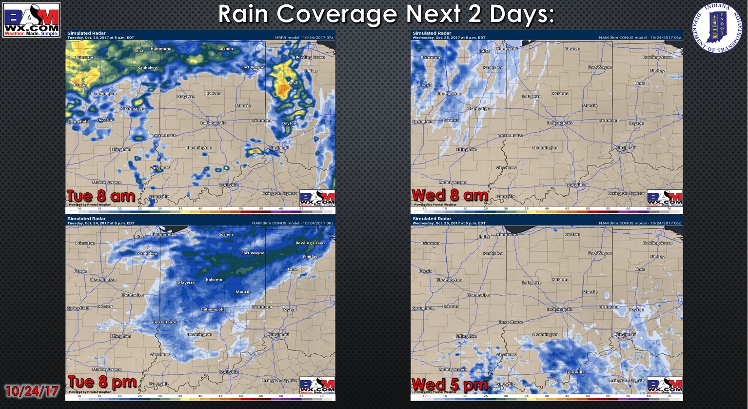
Simulated radar guidance as we go throughout the next 2 days:
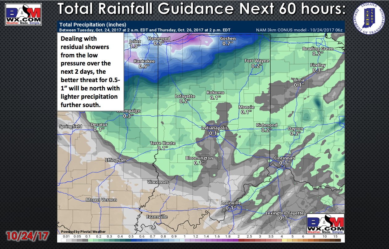
Total rainfall guidance over the next 60 hours:
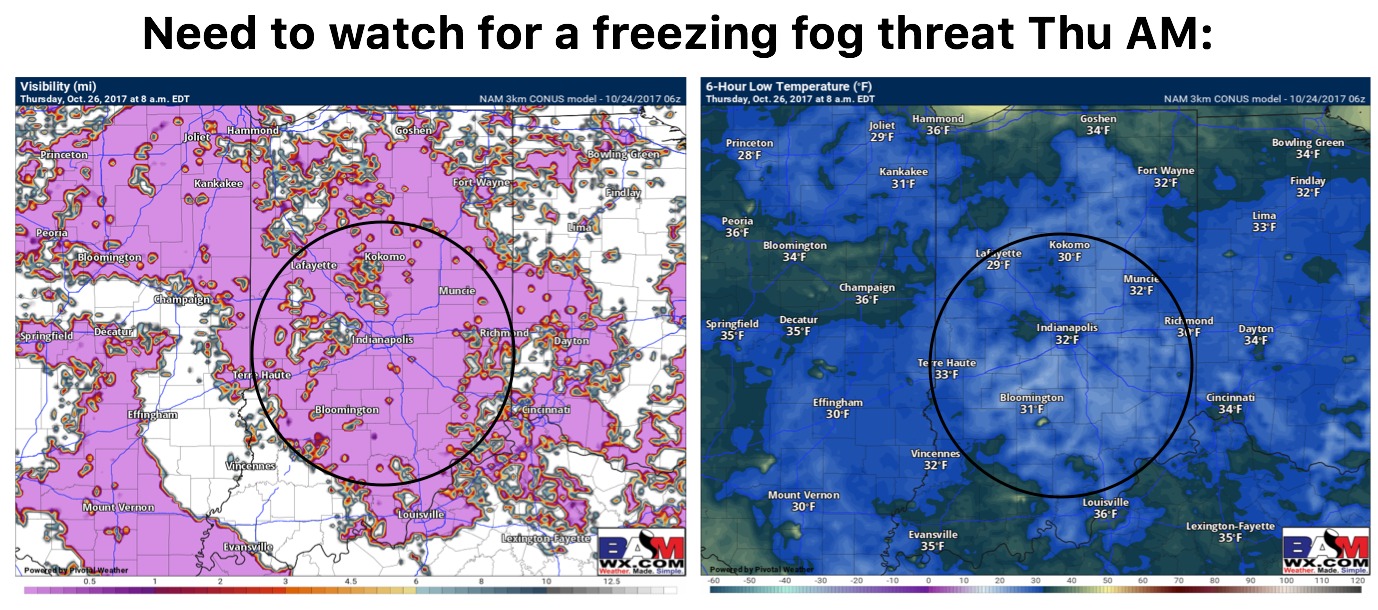
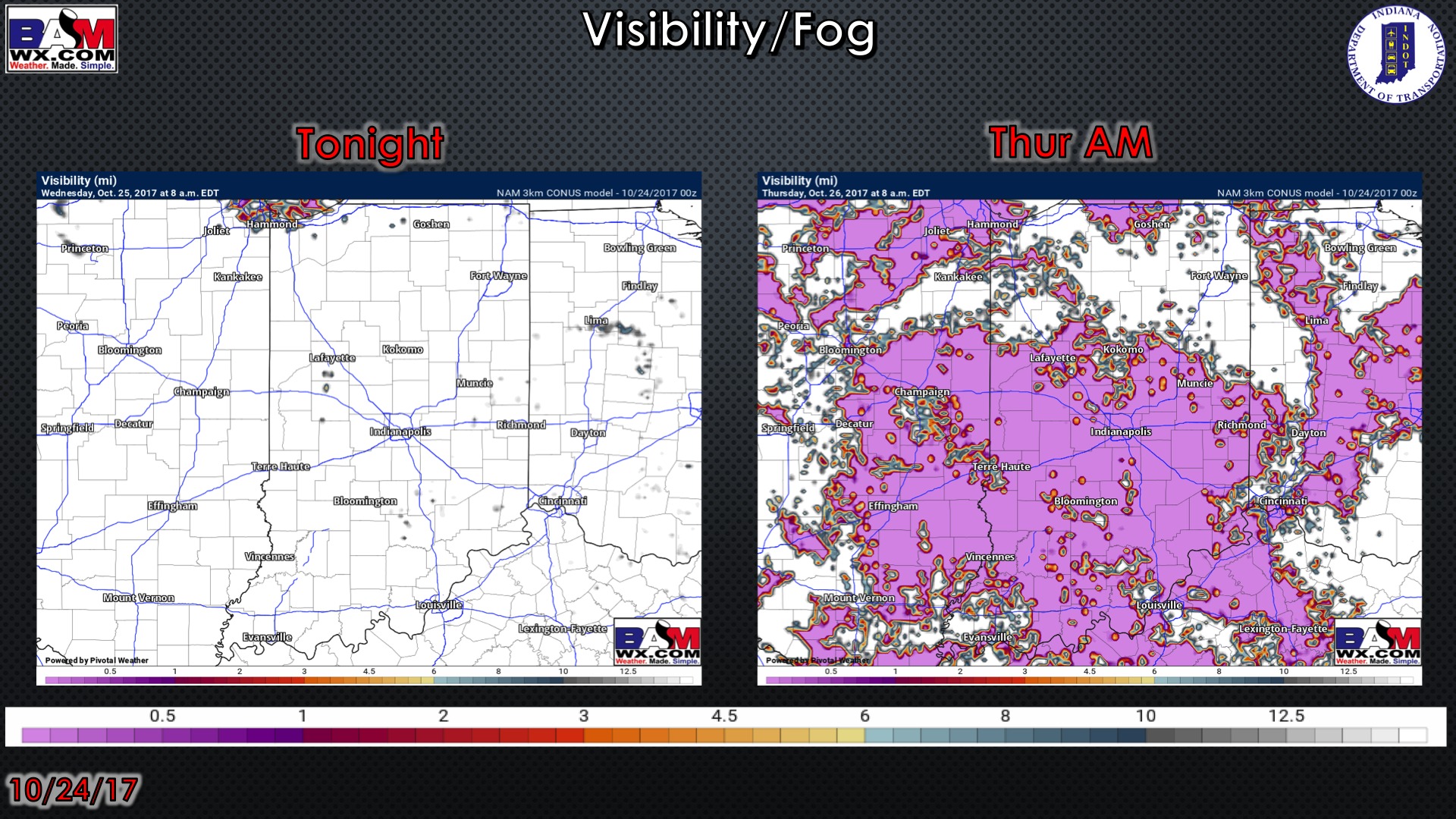
We are concerned for the potential for a freezing fog threat Thursday morning…details in the video:
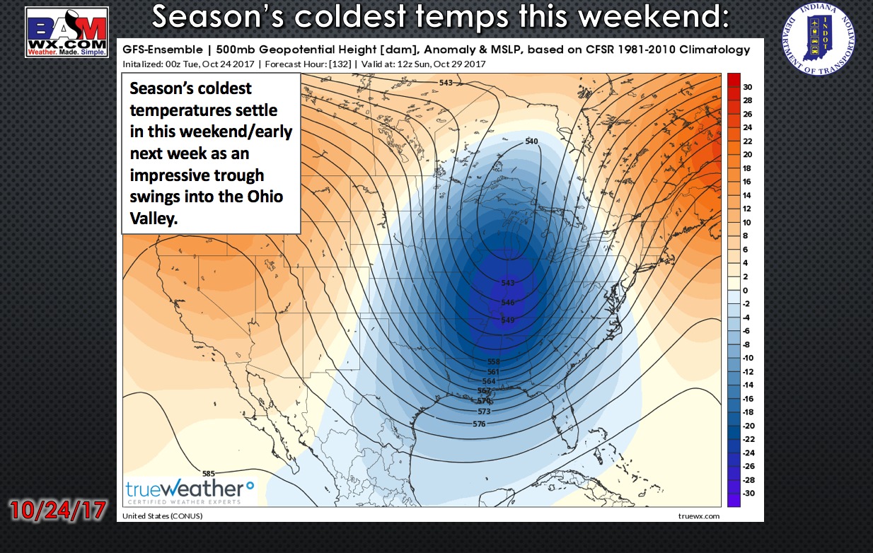
Eyeing a big-time trough to swing through the Ohio Valley this weekend, bringing some of our coldest temperatures of the season to date:
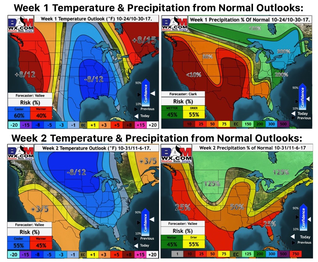
Weeks 1 and 2 temperature and precipitation from normal outlooks:
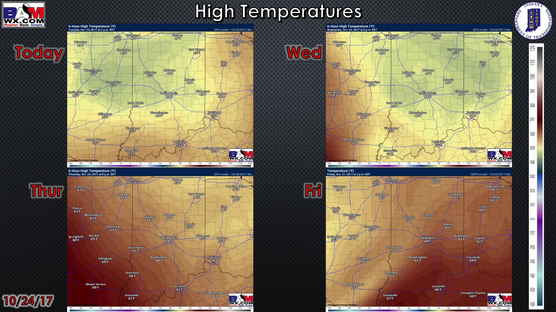
High temperature guidance for the next 4 days:
Low temperature guidance for the next 4 mornings:
Visibility guidance over the next 2 mornings:
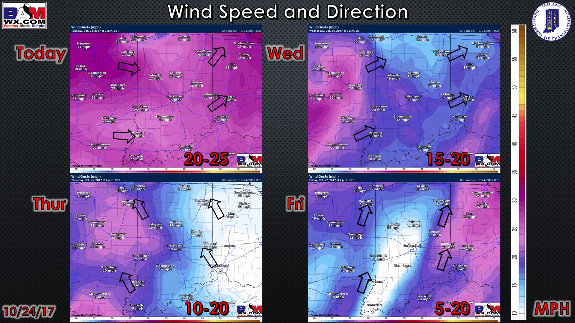
Wind guidance over the next 4 days: