Today’s Illinois Video Update (7 min):
More scattered showers in the forecast today…most numerous over central, northern, and eastern parts of the state through the day. It will be breezy with west winds 10-30 mph and steady temperatures mainly in the 40s.
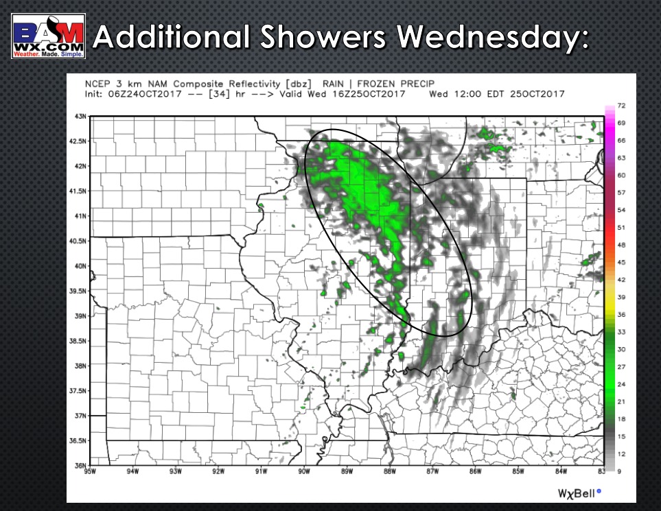
Another disturbance moves through on Wednesday bringing additional scattered showers mainly from a Peoria to Champaign line and points to the northeast.
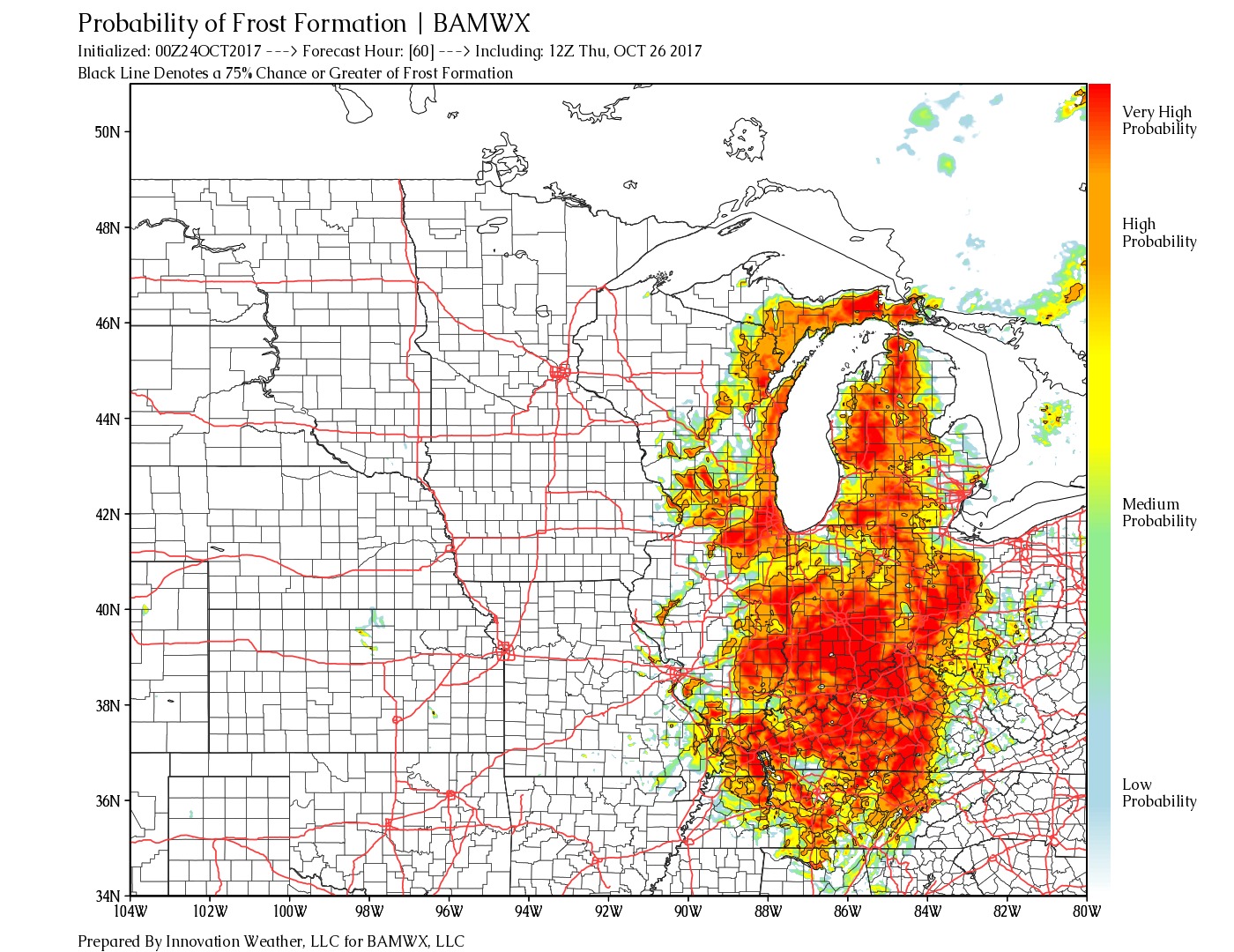
We are watching Thursday morning for some frost and fog potential …with temps close to freezing in areas cannot rule out some freezing fog….something we need to fine-tune as more data comes in. Areas east look to have the best potential. Frost formation probability forecast is shown below.
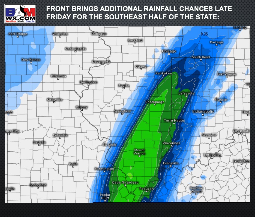
A strong cold front moves through Friday, with additional moisture riding northward along the front Friday afternoon into early Saturday. Showers look increasingly likely across the eastern half of the state, while areas west look to remain dry.