Key Points – Monday, October 23, 2017
Synopsis: Good Monday morning! Expecting widespread rainfall today to work in from south to north for the majority of the work day…1-2″ will be possible, localized higher amounts can’t be ruled out. Mist/drizzle conditions will linger as we transition into Tuesday and Wednesday. We dry out Thursday into Friday before our next precipitation chance moves east along a cold front this weekend. We also mention in the video the potential for a little frozen precipitation to mix in Saturday morning, something we will need to monitor very closely as we move forward this week for slick surfaces. We start to feel this long-advertised colder pattern this week, with 30s, even upper 20s possible as we move into this coming weekend. Let us know if you have any questions, have a blessed day!
Today’s video (6:30 min):
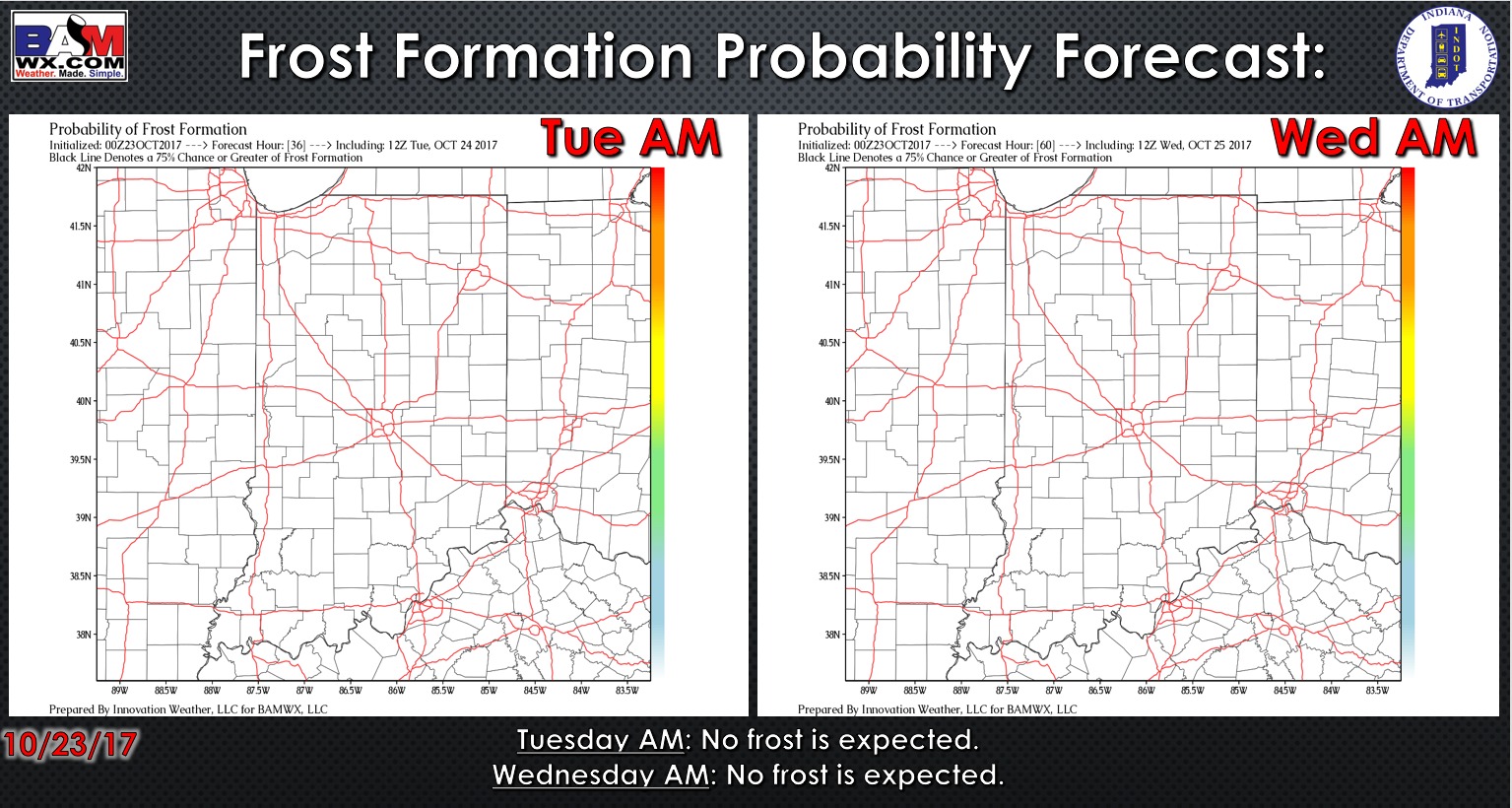
No frost is expected as we heat into the early week:
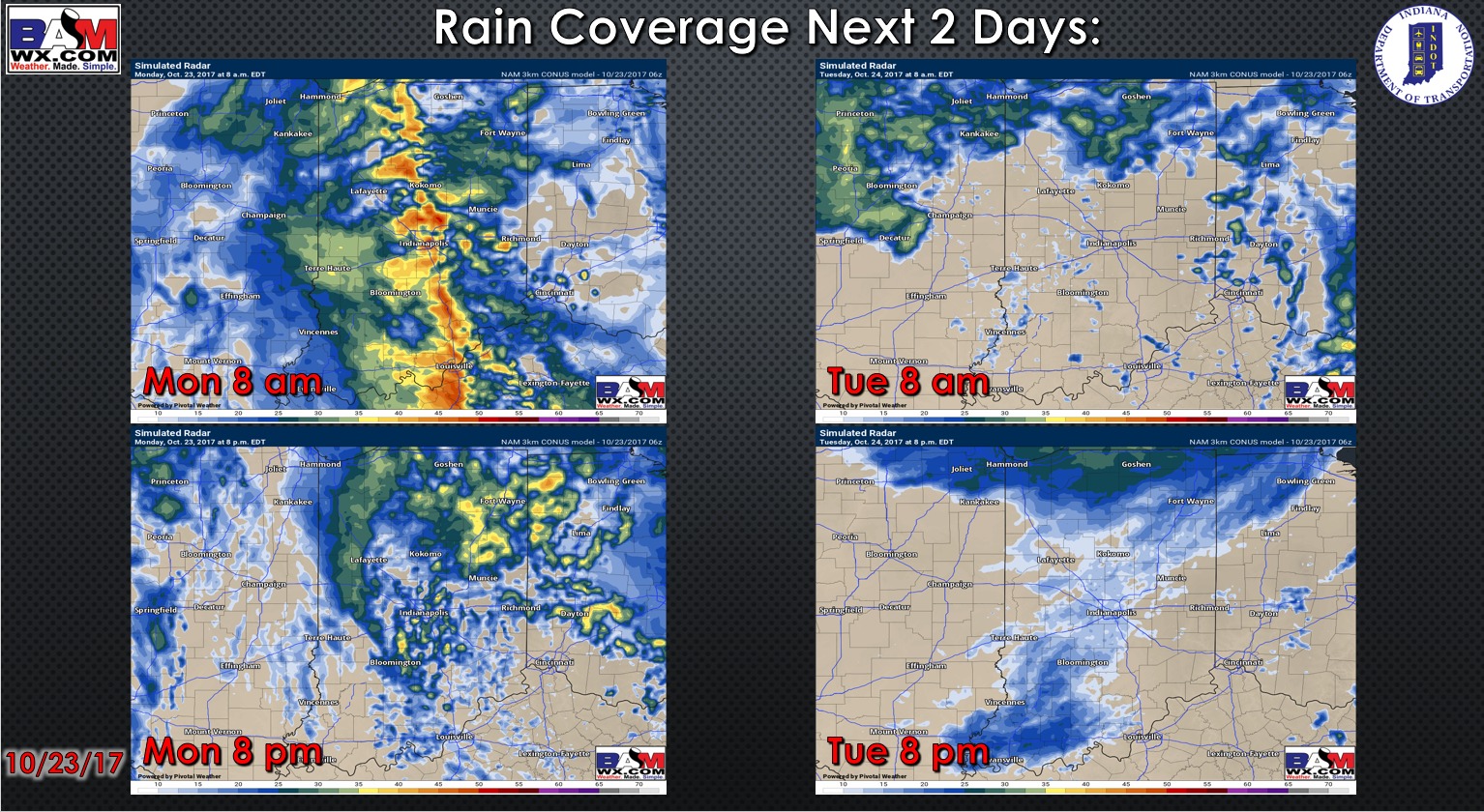
Simulated radar guidance as we go throughout the next 2 days:
Total rainfall guidance over the next 60 hours:

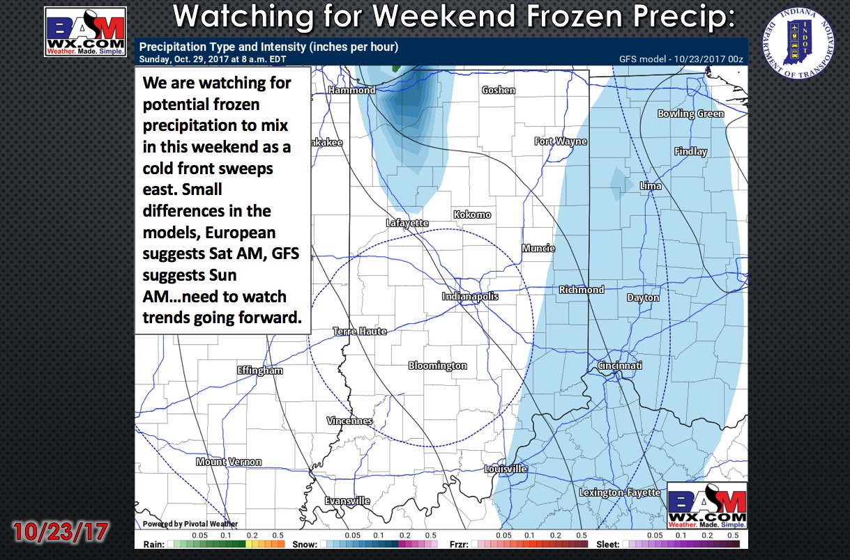
Eyeing next weekend for our next precipitation chances to sweep east along a cold front…we can’t rule out some frozen precipitation mixing in Saturday morning, need to monitor for slick-surfaces:
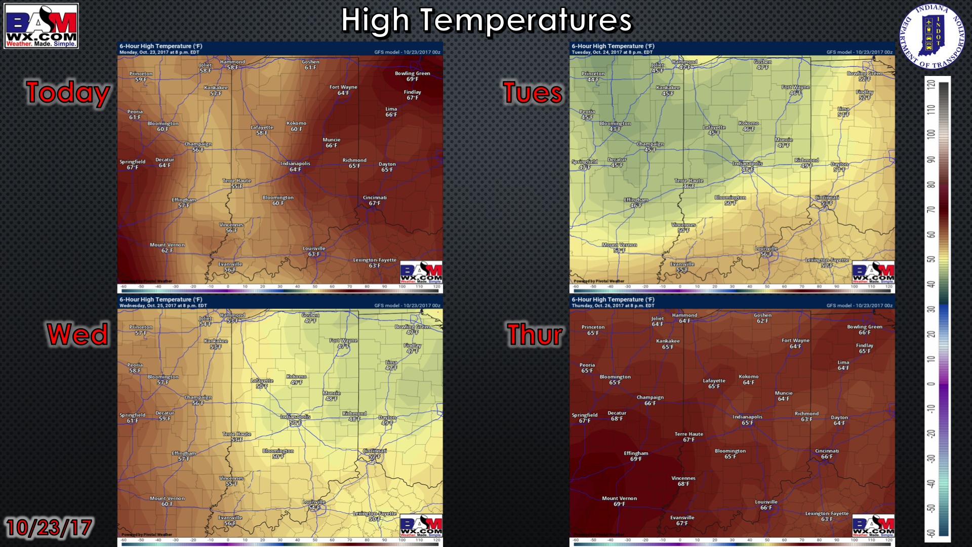
High temperature guidance for the next 4 days:
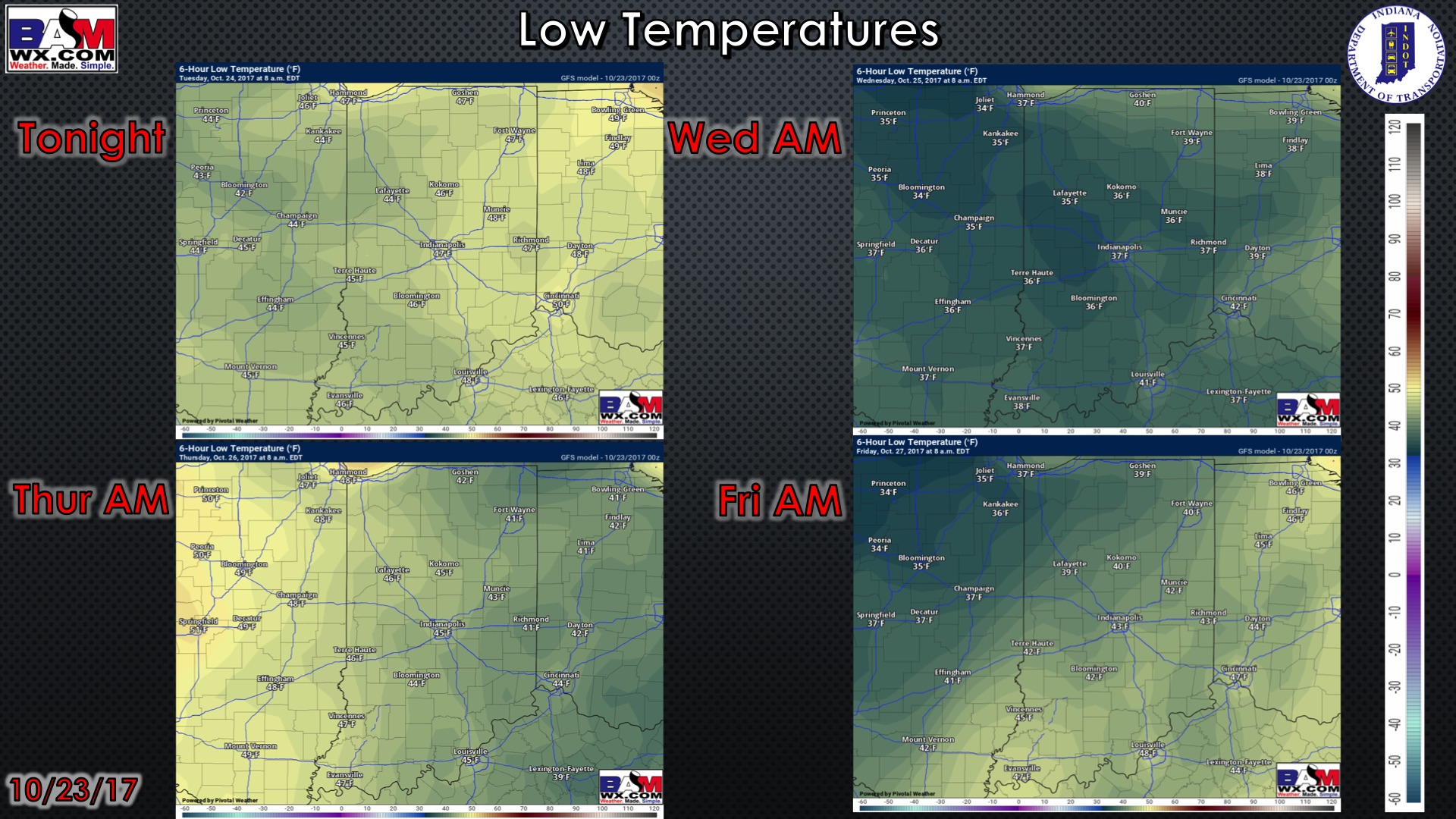
Low temperature guidance for the next 4 mornings:
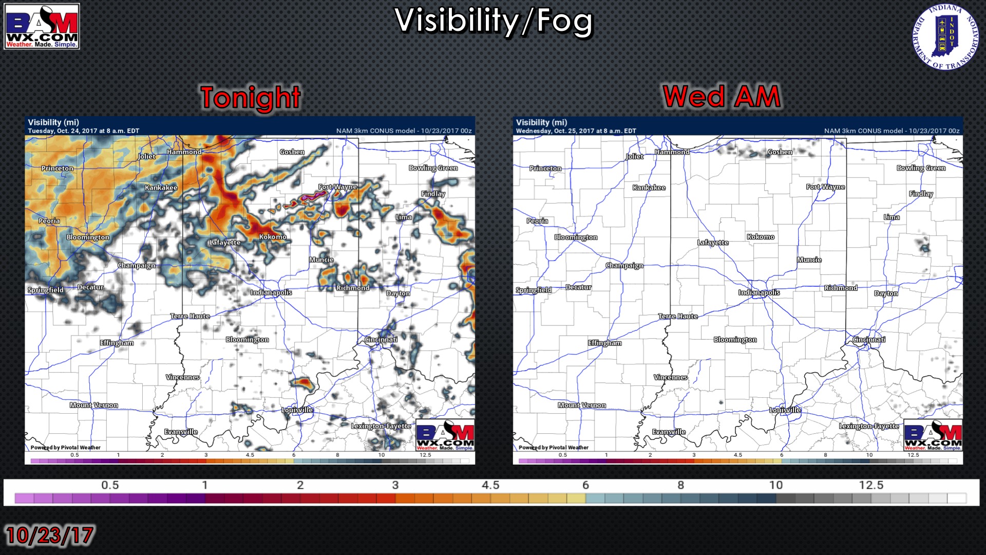
Visibility guidance over the next 2 mornings…can’t rule out a patchy drizzle/fog Tuesday AM:
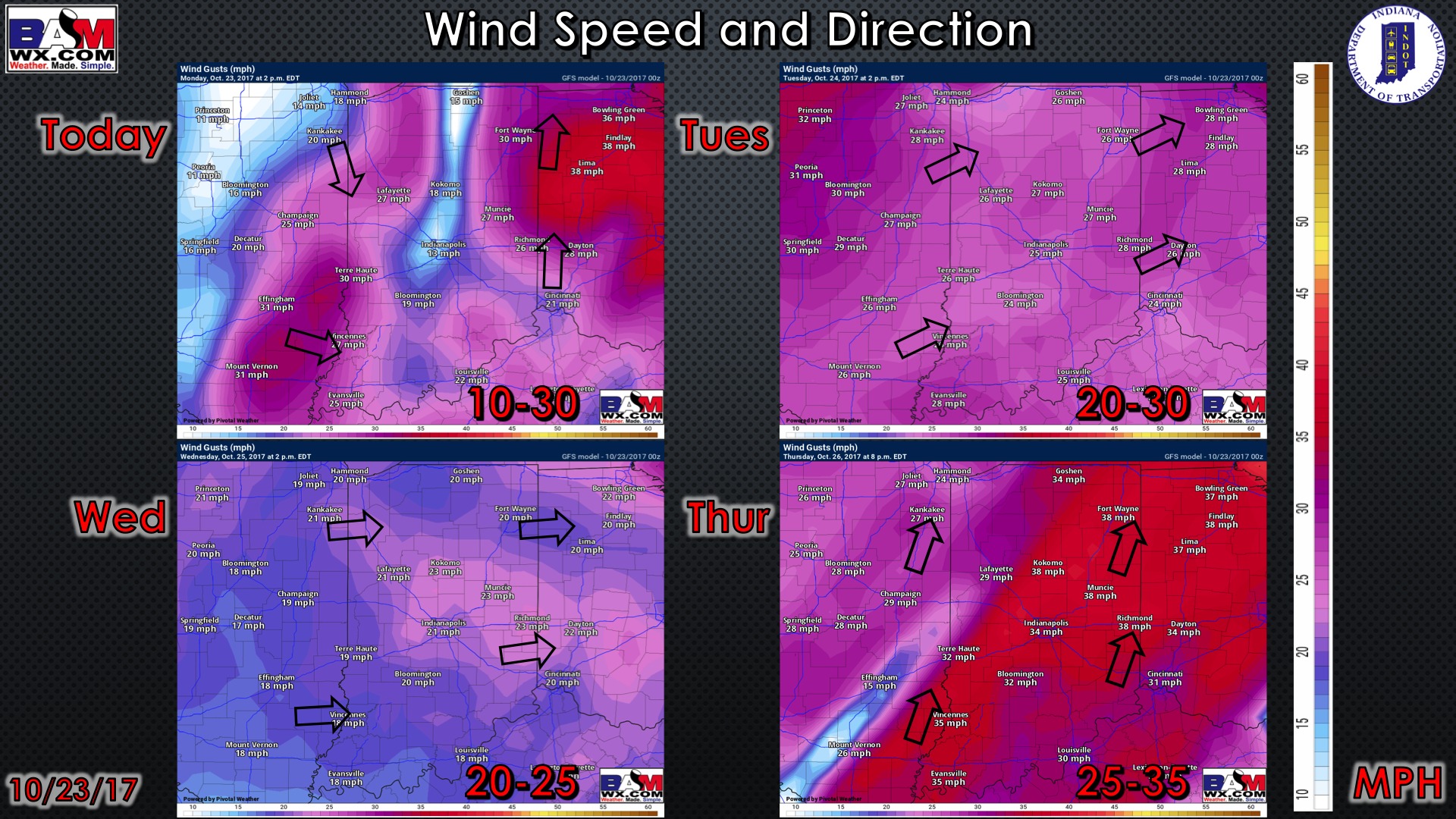
Wind guidance over the next 4 days: