Key Points – Friday, October 20, 2017:
Synopsis: Good Friday morning! Clear conditions persist across the state over the next 2 days under high pressure before out next rain maker moves east along a cold front the second half of the day on Sunday into Monday. We mentioned yesterday the risk for heavy rainfall to work in Sunday into Monday and Tuesday, in today’s video we continue to find confidence in this solution…maybe even be some flash flooding going on; need to watch this storm closely. As of right now, it doesn’t look like rain exits the area until late Tuesday night. Right now looking like 1-3″ of widespread rainfall through this period will be possible, localized 3″+ will also be on the table. A few lake effect rain showers will be possible to the north across northern locations on Wednesday…beyond this, eyeing next weekend for our next more widespread rain maker. A very active and progressively cooler pattern looks to evolve as we head towards late October. If you have any questions please let us know, have a blessed day! -Kirk
Today’s video (6:30 min):
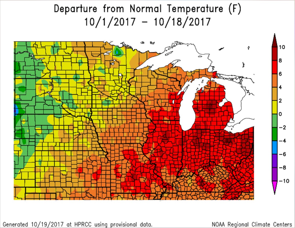
October temperatures from normal across the Midwest…we are running at the warmest month on record in Indy…a very warm month especially overnight:
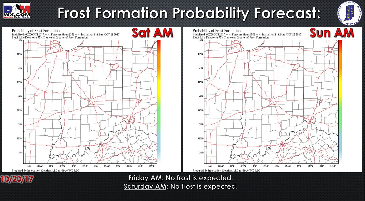
No frost is expected as we heat into the weekend with southerly winds in place, ushering in warmer temperatures:
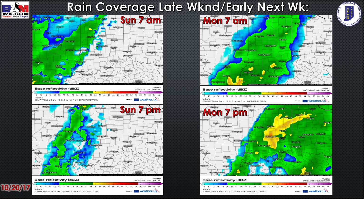
Simulated radar guidance this weekend into early next week shows the cold front advancing from west to east…the timing for best showers will be late Sunday night into Monday:
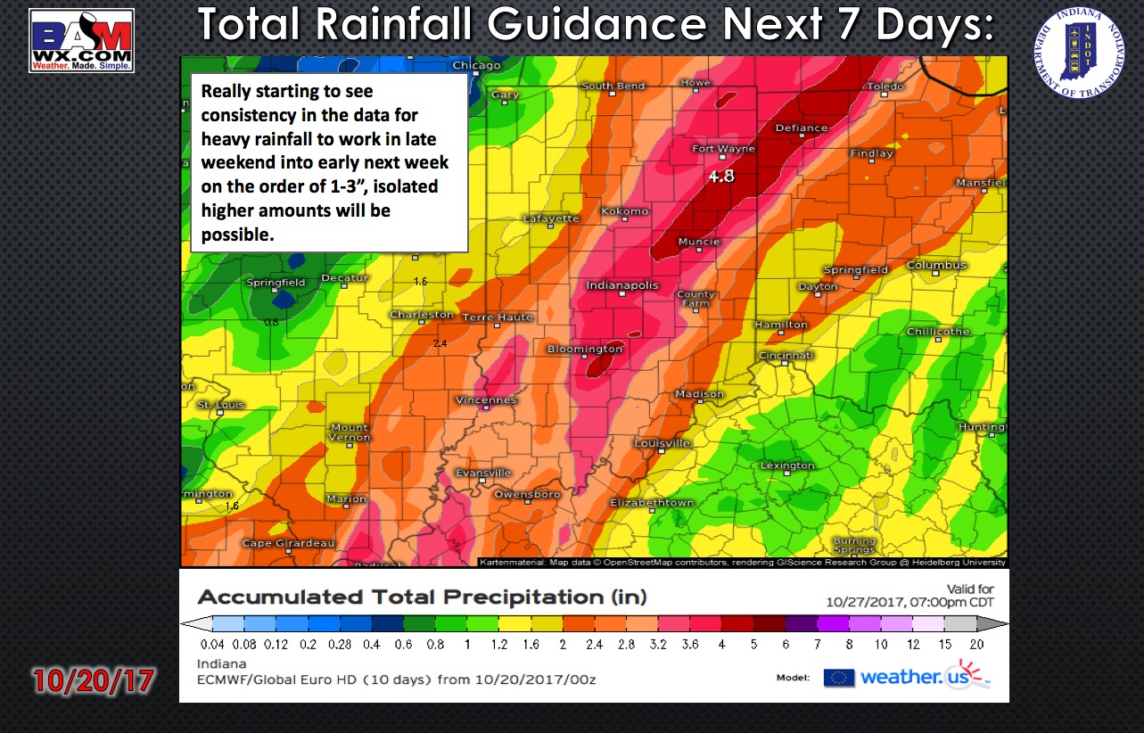
Total rainfall guidance over the next 7 days…a solid swath of 1-3″ will be possible, with localized higher amounts of 3″+ will be possible:
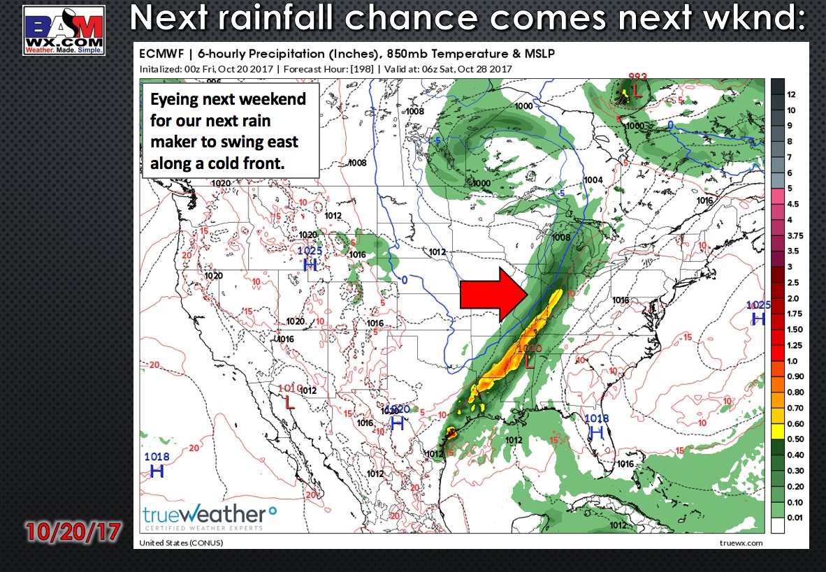
Eyeing next weekend for our next rain maker to sweep east along a cold front:
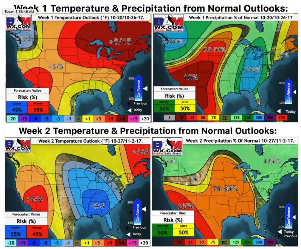
Weeks 1 and 2 temperature and precipitation from normal outlooks:
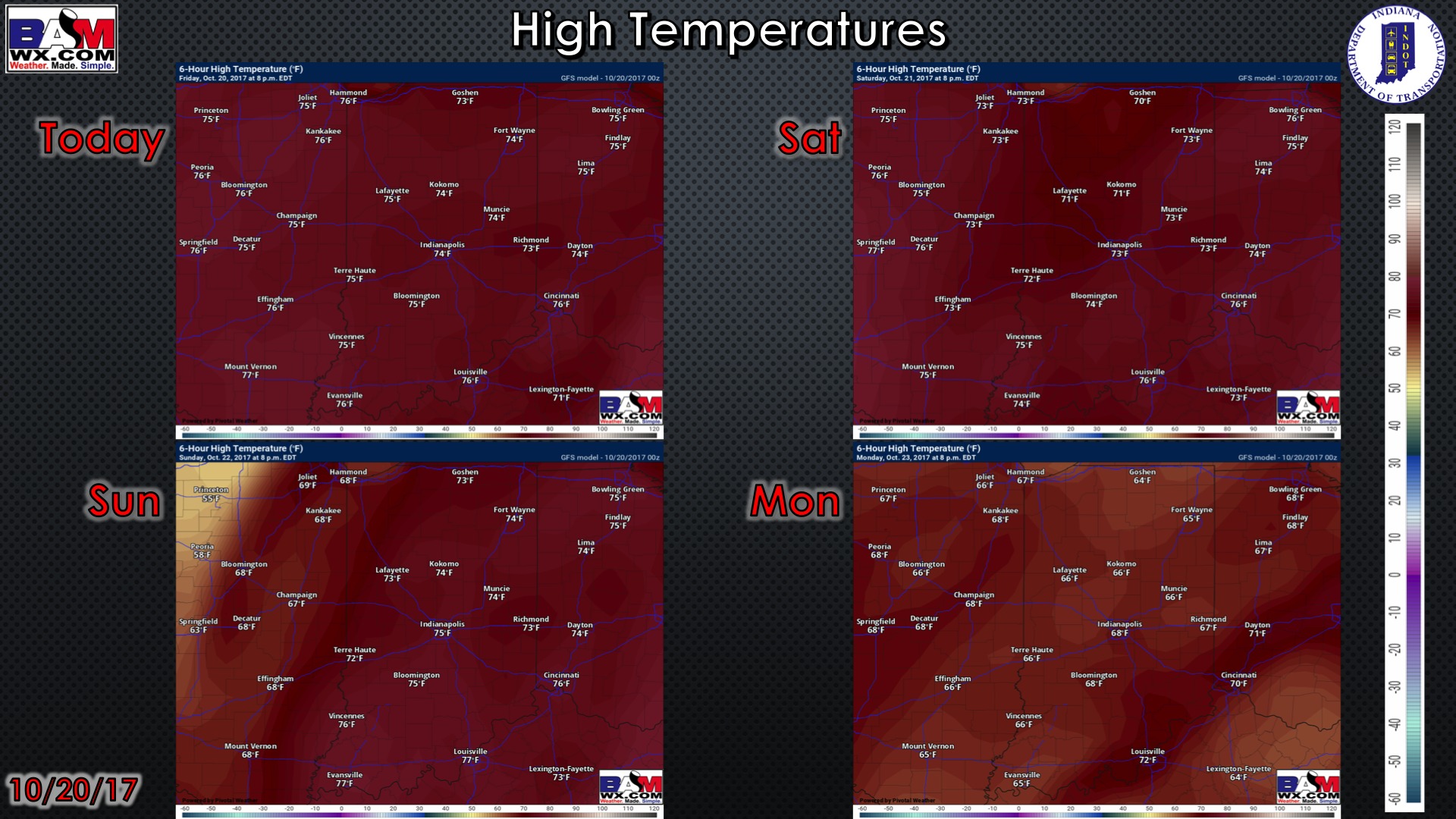
High temperature guidance for the next 4 days:
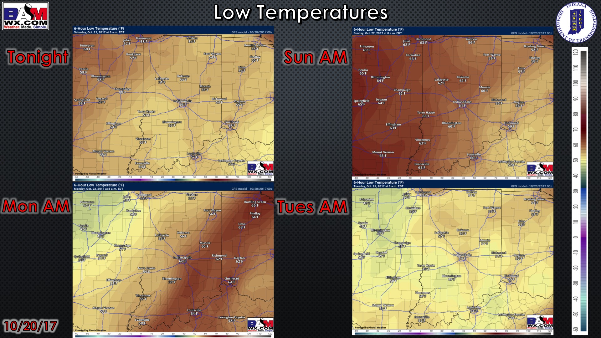
Low temperature guidance for the next 4 mornings:
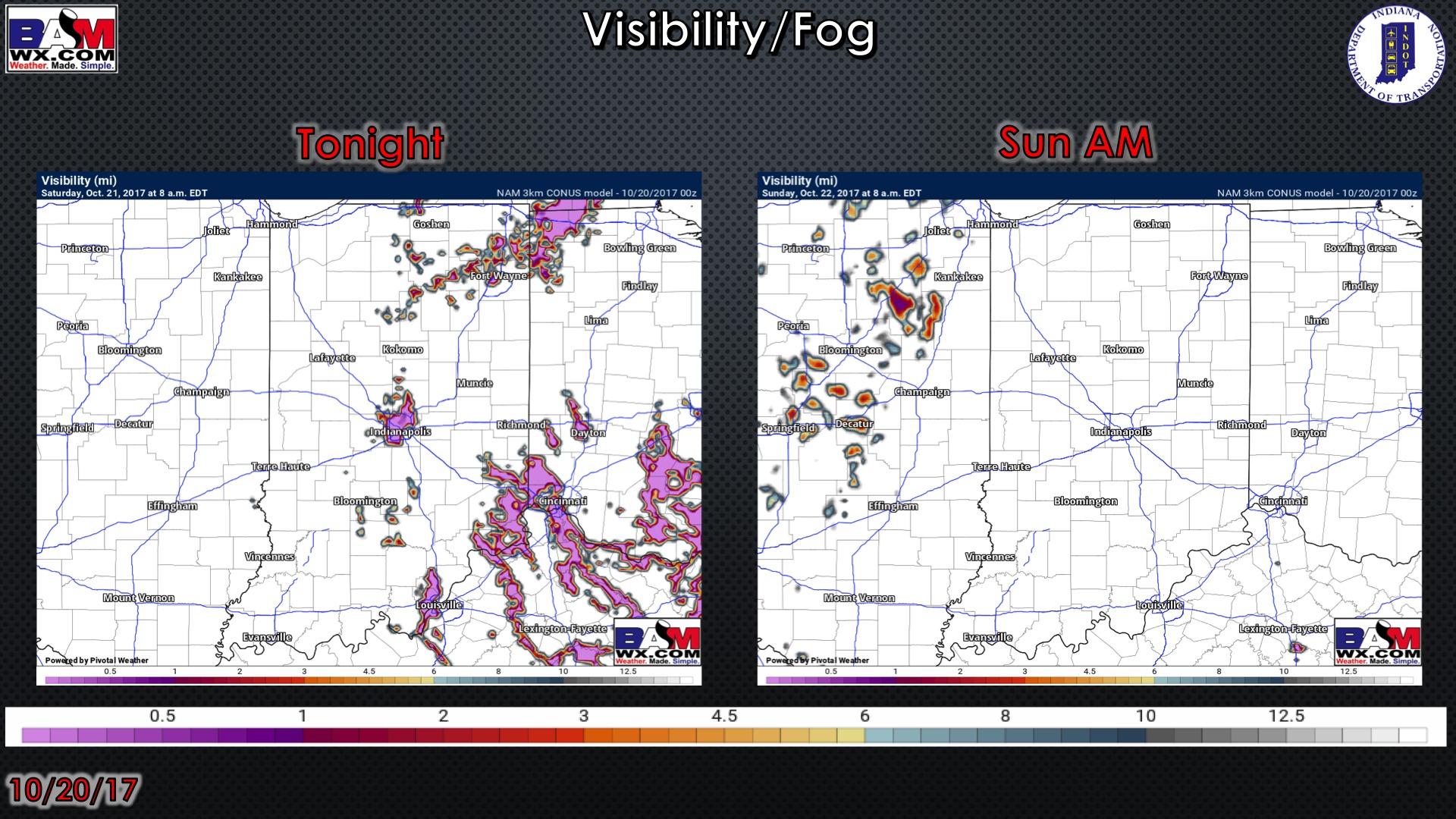
Visibility guidance over the next 2 mornings…some very patchy fog possible Saturday morning in low-lying areas:
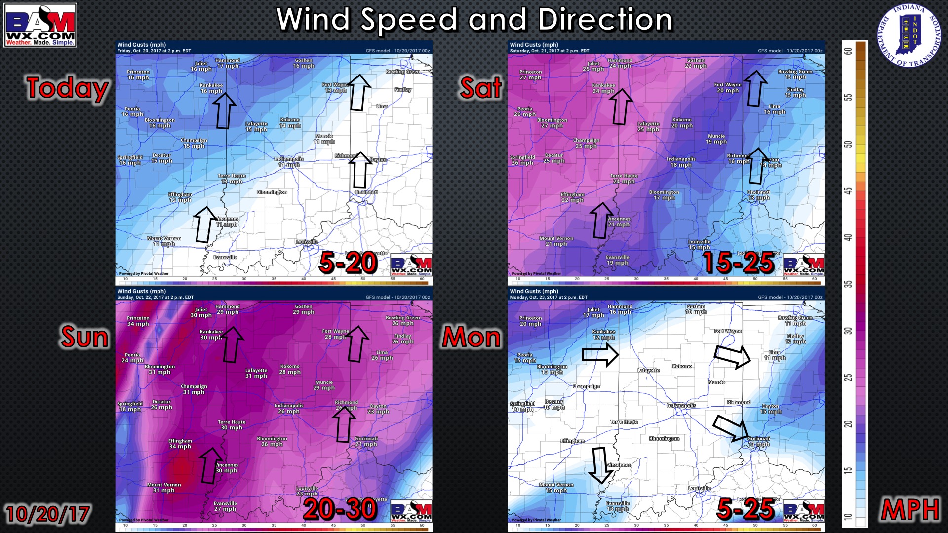
Wind guidance over the next 4 days: