Key Points – Tuesday, October 17, 2017:
Synopsis: Good Tuesday morning! Waking up to another beautiful, crisp morning across the Ohio Valley, which will be the story each and every day through early weekend…one of our more “quiet” weather-weeks in some time. We target the next rain chance late Saturday into Sunday as a cold front advances east…we still aren’t sold that this will be more than an “average” rain-maker…~0.5″ will be possible. It’s behind this front is where things get sharply colder, as we’ve been discussing for the last week of October as well. If you have any questions please don’t hesitate to reach out, have a blessed day! -Kirk
Today’s video (5 min):
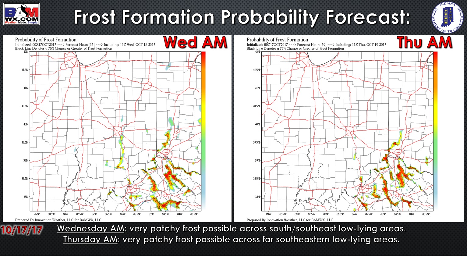
Exclusive BAMwx frost probability forecast over the next 2 mornings is below. Patchy frost is possible over the next 2 mornings, better risk in southeast Indiana.
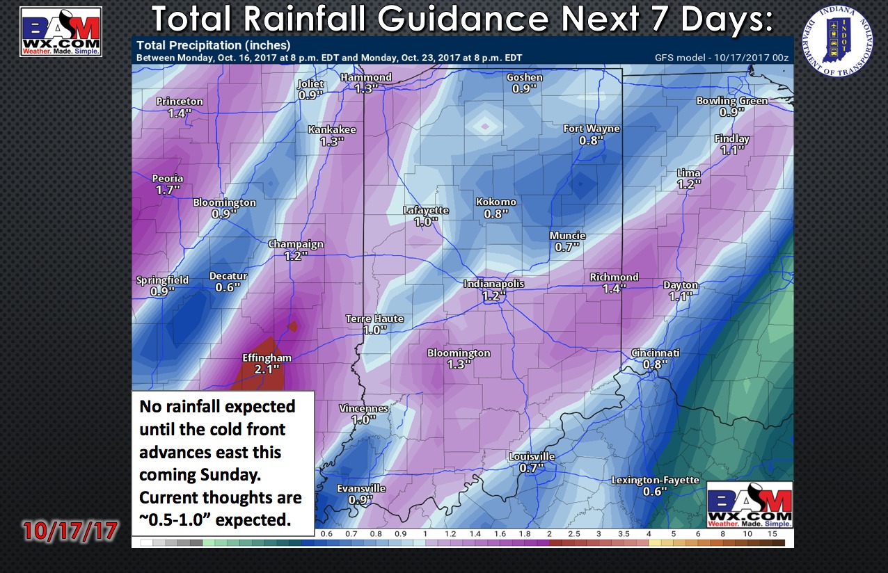
Total rainfall guidance over the next 7 days…no rainfall is expected until the cold front advances east this coming Sunday. We still have uncertainty as to the extend of this rainfall, but ~0.25-0.75″ will be possible.
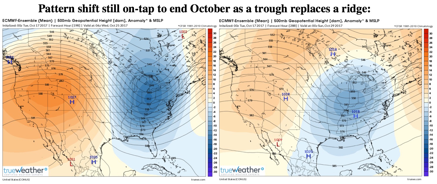
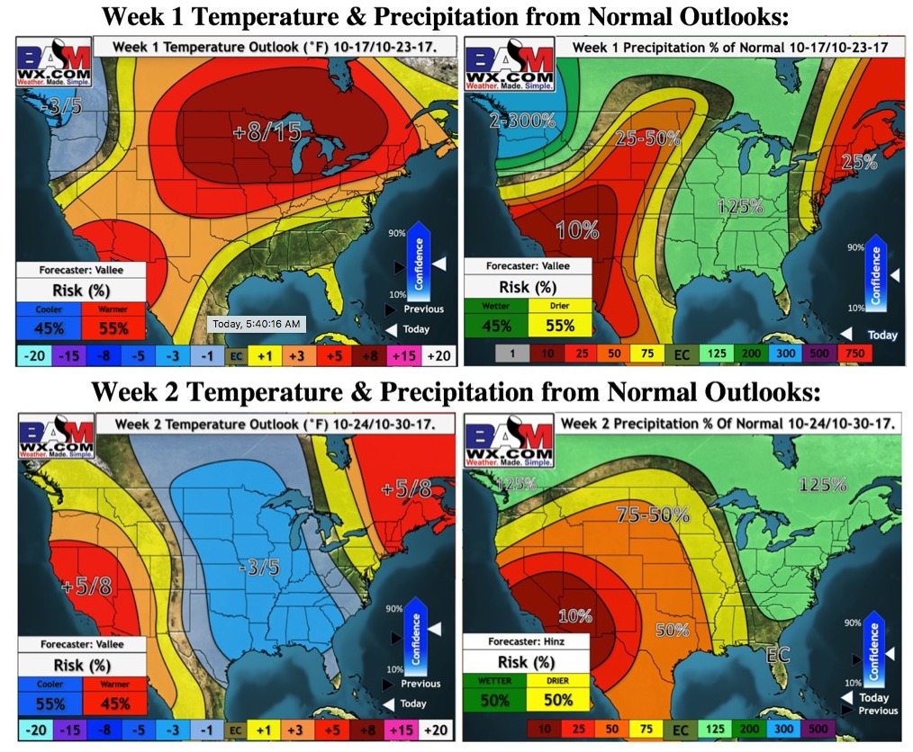
Continuing to eye a pattern shift the last week of October as a trough (area of lower pressure) replaces a ridge…a colder regime will work in:
Weeks 1 and 2 temperature and precipitation outlooks:
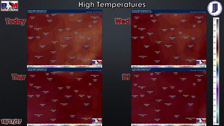
High temperature guidance over the next 4 days:
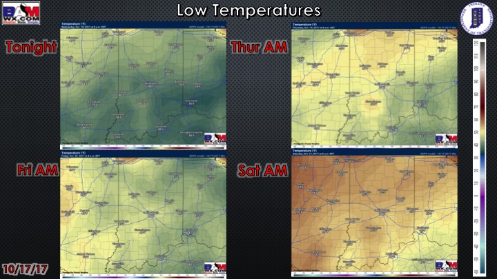
Low temperatures over the next 4 mornings:
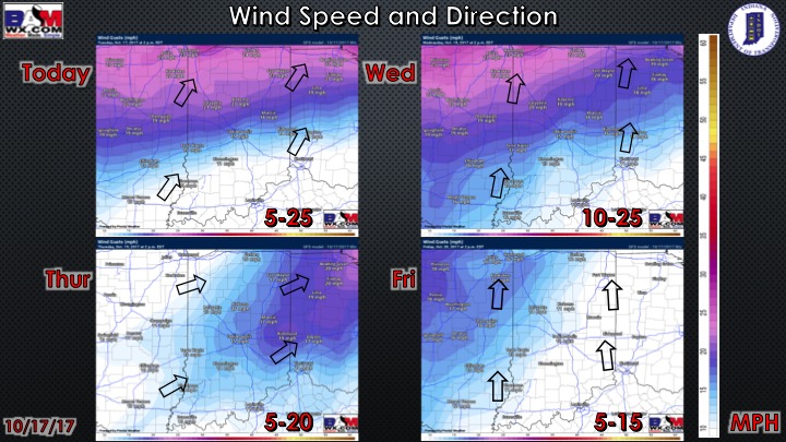
Wind forecast over the next 4 days:
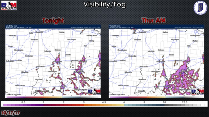
Visibility forecast over the next 2 mornings…can’t rule out very patchy fog especially near bodies of water and low-lying areas.