Key Points – Monday, October 16, 2017:
Synopsis: Good Monday morning! High pressure is building in this morning leading to clearing skies and a cool air mass. This area of high pressure sticks around all week with mainly sunny/warm days and clear/cool nights. Expect a gradual warming trend through the week. A cold front looks to arrive late next weekend which will bring our next opportunity for rain.
Today’s video (6 min):
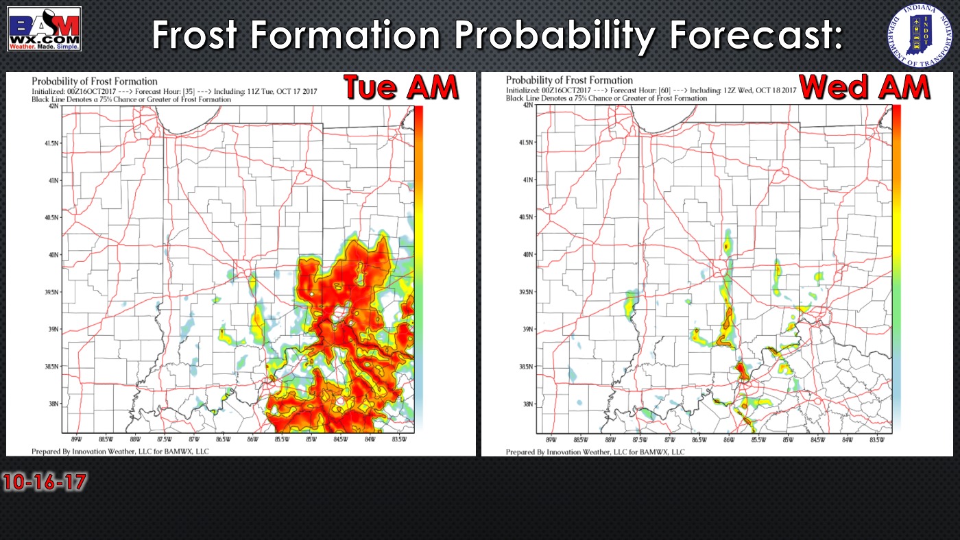
Exclusive BAMwx frost probability forecast over the next 2 mornings is below. Patchy frost is possible over the next 2 mornings, better risk in southeast Indiana.
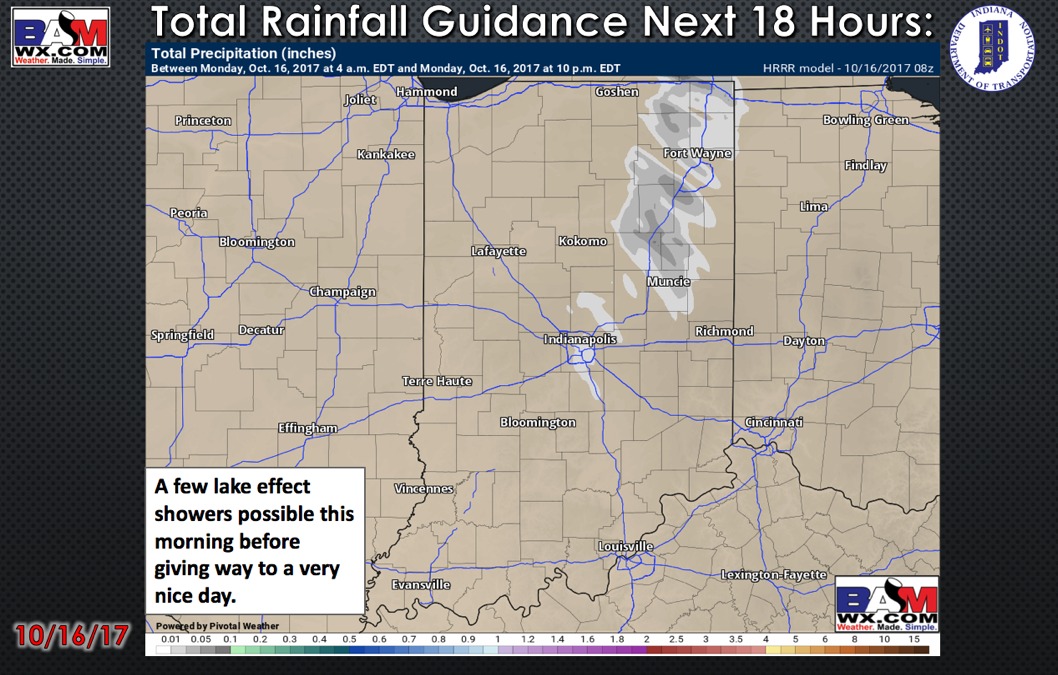
Total rainfall guidance over the next 18 hours…barring a few lake effect showers this morning, no rainfall is expected:
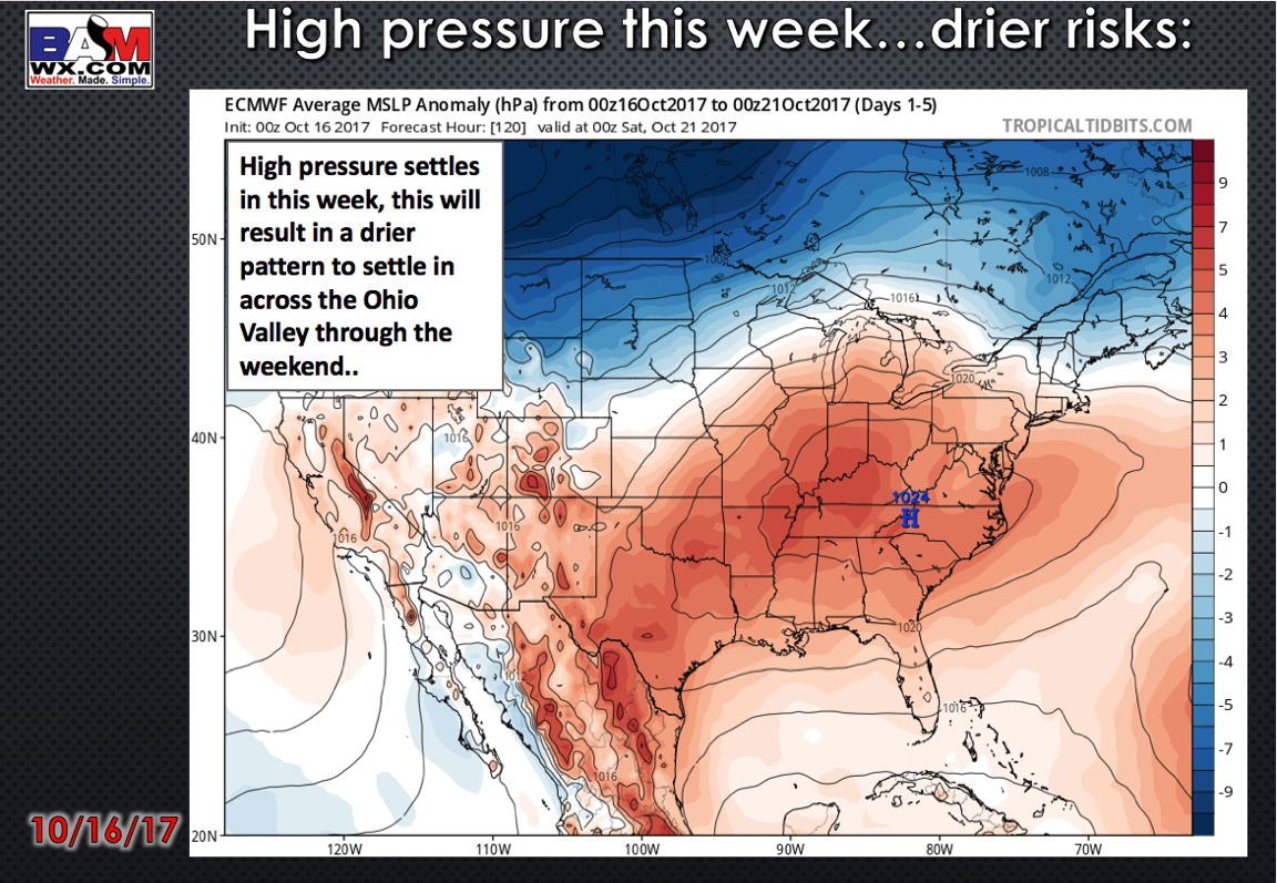
High pressure settles in nearly all of this week…allowing for a much drier pattern to set-up; not expecting much of anything in the way of precipitation:
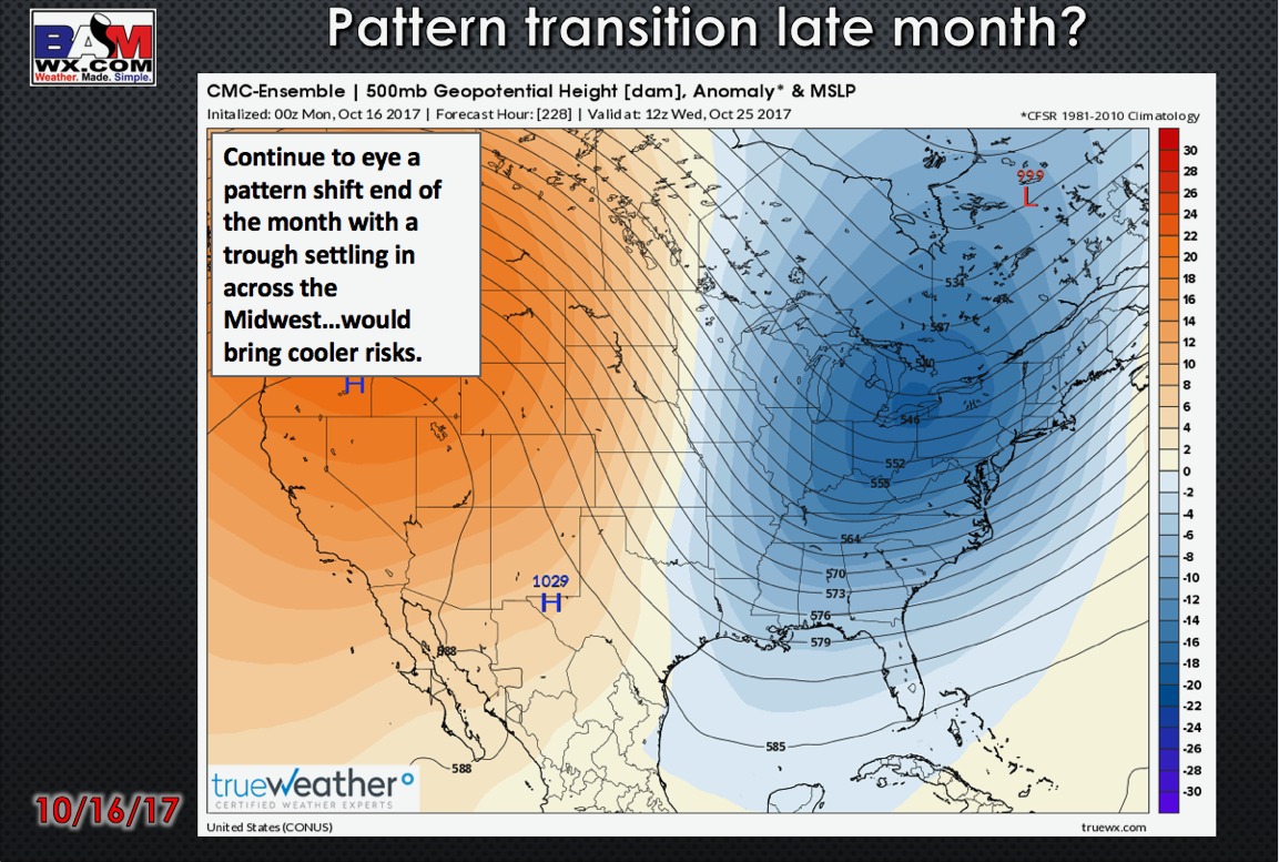
We continue to monitor a pattern shift expected next week leading to cooler risks for late October.
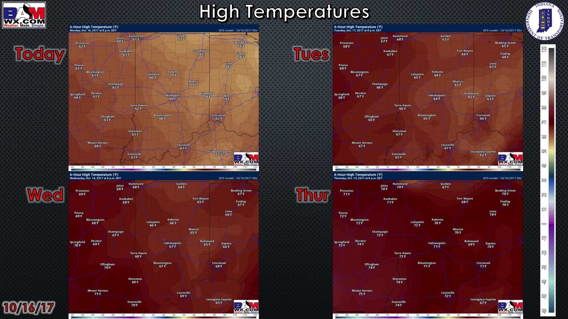
High temperature guidance over the next 4 days:
Low temperatures over the next 4 mornings:

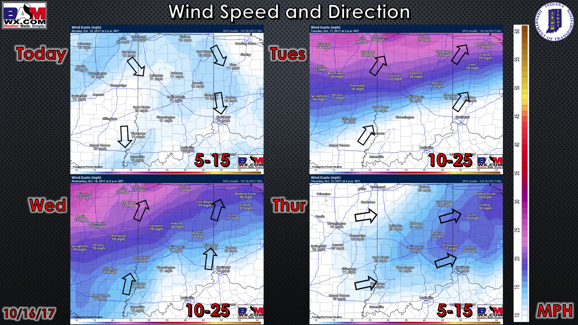
Wind forecast over the next 4 days:
Visibility forecast over the next 2 mornings…can’t rule out very patchy fog each morning this week.

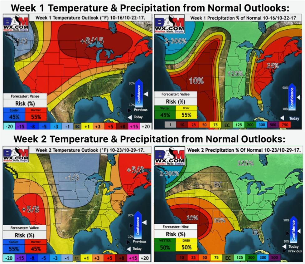
Weeks 1 and 2 temperature and precipitation outlooks: