Key Points – Friday, October 13, 2017:
Synopsis: Good Friday morning! The big story will be the cold front pushing west to east later Saturday into Sunday bringing strong wind gusts and our best chance for rainfall over the next week. We get warm ahead of the front on Saturday, but as the front passes east on Sunday we cool off in a big way into early next week. We stay very dry under high pressure conditions next week as well…in the video we continue to discuss the cooler trend towards the end of the month. If you have any questions please let us know, have a blessed weekend! -Kirk
Today’s video (5:50 min):
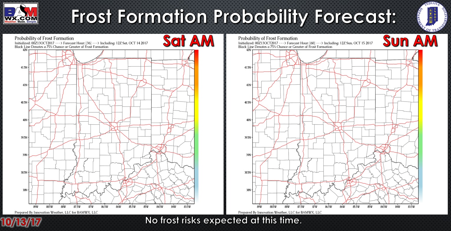
Exclusive BAMwx frost probability formation forecast over the next 2 mornings is below…no frost is expected:
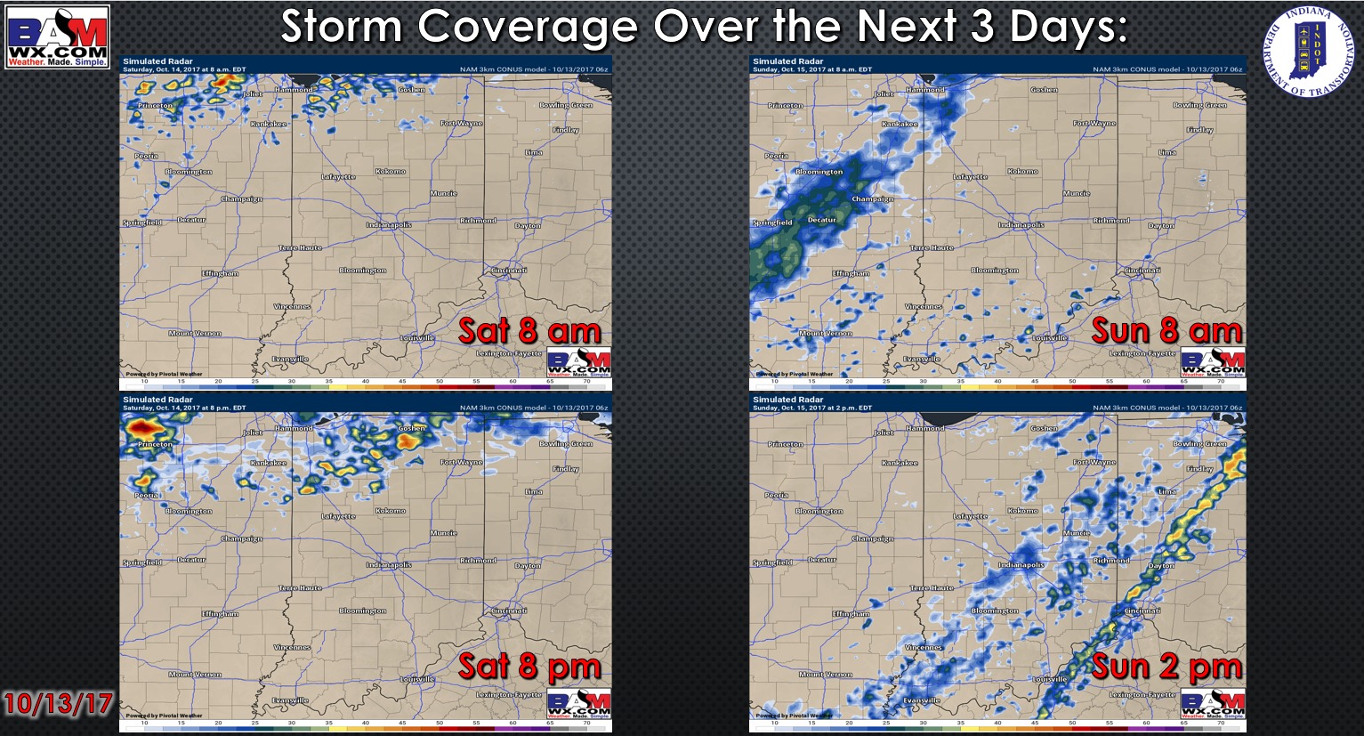
Storm coverage over the next 3 days:
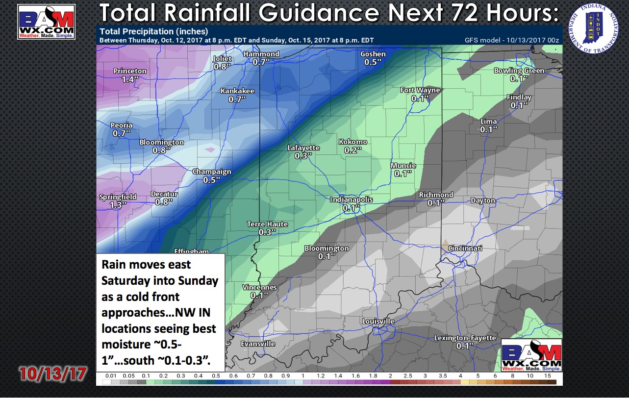
Total rainfall guidance over the next 72 hours:
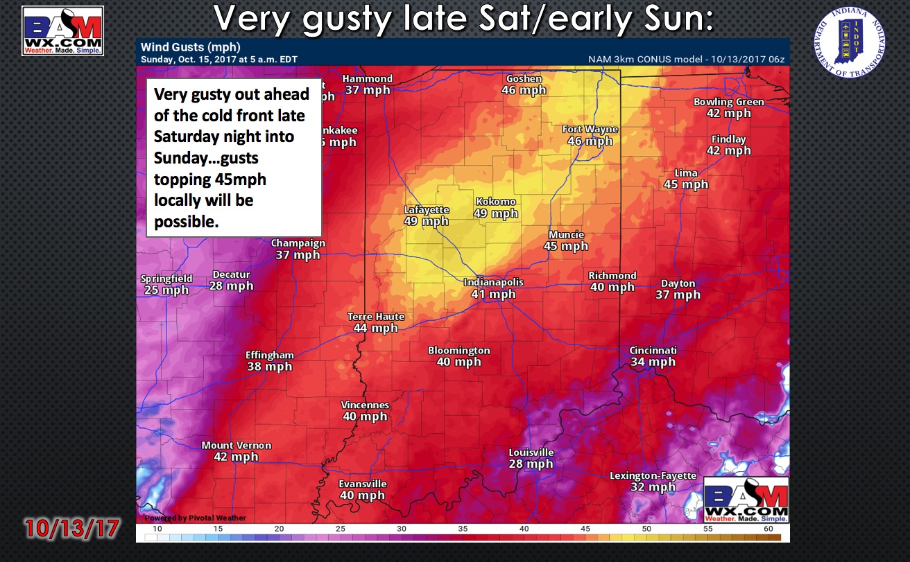
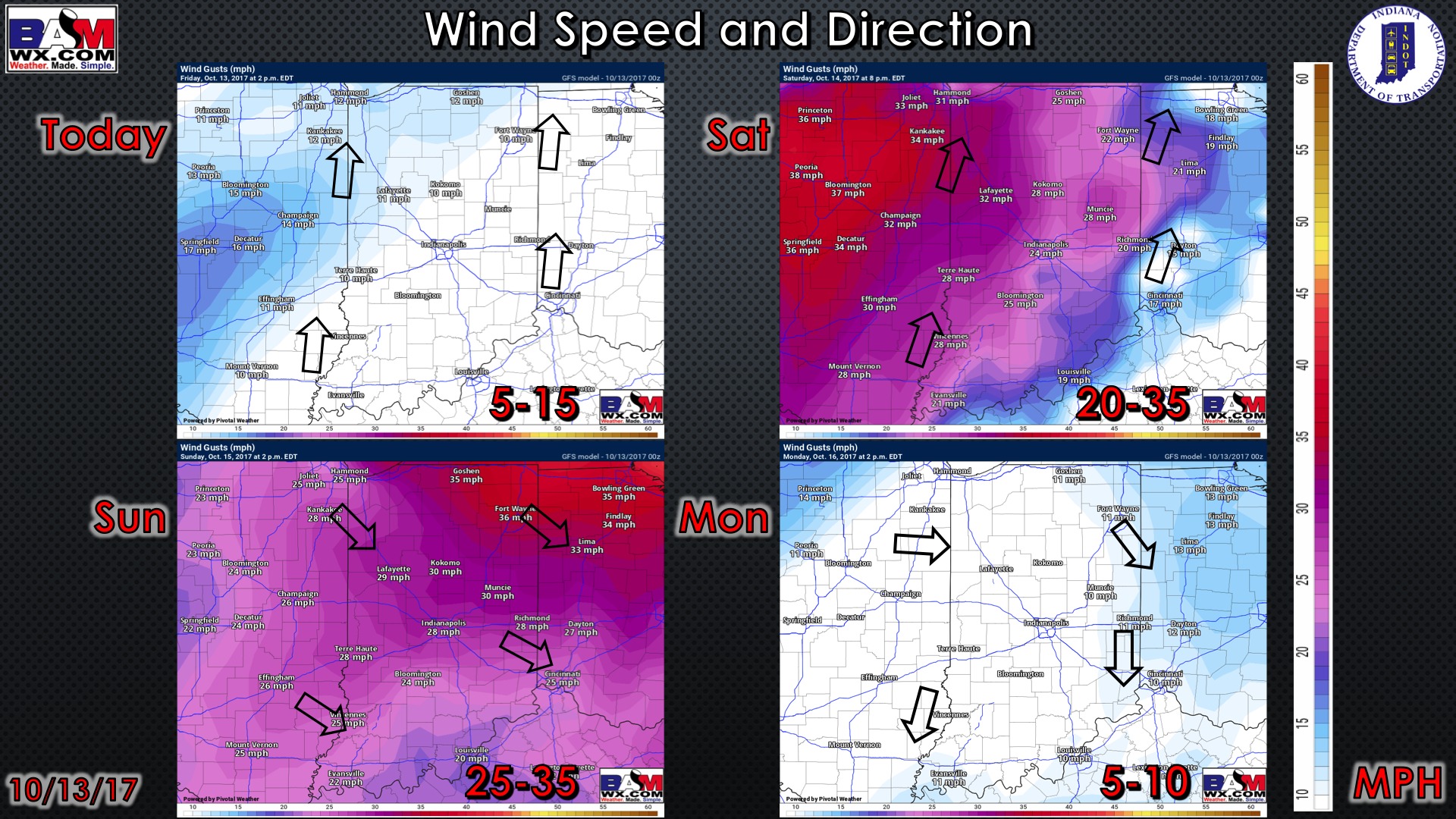
Things get very windy as the cold front approaches late Saturday into early Sunday morning…wind gusts topping 45mph locally will be possible:
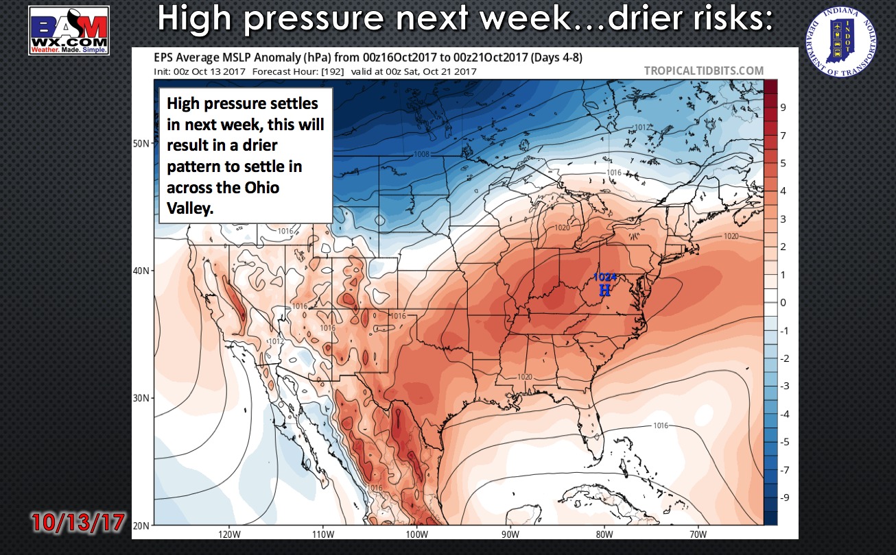
High pressure settles in nearly all of next week…allowing for a much drier pattern to set-up; not expecting much of anything in the way of precipitation.
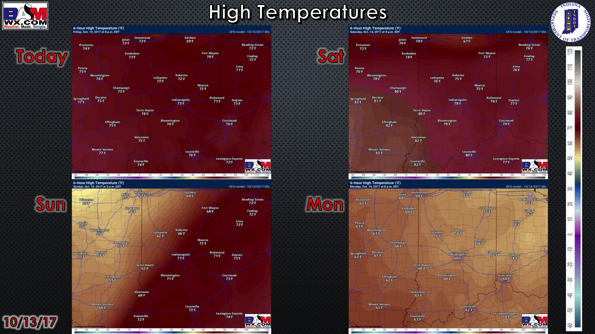
High temperature guidance over the next 4 days:
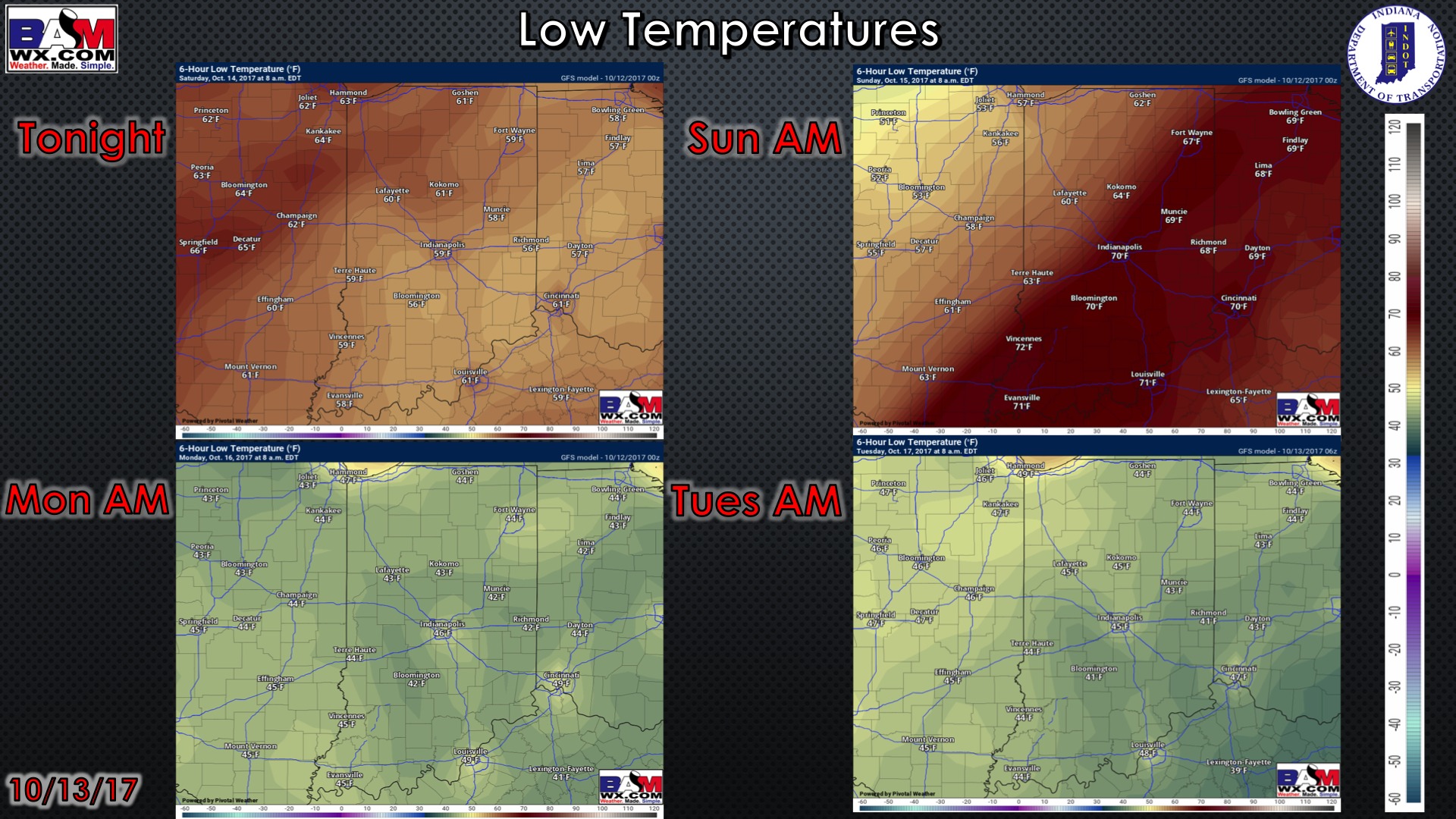
Overnight low temperature guidance over the next 4 mornings:
Wind forecast guidance over the next 4 days…getting windy later Saturday into Sunday:
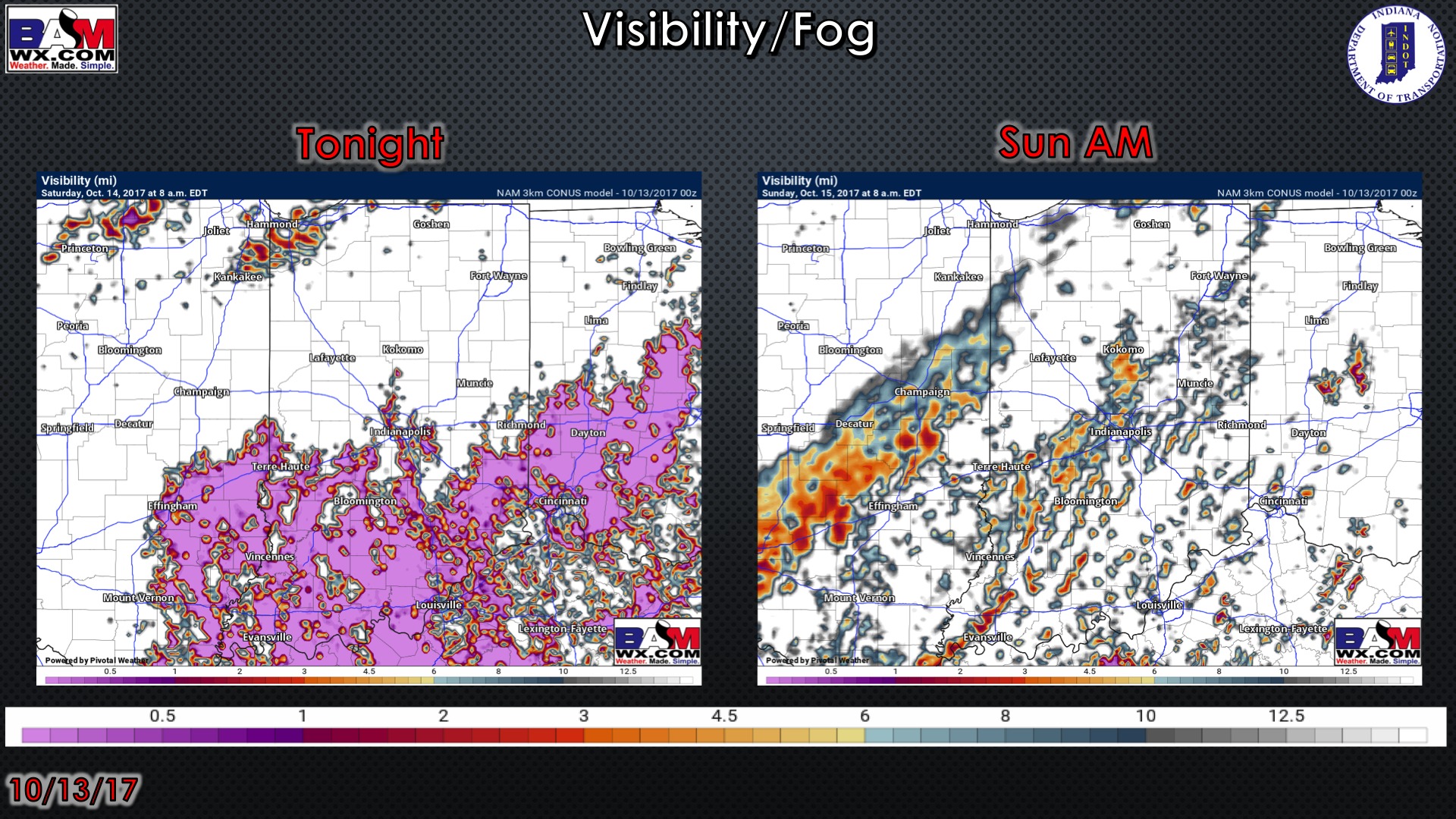
Visibility guidance over the next 2 mornings:
Weeks 1-2 temperature and precipitation from normal outlooks:
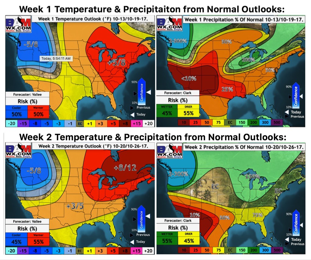
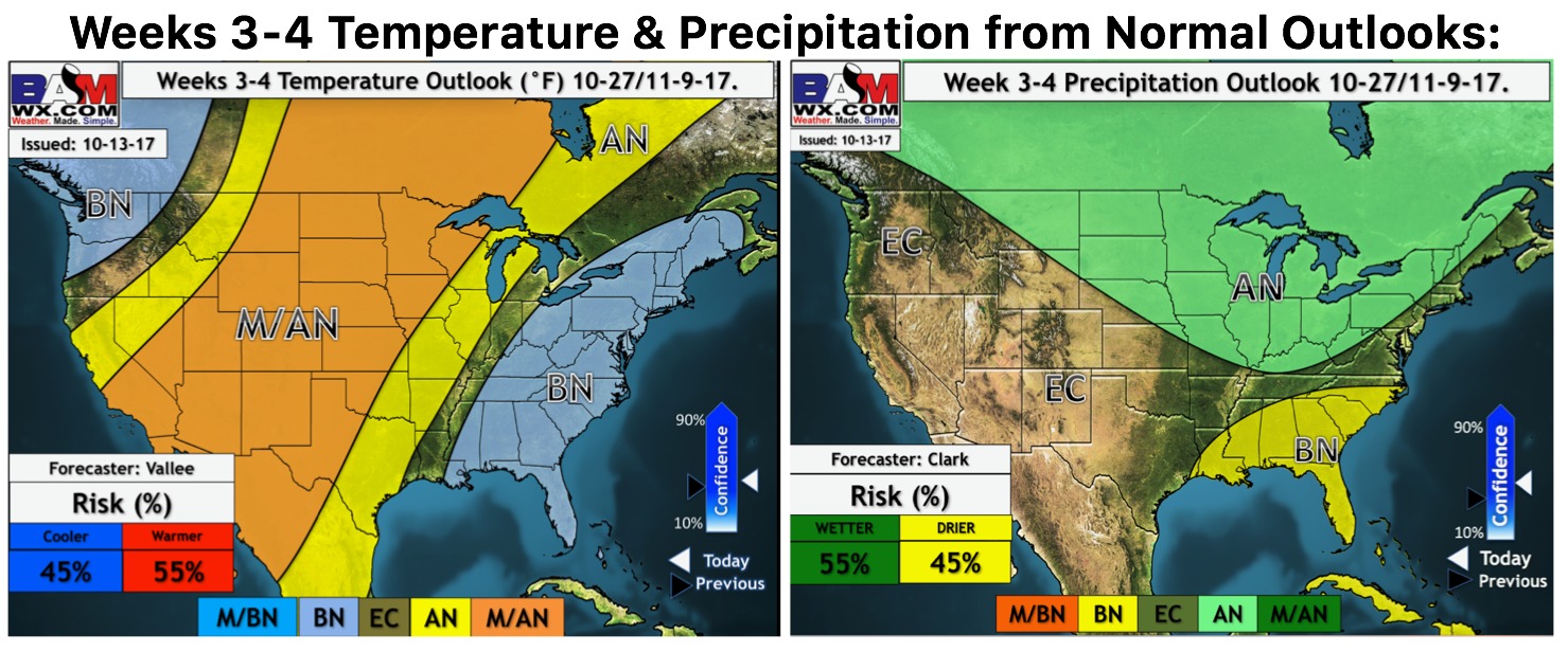
Weeks 3-4 temperature and precipitation from normal outlooks: