Synopsis: Good Thursday morning! Clouds will hang around through much of the day, along with some patchy drizzle possible. Sunshine should work into the forecast on Friday and most of Saturday along with warmer temperatures. A front moves through Sunday bringing scattered showers across the area, then we clear out with a very sunny forecast next week along with pleasant fall temperatures.
Today’s forecast video:
Today’s daily weather hazards quick sheet:
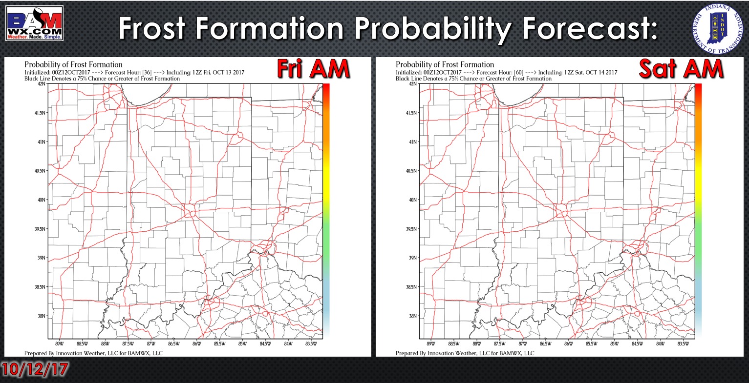
Exclusive BAMwx frost formation probability forecast over the next 2 days…no frost expected.
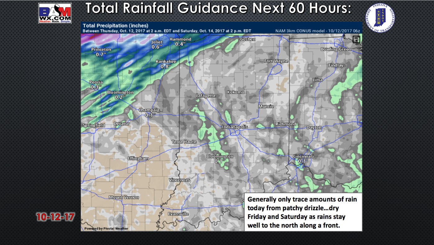
Here is a look at the forecast rainfall over the next 2 days. Areas of patchy drizzle will be possible today (especially this morning) then we look dry on Friday and Saturday.
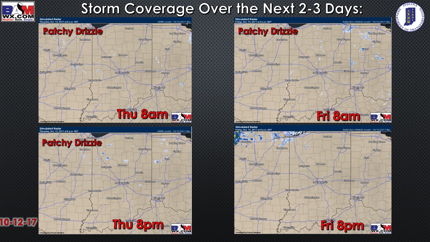
Forecast rainfall over the next 60 hours: Mainly trace amounts from patchy drizzle today, otherwise dry.
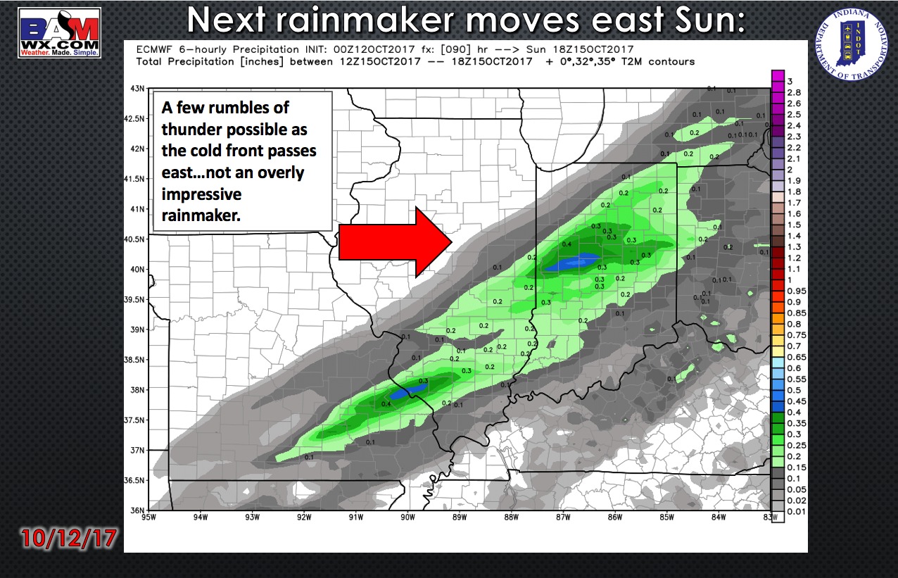
A frontal boundary will bring scattered showers to the area on Sunday. Timing has sped up from yesterday, with showers now expected to move through during the morning hours into mid-afternoon, then clearing from northwest to southeast. Rain totals will not be impressive with this, generally up to a quarter-inch possible.
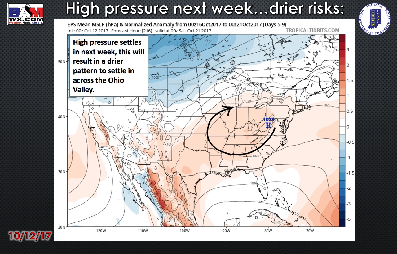
Once this front passes, the weather looks fantastic into much of next week with lots of sunshine and dry conditions.
High temperatures over the next 4 days:

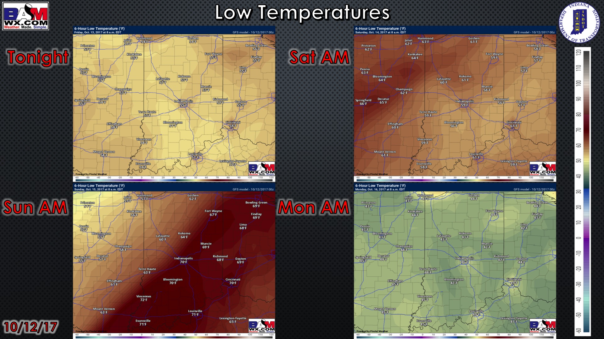
Low temperatures over the next 4 mornings:
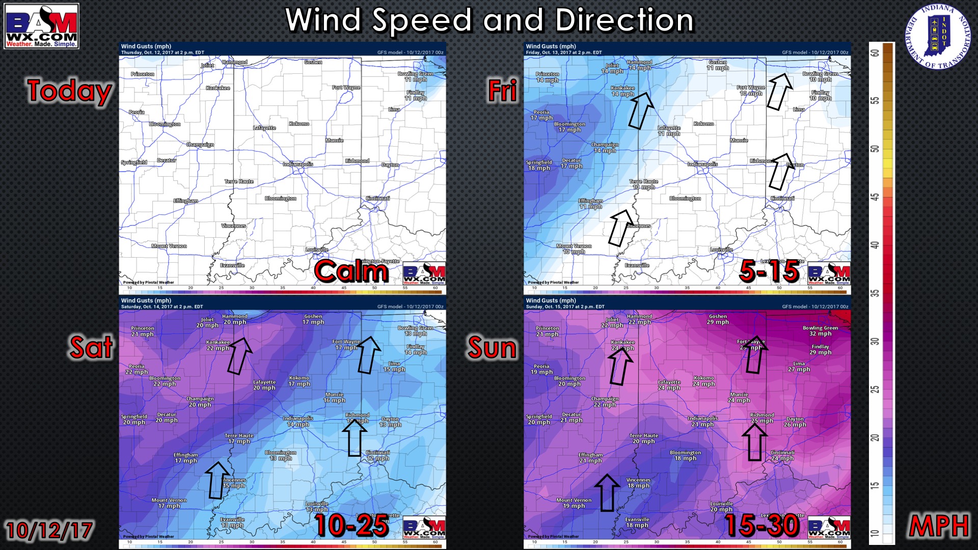
Wind forecast over the next 4 days:
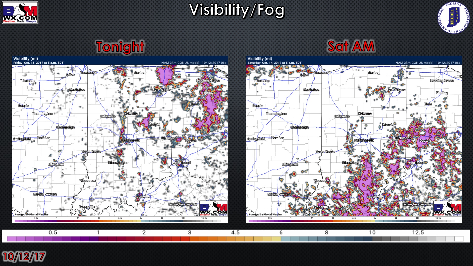
Visibility forecast over the next 2 mornings is shown below. Watch for some patchy fog, with areas of more dense fog likely Saturday morning thanks to clear skies and light winds.
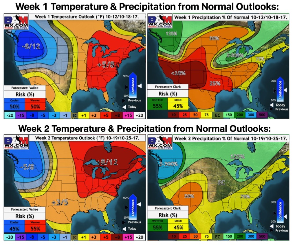
Latest weeks 1 and 2 temperature and precipitation outlooks: