Key Points – Thursday, October 12, 2017:
Synopsis: Good Thursday morning! The drizzly conditions persist today and look to continue through the first half of Friday…overall it’ll be a very damp a cool next 24-36 hours. Sunshine looks to break through early Friday afternoon and clear through Saturday…then we watch a cold front move from west to east later Saturday night into Sunday ushering in our next rainfall chance (although not looking overly impressive Sunday). The majority of next week will be dry as we feel the influence of high pressure settling in, looks to be a very nice week with pleasant temperatures. In today’s video we continue to eye a pattern change end of October as a trough (area of lower pressure) replaces the current ridge (area of higher pressure, why we are warmer than normal), allowing a colder trend to work in. If you have any questions please let us know, have a blessed week!
Today’s video (5:40 min):
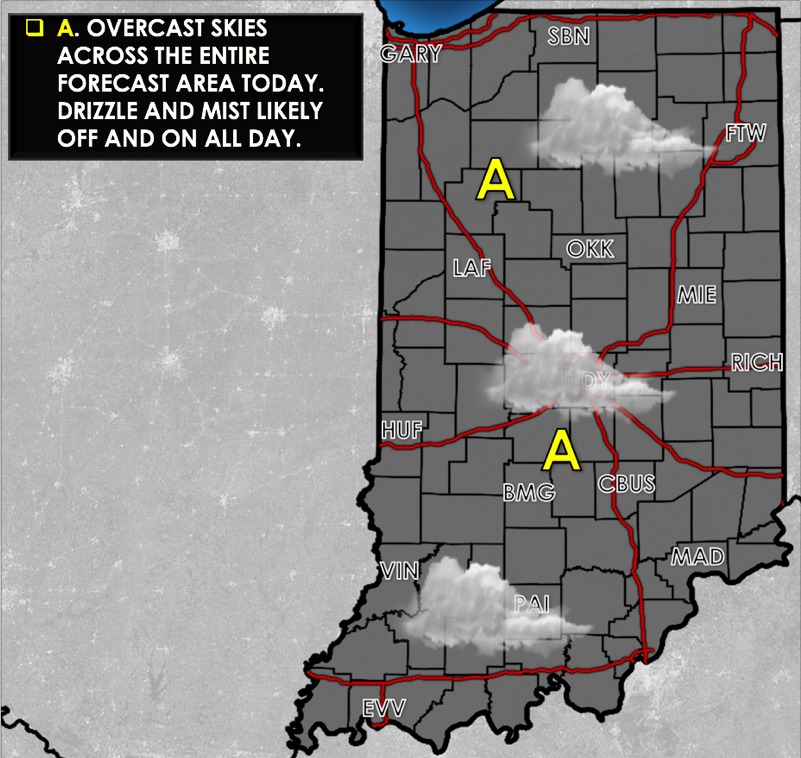
Today’s weather hazard quick sheet:
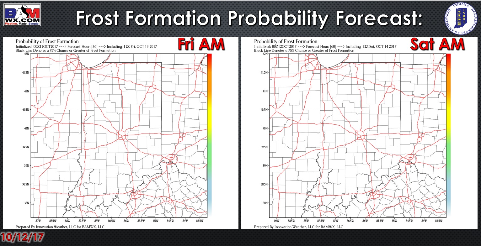
Exclusive BAMwx frost probability formation forecast over the next 2 mornings is below…no frost is expected:
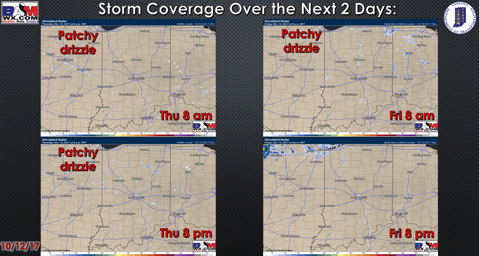
Storm coverage over the next 2 days:
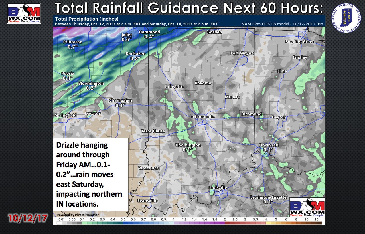
Total rainfall guidance over the next 60 hours:
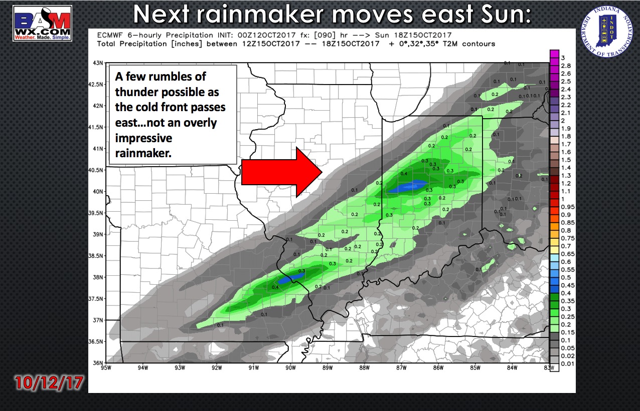
Next rainmaker moves east late Sunday evening into early Monday morning as a cold front sweeps across the Ohio Valley:
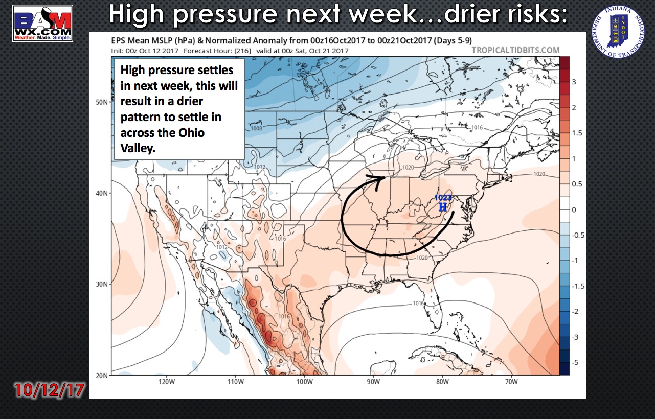
High pressure works in next week…allowing for a drier trend to settle in across the state:
High temperature guidance over the next 4 days:

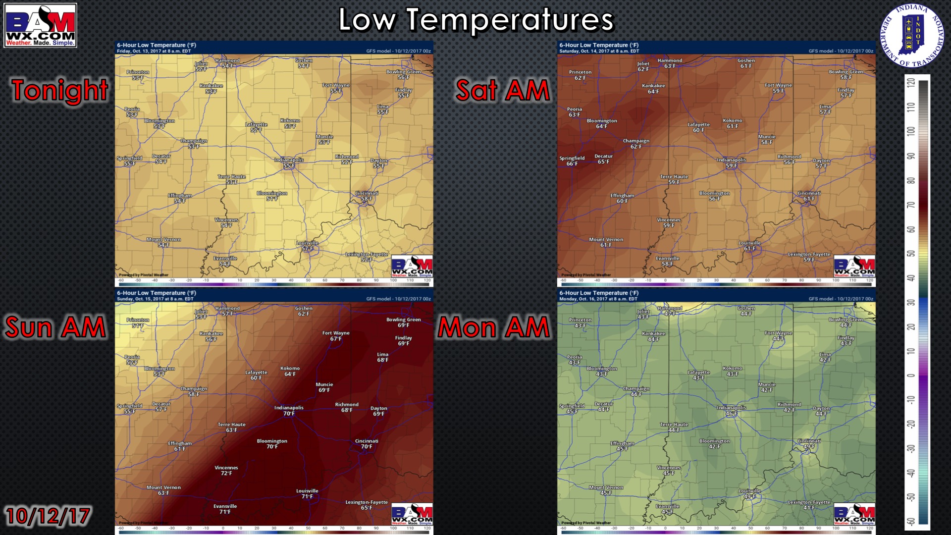
Overnight low temperature guidance over the next 4 mornings:
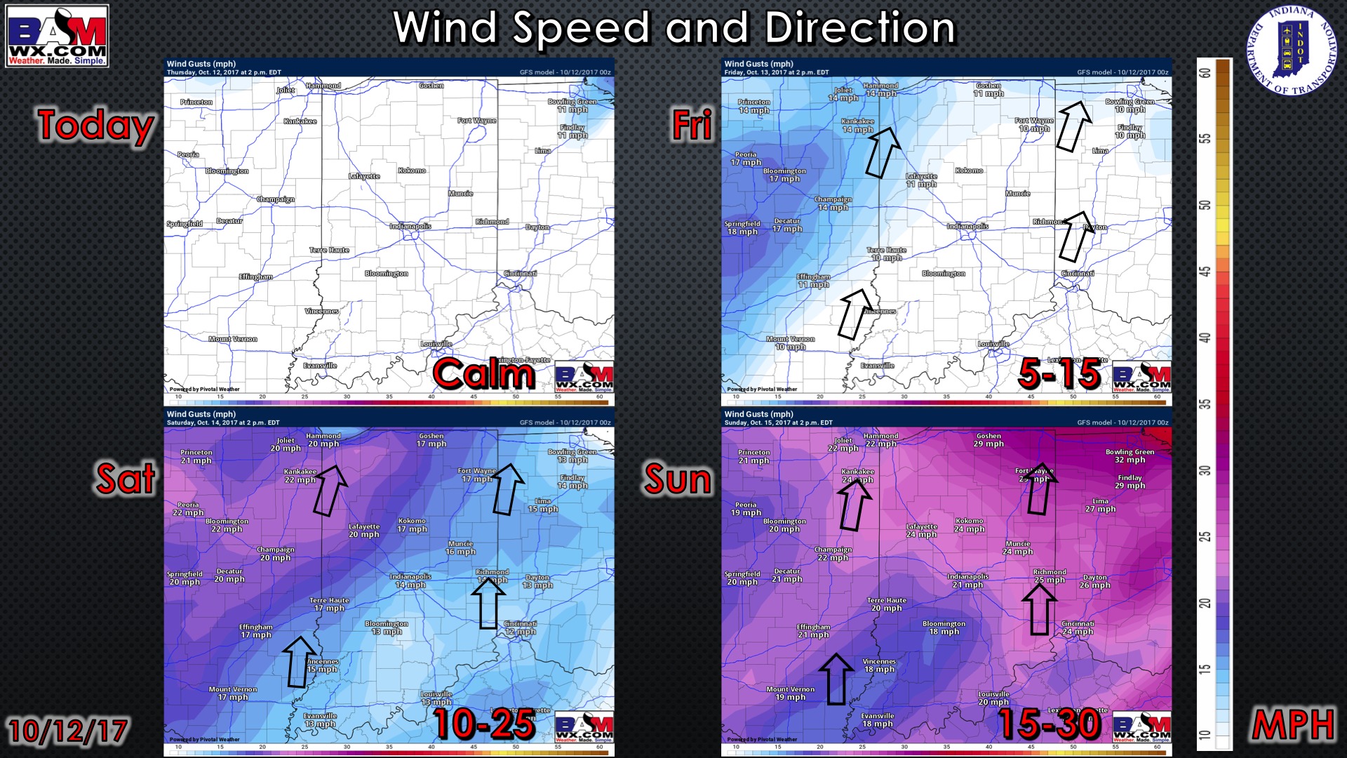
Wind gusts forecast guidance over the next 4 days:
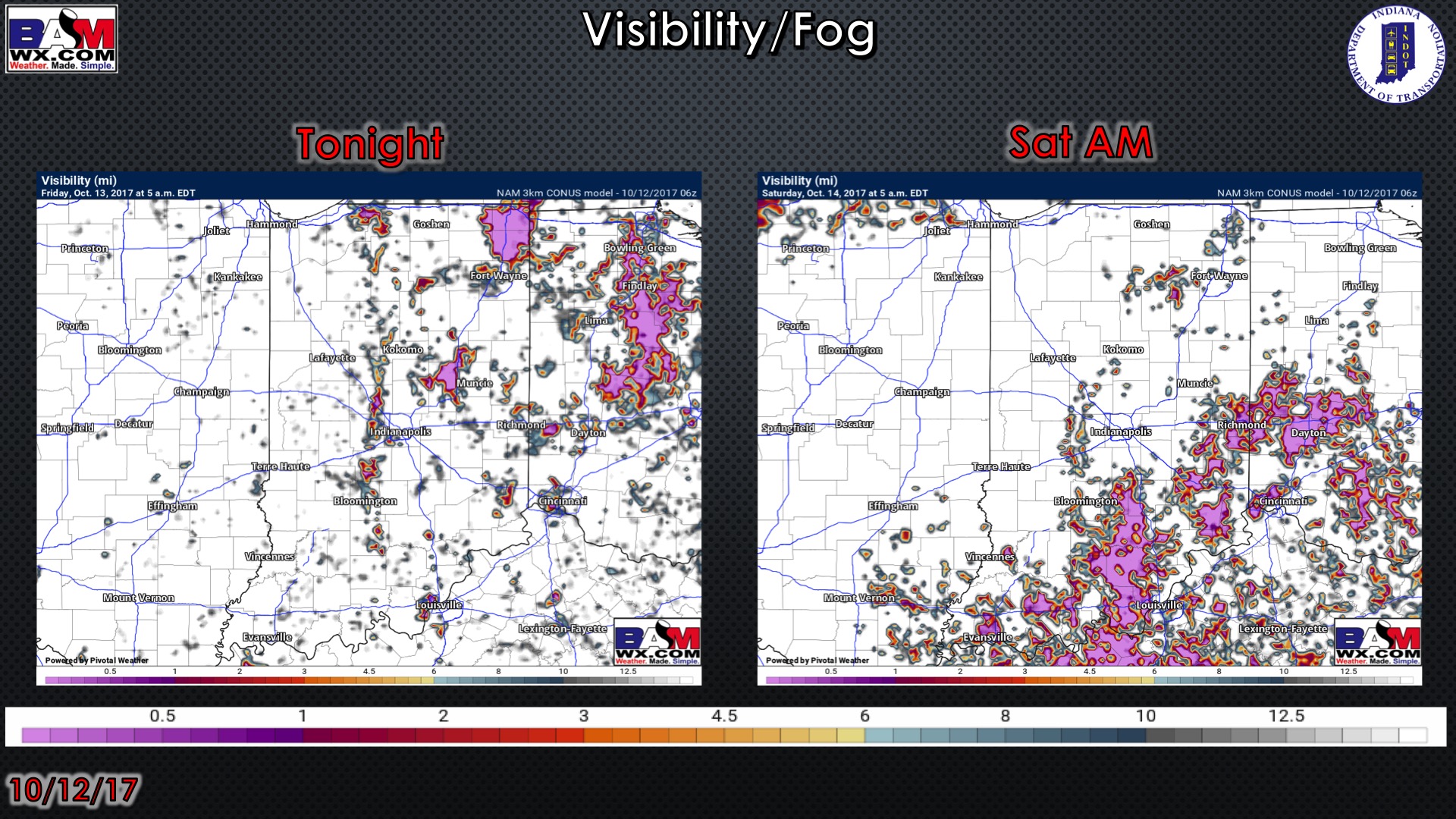
Visibility guidance over the next 2 mornings…patchy fog/drizzle possible, otherwise, cloudy skies will persist through first half of Friday:
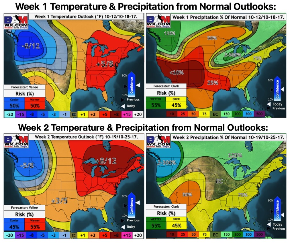
Weeks 1-2 temperature and precipitation from normal outlooks: