Synopsis: Good Wednesday morning! After some wet weather on Tuesday, showers are moving out of the forecast area. Cooler air is filtering into the region this morning from west to east. Expecting lingering clouds for much of the day along with much cooler temperatures. These clouds will hang around for most of Thursday too, but expecting sunshine to return by Friday and Saturday along with much warmer temperatures. A front will move in on Sunday bringing a chance for some passing showers and storms followed by a return of sunshine and cooler weather early next week.
Today’s forecast video:
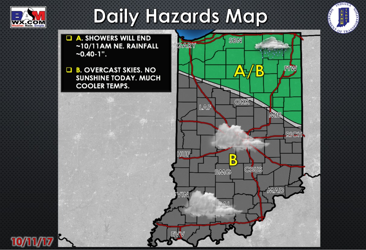
Today’s weather hazards quick sheet:
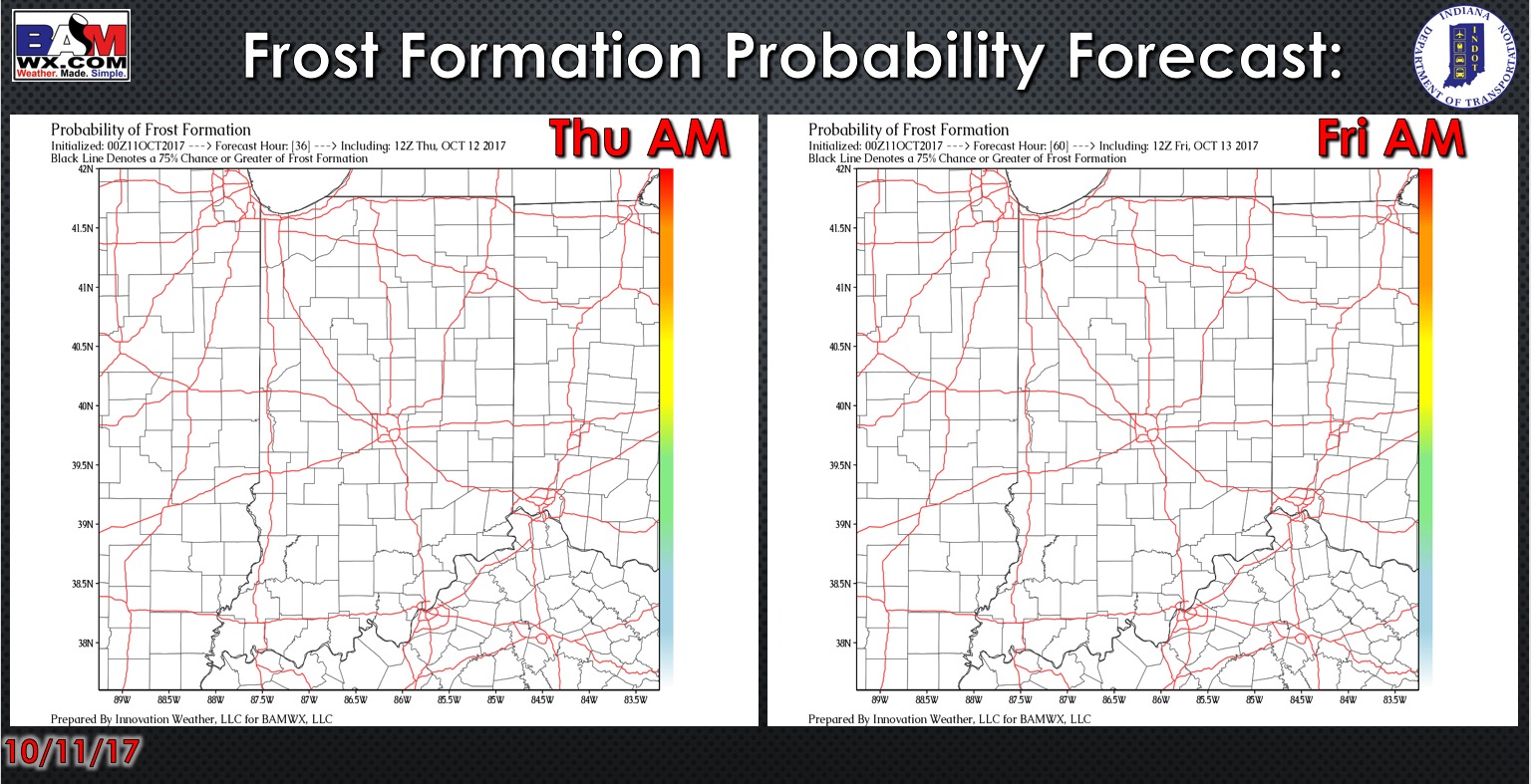
Exclusive BAMwx frost formation probability forecast over the next 2 mornings is shown below. No concerns for any frost.
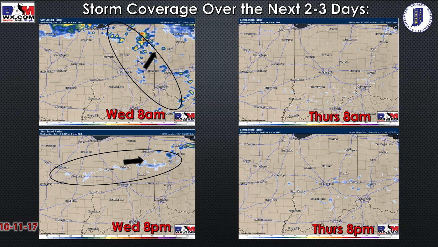
Rain coverage forecast over the next 2 days is shown below. Overall we are drying out through the day but remaining cloudy across the forecast area – could see a few sprinkles or patchy drizzle. Tomorrow looks like a dry and mainly cloudy day.
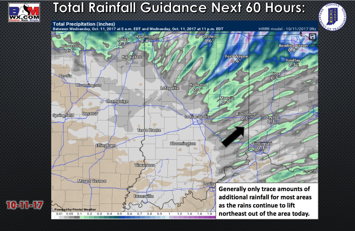
Only expecting trace amounts of additional rain for most areas today.
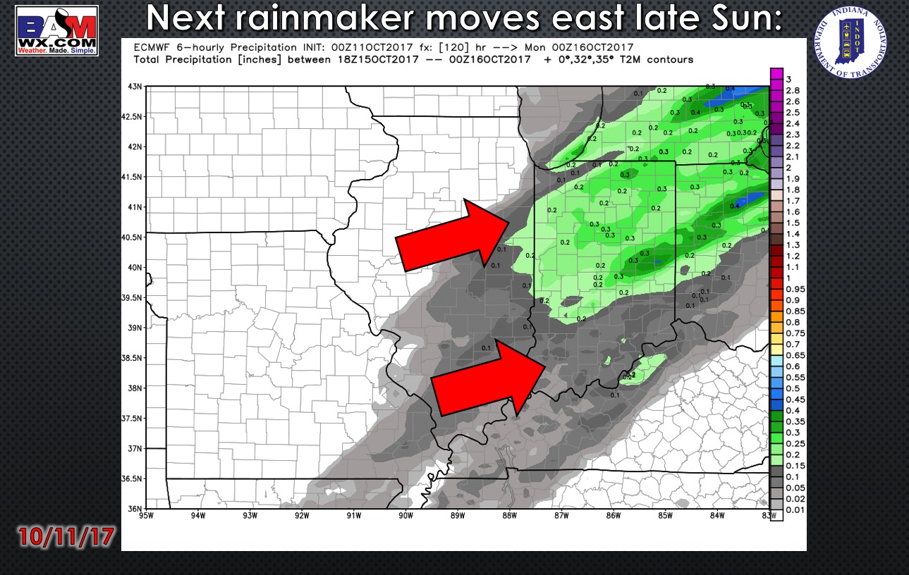
Latest model guidance brings in scattered showers and storms Sunday afternoon. Right now rain totals do not look very impressive as the front will be moving through rather quickly, and the best forcing remains to our north.
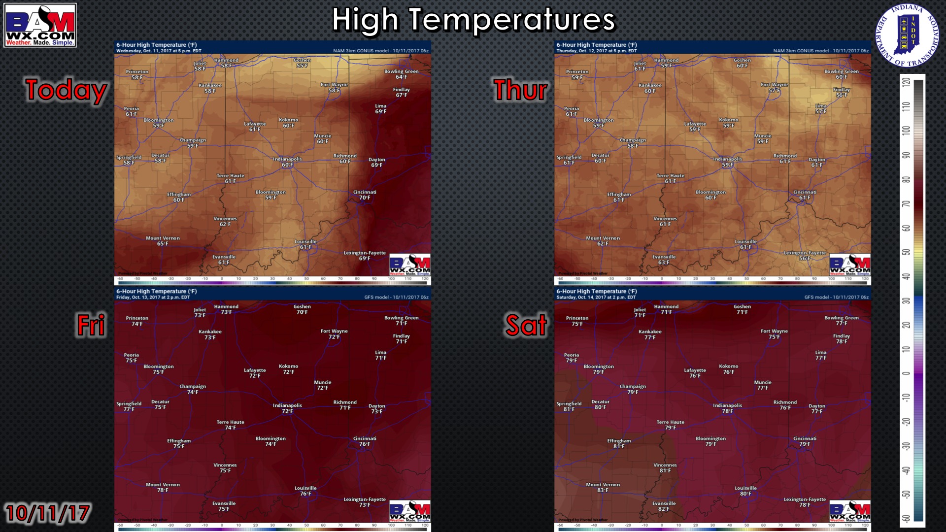
High temperatures over the next 4 days..cool with the lingering clouds next 2 days, then turning much warmer Friday and Saturday with some sunshine.
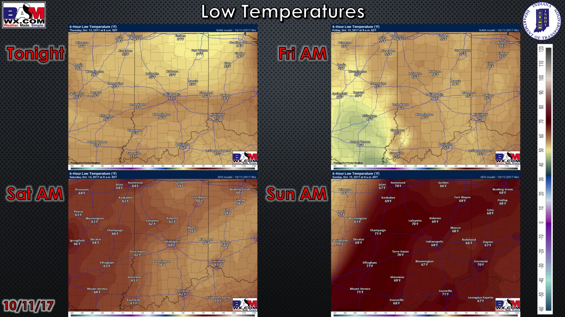
Low temperatures over the next 4 days:
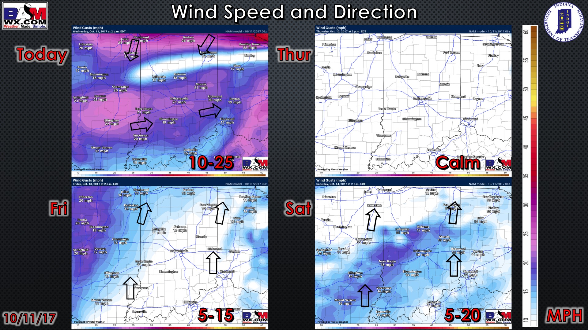
Wind forecast over the next 4 days:
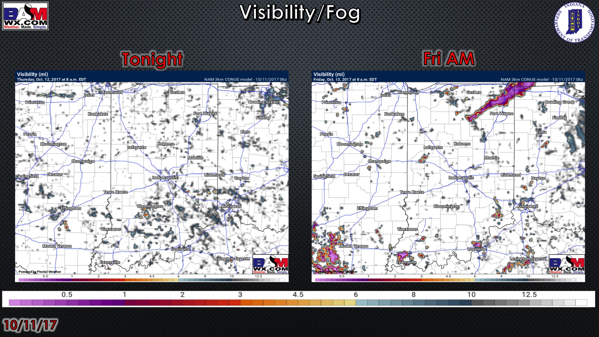
Visibility forecast over the next 2 mornings is shown below. Patchy fog will be possible Thursday and Friday mornings…possibly locally dense on Friday morning.
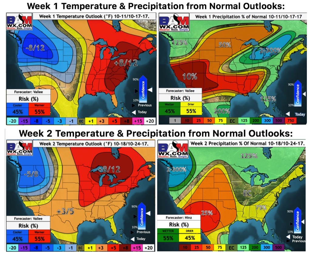
Latest weeks 1 and 2 outlooks: