Key Points – Wednesday, October 11, 2017:
Synopsis: Good Wednesday morning! Showers continue to slowly work north and to the east as the low pressure system pushes off to the east throughout the day today…cloud-cover lingering for most locations, however. Mostly cloudy skies linger through Thursday into the first half of the day on Friday, however, expecting the clouds to finally break Friday afternoon into the evening giving way to a pleasant first half of the weekend. Next shot of rainfall on-tap Sunday night into Monday as a cold front will work from west to east. A drier trend looks to work in across the Ohio Valley as we work deeper into next week, we stay overall mild as well. If you have any questions please let us know, have a blessed day! -Kirk
Today’s video (5:30min):
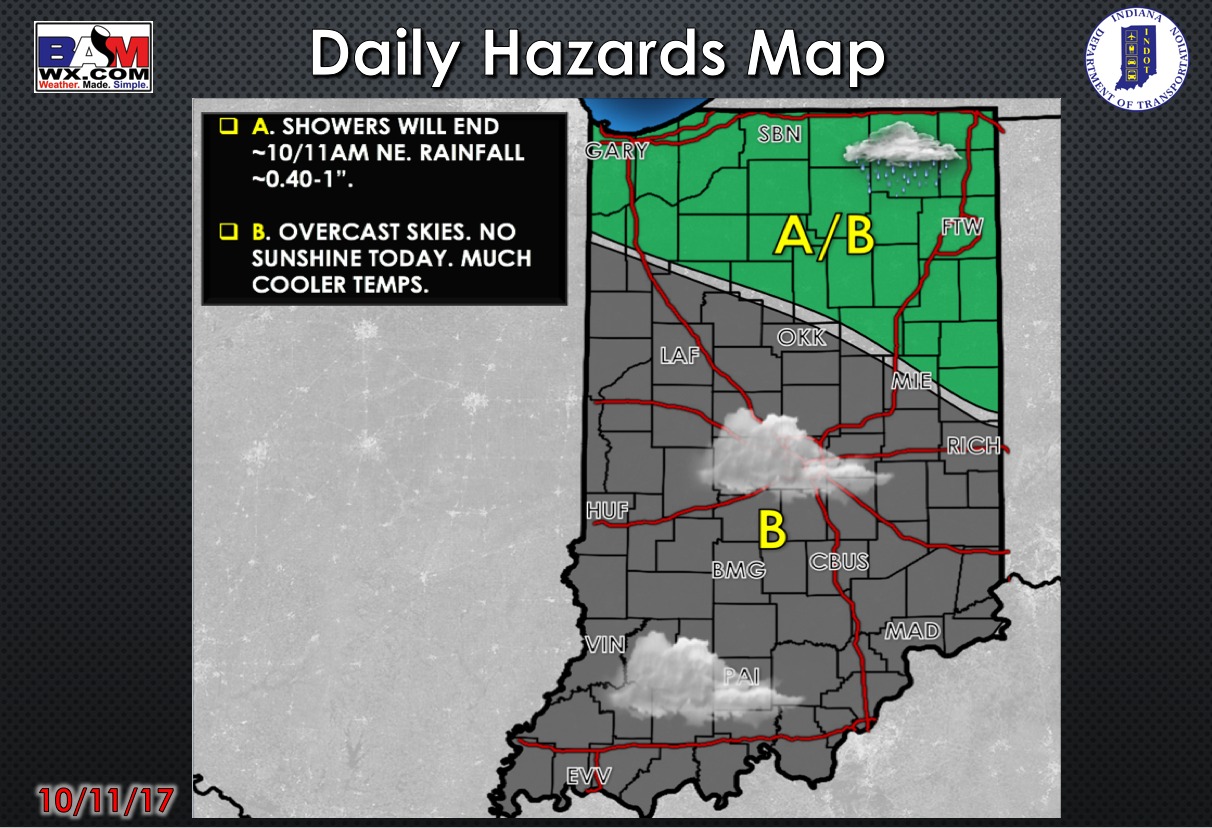
Today’s weather hazard quick sheet:
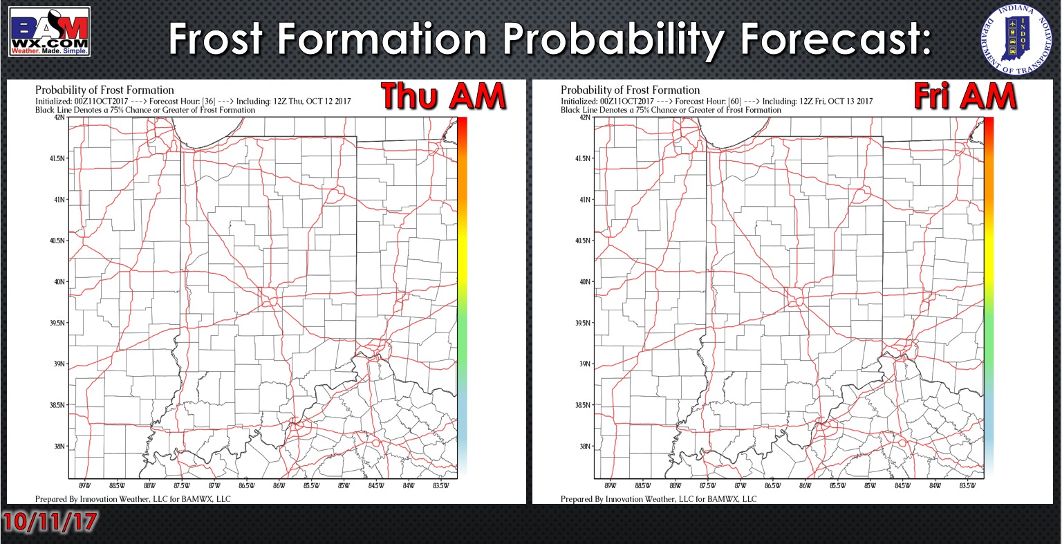
Exclusive BAMwx frost probability formation forecast over the next 2 mornings is below…no frost is expected:
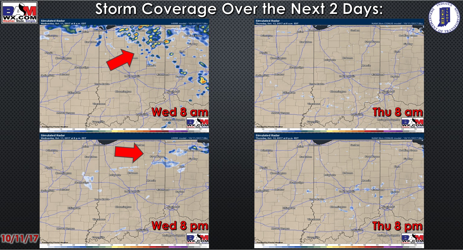
Storm coverage over the next 2 days:
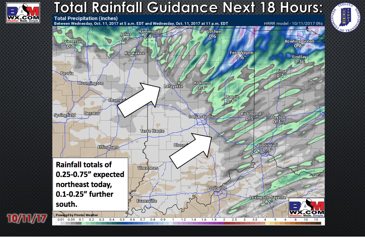
Total rainfall guidance over the next 18 hours:
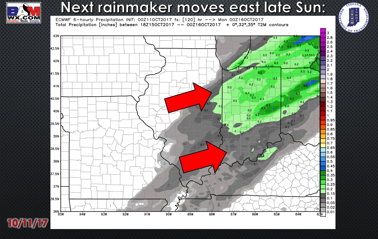
Next rainmaker moves east late Sunday evening into early Monday morning as a cold front sweeps across the Ohio Valley:
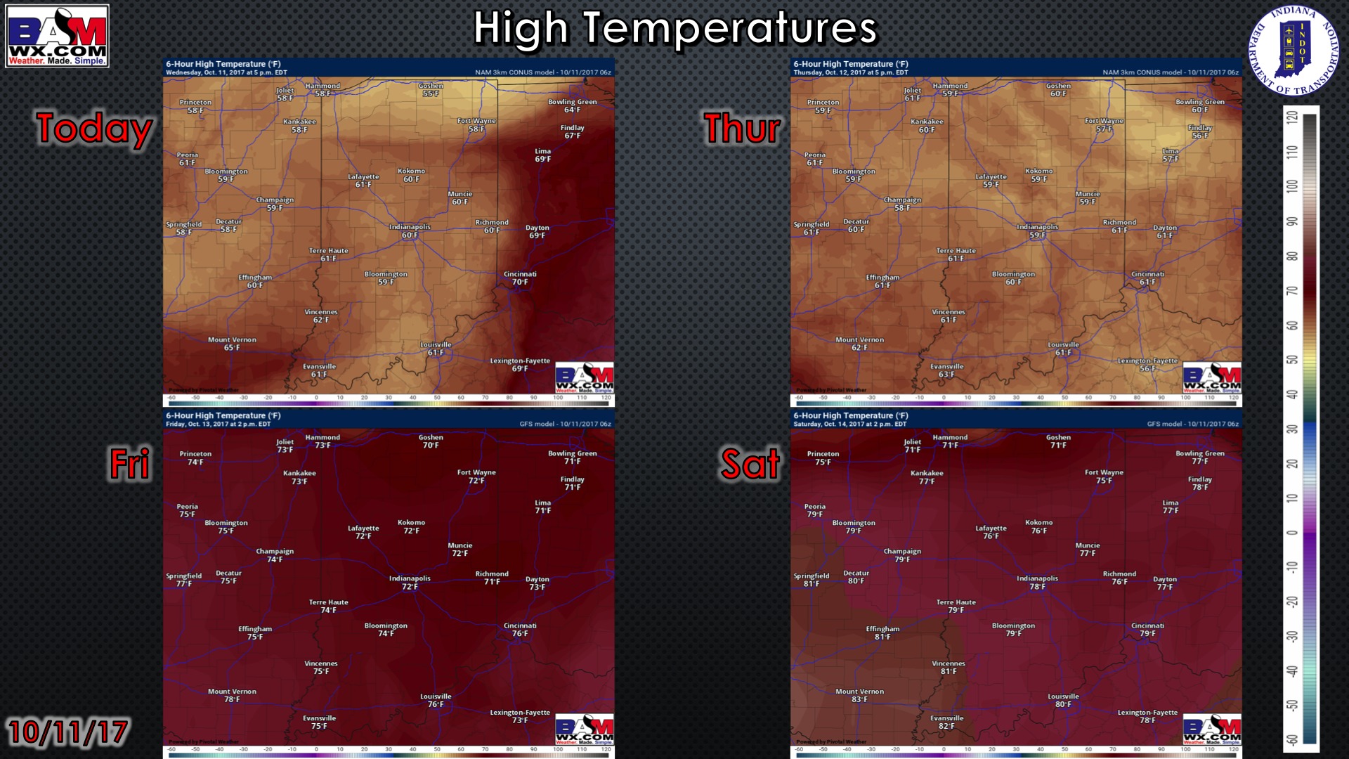
High temperature guidance over the next 4 days:
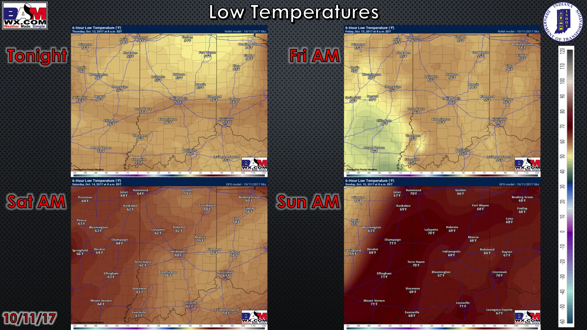
Overnight low temperature guidance over the next 4 mornings:
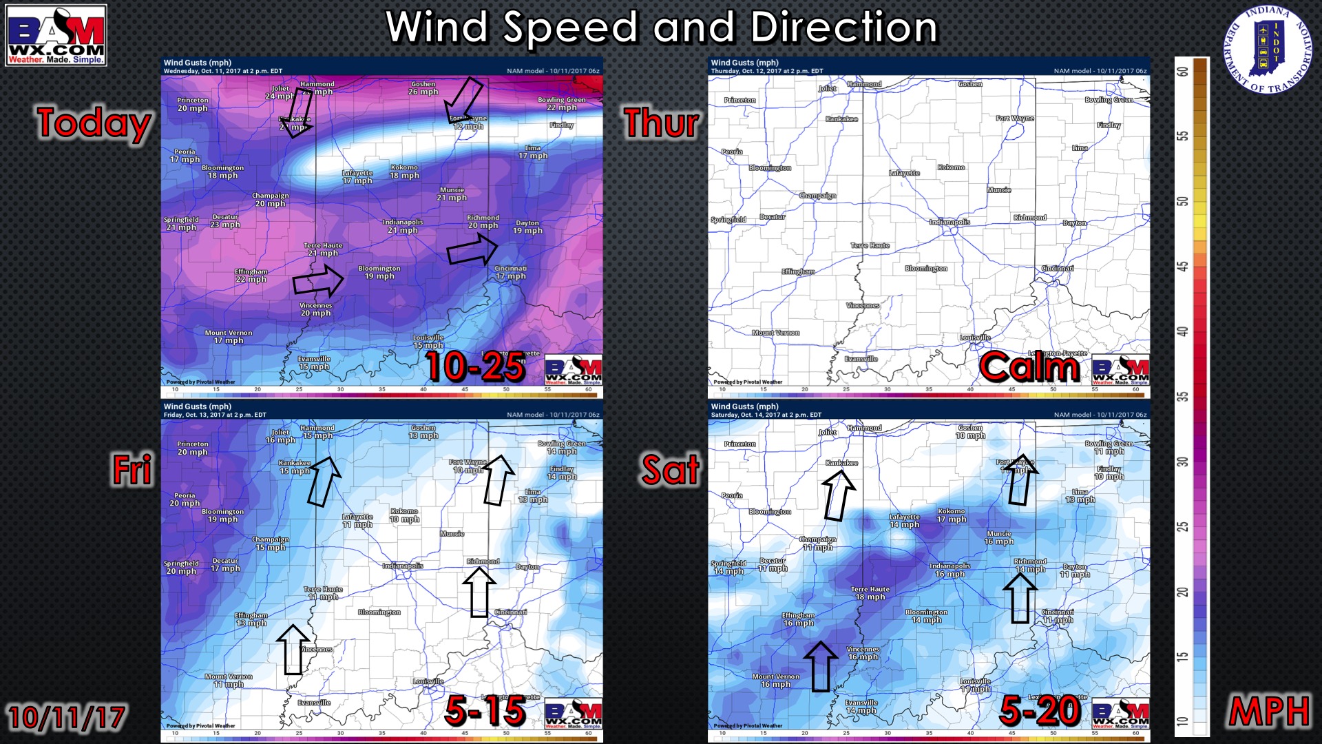
Wind gusts forecast guidance over the next 4 days:
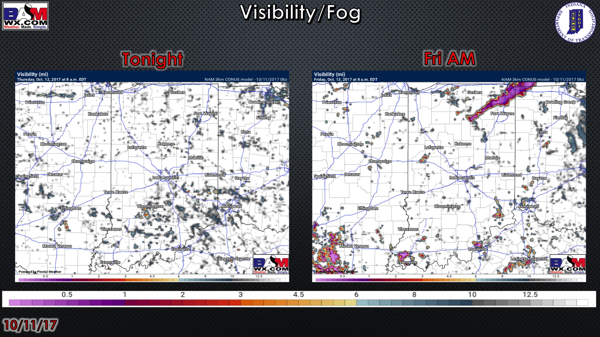
Visibility guidance over the next 2 mornings…very patchy fog possible in low-lying areas, otherwise, cloudy skies will persist:
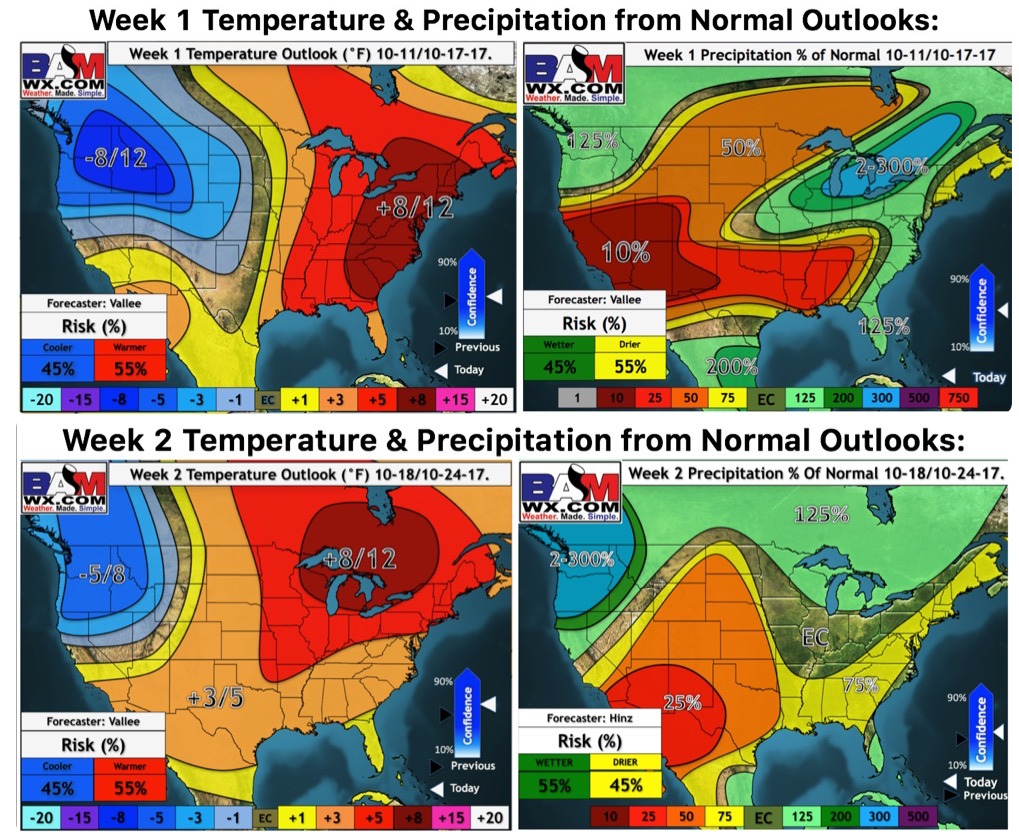
Weeks 1-2 temperature and precipitation from normal outlooks: