Synopsis: Good Tuesday morning. We are seeing areas of dense fog this morning as well as an area of heavy rain lifting northeast impacting western/northwest sections of the region this morning. Additional scattered showers and storms expected this morning, then another round moves across the forecast area tonight. Drier and cooler conditions settle into the area on Wednesday, with lingering clouds. It’s a dry forecast as we go into late week into much of the weekend with another surge in temperatures on the way. Our next front poised to move through Sunday night bringing our next rain chance.
Today’s forecast video (5:25):
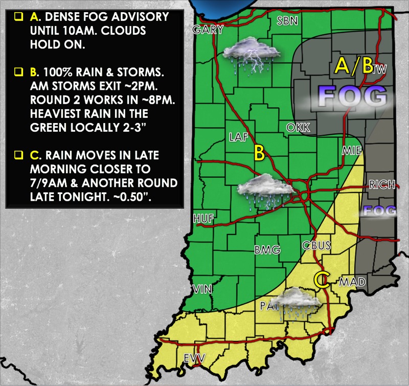
Today’s weather hazards quick sheet:
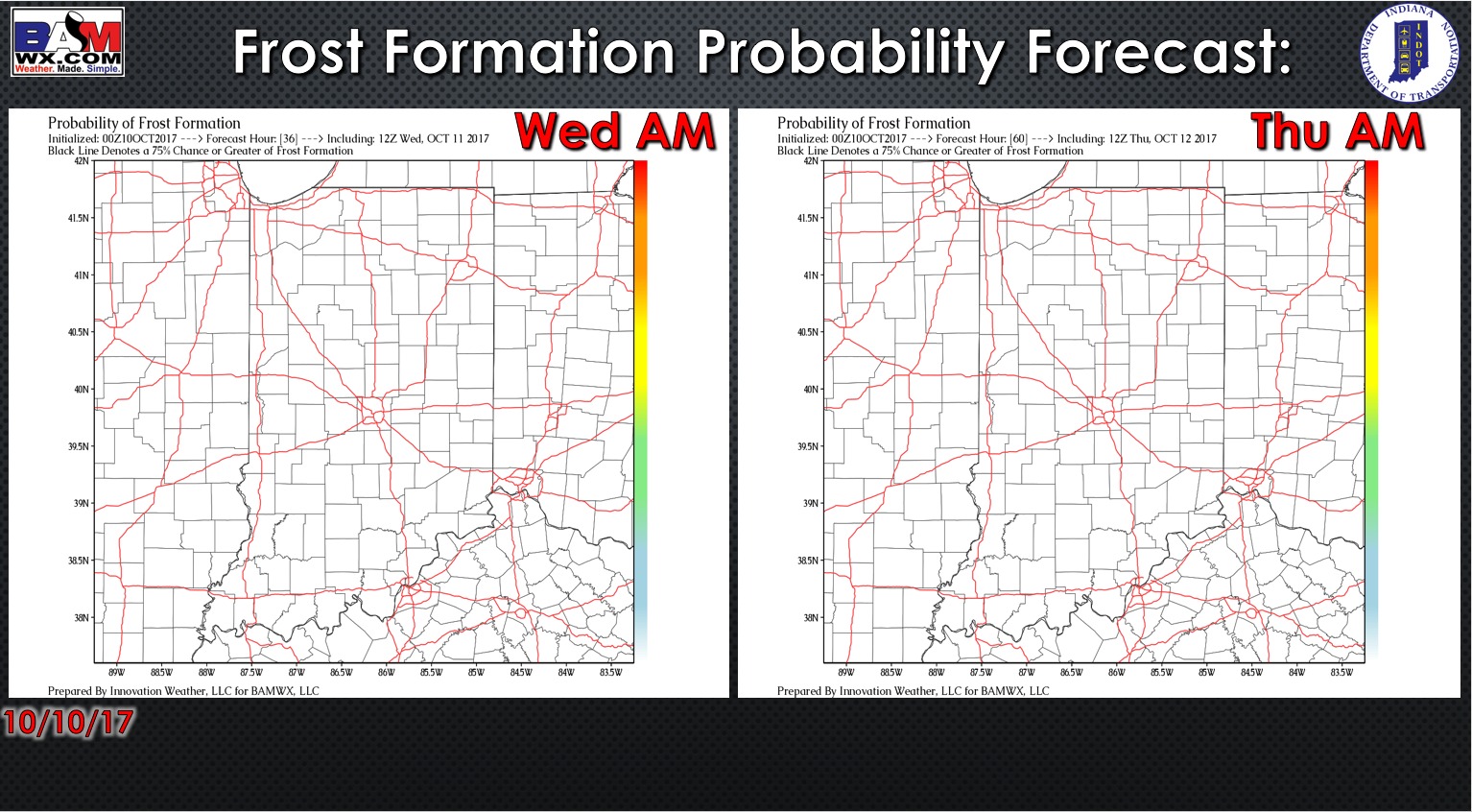
Exclusive BAMwx frost formation probability forecast over the next 2 mornings is shown below. Certainly no frost concerns.
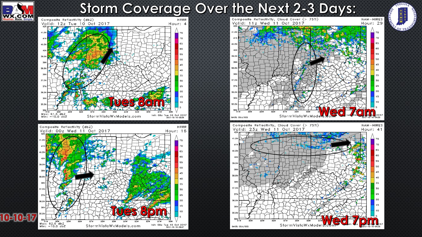
Storm coverage forecast for today and Wednesday is shown below. A round of heavy rainfall is affecting northwest portions of the region this morning, and this area will continue to deal with these showers into early afternoon. Areas further southeast will have the threat for some scattered showers late this morning, then most of the region sees some dry periods this afternoon. More widespread rainfall and storm chances work in tonight beyond 8pm. Showers lift out of here late tonight, but expect lingering clouds much of Wednesday along with much cooler temperatures. Can’t rule out a few additional spotty showers.
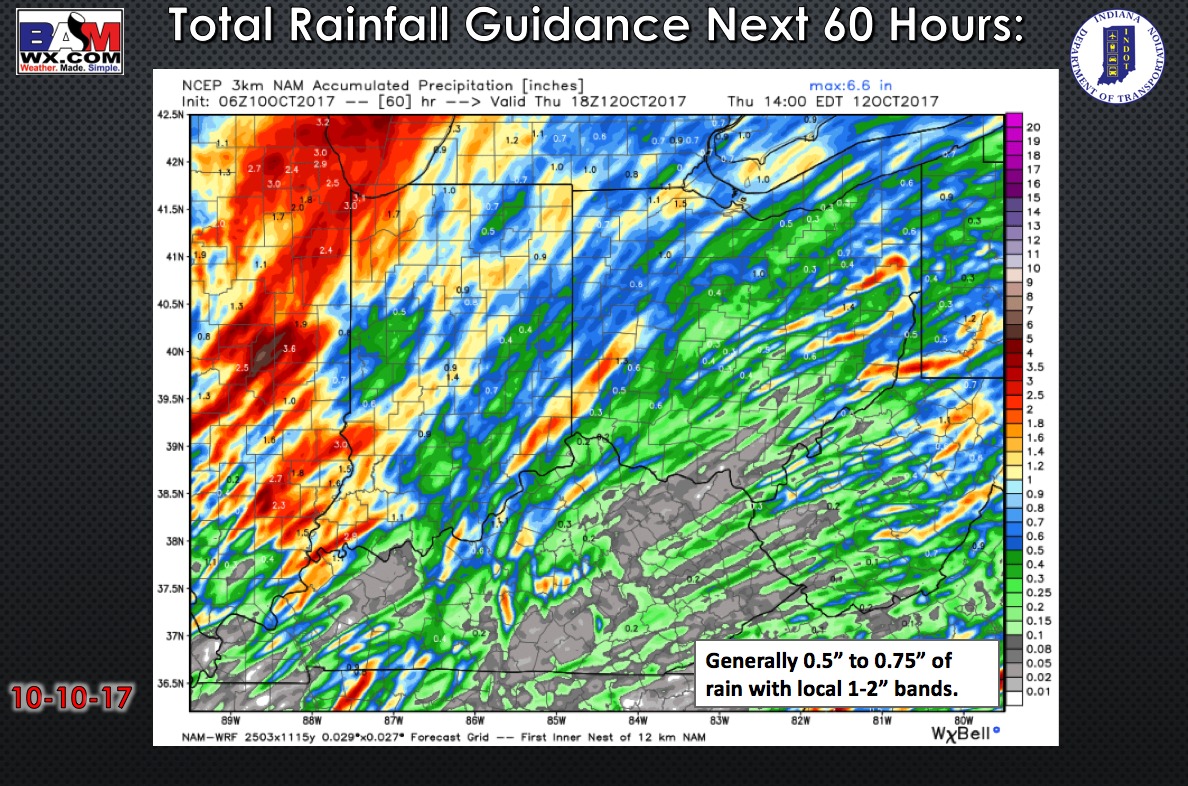
Here is a look at rainfall accumulation guidance. Localized areas pick up 1-2″ of rain (especially northwest portions of the forecast area), with a general 0.5″ to 0.75″.
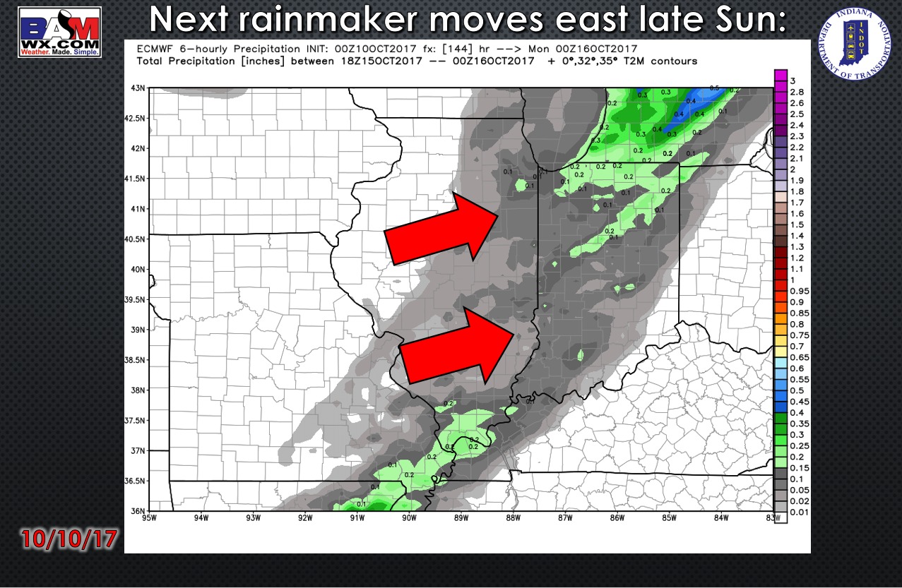
Our next rainfall chance arrives late Sunday as a cold front moves through the forecast area.
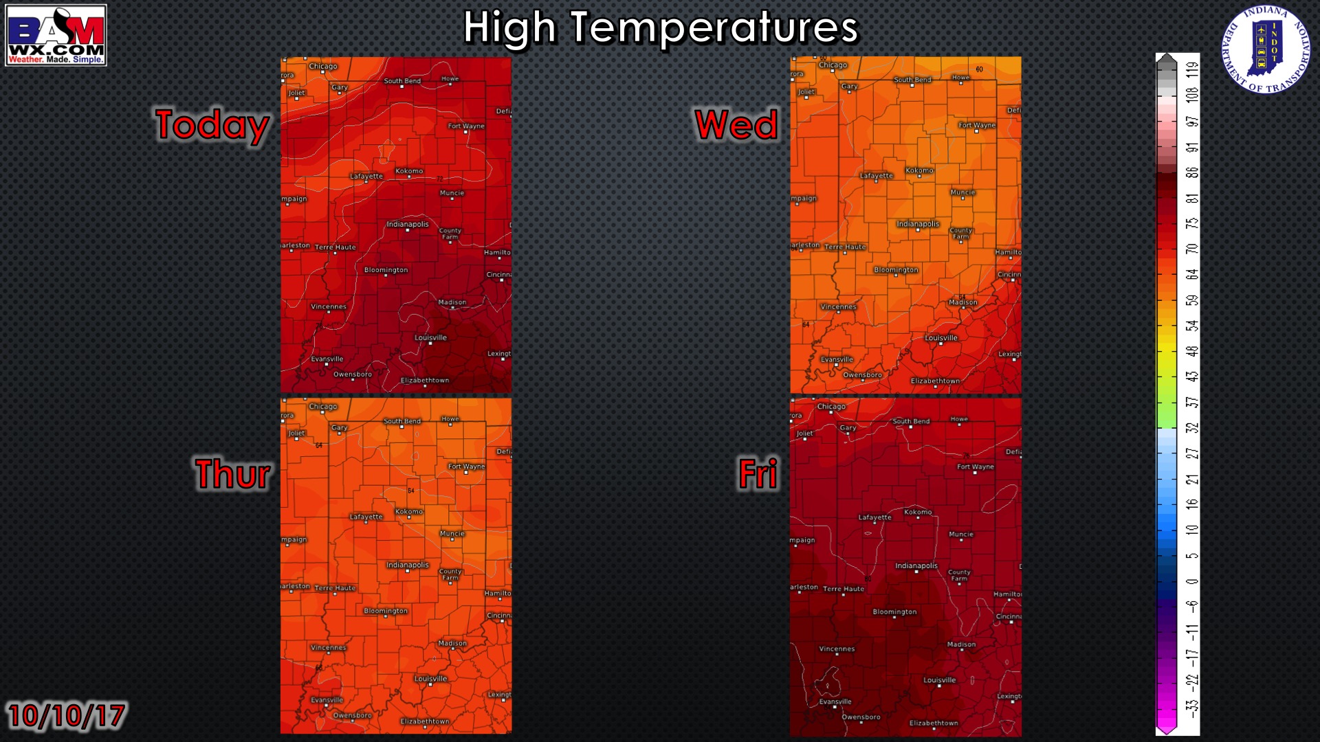
High temperature forecast over the next 4 days…cooler air arrives Wednesday and Thursday before we warm again by Friday.
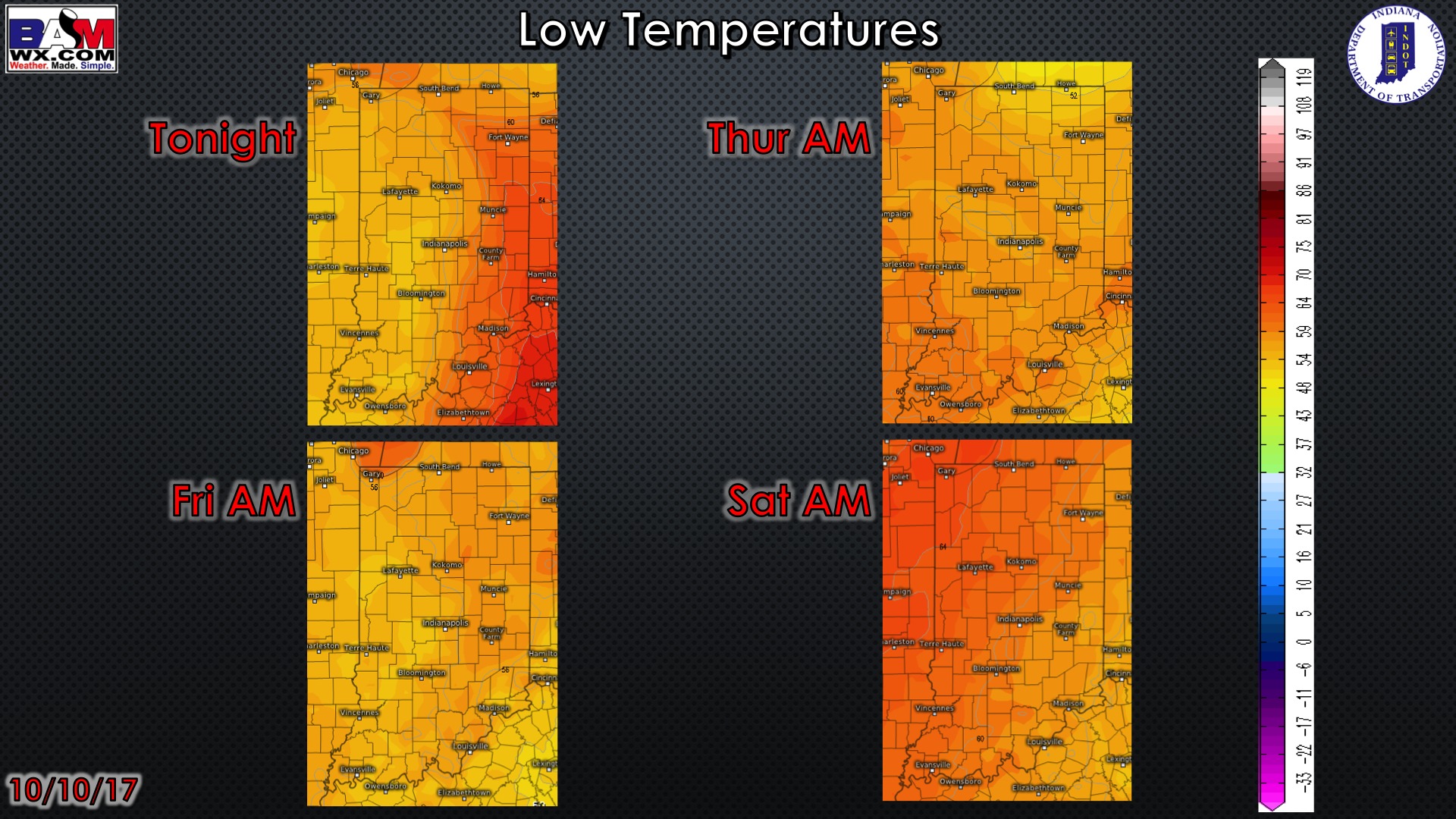
Low temperature guidance over the next 4 mornings:
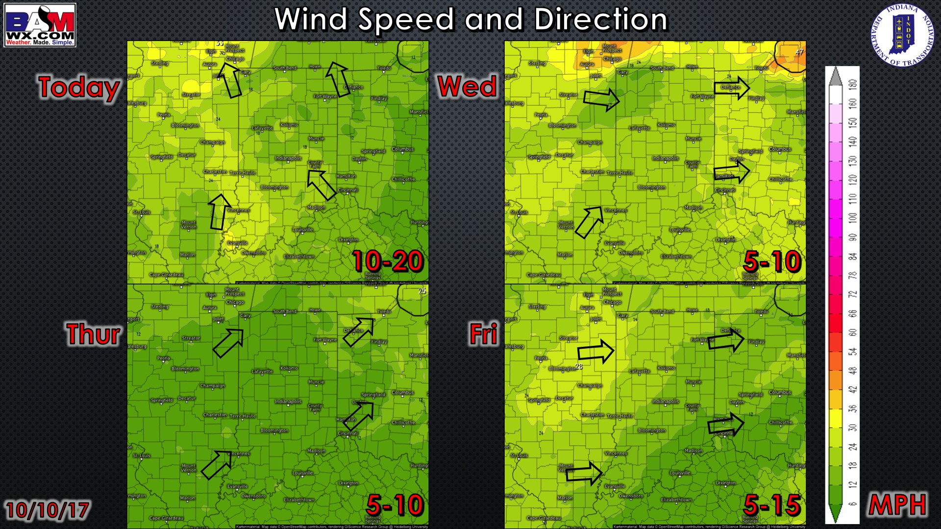
Wind forecast over the next 4 days:
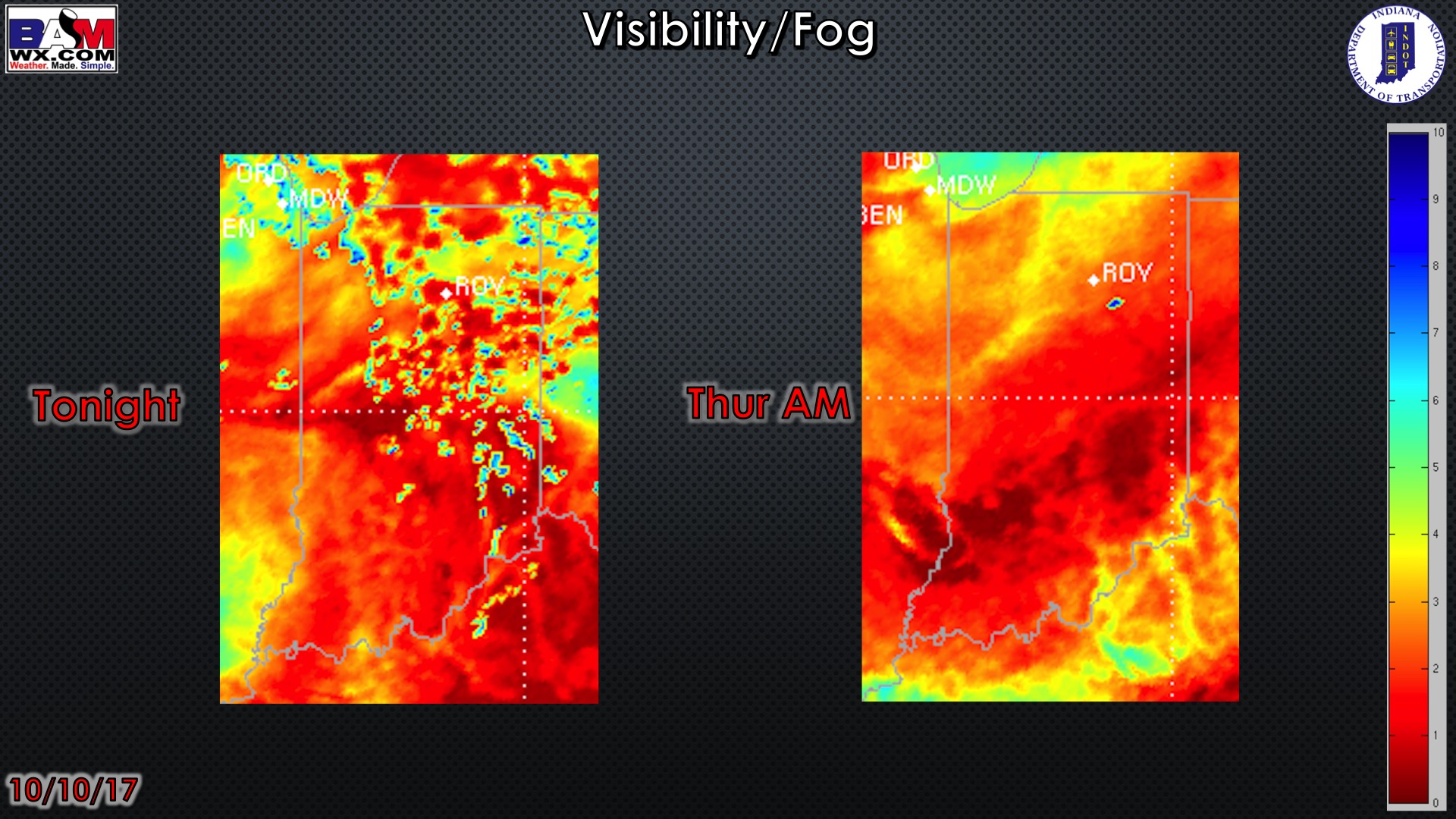
Here is the visibility/fog forecast over the next couple of nights. Not much of fog concern tonight with a storm system lifting through the region. Patchy fog will be possible Thursday morning. We may see better conditions for fog on Friday morning.
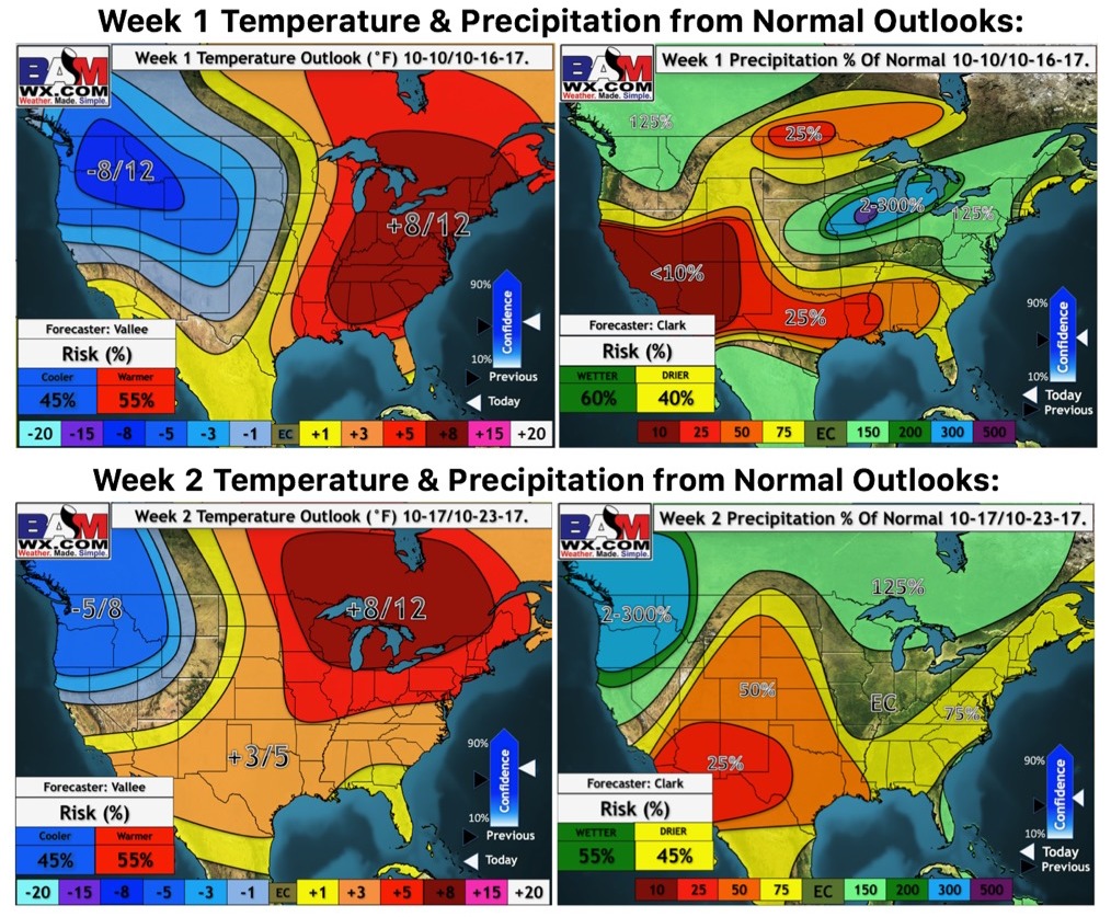
Updated weeks 1 and 2 temperature and precipitation outlooks: