Key Points – Tuesday, October 10, 2017:
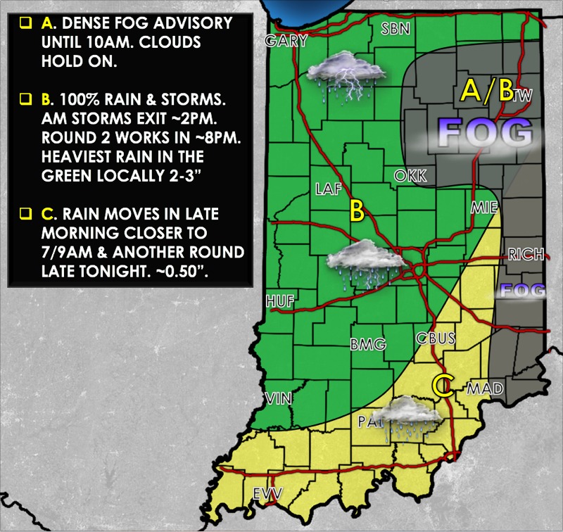
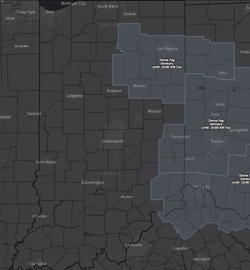
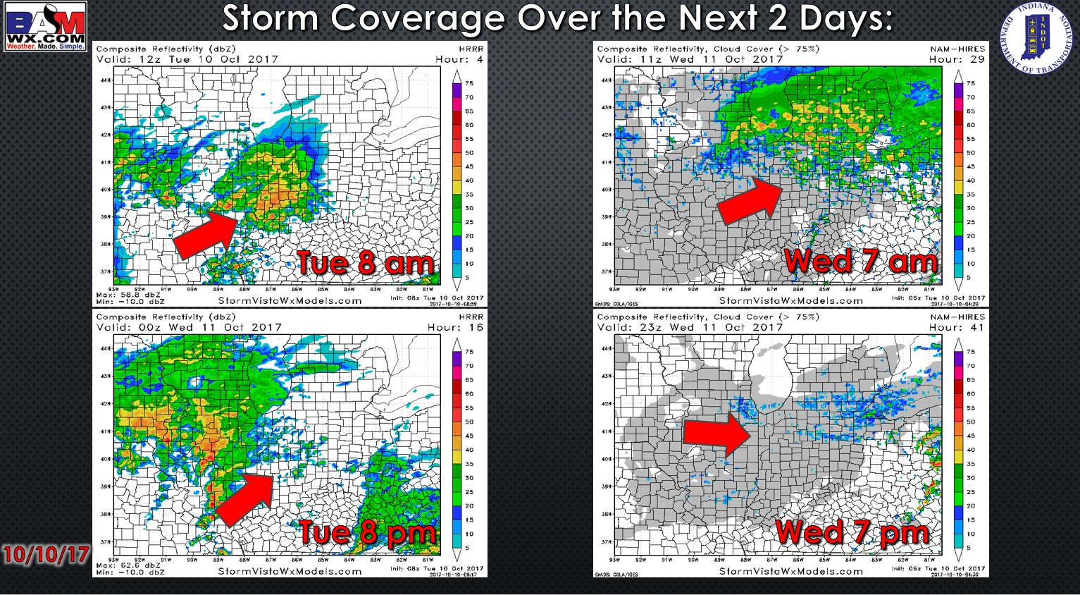
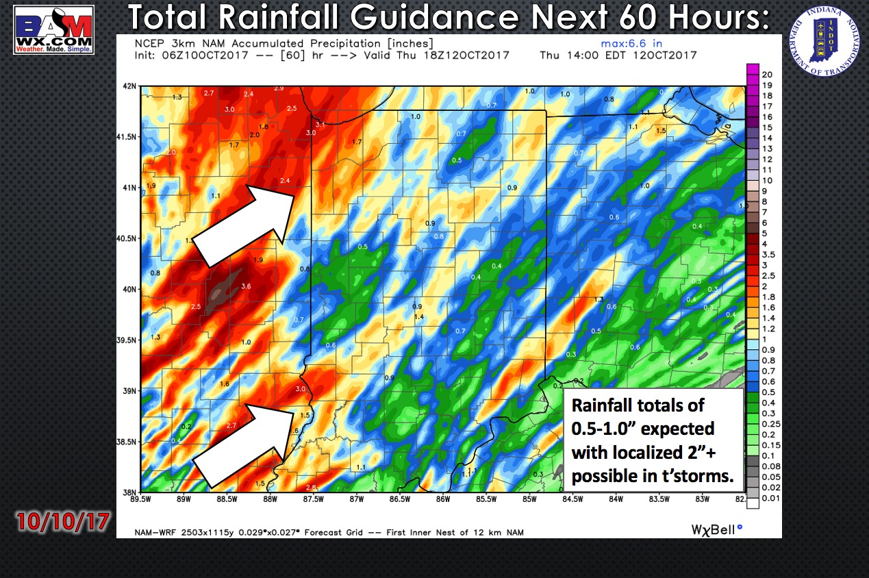
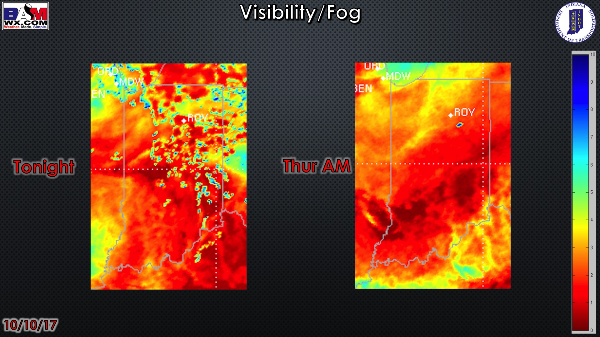
Synopsis: Good Tuesday morning! Waking up today with some visibility issues especially for locations across eastern Indiana, dense fog advisories hoisted until 10amEDT as well currently. Heavy rainfall continues to work in from southwest to northeast this morning…as we head into late morning into this evening from I-70 north, showers are anticipated to weaken and become more isolated; we do note that by ~7pmEDT an additional round of showers and storms work in from west to east as the low pressure system ushers in. Generally 0.5-1″ will be possible with localized 2-3″ possible through Wednesday. In the video we discuss patchy dense fog possible Thursday and Friday morning’s, which is very common this time of year under high pressure conditions (the better day looks like Friday at this time for fog). Our next weather maker will come in late Sunday night into Monday as a cold front passes from west to east…a potent shot of cooler air follow behind it. If you have any questions please let us know, have a blessed day! -Kirk
Today’s video (5 min):
Today’s weather hazard quicksheet:
Dense fog advisories this morning:
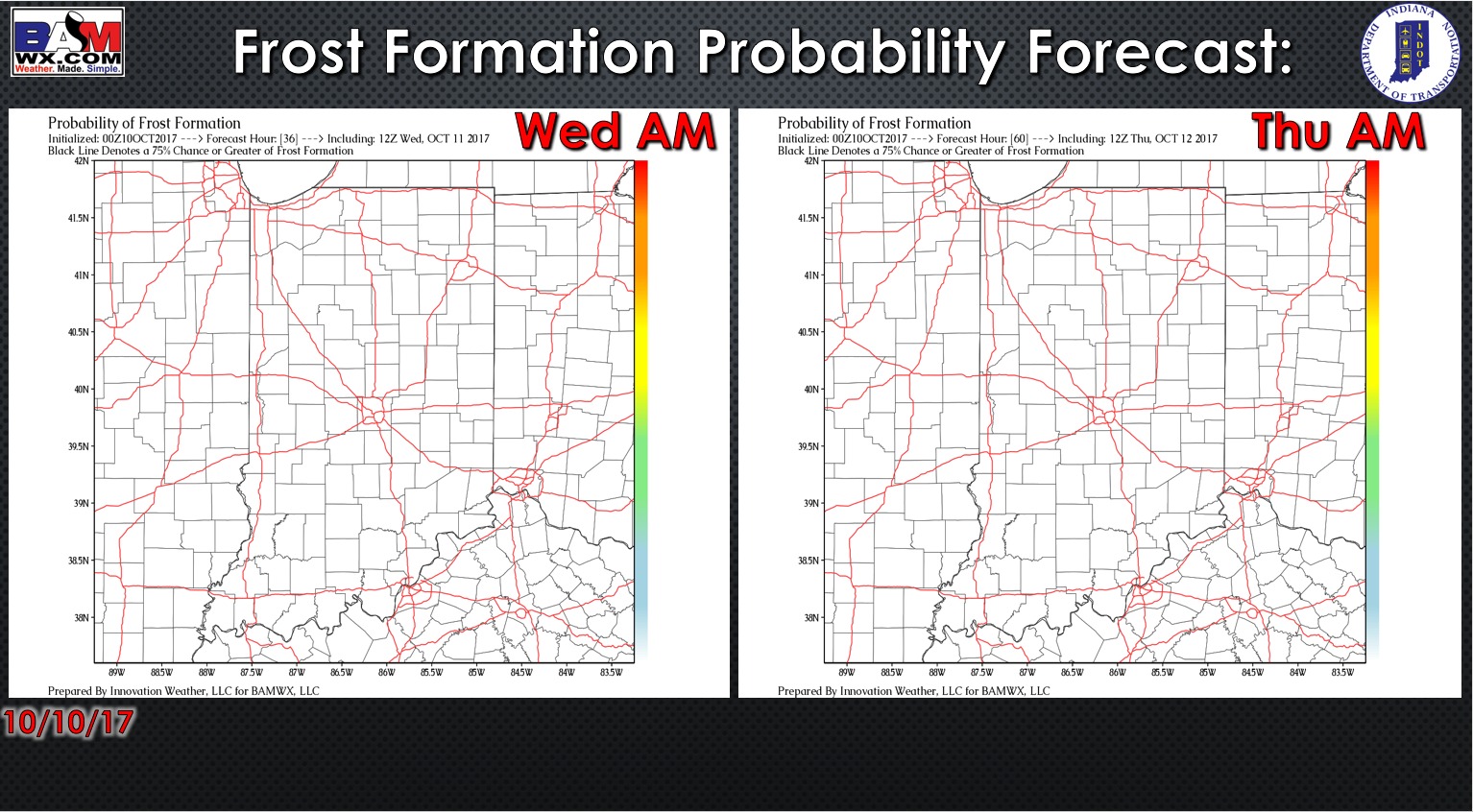
Exclusive BAMwx frost probability formation forecast over the next 2 mornings is below…no frost is expected:
Storm coverage over the next 2 days:
Total rainfall guidance over the next 60 hours:
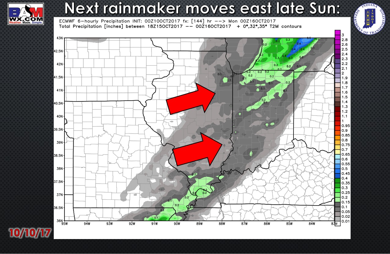
Next rainmaker moves east late Sunday evening into early Monday morning as a cold front sweeps across the Ohio Valley:
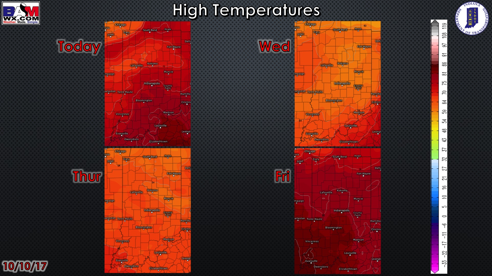
High temperature guidance over the next 4 days:
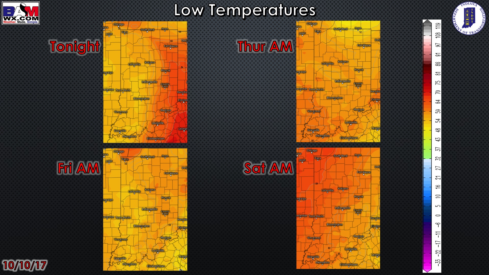
Overnight low temperature guidance over the next 4 mornings:
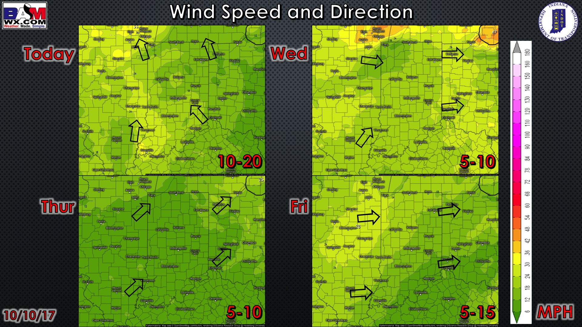
Wind gusts forecast guidance over the next 4 days:
Visibility guidance over the next 2 mornings:
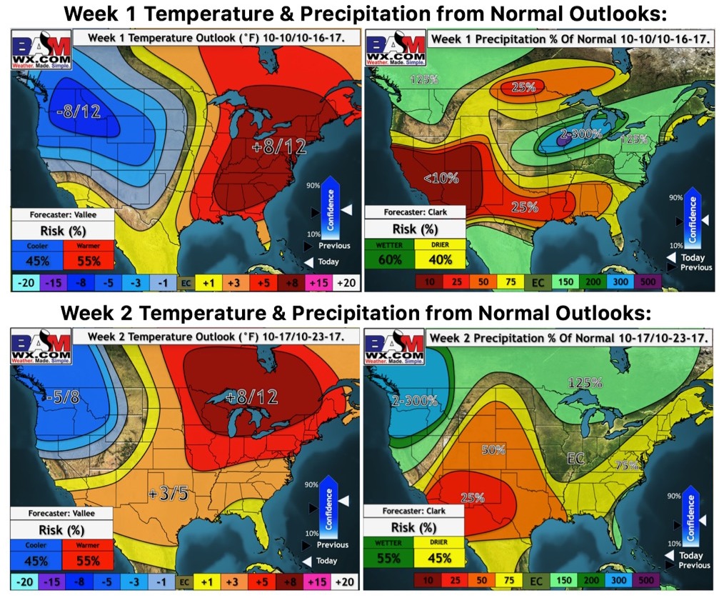
Weeks 1-2 temperature and precipitation from normal outlooks: