
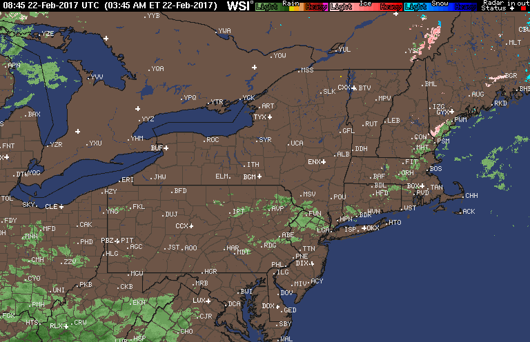
Good morning! A decaying cold front is moving through the region early this morning with a few showers in southern areas. Here’s the radar as of 6 AM.
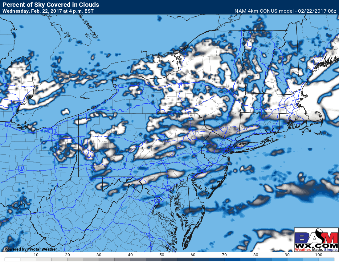
Showers will dissipate late in the day and clouds will slowly break as well. Temperatures will be quite warm today – into the 60s for many, 50s across southern New England. Here’s a look at high temperatures and how the clouds may break late in the day.

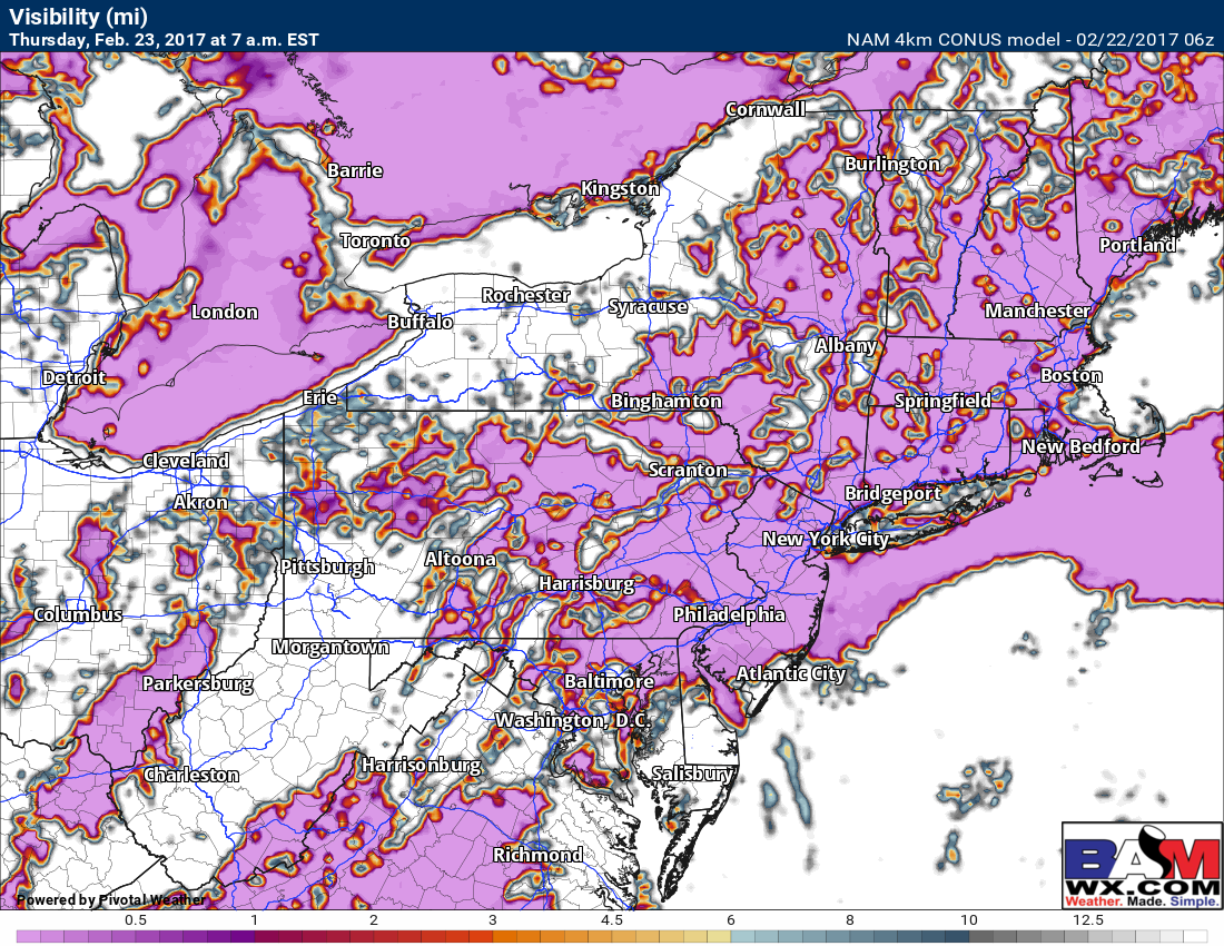
Thursday looks quite similar with clouds and some sunshine after some morning fog. Here’s a look at morning visibility – note where there is pink is where there can be some patchy fog and reduced visibility.
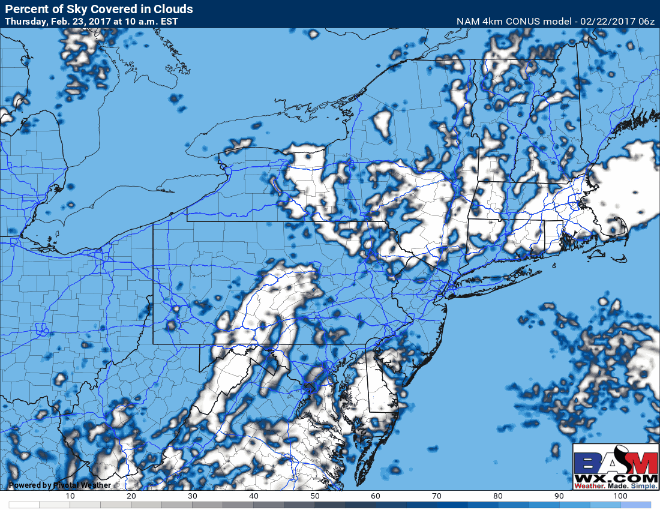
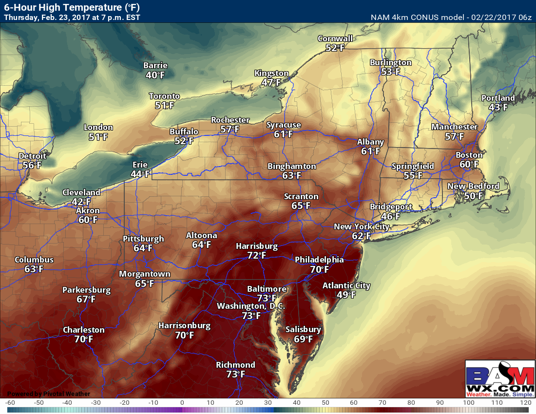
Warmth will be the big story with temperatures well into the 50s and low 60s across New England and in the 60s to low 70s elsewhere! Here’s a look at cloud cover and approximate high temperatures Thursday.
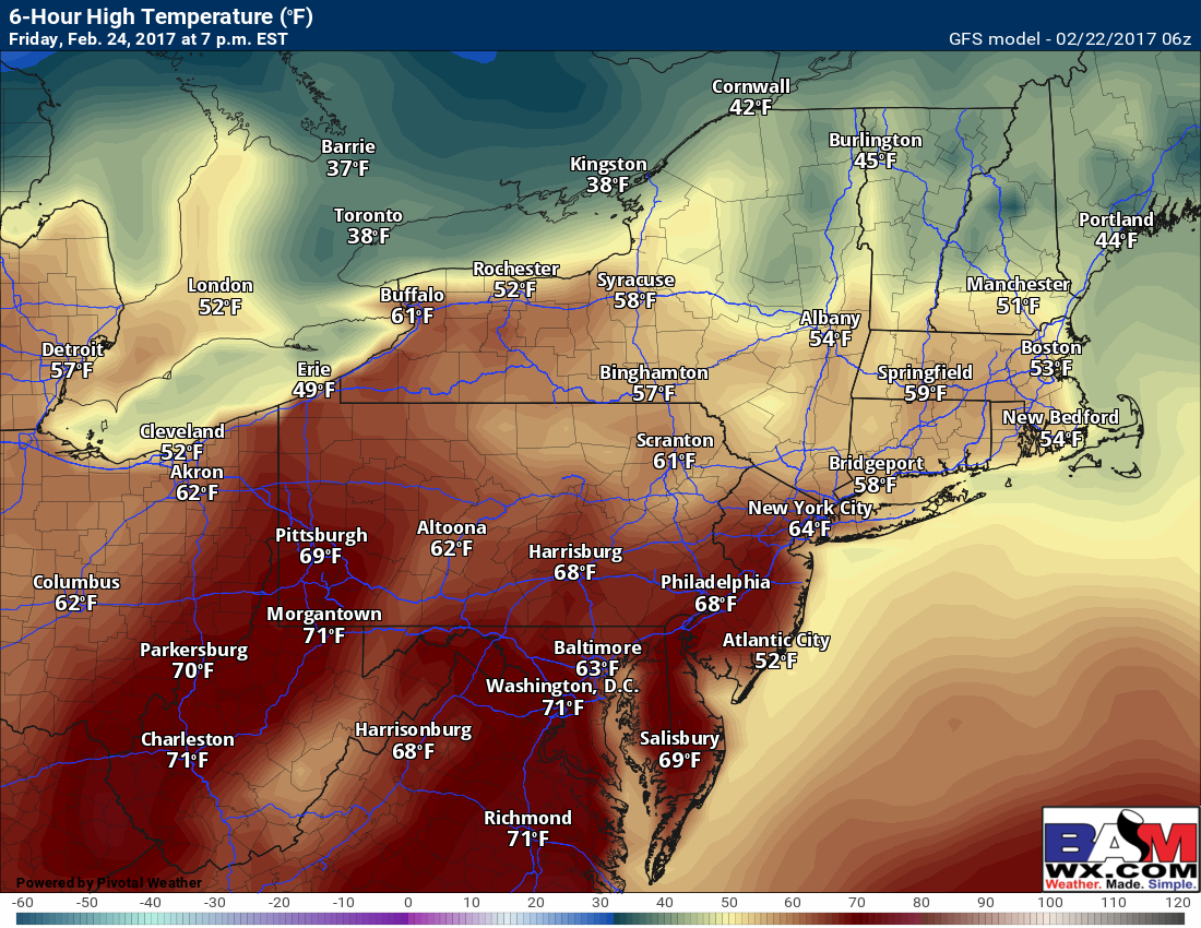
A large storm will move into the Midwest Friday sweeping a warm front through the Northeast with some clouds and maybe a shower during the morning. This will set the stage for a very warm Friday afternoon with many into the 60s and even some low 70s as clouds break. Here’s a look at approximate high temperatures Friday from the GFS – actual highs may be even a bit higher than this.
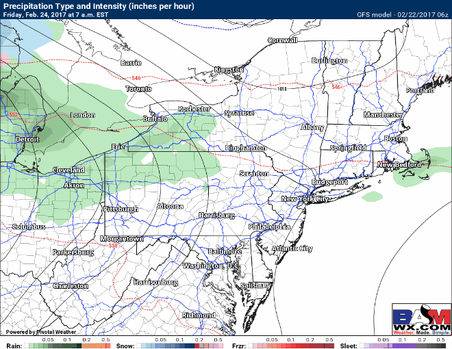
As the system moves through the Midwest, a cold front will sweep through the Ohio Valley Friday evening. This will lead to some showers and thunderstorms moving into Ohio late in the evening, then through Pennsylvania overnight into Saturday morning. These will move into New England Saturday evening and overnight with some heavy rain and even a rumble of thunder. Here’s an idea of the radar Friday morning through Sunday morning.
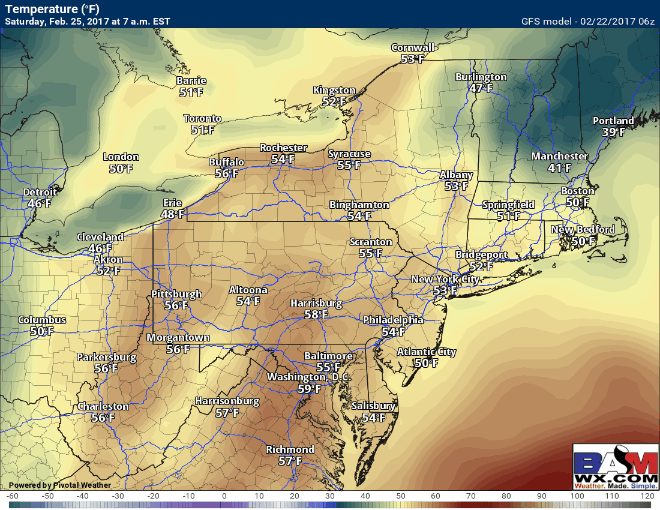
Temperatures will fall rapidly behind the rain as well. Here’s the temperature forecast Saturday morning through Sunday morning.
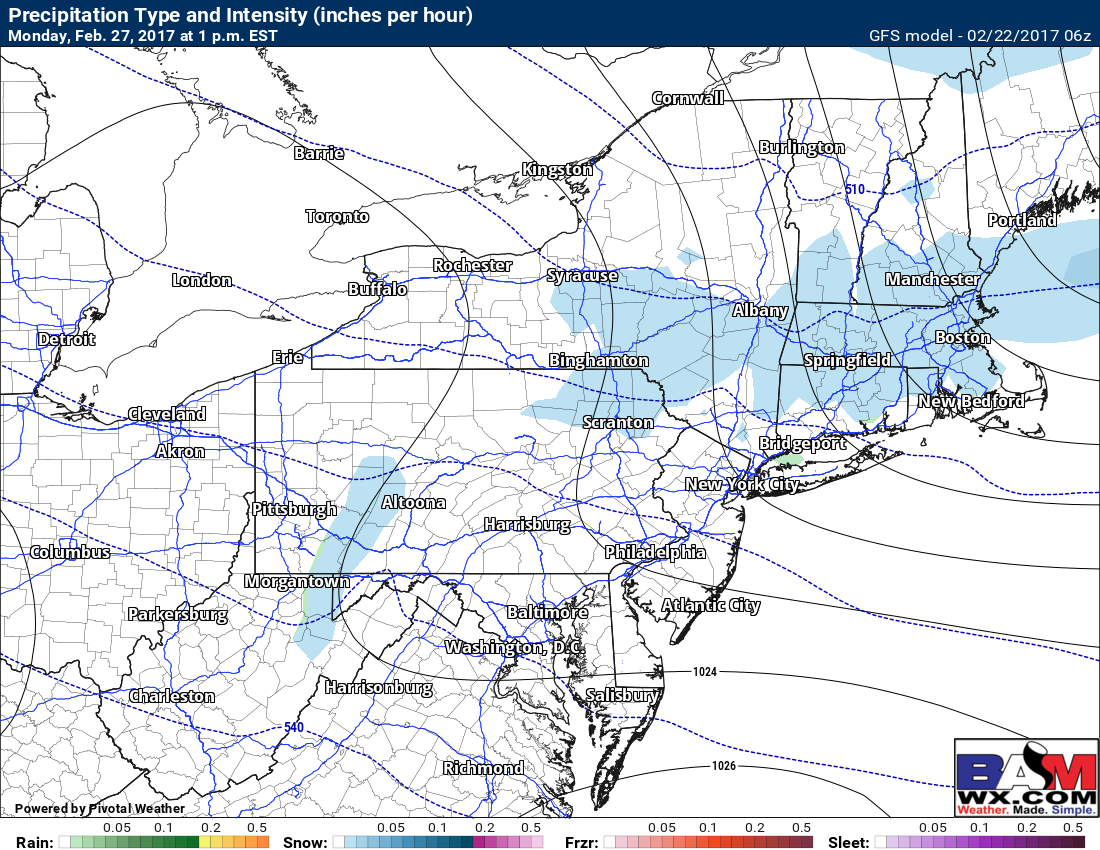
The next weather maker may come Monday into Tuesday with some light snow, but timing and track is quite uncertain. Here’s what the GFS has for Monday afternoon.
Risks and Confidence:
- High confidence in warmth today through Friday ahead of a strong cold front.
- Moderate to high confidence in rain and thunder Friday night through Saturday night from west to east.
- High confidence on a rapid temperature drop and return to winter like conditions Saturday into Sunday behind the front.
- Low confidence on timing and track of any light snow Monday-Tuesday. Stay tuned!
Today’s video is 5 minutes discussing it all. Have a great day! ~Ed