
Good morning! We are tracking a warm front moving through the region this morning with a few showers and even a few embedded thunderstorms. Here’s the radar and temperatures as of 6 AM. South of the warm front it is into the 50s and 60s, while north remains stuck in the 30s and 40s.

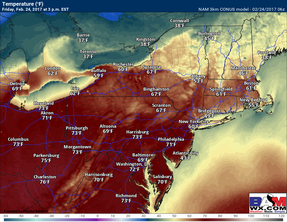
Today will be a very warm day as the warm front pushes northward, peaking in the low to middle 70s for much of the Mid-Atlantic and Ohio Valley, with 60s across southern New England. Here’s a look at mid-afternoon temperatures.
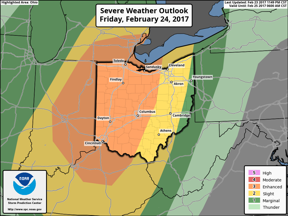
A strong storm moves into the Ohio Valley tonight dragging a strong cold front through Ohio overnight. This will spark a line of strong to severe thunderstorms capable of producing very strong winds in excess of 60 mph, torrential rainfall, and even an isolated tornado. Because of this, the SPC has issued an enhanced risk for severe weather across much of central Ohio, and a slight risk to the PA border.
Model guidance brings the line through central Ohio between 11PM and 2 AM then moves it east toward the PA border by sunrise Saturday. Here’s a look at the radar through tomorrow morning.

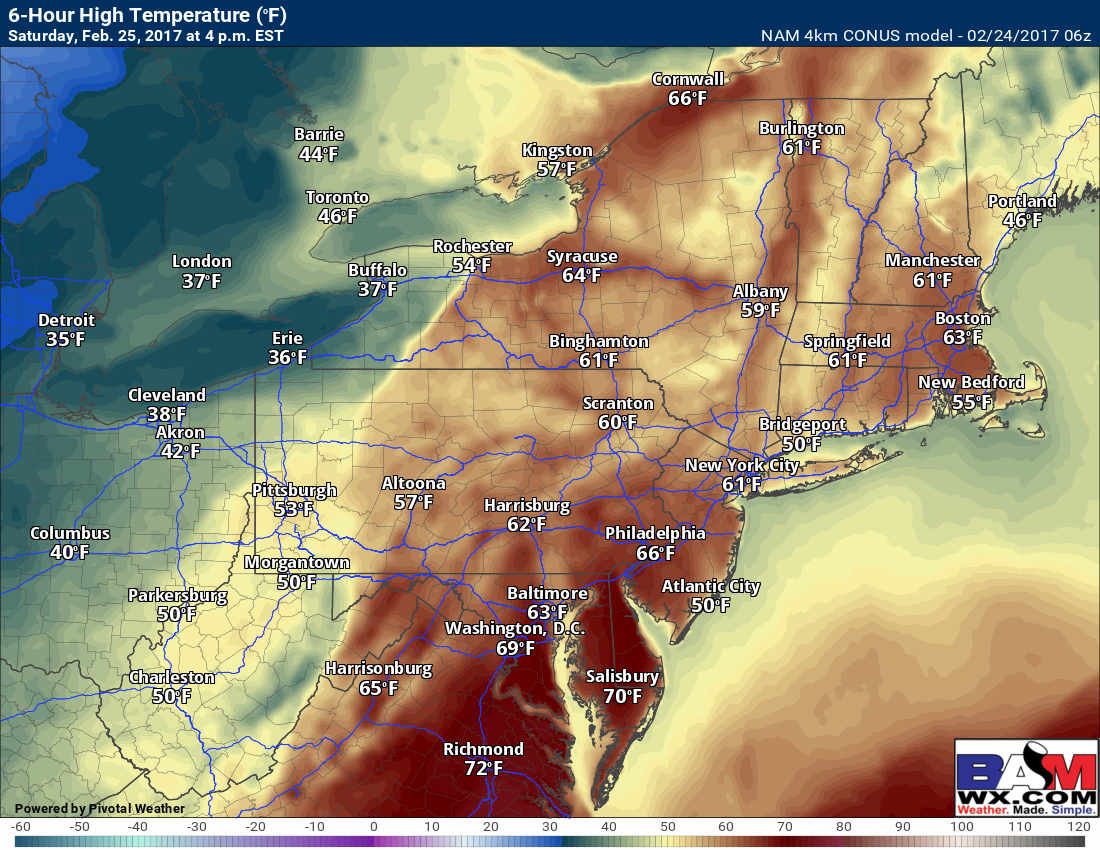
Saturday will be quite warm ahead of the front, allowing the line of storms to maintain itself through the afternoon. With that said, available energy in the atmosphere for these storms (CAPE) will be plentiful across Ohio this evening, approaching 2,000 J/kg, which is more than enough for severe thunderstorms as this strong disturbance moves through. But notice Saturday the available energy across PA and the Mid-Atlantic is much lower, thus lowering the risk for widespread severe weather.
Even still, temperatures Saturday will be warm enough to support some thunderstorm activity. Here is a look at temperatures and dew points Saturday afternoon. Well into the 60s and dew points approaching 60°F!
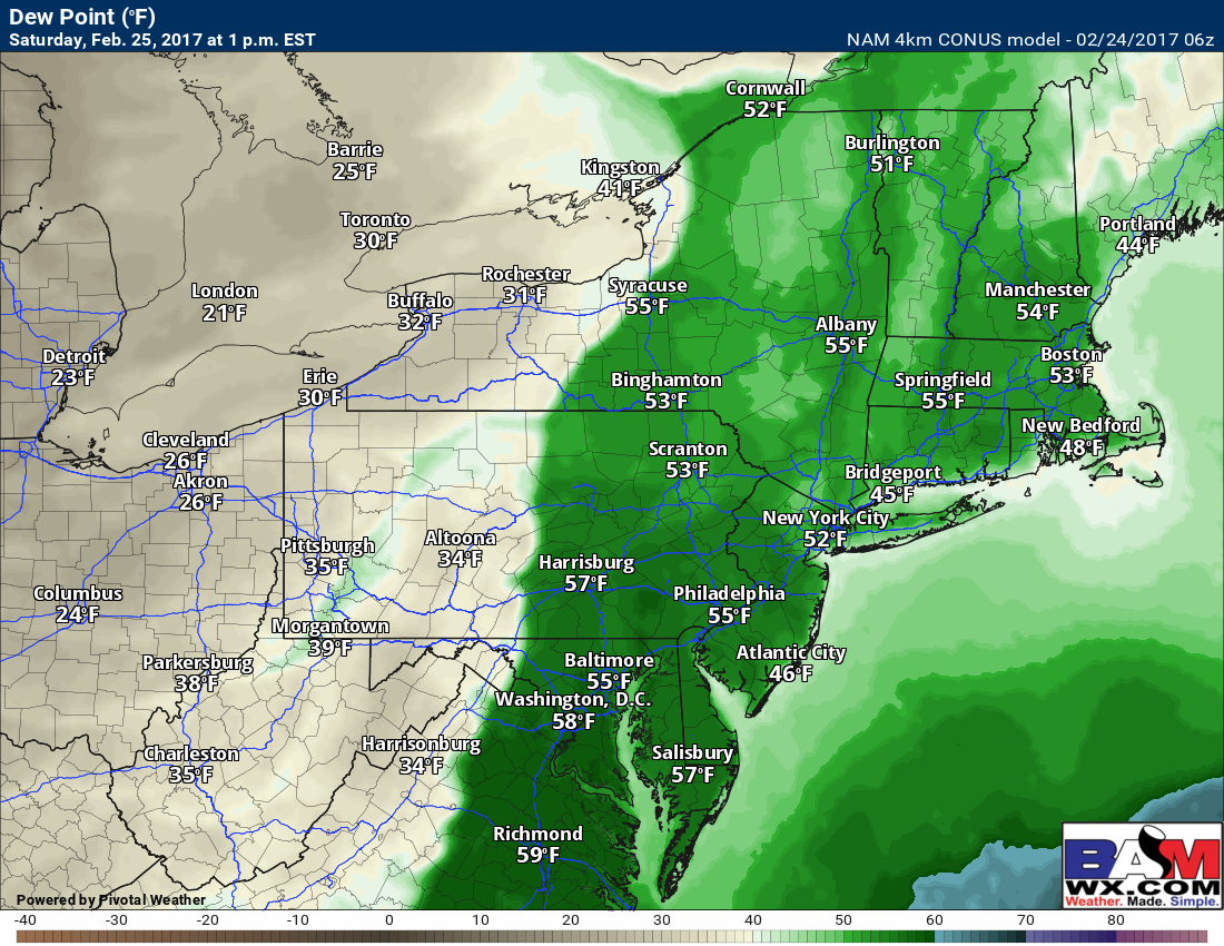
The SPC has issued a “marginal risk” for some thunderstorms Saturday where dew points are high enough across the Mid-Atlantic.

Here’s a look at the radar Saturday into Saturday night. Notice a line of weakening storms appears likely in much of the Mid-Atlantic and western New England. As colder air rushes in behind the front, some snow showers are even possible across PA, northeastern Ohio, and northern New England!
Speaking of colder air, here’s a look at the temperature drop into Saturday night. Be prepared for a flip back to reality!

The system for Monday-Tuesday has trended much weaker, with only a few showers expected during the day with temperatures into the 40s and 50s for most places. A stronger, warmer system is expected Wednesday with some rain. Here’s the projected radar from the GFS.
Confidence and Risks:
- High confidence on warmth and strong storms today and Saturday from west to east.
- High confidence on a flip back to winter Sunday with temperatures 25-35°F colder than Saturday!
- Moderate to high confidence on low impact showers Monday with a quick moving disturbance, then a stronger rain maker for Wednesday.
Today’s video (7 min) covers it all! ~Ed