
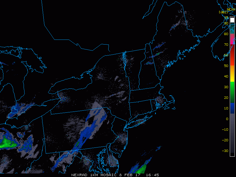
Good afternoon. Latest information coming in this morning supports even more snow as the system continues to deepen faster and closer to the coast. We are beginning to see the system on radar across the Ohio Valley moving eastward. Here’s the radar as of 1:45 PM.
Low pressure will deepen as it approaches southern New England tomorrow morning, spreading heavy bands of snow across the region. Snow (mixed with some rain south of I-80 initially) looks to start late this evening across PA and spread eastward through the overnight, arriving in southern New England just before the morning commute. Here’s the projected radar through the storm.

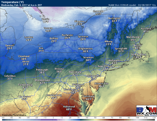
Temperatures look to drop quickly below freezing once the snow starts and will stay below freezing through the remainder of the storm. This combined with heavy snowfall rates will allow for snow to stick very quickly to pavement. Here’s an updated look at temperatures throughout the storm.
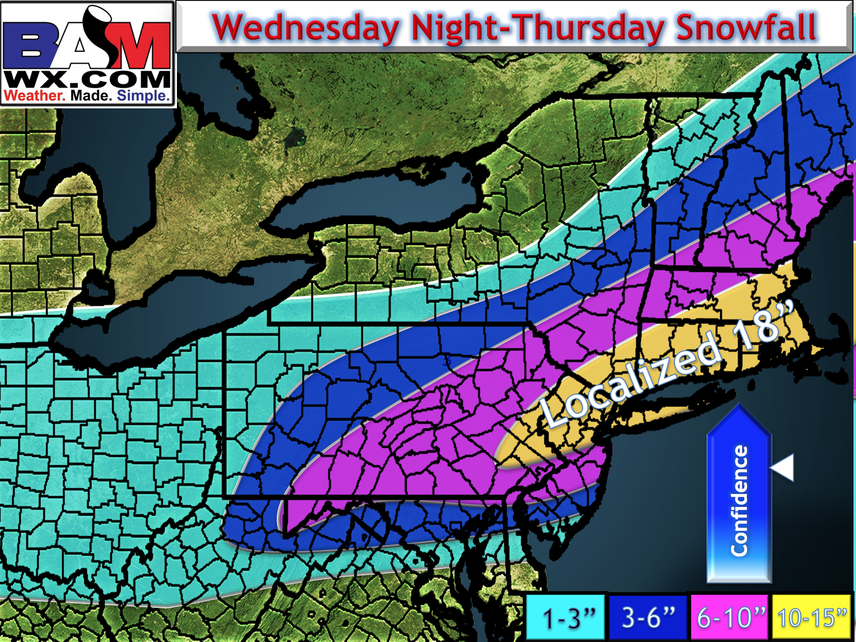
I cannot stress enough that this storm will make travel nearly impossible tomorrow morning. Snowfall rates approaching 3″ per hour for a time will put incredible stress on road crews and if possible, it’d be best to stay off the roads! I have upped snowfall amounts as things have trended stronger. Here’s the latest.
The video below covers everything in detail. I’ll have some updates later on this evening. ~Ed