
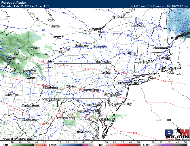
Good morning! We are tracking a few snow showers across northern Ohio that will continue to move eastward this morning, otherwise quiet conditions can be found around the region. Here’s the latest radar as of 5:50 AM.

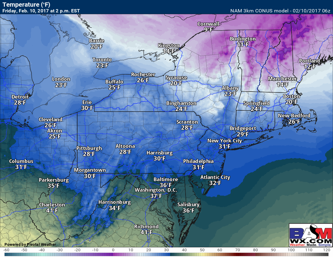
It’s cold out there, too, with most areas down into the 10s and low 20s- certainly a winter morning!

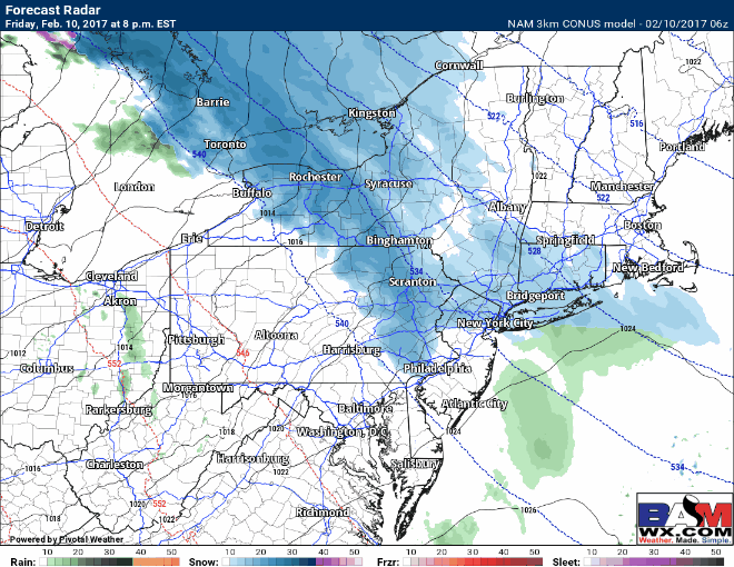
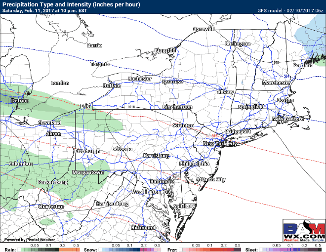
With quiet and cold conditions expected today, we are tracking snow for this afternoon across Ohio and western PA this afternoon and then moving east this evening into the overnight from northeast PA into New England. Here’s the projected radar this morning through about 7pm as the warm front moves through.

Temperatures today will be cold, only getting into the 20s and lower 30s south, allowing whatever snow falls today and tonight to stick.
Snow moves into New England this evening and persists through the overnight, accumulating generally 1-3″. Here’s the projected radar overnight.
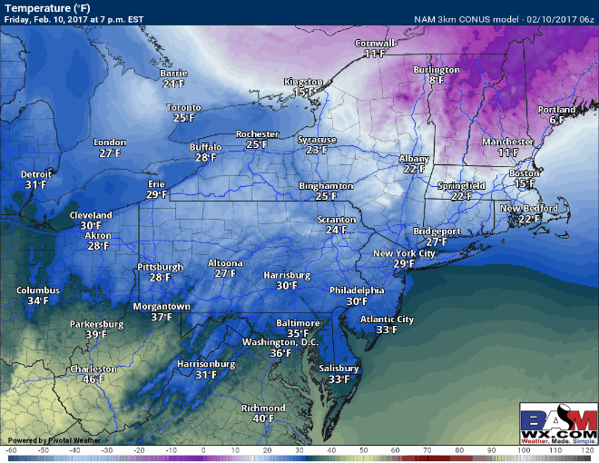
As the warm front passes, notice temperatures will rise along the coast overnight, likely approaching freezing by sunrise, making this initially a dry snow, trending toward a wetter snow toward sunrise. Snow will be dry across interior areas. Here’s the overnight temperature animation.
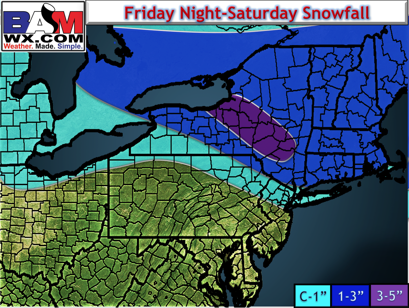
Snowfall consistency is below.

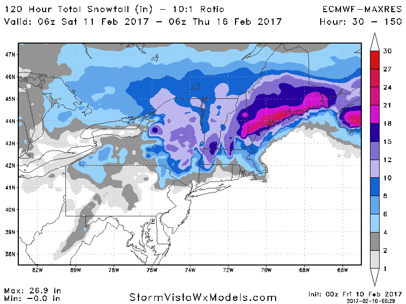
Total snowfall expected. Note locally 3+” can occur in the 1-3″ area in the steadiest bands. The best chance of this happening with be across northern CT into southern New Hampshire. Snow will wind down Saturday morning from west to east.
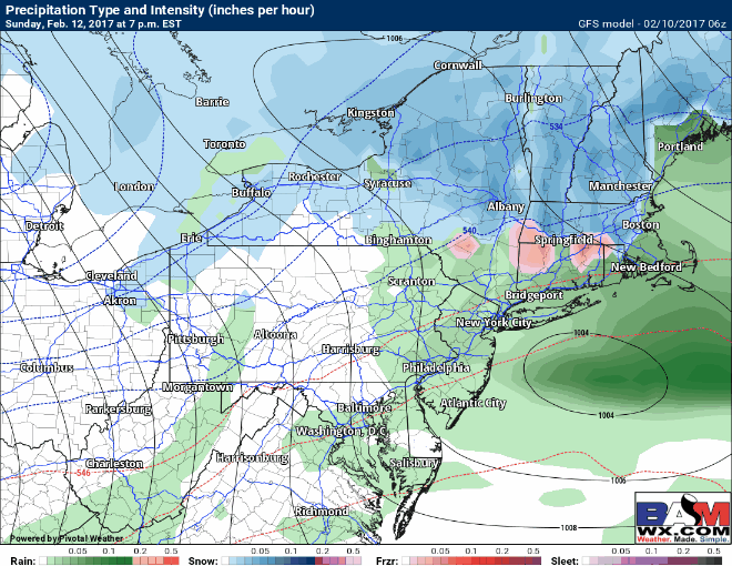
Another storm will approach for Sunday. This one looks quite complex with a bunch of different precipitation types. Across Ohio and much PA, this will be mainly rain. However, farther east across New England looks very messy Sunday morning before a change to rain from north to south – here’s the high resolution NAM radar Saturday night into Sunday.
The GFS model is quite similar, adding *some* confidence to a change to rain for most Sunday afternoon south of I-84 or I-90.
Sunday night is when things get quite interesting. Latest guidance is attempting to rapidly strengthen the area of low pressure into Monday east of Cape Cod pulling cold air into the system once again. This would rapidly change rain or a mix back to snow. We look at ensembles (many different solutions of a weather model) to get a better idea of what’s going to happen. The latest European ensemble is quite confidence (many member near the mean solution) in a rapidly strengthening storm, adding confidence to the possibility of this occurring.

Possible snowfall outcome per the European:
The GFS also agrees in a rapidly strengthening storm as it moves east. Here’s it’s take:
Confidence and Risk:
- High confidence on snow tonight with mainly 1-3″ of accumulation across New England. There is some question as to whether some higher elevations of northern CT and MA can see locally 3-5″, but confidence was not high enough to add it to the map.
- Moderate to high confidence on mixed precipitation Sunday morning changing to rain at the coast in New England, but LOW confidence on precipitation type evolution Sunday evening through Monday morning as the area of low pressure strengthens.
- Uncertainty is very high on how quickly the storm strengthens and how fast rain can change back to snow in New England Sunday night.
I will have an update out this afternoon and explain it all in the video below. ~Ed