
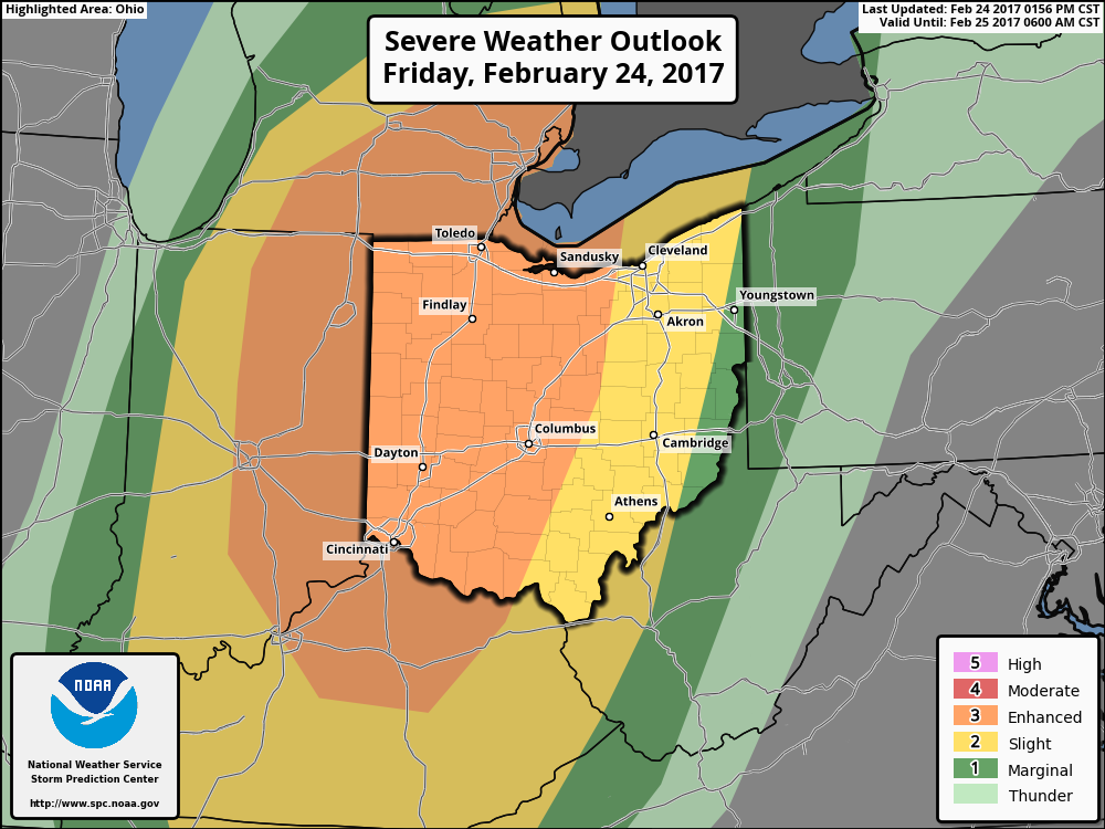
Good afternoon! Quick update on the strong thunderstorms expected across the region late tonight through Saturday. The latest SPC outlooks match my thoughts fairly closely for tonight and tomorrow, painting a slight risk almost to the PA border tonight and a marginal risk across PA and NJ tomorrow.

As discussed in the morning update, the ingredients (dew points into the 50s, a vigorous disturbance moving through, and some available atmospheric energy) are there for a line of storms from eastern Ohio into PA late tonight into tomorrow. Here’s an updated look at the timing of the line late tonight from the high resolution NAM.
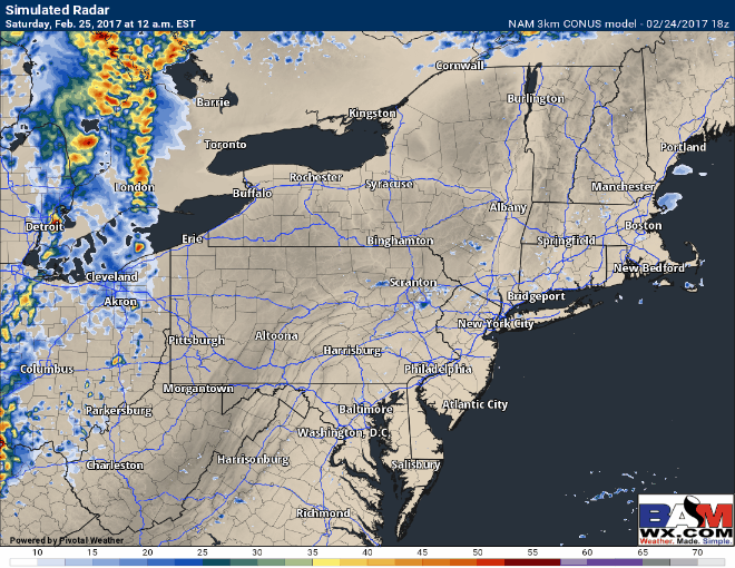
Timing looks pretty good here, with the line moving through eastern Ohio between 3-6am, then weakening across western and central PA during the morning. East of the mountains as the line encounters a more favorable environment, the line will likely strengthen again, packing some gusty winds across eastern PA, New Jersey, the Hudson Valley, and even NYC tomorrow afternoon between 1-7pm from west to east. Some winds may gust over 50 mph!

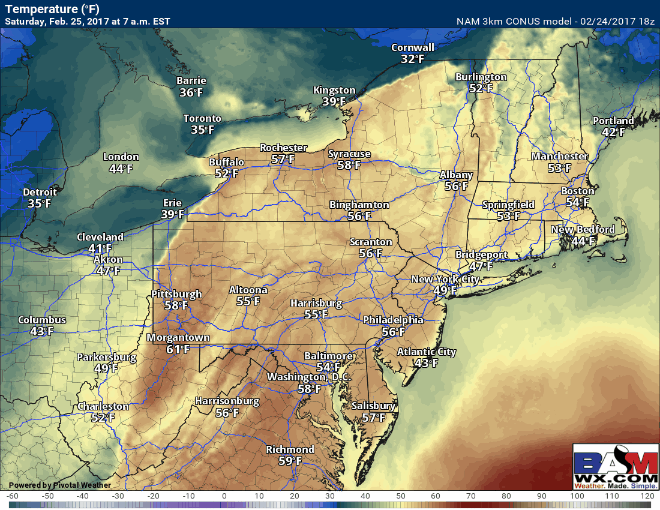
The line will weaken across southern New England tomorrow evening as it encounters a cooler environment, but temperatures will fall drastically behind the front. Here’s the temperature forecast through Sunday morning – it’ll feel like late February for sure by Sunday morning.
I’ll have an update out tomorrow morning with the latest! ~Ed