
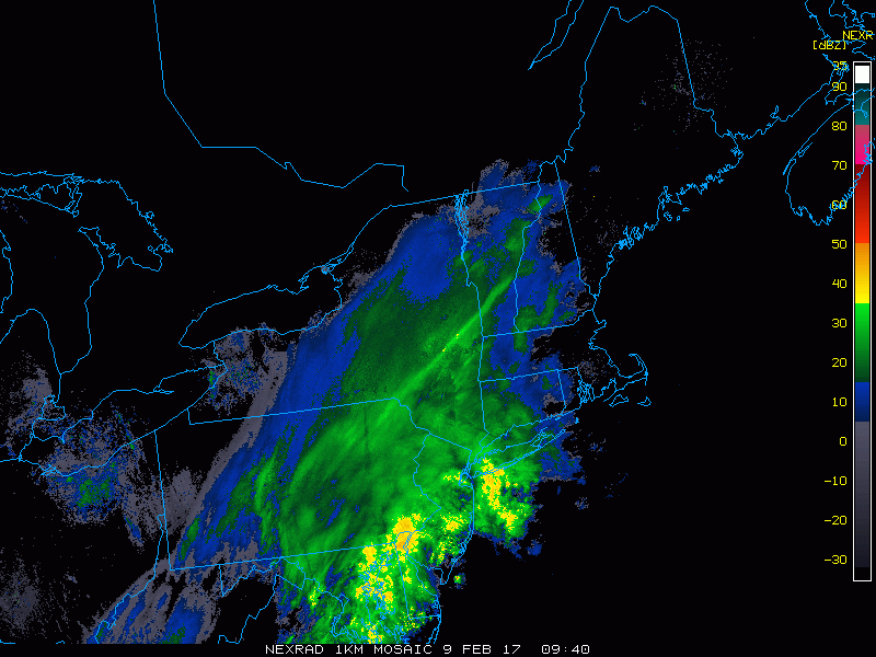
Good morning! We continue to track snow winding down this morning across eastern Ohio and western PA. A few lake induced snow showers are still lingering and will do so throughout today. Here’s the latest radar as of 6:40 AM.
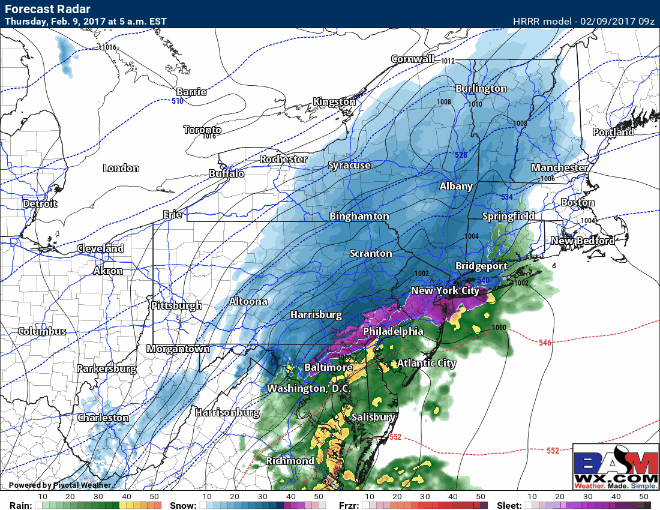
Snow will continue to wind down this morning as an area of low pressure moves away from the region. The result will be only a few lingers snow showers, mainly in the higher terrain totaling a coating to an inch during the day today. Here’s the radar through tonight.
Temperatures today will be cold, mainly in the upper teens and lower 20s. Here’s an animation through today.

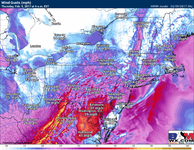
Winds today behind the area of low pressure will be gusting past 30 mph at times, allowing any leftover snow to blow around. Here’re the expected gusts.
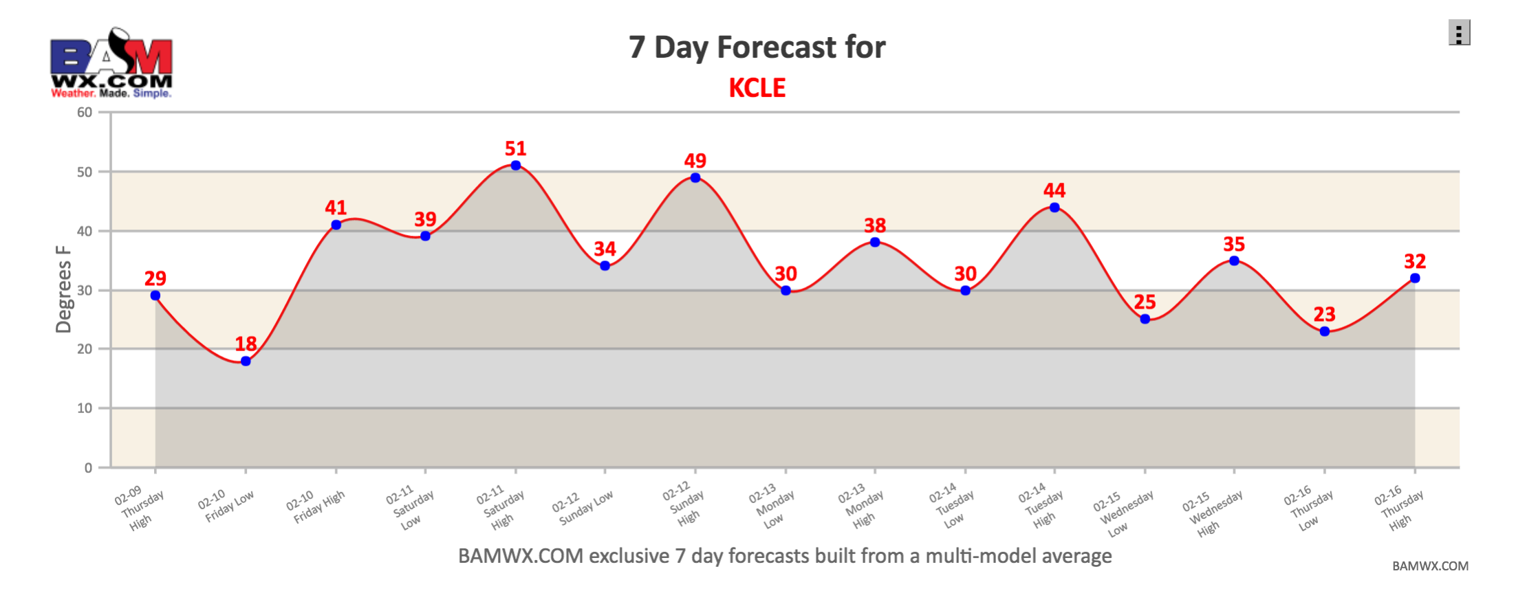
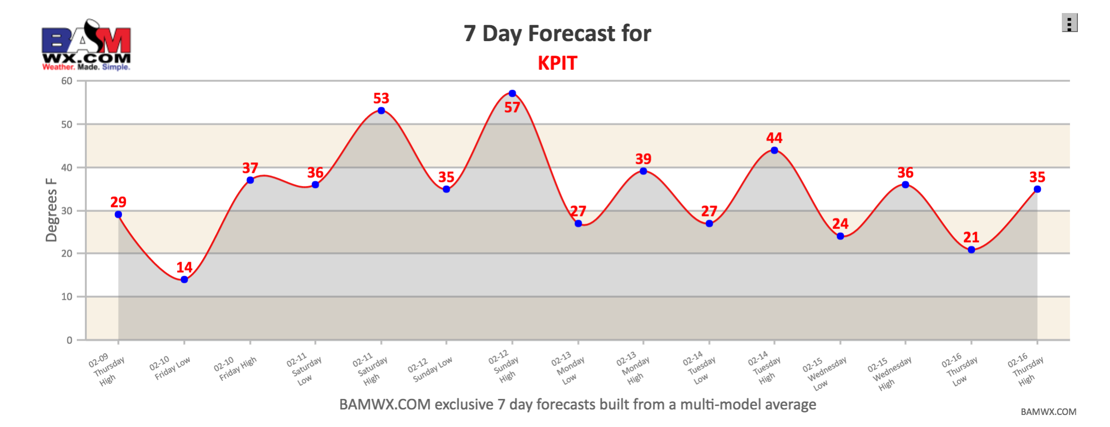
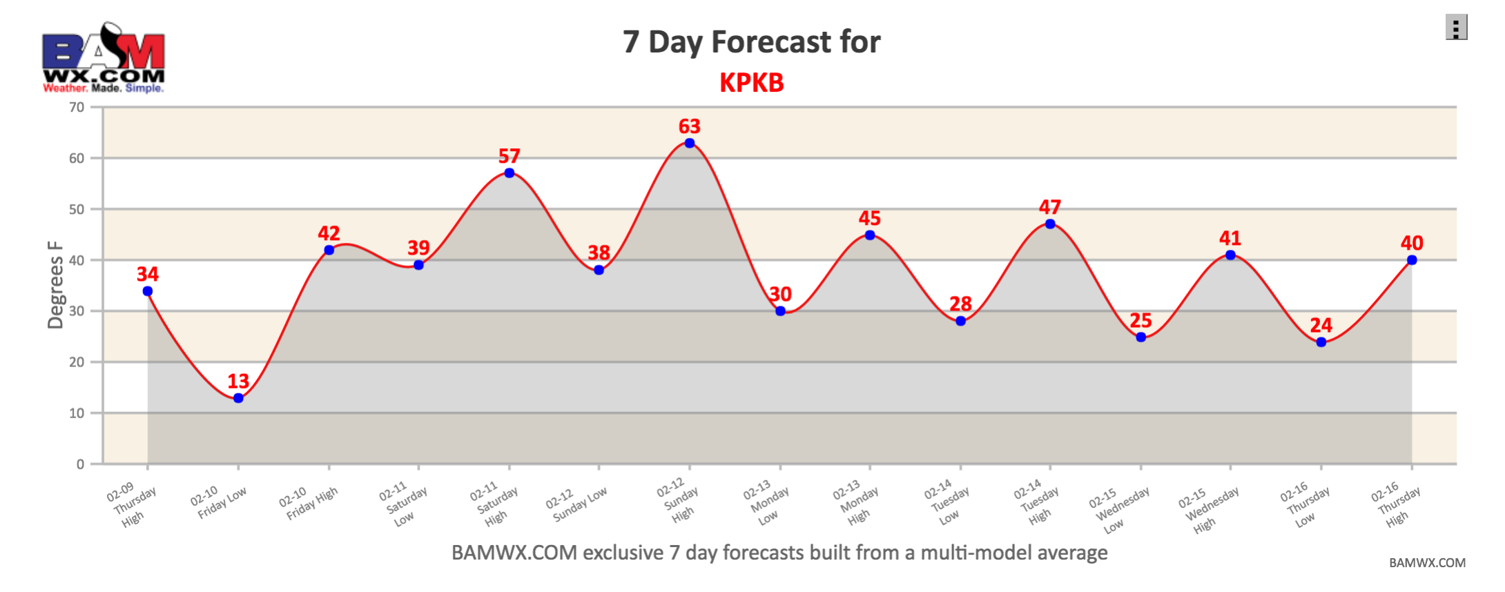
High pressure will control our weather Friday, but a northwest flow off the lakes will allow for plentiful cloud cover and maybe even a few flurries. Temperatures over the weekend will warm significantly into the 40s and 50s ahead of another storm system bringing rain showers Saturday afternoon into Sunday. Here’s a look at 7 day forecasts for a few locations around the region.
Also here is a look at the the GFS model for Sunday, painting the threat for rain across the region.

The video spells out the next week or so of weather. Have a great day!