
Good morning! A weak warm front associated with a strong storm moving into the Midwest today into tomorrow is sparking a few showers in western areas this morning. Elsewhere some patchy fog is impacting southern New England and the Tri-State area. Here’s the radar as of 6 AM.

Here’s where fog is an issue this morning (orange shading). Temperatures are above freezing, so the threat will be reduced visibility. 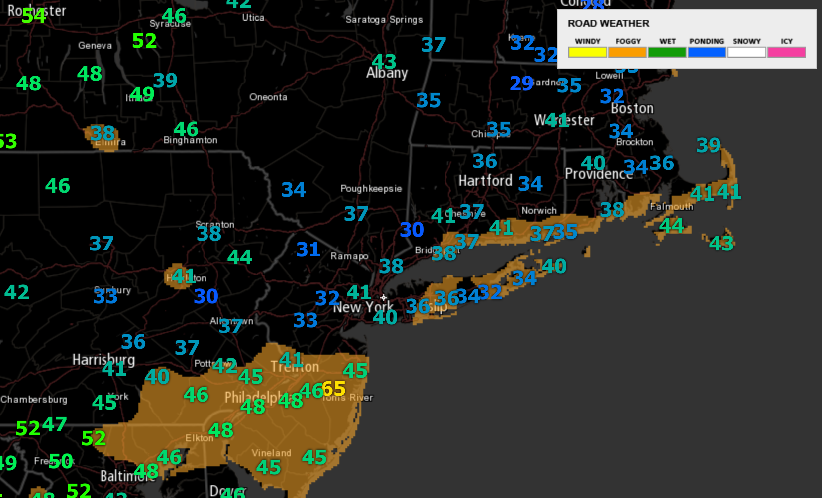
The warm front will push closer toward the region today bringing the threat for a quick shower or storm in Ohio and Pennsylvania. The warm front will truly push through overnight tonight with a batch or rain and thunderstorms in western areas. Some small hail is possible with these storms overnight. Here’s a look at the projected radar for today into tonight.

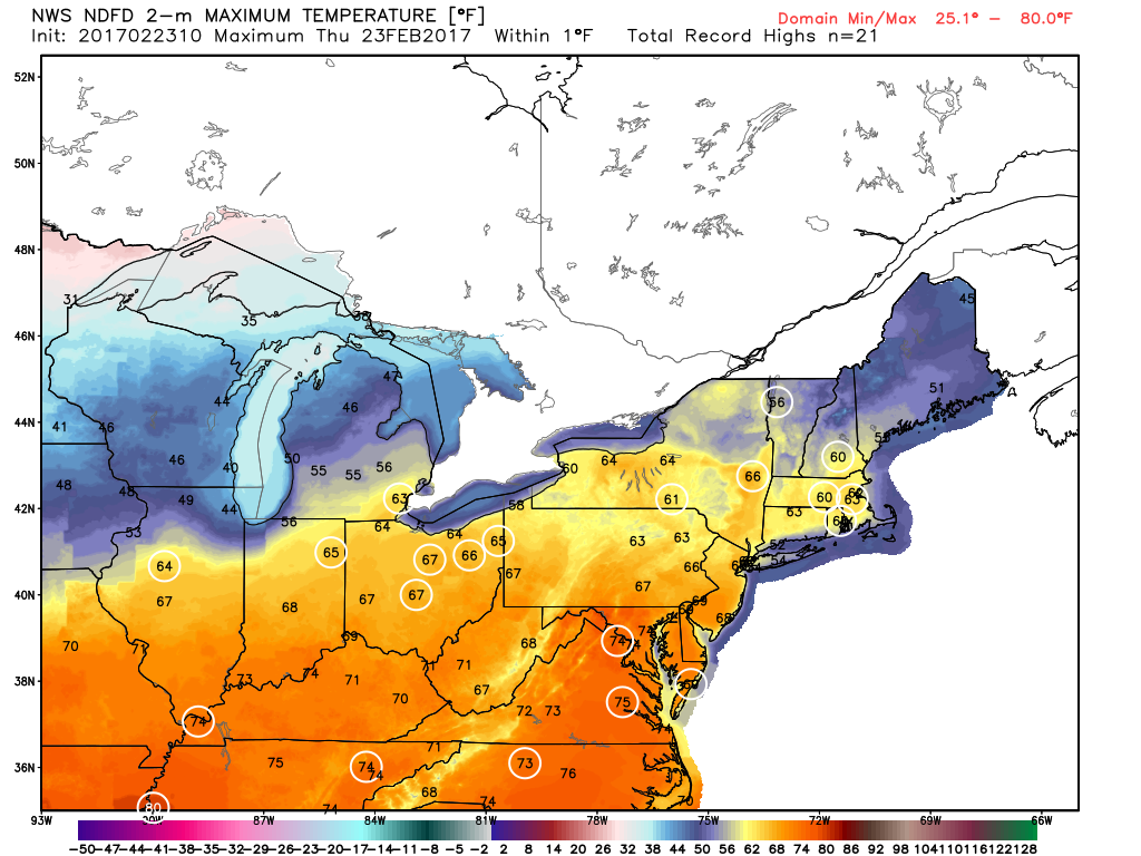
Temperatures today will be incredibly warm, approaching record levels in many areas. Here’s a look at the projected high temperatures. Every circled temperature is above the record high for February 23rd!
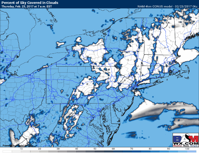
While it won’t be a perfectly sunny day, peeks of sunshine will dictate who sees the highest temperatures. Here’s a look at cloud cover through this afternoon.
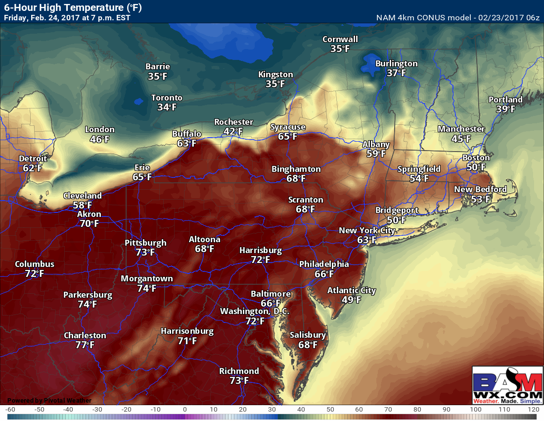
A large storm will move into the Midwest Friday sweeping the warm front through the Northeast. This will set the stage for a very warm Friday with many into the 70s west and 50s and 60s east closer to the Atlantic. Here’s a look at approximate high temperatures Friday.
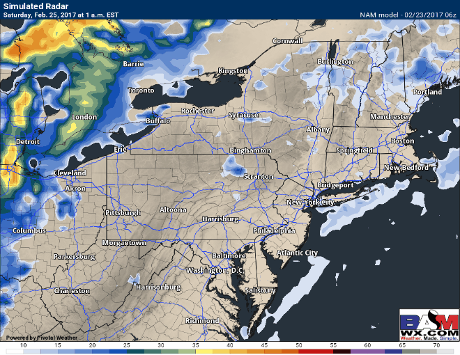
As the system moves through the Midwest, a cold front will sweep through the Ohio Valley Friday evening. This will lead to gusty, strong thunderstorms moving into Ohio late in the evening, then through Pennsylvania into Saturday morning. These will move into New England Saturday evening with some heavy rain and even a rumble of thunder. Here’s an idea of the radar Friday afternoon through Saturday night.
Saturday afternoon ahead of the front will be quite warm from eastern PA into New England. This will provide some fuel for thunderstorms to erupt. CAPE (available energy in the atmosphere) should be sufficient for a line of storms with gusty winds and heavy rain across PA, NY, and NJ Saturday afternoon and evening before weakening overnight across southern New England. Here’s a look at the available CAPE, where storms may exists Saturday afternoon.

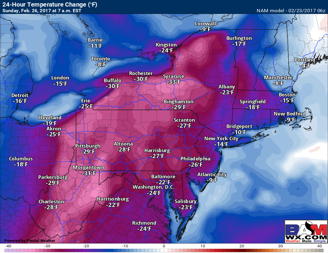
Temperatures will fall rapidly behind the rain and storms as well. Here’s the temperature forecast Saturday morning through Sunday morning.

Some places Sunday will be 25-35 degrees colder than Saturday!
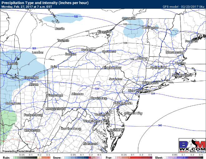
The next weather maker may come Monday into Tuesday with some light precipitation, but latest indications are that surface temperatures will be rather warm, into the 40s for most. This would support a mix of rain and snow with little opportunity for accumulations. Here’s a look at the latest GFS for Monday-Tuesday.
Another warm up looks likely Tuesday into Wednesday ahead of another rain maker Wednesday into Thursday. I’ll have more information on this as we get closer!
Risks and Confidence:
- High confidence in warmth today and Friday ahead of a strong cold front.
- High confidence in rain and thunderstorms Friday night through Saturday night from west to east.
- High confidence on a rapid temperature drop and return to winter like conditions Saturday into Sunday behind the front.
- Moderate confidence on timing and track of any light precipitation Monday-Tuesday.
- Moderate confidence on a warm up through mid week next week ahead of another rain maker.
Today’s video (7 min) discusses it all! ~Ed