
Key Points – Sunday, February 5, 2017 – This Week
Synopsis: Good Sunday morning, we hope everyone is having a great weekend so far and excited for the big game tonight! More sunshine and mild temperatures are on tap across the Midwest today, with winds out of the southwest turning to northwest at 5-20mph, becoming more calm this evening into tonight. The big story that we’ve been mentioning all of last week is the potential for strong to severe storms Monday night into Tuesday this coming week. We discuss the details in the video, but our latest data does support the possibility for some damaging winds, hail and even a few tornadoes are not off the table at this time. What’s also interesting is that our global suite of forecast models (the European, GFS, and Canadian) are all picking up on a small clipper system moving west to east Wednesday into Thursday morning. What’s even more interesting is this small piece of energy looks to move through in an environment conducive for snow showers…something we need to keep close eyes on.
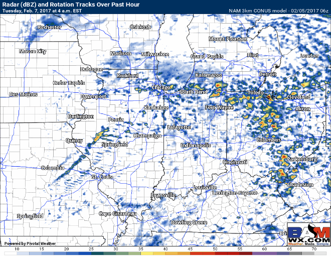
The first batch of showers and a few storms lifts north off a warm front Monday night into Tuesday morning, bringing possible small hail, thunder and lightning. We are in what we like to call the “warm sector” by Tuesday morning, meaning temperatures actually increase overnight as seen below.
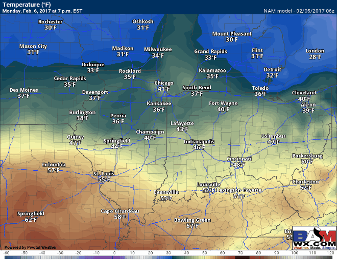
The first batch of showers and storms lifts north off a warm front Monday night into early Tuesday morning.

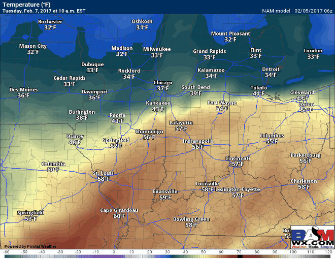
Temperatures warm even higher on the day on Tuesday as warm air continues to advect (move) into the Ohio Valley. Highs in the 60s likely, even a few stations reporting 70s near the Ohio River on Tuesday will be possible. As the front passes Tuesday into Wednesday, temperatures return back to more of a “winter-feel”.
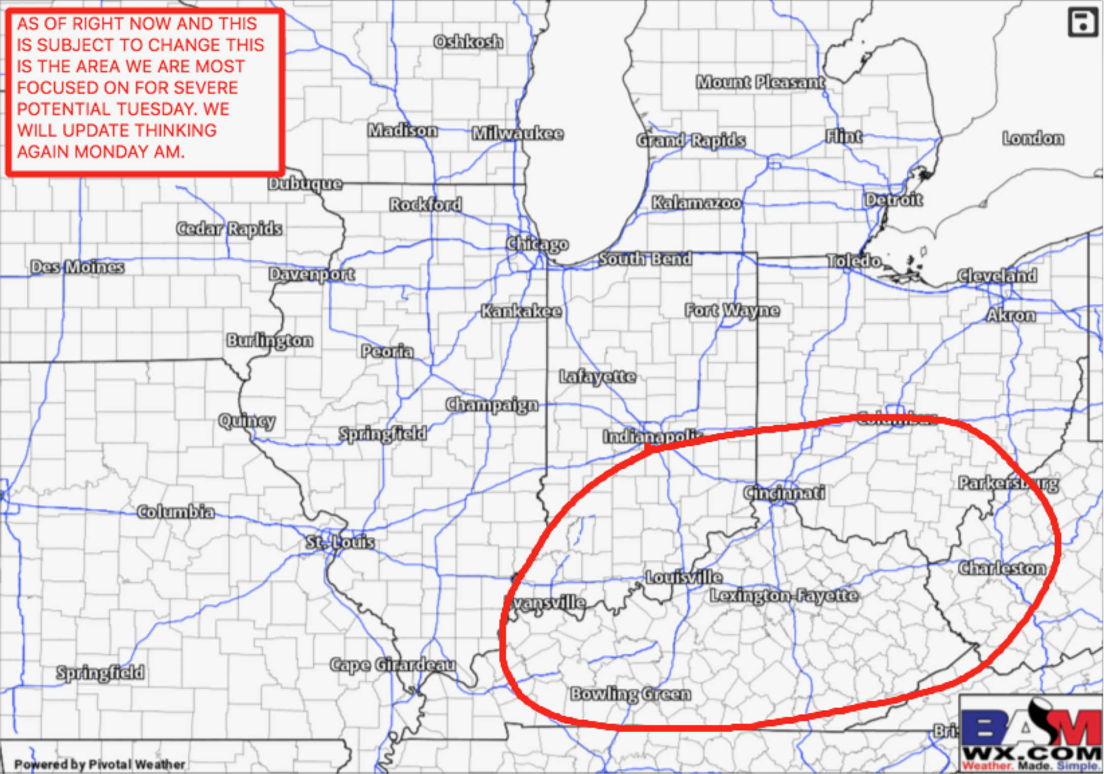
It’s these storms during the day on Tuesday (pending the level of destabilization or sunshine we receive) we need to watch for more of the risk for strong to severe storms.
BAM Severe Risk Map…hail, damaging winds, even a few tornadoes are on the table here and something we need to take seriously on the day Tuesday.
Latest rainfall totals from the European (mainly all from the Monday night into Tuesday system) this week…you can start to notice an area across IL/IN/OH receiving over 1.0″ of rain, which is where we are watching for those stronger storms to set-up.

We believe there is a possibility our forecast models are not pushing in the cold air on the backside of this system fast enough Tuesday night into Wednesday morning, so flash freezing concerns are certainly something we need to keep an eye on. Another system that is very intriguing moves in Wednesday into Thursday morning that has potential to bring snow into the Midwest. Confidence on this right is about average, but our global suite of forecast models are all laying down some kind of accumulating snow ~1.0″ at this time.

We discuss towards the end of the video our latest long-range thoughts including the February warmth and colder concerns to end February and open March. Thanks for checking out the latest work-week forecast, have a great day!
Confidence and Risk:
- Above average confidence the Midwest will see thunderstorms Monday into Tuesday, some possibly being strong to severe.
- High confidence we will see well above normal temps Monday into Tuesday as well.
- Average confidence on a little clipper system streaming through the Midwest Wednesday into Thursday with the potential of bringing more widespread snow showers.
Today’s Video (5 min):