
#ILwx #INwx #OHwx Wed Short-term
Synopsis: Hey good afternoon and thanks for checking out the latest short-term forecast today. First things first, here’s a cool stat for you: Indianapolis has reached 60ºF or higher 6 days in a row, one of the longest streaks during February on record. Even more, for Indy, the first 3 weeks of February 2017 were the warmest start to the month in 135 years!
Okay, back on track…we are focusing solely on Thursday through early weekend today as we have showers and storms lifting north off of a warm front Thursday evening, and a trailing cold front moving west to east Friday afternoon into the evening. Our concerns haven’t changed since this morning, the severity of the storms widely hinges on how much sunshine (energy or CAPE) we receive out ahead of the cold front that would intensify the conditions. Our latest data suggests that we do in fact receive some sunshine on Friday, the question that still remains fluid is, how much? As temperatures plummet on the backside of the low pressure, a few snow showers will be possible on Saturday mainly across the northern half of Illinois up through northern Indiana, southern Michigan into northwest Ohio; a few slick surfaces cannot be ruled out.
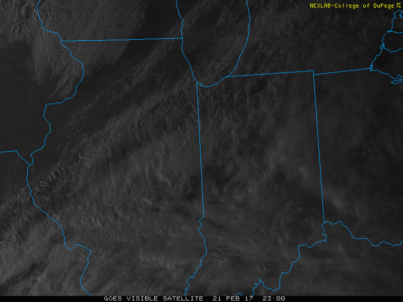
Latest glance at satellite across the Midwest this afternoon shows the fog layer finally able to burn off, and sunshine/warmth filtering in.
Clouds increase on the day on Thursday, showers and a few storms increase in coverage as well Thursday afternoon to evening as the warm front lifts north from our powerful low pressure system. Small hail and gusty winds remain possible with this first wave moving through.
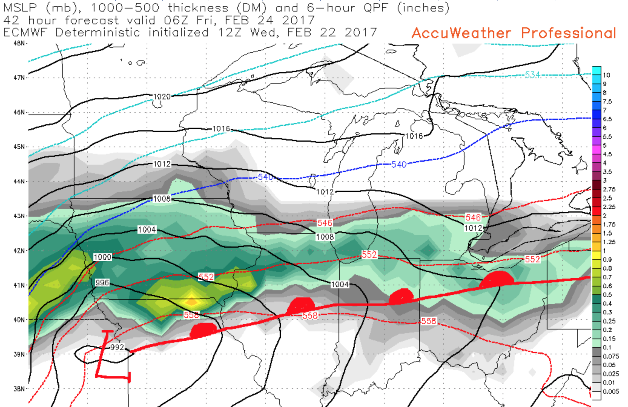
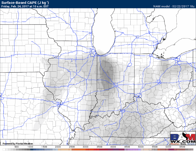
Our main focus then transitions to Friday…based off latest data we feel some sunshine is still possible during the morning and even afternoon hours, but this is not a “slam dunk” 100% take it to the bank call…we are still monitoring this. Below is a loop of CAPE or “energy” that would fuel these storms, suggesting 1000+ J/kg would be possible, which would likely be enough to produce some severe storms, even supercells out ahead of the front Friday night.
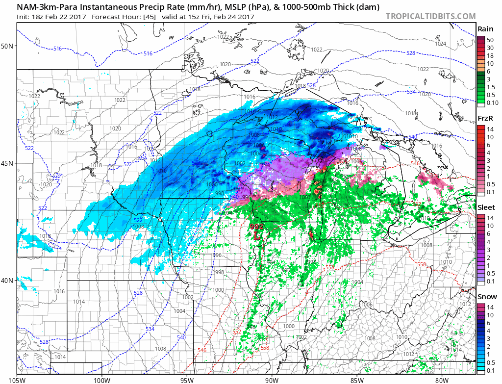
In fact, the 3km NAM shows the line of storms very well later Friday afternoon into the overnight from west to east. It even suggests supercells possible out ahead of the main line that we would need to watch for potential isolated tornadoes. The threats remain as followed: damaging winds, hail and isolated tornadoes…so everything is on the table still right now.
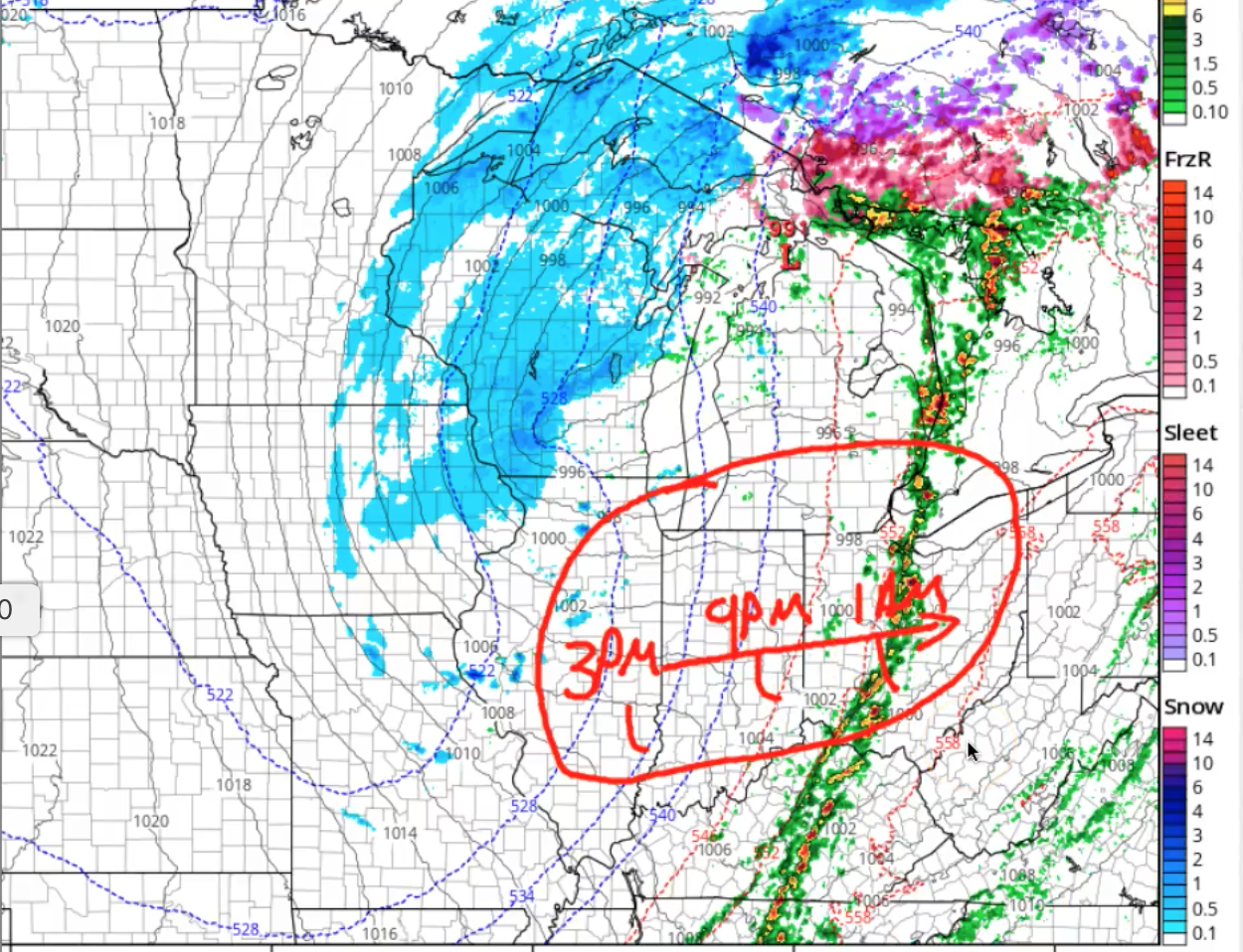
Here’s our current thoughts on timing of the storms to move through from west to east…this can, and may change based on if this system speeds up or slows down.
As discussed in the synopsis, a few snow showers possible on the backside of the low pressure as it moves east through the Midwest, confidence on accumulations is still low but we cannot rule out a dusting with a few slick surfaces on Saturday.

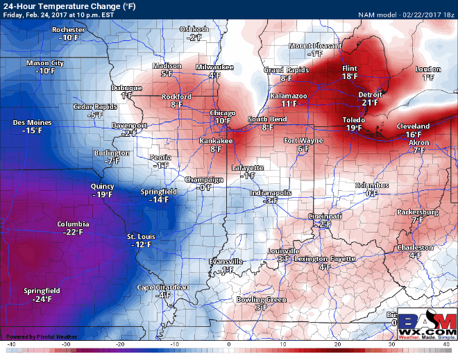
Temperatures drop off the table as well, with 30-40ºF temperature differences expected from Friday into Saturday…which is the equivalent of going from the 60s/70s to the 30s…even dipping down into the 20s is possible!
Please stay tuned to the updates going forward as they will be crucial in terms of discussing the timing, location and severity of the storms over the next 2 days.
Confidence and Risk:
- Above average confidence clouds increase on Thursday, along with showers and a few storms lifting north with the warm front.
- Increasing confidence a line of strong to severe storms is possible Friday afternoon into the evening from west to east…largely depending on how much sunshine we receive.
- High confidence temperatures drop off significantly Friday into Saturday, with 30-40ºF differences possible!
- Average confidence in a few snow showers on the backside of this system on Saturday.
Today’s video (6 min):